So, we ended up in Gunnison for the night.
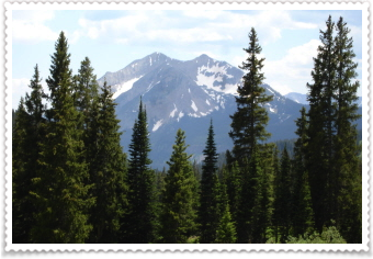
After coffee, we drove to my favorite Colorado town....Crested Butte.
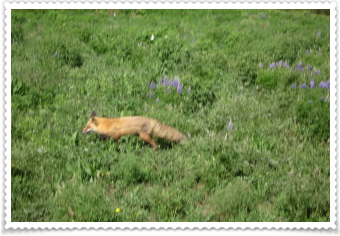
We were driving down Gothic Road (my favorite road in CB) and spotted this fox, meandering through the wild flowers.
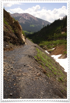
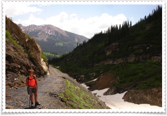
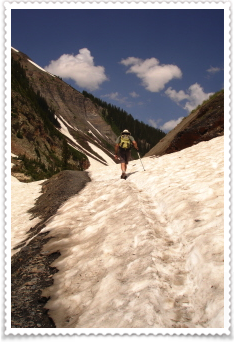
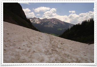
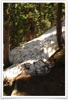
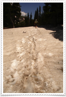
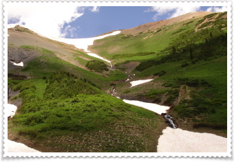
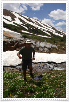
One of my "goals" the next time I can back to CB, was to walk the 4WD pass that scared me sooo much last year. I wanted to see, on foot, if it was as bad as I remembered it. AND IT WAS! Because of all the snow this year, the road is still blocked and closed by a huge "snow plug"; but parts of it were clear. The photo on the left and in the middle show how narrow and bumpy the road is and the drop off; the photo on the right is Danny hiking over the snow plug.
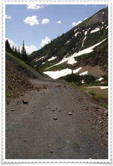
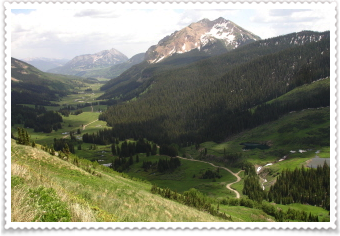
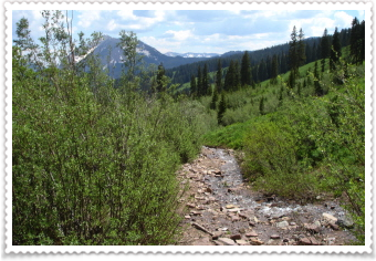
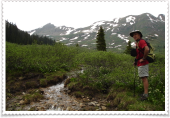
We were on our way to the trailhead...it's a mountain bikers trail that runs high along the mountain but parallels the road. So, we hiked the road and then found the trail head.
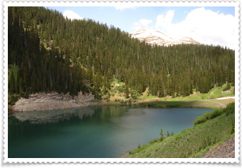
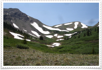
This lake was filled with the most beautiful turquoise colored water. The road on the other side of the pass was clear in spots and finding the trailhead was easy....finding the actual trail became more difficult.....
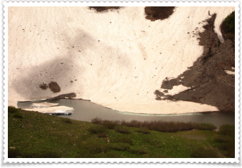
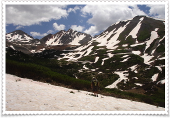
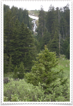
The trail began in a heavily forested side of the mountain...not much sun shining through here. This meant that lots and lots of snow was still there...covering the trail. It put our route-finding skills to the test. It was slow going, as one of us would stay on the "found" trail, and the other go through the snow and try to locate the trail somewhere on the other side. The snow was as little as a few inches high to over six feet high covering the trail...and we climbed up and over piles of it about 40 times! Natures stair-master.
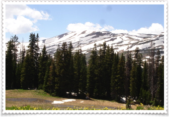
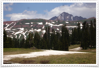
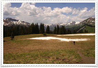
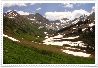
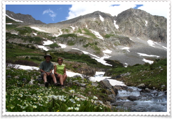
Finally we reached the top, and the views were magnificent!!!!! Spectacular!! Incredible!!!
This is why this place is so special to me. What you see are so many colors (reds, grays, greens, pure white, browns,) and all the textures (rock, snow, grass, leaf, clouds, flowers, water), and all of it mixed together yet each one stands out perfectly to your eyes.
(That's one of the Maroon Bells in the photo on the right.)
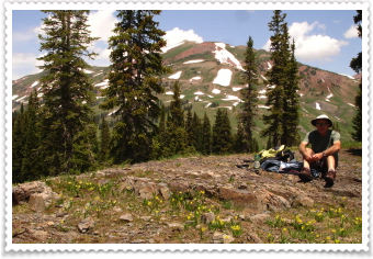
This was our lunch spot (actually, Danny got out the food, while I was jumping around going crazy for the views!)
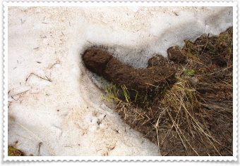
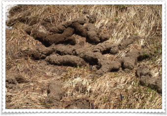
What are you thinking when you see these?
They're the ways ants live in the mountains. Instead of going underground, they go under "snow". The photo on the left if one sticking out of snow (the rest is under the un-melted snow) and the ones on the right you would see all around the top of the mountain where the snow had already melted.
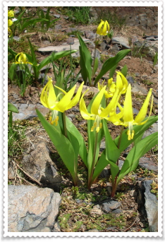
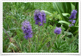
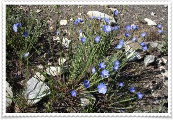
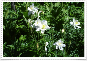
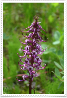
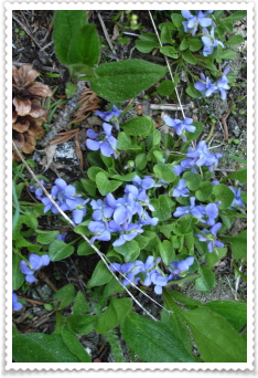
More beautiful wild flowers...remember that Crested Butte is the wild flower capital of the world!
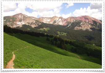
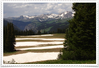
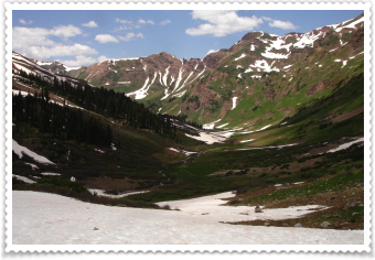
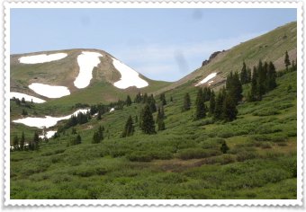
These photos show part of the trail. The photo in the middle shows the road we hiked up and as it snakes it way through the valley. Isn't all so gorgeous?
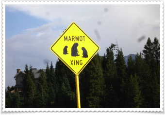
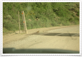
Another one of my "goals" when coming back to CB, was to drive down Slate River road again. Danny did the honors and we enjoyed the beautiful water falls, the fast running Slate River, and a little wildlife. Right after we passed this sign, we saw two marmots run across the road. I took this one on the way back out.
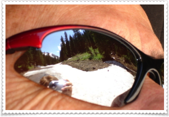
Okay, my photography needs a little work...but I've added a new series to my photos...this ones called....ready? it's clever....
"Sunglass Shots"
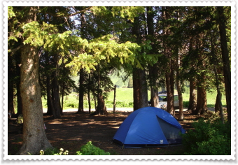
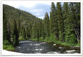
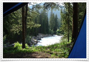
We found a wonderful campsite on Gothic Road; our tent is set up, the night chill is all around, but so are the clear skies filled with stars, and the sounds of the rushing stream across the road.
It's not only great to be back in Colorado...it's so spectacularly cool to be back in Crested Butte.
*****
7/9

This is the view from our tent. We both slept great last night!
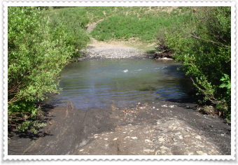
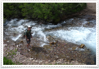
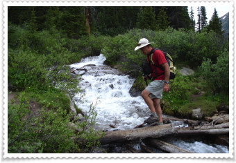
This is the beginning of the trail we took today (photo on left). Last year, I drove through this, but the water wasn't near as high, now it's about a little higher than the bottom of a car door. Last year I went about 3/4 of the way on this hike, but this year really wanted to finish it and super wanted Danny to see it too.
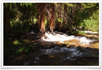
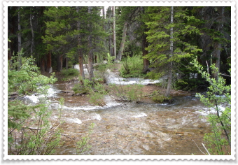
This was only the first; the second was about a 1 1/2 mile down the trail...you can see (photo on the right) that the stream is WAY out of its banks and spilling through the trees. We had to be careful, but it wasn't a problem...however there was a family behind us that shouldn't have even considered going over. To say the least, my gallant fellow hiker, went back and forth a couple of times to help them out...his feet were practically numb when done. We left our sandals on (I'd never even put on my boots), knowing we had a couple more streams to ford.
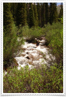
This was the scary one! We had to hike off the trail just to find a spot to cross. The current was so strong, but we managed to stay on our feet. As I was crossing on our way back, I heard this huge boulder go rolling down the stream, pushed by the water. It was below me, so I wasn't worried I'd be hit by it, but it sure was a reminder (as if I needed one) how powerful water can be.
(We had some discussion as to if this was the MOST scary water crossing we'd ever had. Danny said yes it was; I still think it was a HUGE and DEEP one we did a couple of years ago in Wyoming). But...onto the rest of the hike. We still had some smaller streams to cross, but they were no big deal, so we sat down, dried off our feet and put our boots on.
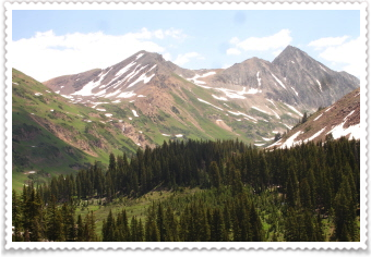
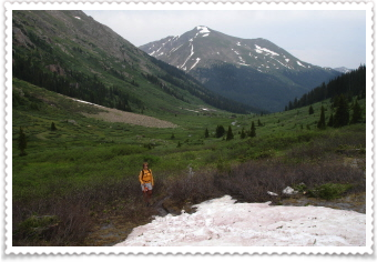
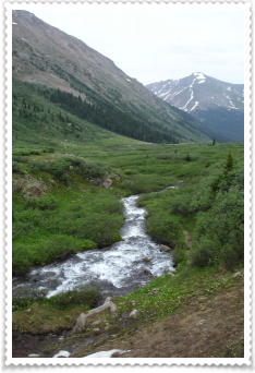
This hike takes you through the valley, then up into a bowl, circled by the mountains. So worth all the effort to get here. You can see there's still a lot of snow up here, but the sun was so bright and sky so blue...just perfect. All around us, the snow was melting into these beautiful waterfalls.
Here's a little of what Danny goes through to get a picture of the two of us (I get bored waiting for him, so I'm documenting the process). This tradition he started when we began hiking, and our bedroom walls are filled with the photos of the two of us in some amazing places.
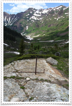
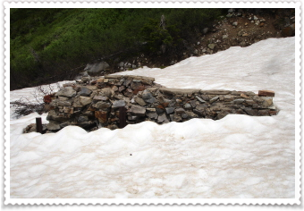
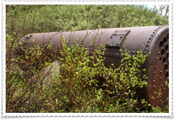
We hiked 4 miles into the wilderness to a site of an old silver mine. I'm always so amazed at how these mines are in the most beautiful places...and ....how the heck did they get all this junk up there? The photo on the right, is of an old boiler....it must weigh a ton and have killed a whole herd of mules to get it there.
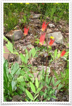
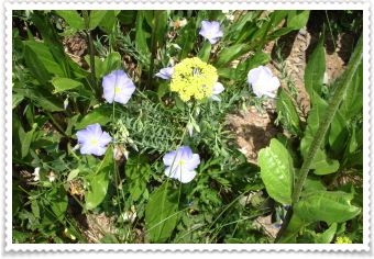
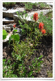
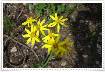
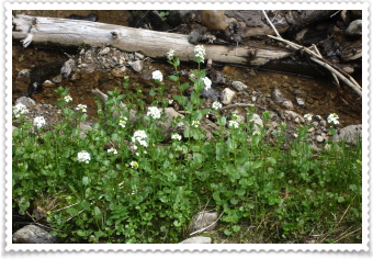
Here are today's beautiful flowers...they're so triumphant that they will grow anywhere!
The photo on the left was Danny's favorite mountain; and the one on the right is of part of the trail....only it looks like a stream....but, you just keep going and walk right through it!
Danny looking over one of the streams at the place where the trail crosses it...we chose not to cross here though; and the photo on the right is of the second stream crossing on the way back.
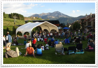
We finished the hike and drove a very short distance to our campsite. We met our "neighbor" and visited with him and his dog for a few minutes. Then we got back in the car, and drove to Mt. Crested Butte to listen to a band play and ate our dinner, picnic style. We love to hear live music and watch the crowd. The band playing was "The Lucky Bucks" from Tennessee.
It's now dark and we're driving back to our camp (it's really hard to type on my computer while on a bumpy dirt road, so the typos aren't really my fault); going to enjoy a beer then head to bed.
*******
7/10
Today we decided to go on a shorter hike. We'd been to Judd Falls before, you pass it on the way to Copper Lake; a hike we did in 2006.
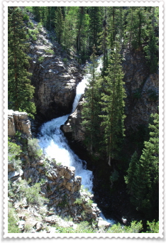
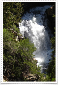
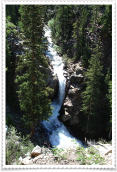
The uphill hike was a good way to get our legs moving in the morning, and with more water than ever, the falls were beautiful. There's no way (no man made trail) to get to the bottom of the falls, so all the shots are from the top. We climbed around as much as we could; they're wonderful from every angle!
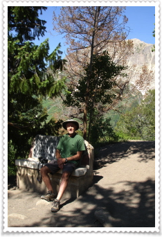
Danny's resting on a bench that sits at the viewpoint of the falls. The falls are named after "the man who stayed" (until he was almost 80) even after the mines were closed. So, in this tiny town of Gothic, is where he decided to live.
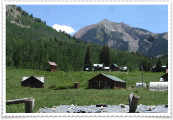
Gothic is now the home to the Rocky Mountain Biological Research Center where students, professors and others come to study and research flowers, trees, lakes, insects, mammals, etc. in this area. At the high point (now) there are about 150 people living in these tiny cabins spread throughout Gothic (this town is about 1/3 of the size of Linwood). More on RMBR later.
So every time we drive from our campsite to town, we drive through Gothic. And when you're hiking, you'll see some of the students in the field doing some of their studies.
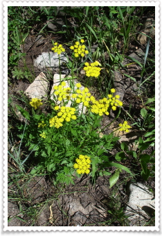
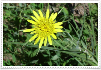
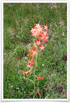
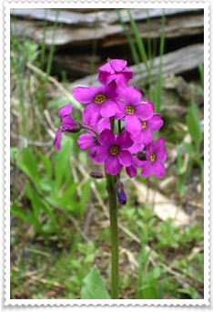
Here are today's wonderful wildflowers.
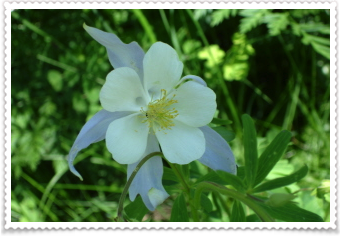
Columbine!
The Colorado state wildflower. This was the first day we've seen so many of them. Such a perfect flower.
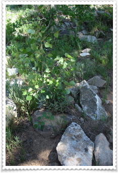
And the perfect tree...although this one is very tiny. The Aspen. I love to walk under a grove of Aspen trees; when the wind blows through the leaves, they almost sparkle in the sunshine.
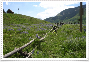
We'd been driving by this fence (really cool fence) surrounded by all these beautiful purple flowers all week...it was time to take a photo and share it.
We'd decided to pack up our tent, clean out the car, and SHOWER! at the hostel in CB. I also decided to wash out some clothes while showering...so I was good and clean with laundry soap and some wonderful smelling soap Jan gave me for the trip (thanks Jan!) We were driving to Taylor Reservoir and then up Cottonwood Pass road (at the beginning of this trip we'd driven up to the top of Cottonwood Pass on the other side) to see what it was like and to find a camping spot.
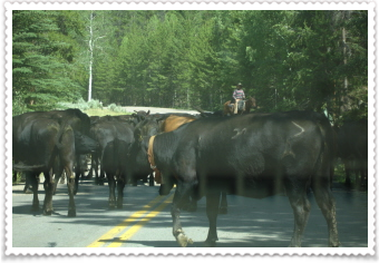
Once again, as we passed a sign that said "Cattle in the Road" we no sooner drove around a corner to come to a dead stop by cows EVERYWHERE! They were coming through the trees and surrounded our car. The cowboy on the horse just kept waving us on, motioning us to honk and we slowly got by all the mooing "wildlife". The Taylor river, which we followed through the canyon, was beautiful.
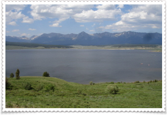
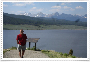
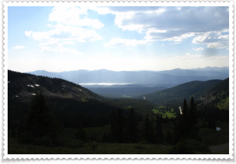
We made it to the Reservoir and took in the views. The photo on the right, is one taken while going up Cottonwood Pass; you can just barely see the water in the background.
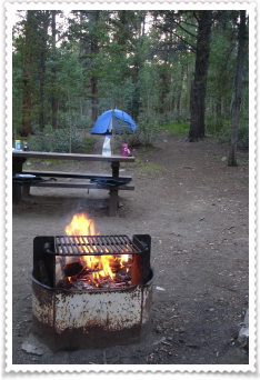
Tonight we were big-spenders and bought a campsite in the Collegiate Peaks campground. The best thing about these campsites, is you can build a fire. Danny and I never build a fire in the wilderness; most of the time it's prohibited, but with all the things that can go horribly wrong with fire in the forests, we just never take the chance.
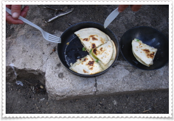
We tried a new recipe for dinner...Pear Quesadillas. Made with havarti cheese, sliced pears, jalapeno, and some red onion. They were delicious!
We sat around the campfire until way past dark, watching the stars pop out one by one, and then fill the sky.
It's time for bed.
night night.
*****************
7/11
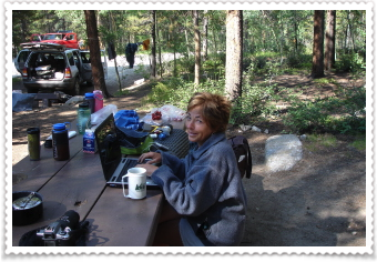
EEK! This is what I look like early in the morning after crawling out of the tent. Danny grabbed the camera and took a photo of me working on the website and asked "so this is your idea of wilderness?" See...he kind of has a love/hate relationship with my website. You have to understand, since we only have one computer, he can't ever follow my trips. So, from his perspective, what he mostly knows about it, is me asking to stop in the towns we drive through to get an internet connection...and I say.."just five minutes"...then "five more"...anyway, he's very patient. (So I'm not really sure what the "love" part is of how he feels about the website.)
We're back in the Collegiate Peaks Wilderness and going on a hike that a gear-guy in Salida recommended; Graham Gulch. It was pretty "closed in"...meaning no big views on the way up to the top. We did have one water crossing however. Now this one wasn't as big as the one's we've had before on this trip...but just big enough to make you wonder whether or not you needed to stop, take off your boots and put on your sandals and wade.
I should tell you here that Danny is a "leaper"...he opts to LEAP rather than change into sandals...and he's a good leaper (this is why he was so good at volleyball, baseball, etc.) And, his leaping over streams has only gotten him in trouble one time; the consequences were purple and blue, but his injuries minor. I, on the other hand, was born with a nice round butt, which I have made a little larger over the years. Having that feature is good for sliding down horribly steep trails, scree and rock faces, and for falling on (which I still do plenty of), but it's not good for leaping.
But, yesterday, I decided to go for it. Taking a big breath, I LEAPED both going over the stream and on the way back. It wasn't pretty, but I didn't fall in!
The trail ended here. But we were mystified by the saddle between the two mountains (photo on right). Everytime we've decided to climb a saddle, the views have been amazing. We could see, through binoculars, a trail going up to the saddle, and one a little lower in the valley. But not a trail leading to where we were currently at to those trails. We were surrounded by scrub bushes (horrible to hike through). We climbed off trail and higher up to try and find a trail. After about 30 minutes of searching, we gave up. A trail to revisit another time.
We hiked back down to the car and drove down the road....and found a wonderful, free little camping area, made lunch and set up our tent. We wanted to go for another hike, even though it was late in the day, and got a recommendation on one from a local. We didn't know much about it, but took off for the trail head anyway.
The trailhead was at the bottom of Independence Pass; one of my favorites! I love the Twin Lakes area; it's so beautiful.
WATER, WATER, WATER, EVERYWHERE!
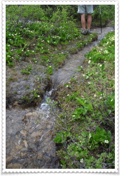
The trail went through a wonderful valley, filled with wildflowers and rushing streams. We must have walked through a marmot habitat right at the beginning, because they were scrambling all around us. We hiked higher and higher, but the water filled the valley. The photo in the middle and on the right is actually the trail; you can see Danny trying to figure out a way around it, but the sides of the trail were mostly scrub bushes.
It was 5:30 when we'd started on this trail. Knowing we'd probably not make it to the lower lake, but just wanting some more time in these amazing mountains. By the time we'd trekked through the water, mud and scrub bushes, we had about 30 more minutes of hiking time, before we needed to turn around and get back to the car before dark. Then the trail crossed this stream. EEEK! It would have taken the whole 1/2 hour just to get across it...and it was a nasty looking crossing. We decided this was a good point to turn around and hike back to the car.
We reached the car plenty before dark, walked down to the stream nearby, and washed all the mud off our scratched up legs, washed our feet and changed into dry socks and sandals. Even though we didn't make it to the top, it had been a wonderful evening.
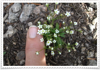
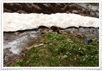
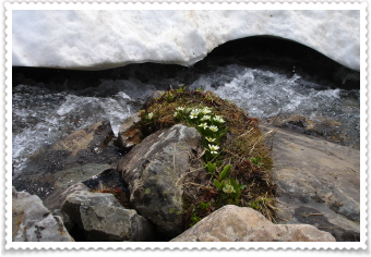
I put my finger in the photo on the left to show you how tiny these little white flowers were; the most dainty little blossoms you've ever seen.
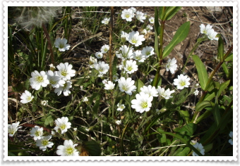
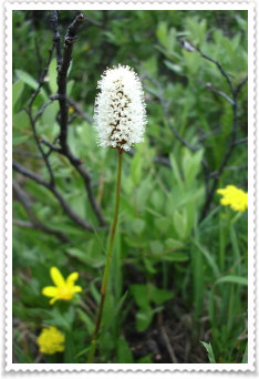
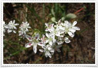
Everyday more and more wildflowers pop out to begin their short-lived lives.
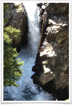
This is the view from our tent!
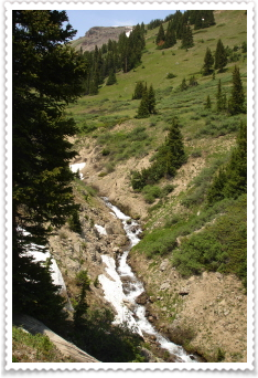
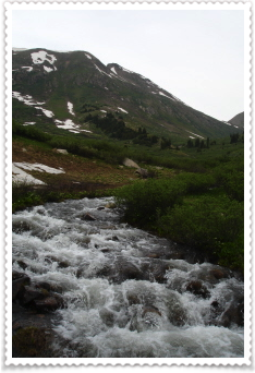
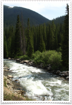
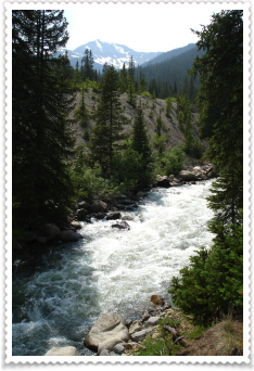
It's very loud, but really cool to see this so-powerful flow of crystal clear water.
Raisin and nut curried couscous for dinner tonight and we're sharing a piece of "fruit of the forest" pie we bought at Bongo Billys in Buena Vista....ummm...what a day!