Day SIX - Thursday
The skies were blue this morning....YIPEEE!! Today our hike is to Daisy Pass...right down the road from our campsite. I’ve tried hiking up to this pass once before, & got about 300’ below the top & turned around due to bad weather...so I was really excited to try for the top today.
To get to the trailhead, you cross the Slate River, which is low right now, so no problem; then drive or walk the 2 mile 4WD old mining road. I’ve walked this road twice before & never driven it (of course).
But, I chose to start today in the passenger seat & learn from there. It was actually much more relaxing to do that & look around than analyze every few feet of road to drive. Here’s another thing about driving these roads...sometimes it’s no faster to drive them because you have to go so slow, but I guess it’s easier on your body to sit rather than to walk & it took 4 miles off the hike. Of course Danny did a perfect job of driving the road, having fun & NOT WORRIED AT ALL...I am truly envious of his skill & mindset!
We parked & crossed the stream & started up the trail. We had two miles to hike up to the pass with about 2,000’ elevation gain...so in other words...UP with every step.
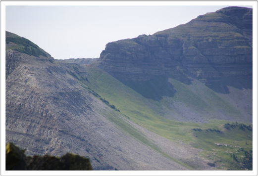
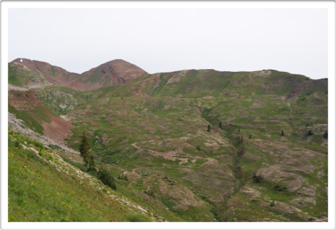
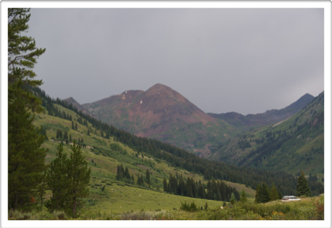
Looking up to Daisy Pass behind Danny...see the low spot in between the mountains? The spot to the right is Daisy Pass.
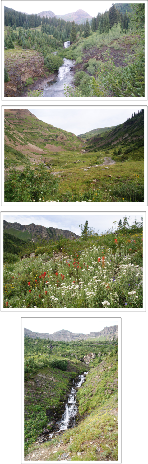
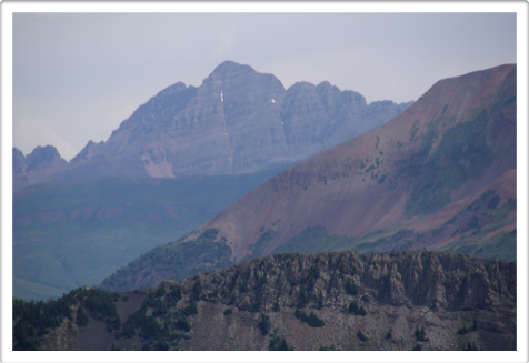
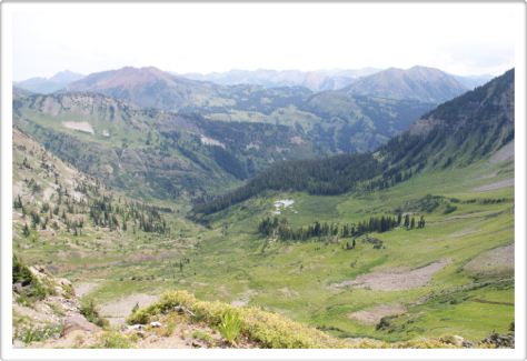
The views all around us were spectacular!!!
I see a Maroon Bell peeking over the top!
So, here’s some more info about this hike:
- I’d seen a picture posted on FB, taken from Richmond mountain climbed from Daisy Pass...of course, I would love to have that shot, but was unsure how exactly to climb Richmond...we’d see if there was an “easy” trail once we were up there;
- This is one of those “connect the dots” places for me. From the top of Daisy Pass, I’d be able to see several other places I’d hiked to but see them all from thousands of feet up; there was also a pass I’d never hiked that I wanted to check out from the top;
- Before you start the last mile of the climb, the old mining trail continues up the side of another mountain to some high mountain lakes...I was curious about that hike, those lakes & the views from there.
The pics below show Danny getting nearer to the top.
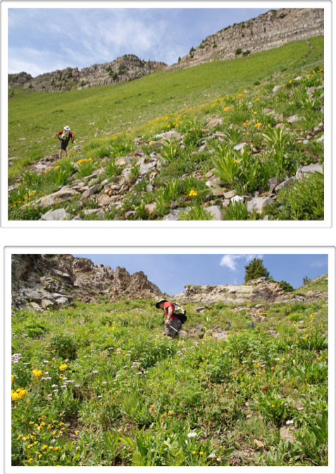
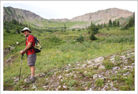
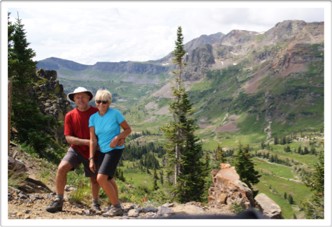
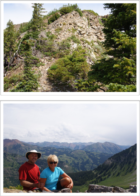
We made it up to the top fairly easy & I was blown away by the views! (If it looks like Danny’s holding me up, he’s keeping me from stepping off back down the steep trail...I had a little ways to run then turn before the timer took the shot.)
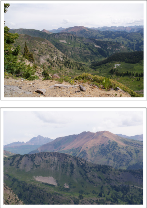
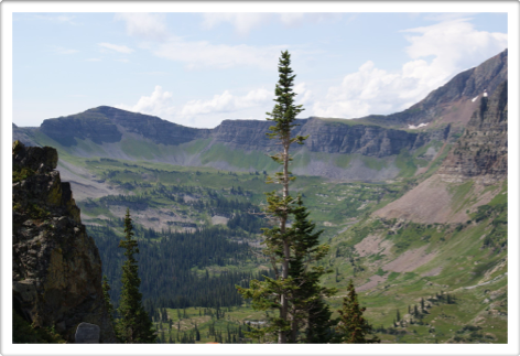
So, if any of you are trail nerds out there....I’m going to connect the dots with next few views. The pic below is of Scarpe Ridge (yesterday we saw the other side of this ridge from Green Lake). Scarpe is usually the first hike I do when arriving in CB each summer.
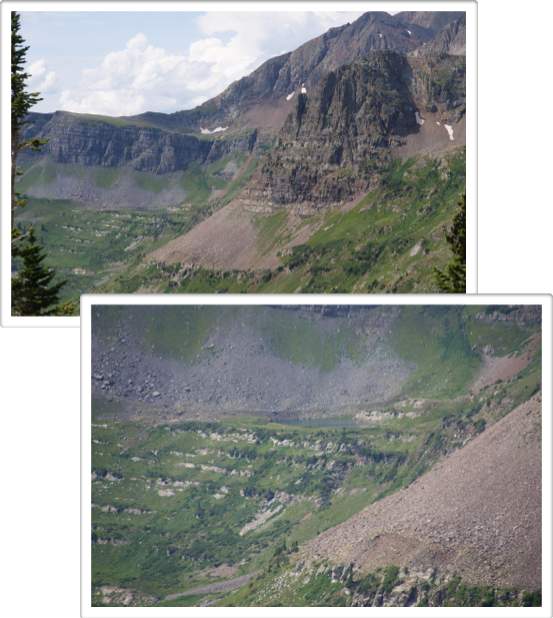
Last year after our super-scary hike, we ended up hiking over Star Pass. A “DD” rated pass that straight down & all on scree...safest to come down on your butt! Here’s the view of Star Pass from across the valley at the top of Daisy Pass. (The part in between the rocky mountains on the green are the switchbacks down the pass & into the valley.)
When you’re standing on top of Scarpe Ridge, you can look down onto Blue Lake (distance & zoom shot). From Star Pass you hike across the valley to Blue Lake...I loved being here with Danny last year.
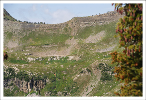
From our view on top of Daisy Pass, I can see Oh-Be-Joyful Pass (see the switchbacks?). It’s one I’ve never done & the hikes approaching both sides of the pass are super long or backpack trips. While I was curious about where exactly Oh-Be-Joyful Pass was, now that I’ve seen it, I’m not sure I ever want to hike it. Good to know.
Then I looked for the trail up Richmond Mountain for the photo shot I wanted. It wasn’t hard to spot a slight trail heading off our pass & up the mountain, but only a trail in the scariest since of the word. No Thanks. I’ll PASS (ha ha). I can live with all the awesome shots I can take from the top of Daisy...no scrambling required.
This is the view from the pass towards the mining road that heads up to the lakes (you can see the road winding up the mountain). We’d seen a few other hikers on the trail & they all headed up that way.
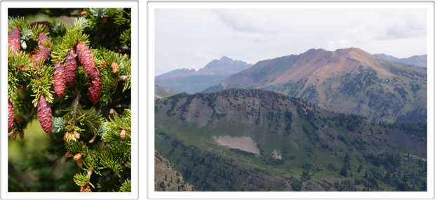
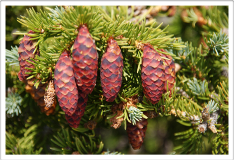
Really cool bright colored pine cones at the top of Daisy Pass.
The view looking back down the trail we hiked.
As we got back down to the trail, we sat & discussed trying to climb the mining road to the lakes. With another 1,000’ elevation up, we’d be out at least another 2.5 hours. The sky was looking OK, but not super-clear...there looked like a dark cloud making it way over the pass.
We’d be leaving CB tonight & need to pack up camp. We were hoping the tent & all would be dry & the rain hold off until after we were done. Plus, hiking all that elevation (up & down) & then driving in a car for a few hours is a killer on the legs.
We chose to leave that hike for next year...I can’t wait to come back for it!
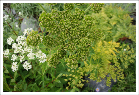
Here’s a few of the flowers & fauna we hiked past.
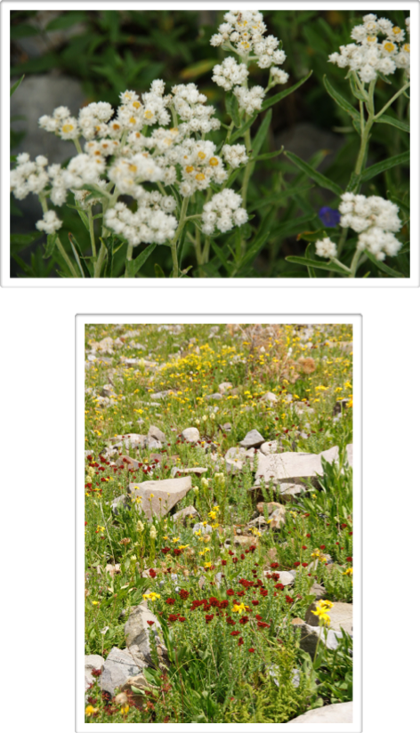
This plant has four different stages happening....super awesome!
As we slowly negotiated the road back down to our campsite, the sky grew black behind up, thunder roared & tiny drops of rain started. We were so glad we’d made the decision to postpone the other hike.
We’d planned on cooking lunch in camp, but with the weather turning bad, we went to Plan B. I broke down the tent, Danny loaded everything else up. I definitely can’t wait to be camping & hiking down this road next year...it’s always sad to be leaving.
We made lunch in one of the town parks that has covered picnic tables & stayed dry.
We had one more opportunity to visit the Brick before we left. Neither Dan or Dickie were working today, but we both enjoyed their special beer of the day...New Belgium’s Heavenly Fejoa Tripel.
We walked down to the Ice House to see if my artist friend Kate was there, but as she was gone, I left a note on her door that I’d see her next time...which I hope isn’t too far in the future!
It had been another nearly perfect (I did chicken out summiting Gothic mountain) trip to Crested Butte...& it’s always super spectacular when Danny can come with me. I think he’s loving this place a lot too...& that makes my heart happy & mind hopeful! We BOTH fit here...together.
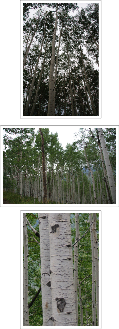
Back on the road...I’d chosen a very, very slow way to drive to our next destination. I haven’t been over Kebler Pass for awhile. It’s home to the largest Aspen Grove in the country & someday, I’m coming to see it & hike it in the fall...leaves of gold...I can’t wait.
But, it’s 31 miles of twisty, slow & today extremely muddy road (both bikes & the camp box got COVERED in mud...ick!) so it added another hour onto our 5 hour trip heading north. However, we weren’t in a hurry, & I love this forest of my fave trees in the world!
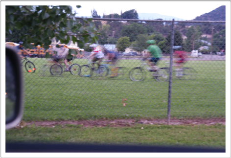
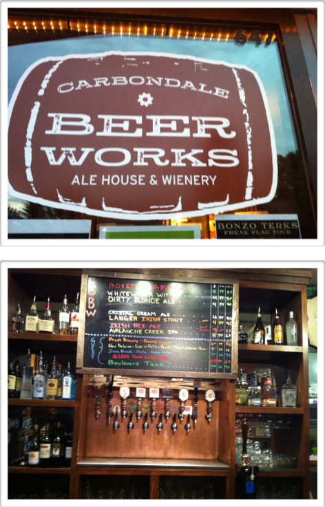
It’s a pretty drive even after you leave the pass, continue over McClure pass & down into Carbondale. There was a brewery we’d never been to before in Carbondale we wanted to check out. On our way through town, we caught some sort of “bike-polo” game going on...Coloradans love to play!
Carbondale Beer Works is a pretty cool little brewery...I’d definitely go back. The people at the bar, working & drinking, were friendly & fun to visit with. Danny had a Whitewater Wit & I tried the Avalanche Creek IPA.
Knowing we wouldn’t be driving all the way tonight, we gassed up in Glenwood Springs & after arriving in Avon’s rest stop, crawled in our sleeping bags ready for some sweet dreams...but this week, we’re living my dream! (One of them anyway!)