day 30…5.20
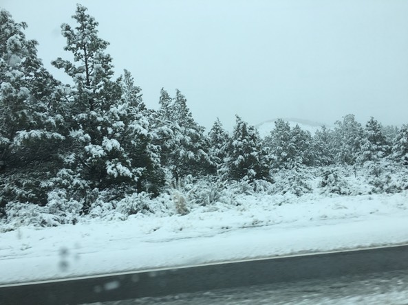
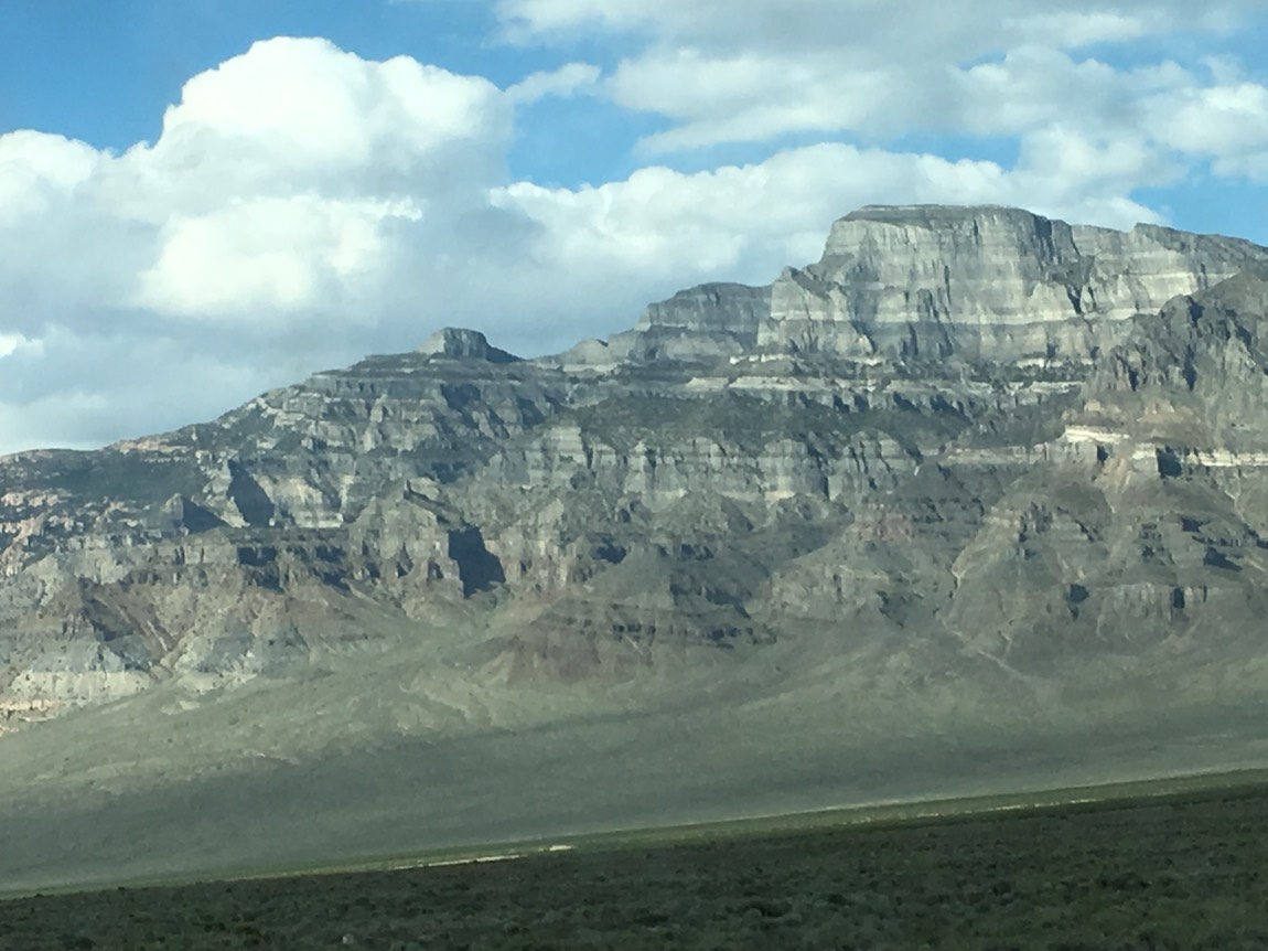
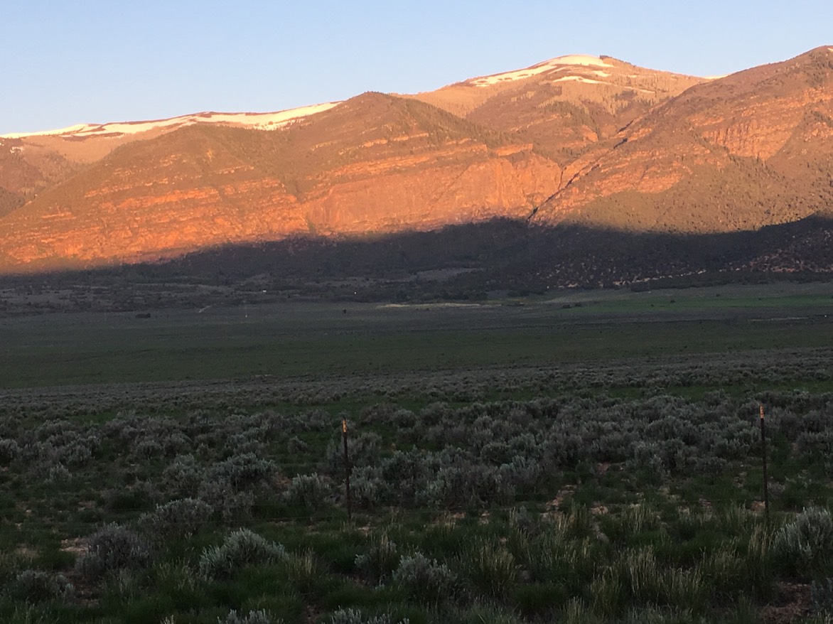
I slept for about 4 hours & it was still raining outside, but no snow. I laid in my bag & checked a few things on my phone for another hour then got up & drove over to the gas tanks to fill up. I thanked the attendants for letting me stay the night there, & they agreed I should go south rather than east. My original trip plan (before I left Kansas), would have taken me south of Bend to Klammath Falls then south to Lassen National Park then down to Lake Tahoe. I changed my plans last week when Sara called & said her, Kevin & Claire were making a last minute trip to Moab & what were my plans? Well, now they were to go to Moab…I’d change them in a heartbeat to see them all! I knocked off Klammath Falls, Lassen NP (I’ve been there before & they’re still plowing the roads in the park) & Lake Tahoe. But with this mornings change in route, I’d be going down near Lake Tahoe after all. I left Lakeview about 6am under gray rain filled skies. Before long it started to snow, but the road was free of snow. When I hit the California border, there was snow sticking on the ground & you could see the mountains had a bunch of new snow. I had to pull in for the state’s Agricultural Inspection (no postcard/contests this time) & pulled out a couple of avocados…which passed…they were grown in California. A little while later I stopped for some coffee (bad stuff) in a little town I was driving through & the guy in there said I’d hit some snow, but the roads were clear. I was pretty relieved.
It wasn’t long until it was snowing much harder, the road had a tire path with a ton of slushy stuff built up in the middle & there was about 4”-5” of snow all around me. It was slow going, but there were two other cars in front of me….for 75 miles we drove through the snow. ICK! & DOUBLE ICK!
When I drove into lower elevation, it was raining. I landed in Reno Nevada & stayed for about 2 hours…under intermittent gray/sun & dry/rain/snow skies. I called the Visitors Center at Tahoe City & asked my questions….it was snowing there & they are 4,000’ higher than Reno. I was perplexed as to what to do. I didn’t want to be in anymore snow…I’d only been at about 6,000’ when I’d driven through the earlier mess; I didn’t know what it would be like at 8,000’. I didn’t really have enough time to stay overnight & hope the weather would be better for tomorrow & then try to drive through the whole state tomorrow night. I grabbed a quick bite to eat & hot drink & took off on I-80 to head across the state. For 300 miles I was under these awful gray clouds sometimes covering the mountains in the distance & on & off rain. There is nothing out here but brown hills & highway. I’m now in a town called Elko. I’ve refilled my water jugs & am once again, at Starbucks. Tired of driving in the crappy weather, I think I’ll just stay here tonight. I’m 4.5 hours away from my destination, which goes south from here, through the mountains, which are currently getting snow. I may change my plans by morning. Days like these are tiring, disappointing & depressing. On the other hand, I have a lot to be grateful for…I was lucky enough to make it through all the bad weather & one bad day out of 30 isn’t too shabby! When you’re on long road trips, these times happen. Tomorrow is a new day & maybe a new plan…I’m so excited & looking so forward to seeing Sara, Claire & Kevin next week in warm, sunny & snow-free Utah! PS: Good thing I wasn’t going into Lassen…the storm hit them so bad they closed the entire road into the park today.
day 31…5.21
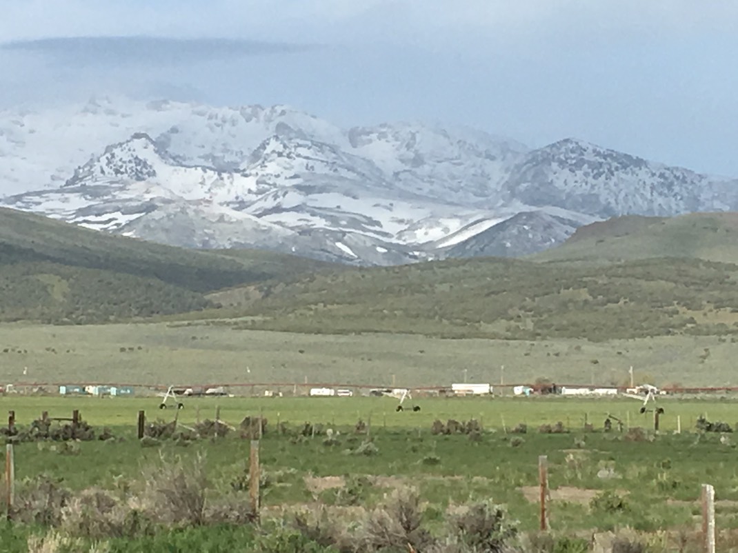
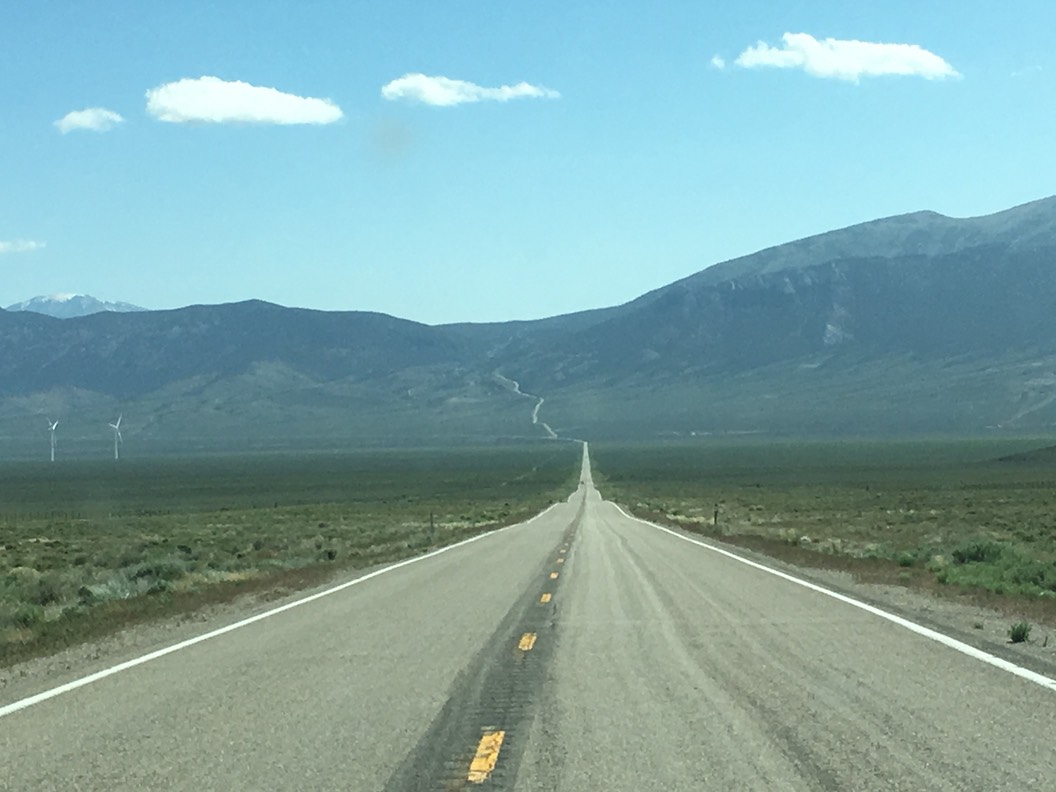
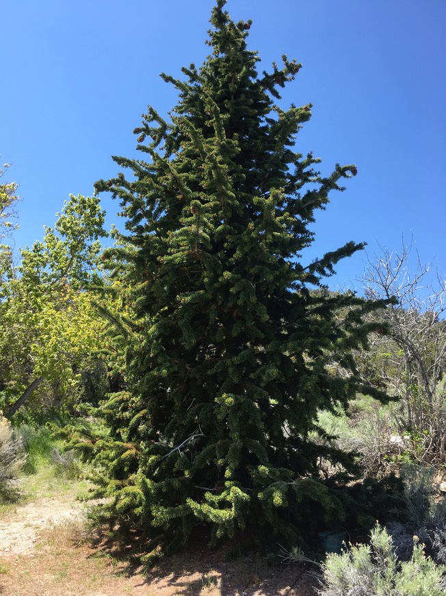
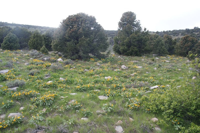
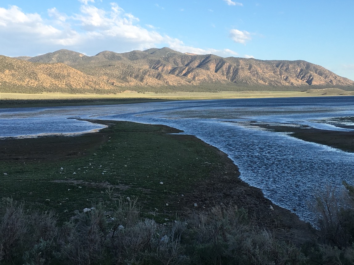
I slept great last night…I was tired from a short night the night before & full of tense muscles from stressful driving! It was early but the skies look like they might clear. I got a cup of coffee & plugged in & phoned Danny with my plans. He was headed to the lake to his mom’s place this weekend & I was going to head south to Great Basin National Park…right on the Nevada/Utah border. Once back on the highway & leaving town, I could see Elko was surrounded by a huge mountain range…big mountains with tons of fresh snow from yesterday’s storm. The sky was so thick & dark & gray yesterday, I’d never even seen these mountains. I soon turned off I-80 & onto a two lane road with a sign greeting me…”No services for 136 miles”. But, it was a beautiful drive through a huge ‘basin’ surrounded by snow covered mountains. The sky was bright blue, the sun was out & NO precipitation. While there were no services, there were some other cars, so not a ‘desolate’ highway…at least not on this Saturday morning.
I drove & drove (stopped in the first town & topped off the tank) & finally turned off the last 60 miles onto another highway…instead of being a straight ribbon of highway, this one twisted it’s way up & through a dense forest.
I arrived at Great Basin around 11:30. It seems what most visitors do here is take a tour of the Lehmann Cave. I’m not a huge ‘cave person’….I’ve been in several. Seven of the 10 mile drive to the top of the mountain was open, so I drove to the Mather Scenic viewpoint.
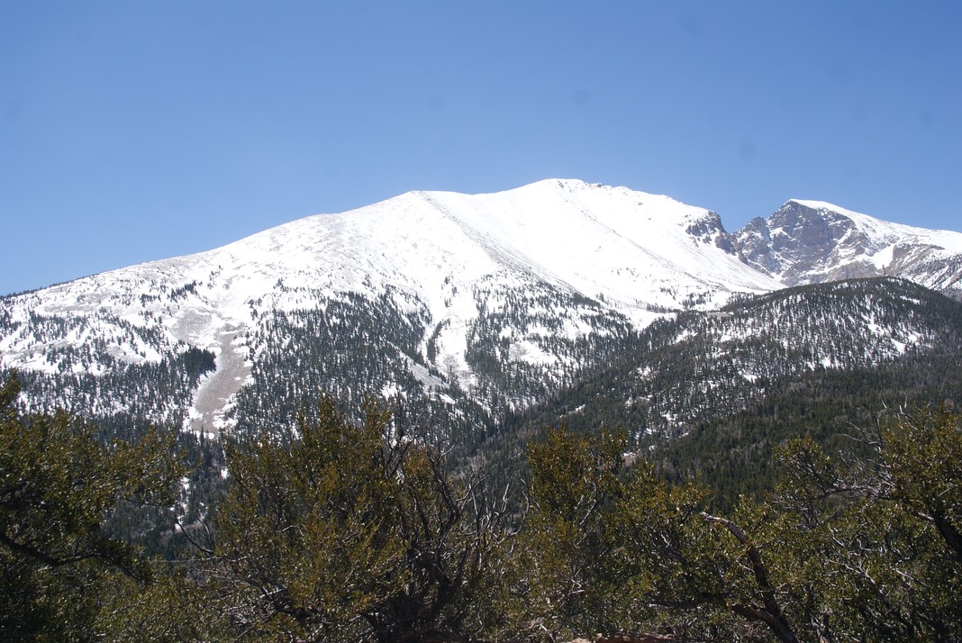
It was cold & windy at 9,200’! The trail any further was closed as was the Bristle Cone Pine Tree Trail…which I’d really wanted to hike. They are the oldest trees in the world…they have some here at the park at high elevation that are about 3,000 years old. But, I did get to see the ‘baby’ one they planted at the Visitors Center 40 years ago.
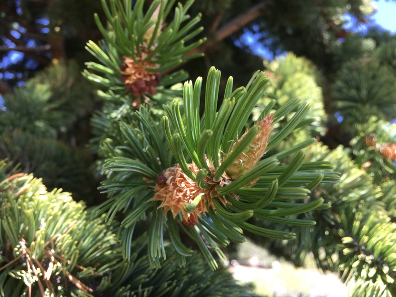
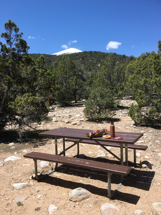
I found a picnic spot & ate some lunch & found some wildflowers blooming.
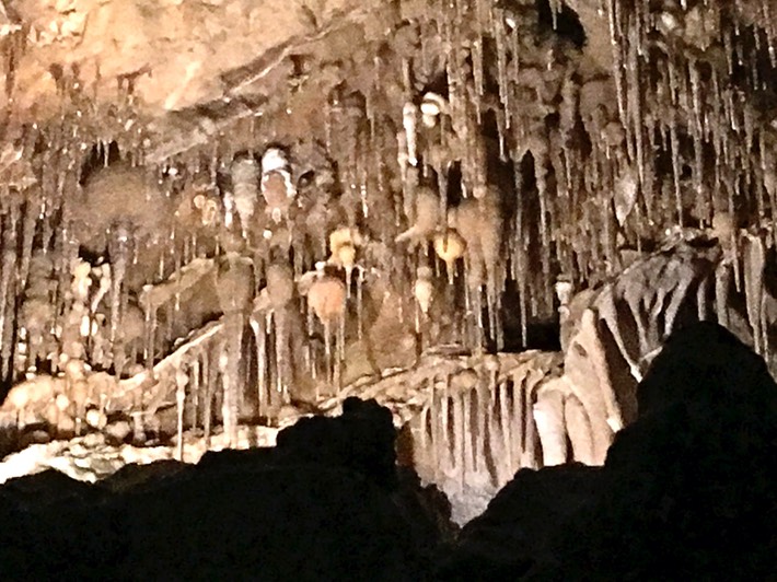
I had signed up for an afternoon tour of the cave, so after driving around this small park & seeing what I could, I was headed underground. Our super young guide was pretty knowledgeable about this cave, but was very chatting about non-cave stuff & made us all introduce ourselves before we started, went over the list of rules in a sing-songy way & wanted us to all touch a certain rock because we weren’t allowed to touch anything inside the cave (she actually said “I want to see each of you touch this rock”)….I sort of thought I was back in school. I obviously don’t know great settings on my iPhone camera for cave photos & know my DSLR doesn’t do well in low light…but here’s what I have..
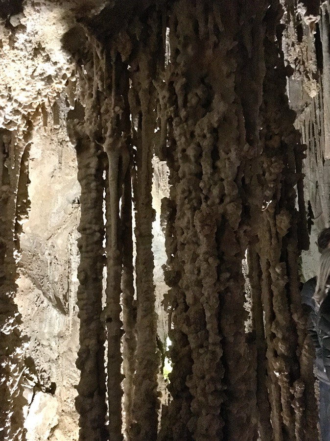
This was the most damaged cave I’ve ever toured (although if you ever go to Mammoth Cave National Park the damage there seems unreal…the NPS has put in a cafeteria inside the bottom of the cave…seriously…people can’t go without food for an hour?) The guy this cave is named after, Lehmann, evidently began charging for people to go through the cave when he first discovered it in the late 1800’s. He charged them a dollar & didn’t want them to leave without a souvenir, so his motto was “If you can break it, you can take it” (referring to the stalactites)…so it seems most are broken off. During prohibition, people made booze down there; at one time there was a speak easy down there complete with a small band; a movie made where they flooded it with water, & as you can see in the pic below, people who toured the cave used candles for light & using the soot from the candle, put their initials & words & dates (there was one for 1894) on the ceiling….it covered the ceiling in one entire room.
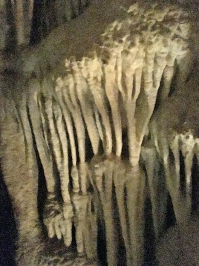
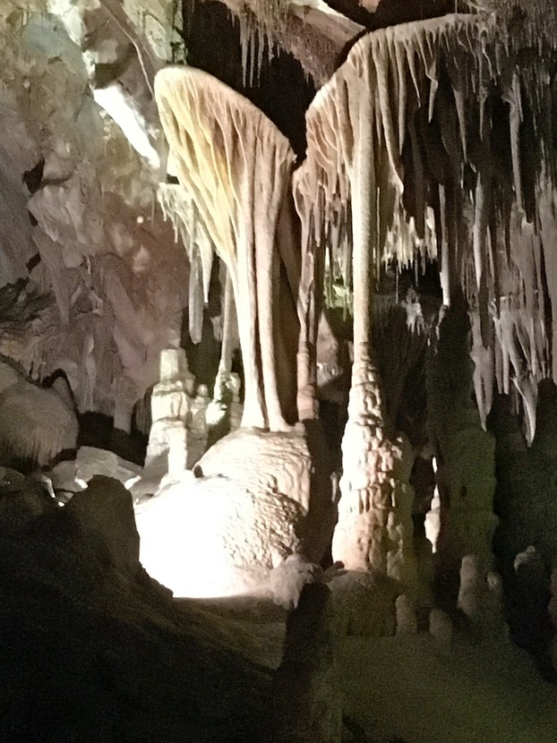
Here are pics of my two favorite cave-things (I don’t remember what they’re called..see I’m not so in to the cave thing). The pic on the left shows something they refer to as bacon (it looks like bacon…especially when you shine a light behind it) & the pic on the right is called turnips…when water can’t find it’s way out of a straw (another formation) & gets kind of bulbous.

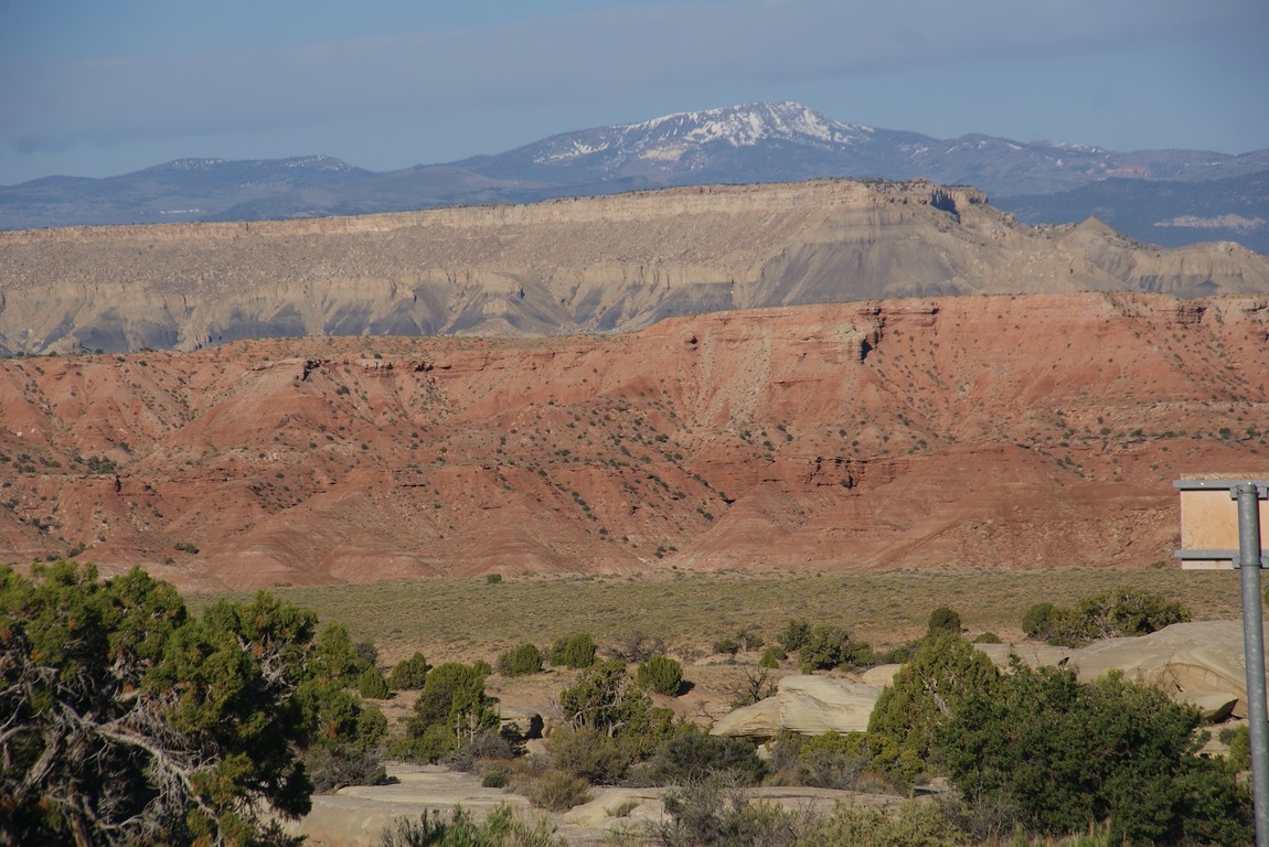
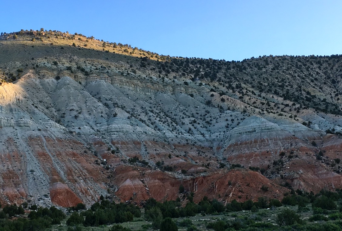
Well, that was my cave tour & the end of my day at Great Basin. I headed east & soon crossed over the Utah border & the landscape got very different…no mountain views, but huge gigantic rocks everywhere.
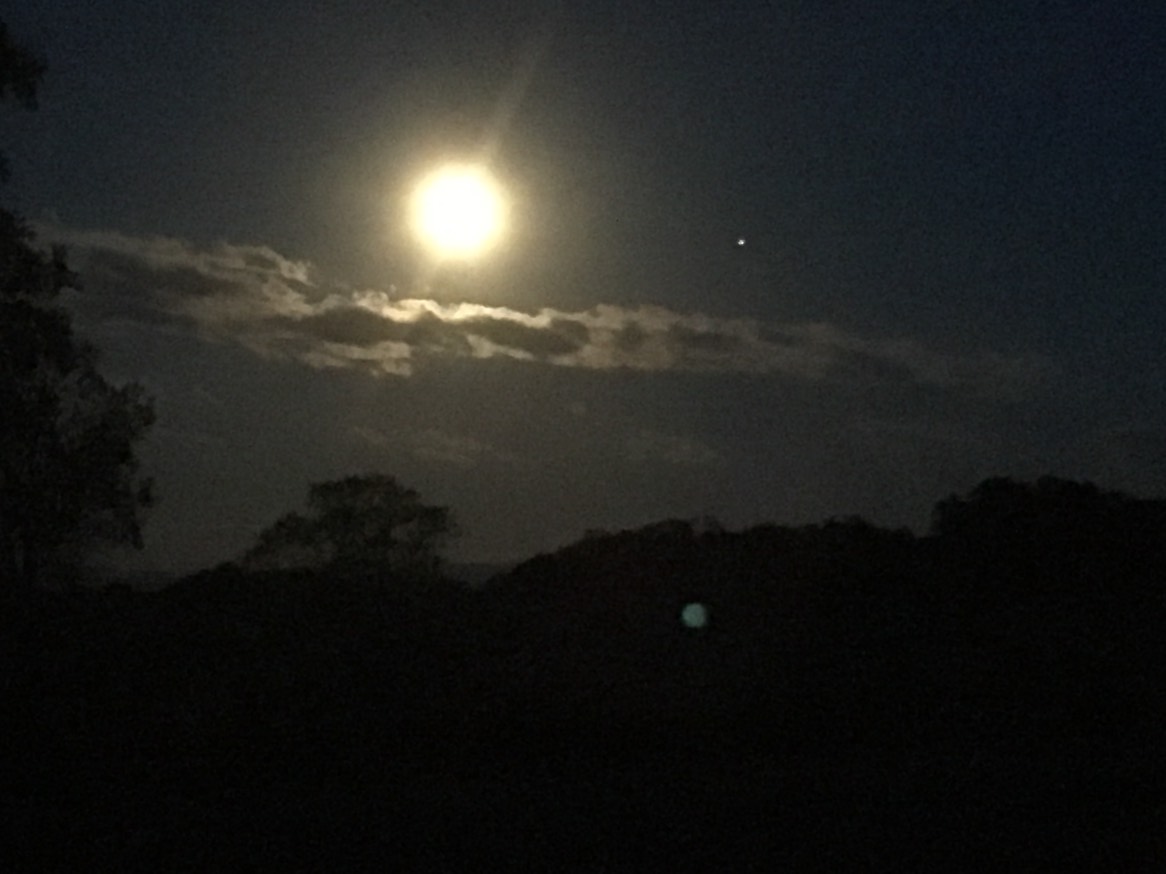
I wanted to find a place to camp before dark & soon I found a dispersed campsite that was just perfect!
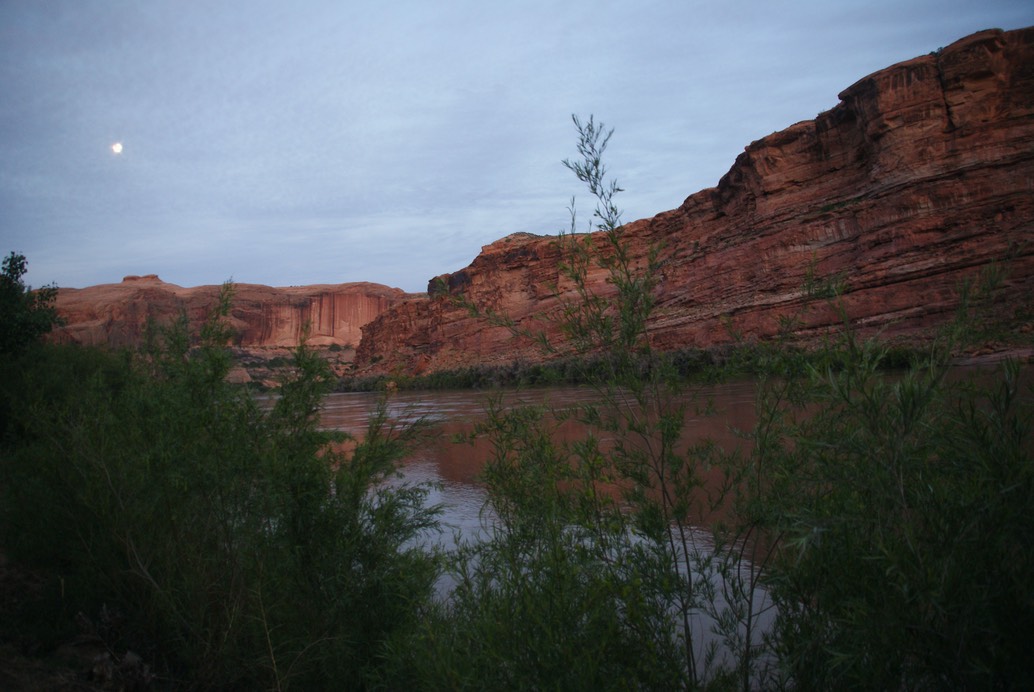
Love these full moon nights & beautiful skies!
day 32…5.22
As I pulled away from camp early this morning, I could still see snow up on top of the rock.
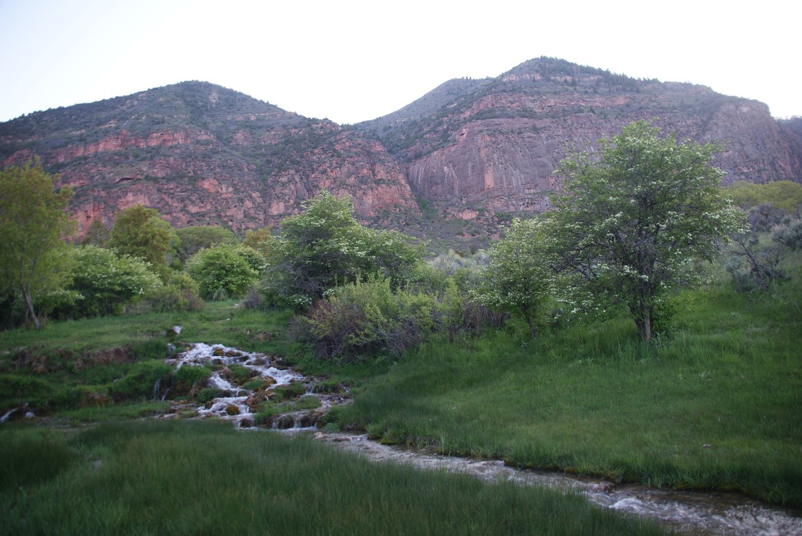
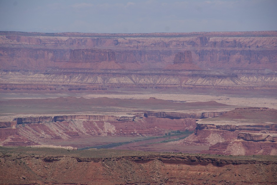
The drive from Salina, UT along I-70 is super awesome. There are quite a few scenic viewpoints. So much of southern Utah is wide open spaces—canyons, rivers, huge rock formations & red & orange colored cliffs…pretty amazing.
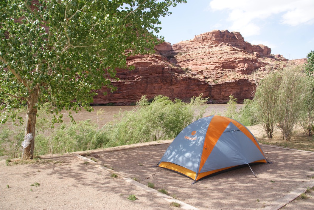
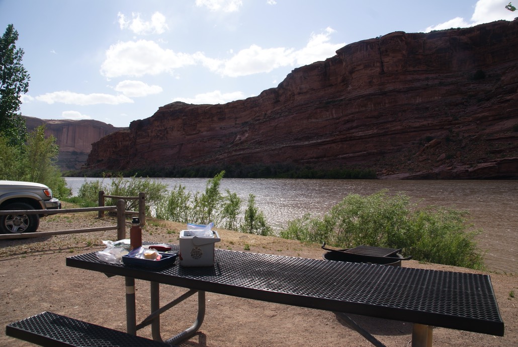
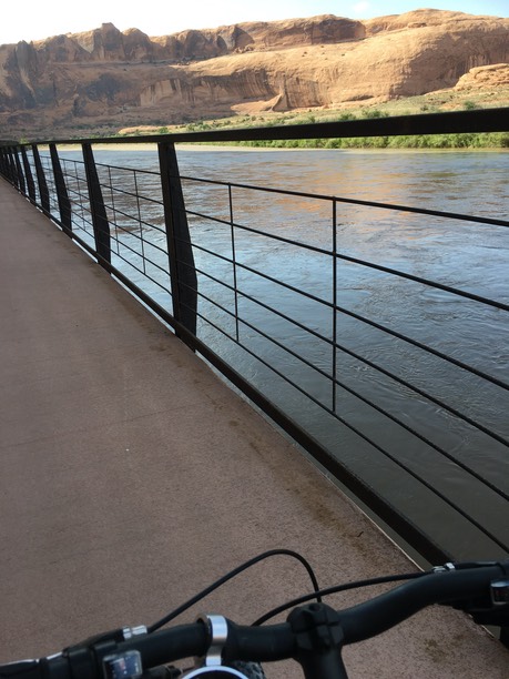
I soon landed at my destination for the next few days…Moab. Home to Arches National Park & one of the Canyonlands National Parks & so many other hiking & jeep trails, opportunities to play on the Colorado river, mountain biking & rock climbing, but not much good food & I’ve yet to find any good beer (Utah’s has the weirdest liquor laws). I needed to find a campsite…not an easy task heading up to the holiday weekend next weekend. But the best time to score one is on a Sunday morning when people are leaving. I was trying to find one where I had cell service, but even the full BLM campgrounds didn’t have service…it’s kind of sketchy all throughout Moab. All the campgrounds had “full’ signs, but I’ve learned to ignore those & do a drive through any way. On my second campground I scored a site right along the Colorado River. I put up my tent while the wind was super gusty, then set out to find a shower. There are 15 places that sell showers in Moab…I think that’s a record number of all the places I’ve visited. My fav places though are the local Rec Centers, so for $5 I bought a shower…& I really needed one. All clean & sweet again!
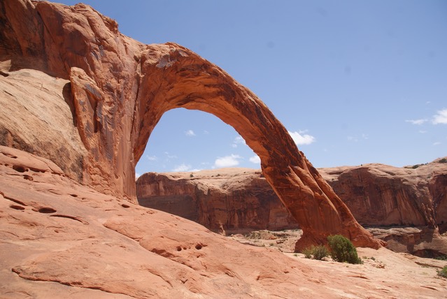
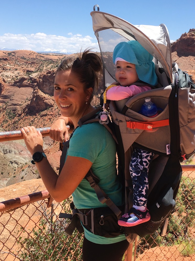
My purpose for coming to Moab was to meet up with Sara, Claire & Kevin! I was pretty excited to see them…Claire is learning so much everyday & while FaceTime is awesome, & I’d be a crying mess without it, I couldn’t wait to see them all in person. I’m supposed to meet up with them tomorrow, so I went to hike Corona Arch. This is my third time for this quick & fun hike. It’s only 3 miles round trip & takes you to what I think is the 2nd best arch in Moab…the first being Delicate Arch inside the National Park.
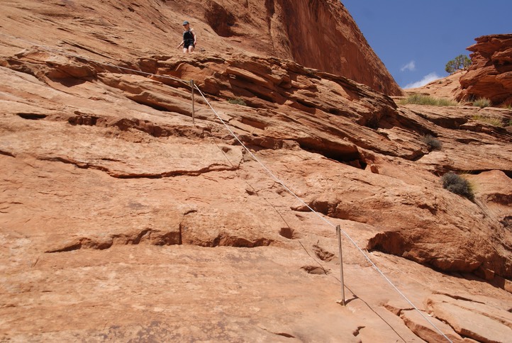
When you hike on slick rock, as most of the hikes in Utah are on, you learn to follow rock cairns…small piles or columns of rocks to mark the path. The trailhead is a few miles down a road that follows the Colorado river on the western side…this is also where a lot of the climbers are, so as you drive your way down the road, you pass tons of climbers up on the rock. Here are some views of the trail with it’s fixed chains & one ladder.
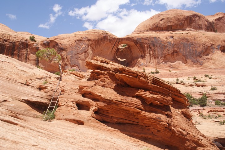
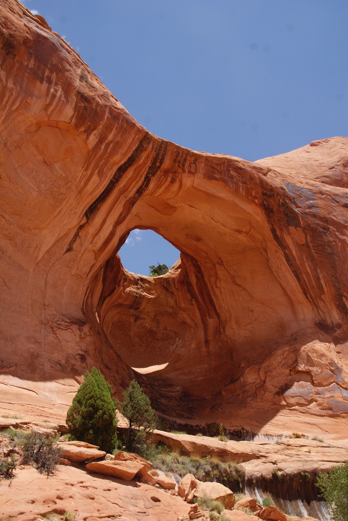
There are two arches along this hike…one looks more like a hole in the rock…it’s named Bowtie Arch.
In 2012, when I first hiked to Corona Arch, climbing was still allowed here. I watched as a group of three guys from Wisconsin started up the route. We’d visited before they started their climb & they even joked they’d like me stick around in case someone needed to call 911. They were interesting & fun, but as much as I like to watch climbers, I really didn’t want to watch this. So, I said good bye & wished them good luck & lots of fun. Here’s the old route: Climbers would work their way up to the top (on the back side where their is a huge flat wall) of the arch, then swing down & through it. I think there’s even a beer commercial that shows someone doing this. But after so many accidents & fatalities, the BLM removed all the bolts & doesn’t allow climbing.
It was busier today than I’ve ever seen it, but then again, it is a Sunday. But when I finally got up near the arch, everyone was gone & I got my photo without people (good luck doing this at most places. People innocently decide they want to ‘picnic’ under the arch or just sit & contemplate for awhile, in spite of the place being crowded, therefore end up in the middle of everyone’s photos).
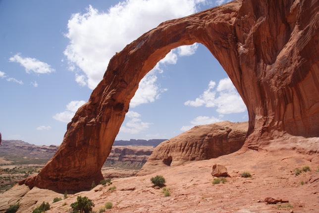
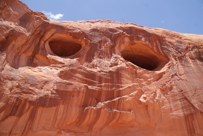
The top shot is the ‘front side’ or the side you see first…the second is from the “back’ or what you see once you’ve hiked under the arch. The flat wall (third pic) is the one that looks like it has two giant eyes!
I was able to just sit there for about 20 minutes on the backside, staring at everything around me, before a group of 4 showed up under the arch, so I began my way back down the trail. When I got near the trailhead, but before I made the descent down to the parking lot, there were 4 photographers with tripods set up…one was right next to the train tracks you have to cross (I’ve never seen or heard a train here & this is my 3rd or 4th time I’ve hiked Corona) & three had climbed up on top of narrow pillar of rocks. Never one to be shy, I asked what they all were aimed at & if they were commercial photographers. They said the “Sunday” train was coming by & they’d like to think they were professionals, but they were also laughing when they said it. I asked what railroad & it was Union Pacific. I decided to hang out for a bit to see what it was about…I had no where to go. However, I’m not a patient person, but the views of the rocks & the Colorado river kept me there, until I heard excitement coming from all the photographers.
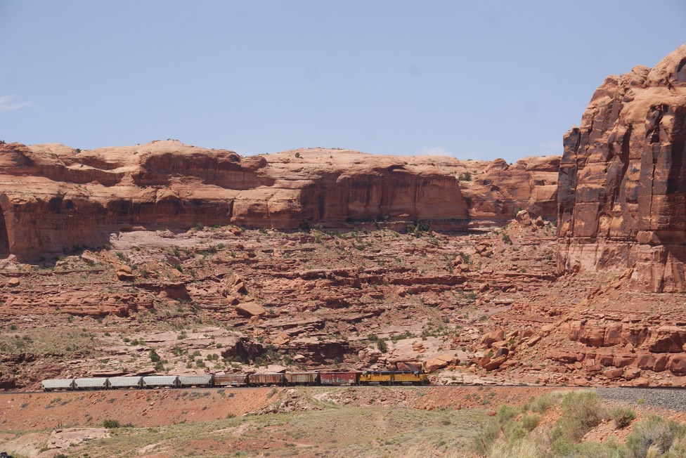
Wow…are you as excited as I was to see this train? Ya…I never really ‘got it’ but since I waited for about 20 minutes I felt obligated to show you the pic. But they were stoked…as soon as the train was out of sight, they practically ran down the trail, loaded their gear & took off on what I overheard was the ’80 mile’ loop…guessing that’s the trains’ route & they were after another photo. Excitement & hobbies come in all different flavors. PS: None of them had hiked to or photographed Corona Arch….
I drove back to town & went to the Moab Brewery. I don’t really think their food or their beer is very good, but I went just for a beer to see if the might have a seasonal. They didn’t so I ordered an IPA…just an ok beer. They’re always so busy but I think it’s because it’s the only brewery in town…I’ve certainly been there once every time I’ve come to Moab….which has now been 1/2 a dozen or more times. After my beer I drove back out to camp, made some lunch & read for awhile. Then I hopped on my bike & rode to the bike trail that leads to town along the river but before I got to town, I had cell service & a text from Sara…they were in Moab & why didn’t I come by?
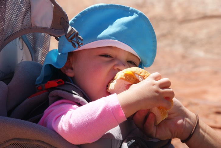
I peddled as fast as I could, put my bike back in the 4Runner & took off to see them! I found Sara in the parking lot, still getting a few things out of the car, so we walked up to their room together. As she walked in the door, she said…”Guess who’s here?” And when Claire saw me, she starting saying “Gki, Gki” held out her arms & ran across the room to me. I hope I never forget that…it was just so fantastic to pick up & hug that wonderful, perfect, special, awesome little girl! We played & laughed & giggled & read & hid & found ….so very great! Soon it was her bedtime, so I said goodnight until tomorrow. Sweet dreams. I am one hugely grateful mom….I’ve gotten to see all three of my kids & Claire on this trip. So. Very. Very. Grateful.
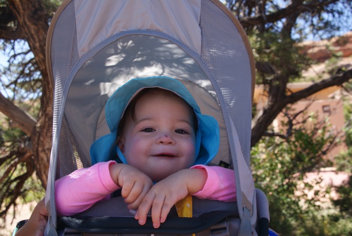
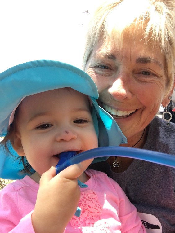
One of my silly selfies of Claire…I love these shots!

day 33…5.23
I slept good last night in my tower of blankets, sleeping bags & mats inside my little tent by the river. I was up around 5:30 & walked to the bathroom, then got my stove out & stuff to make coffee. This is a pretty quiet camp…no RV’s running, a little mumbling can be heard, campfires can be smelled, but there are trees between each site & each site is pretty big—compared to commercial campgrounds anyway.
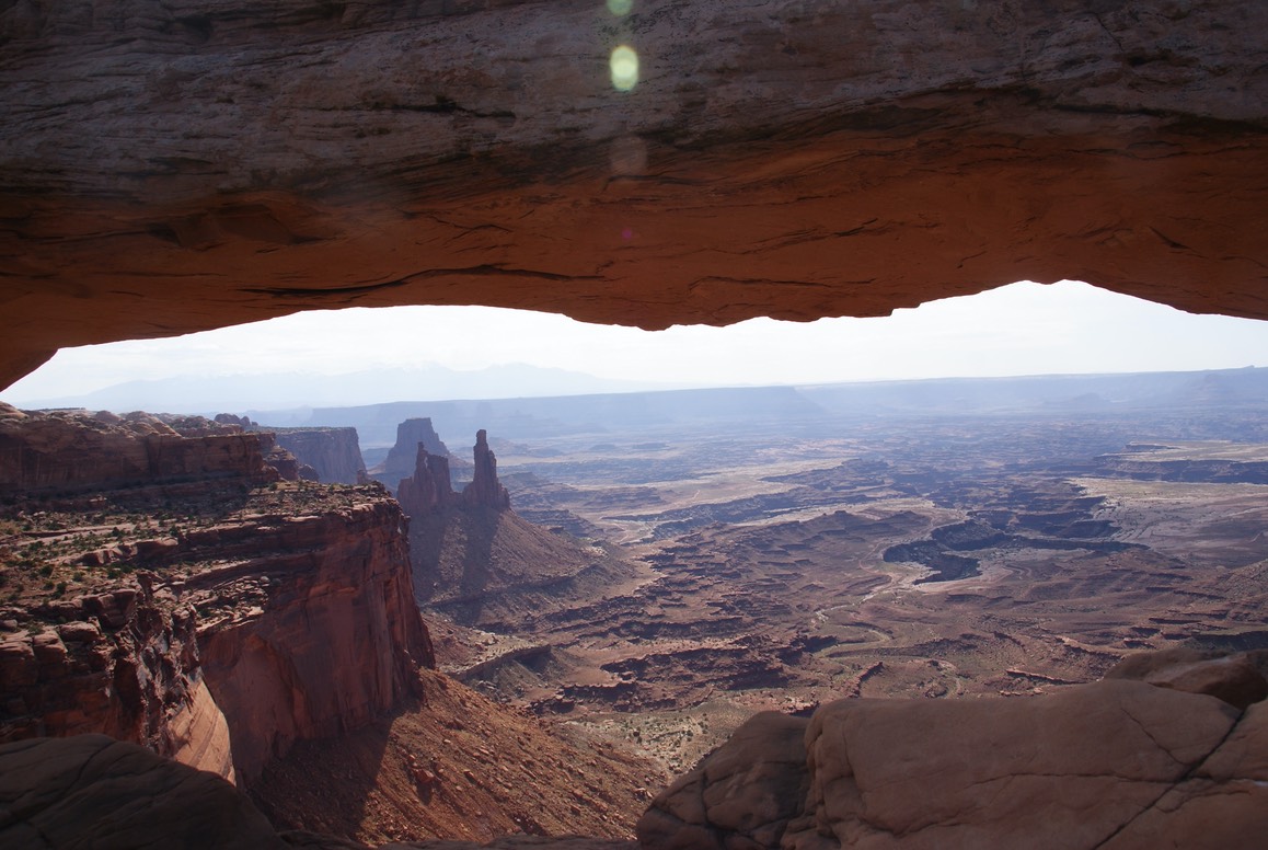
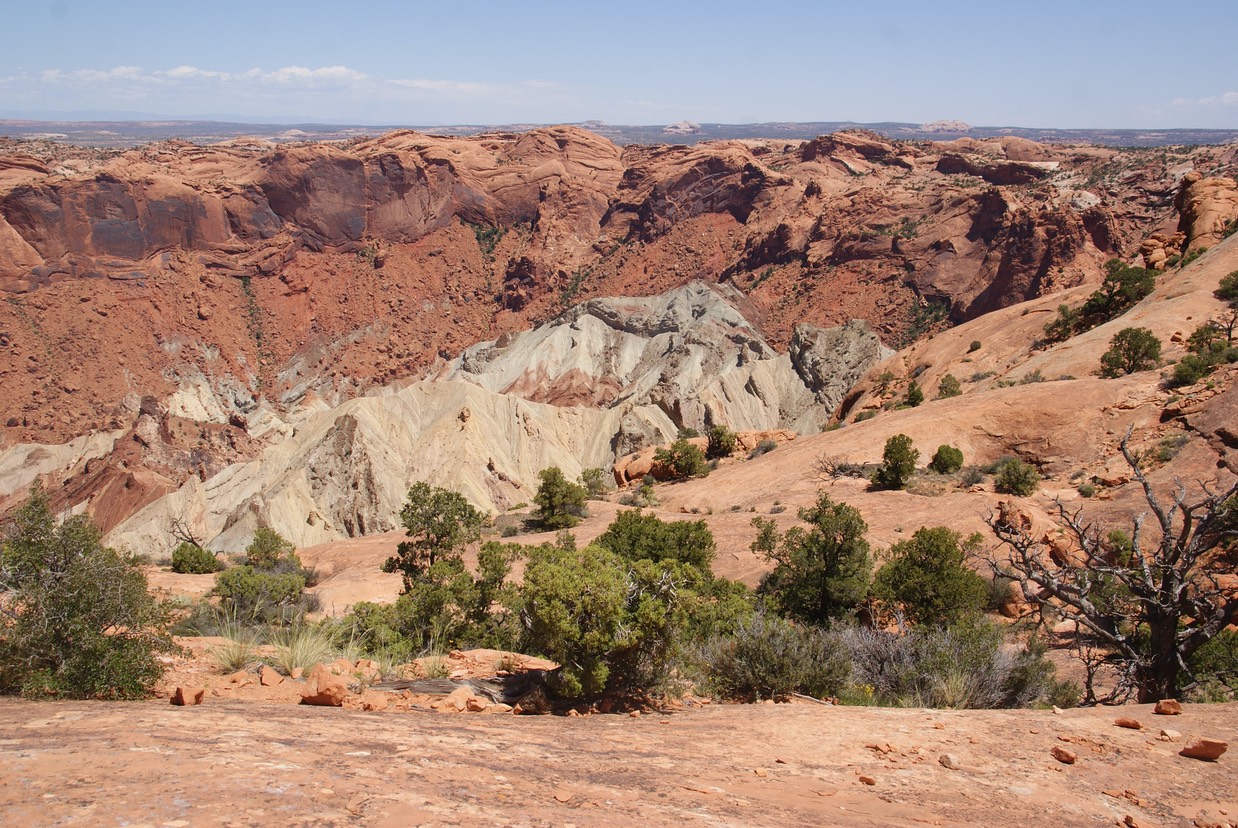
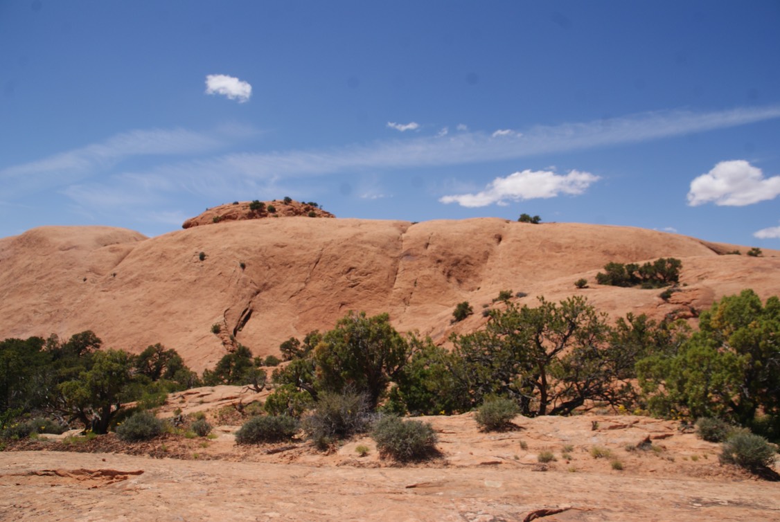
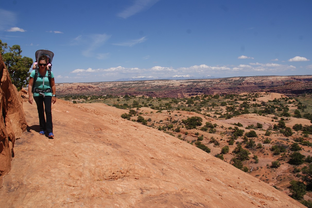
Today, we were driving up to Canyonlands National Park..my 13th National Park to visit on this trip. But…oh how special to be doing my fav thing with Claire & Sara & Kevin! Sara is one tough hiker with Claire on her back! Our first hike was to Mesa Arch!
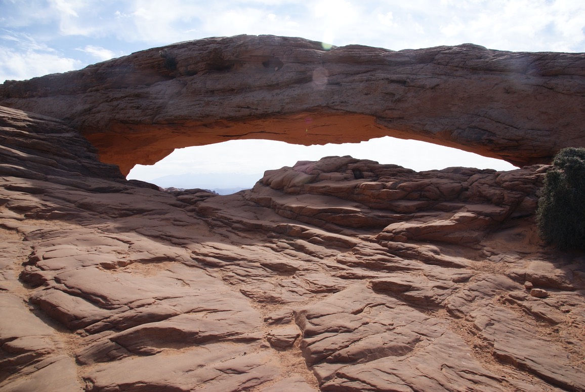
Looking down through the Arch.
Sara, Kevin & Claire!
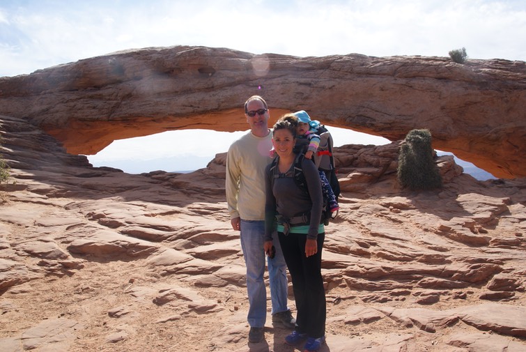
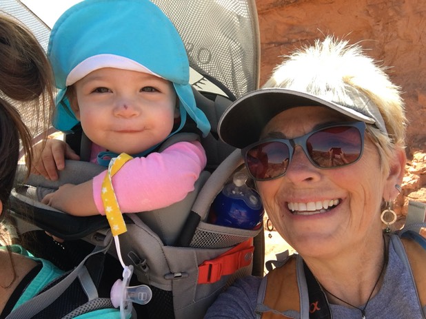
A very happy Mom & Giki!

Claire decided to take a nap for our next several scenic pullouts…great timing! We took turns staying in the car with her & taking in the views!
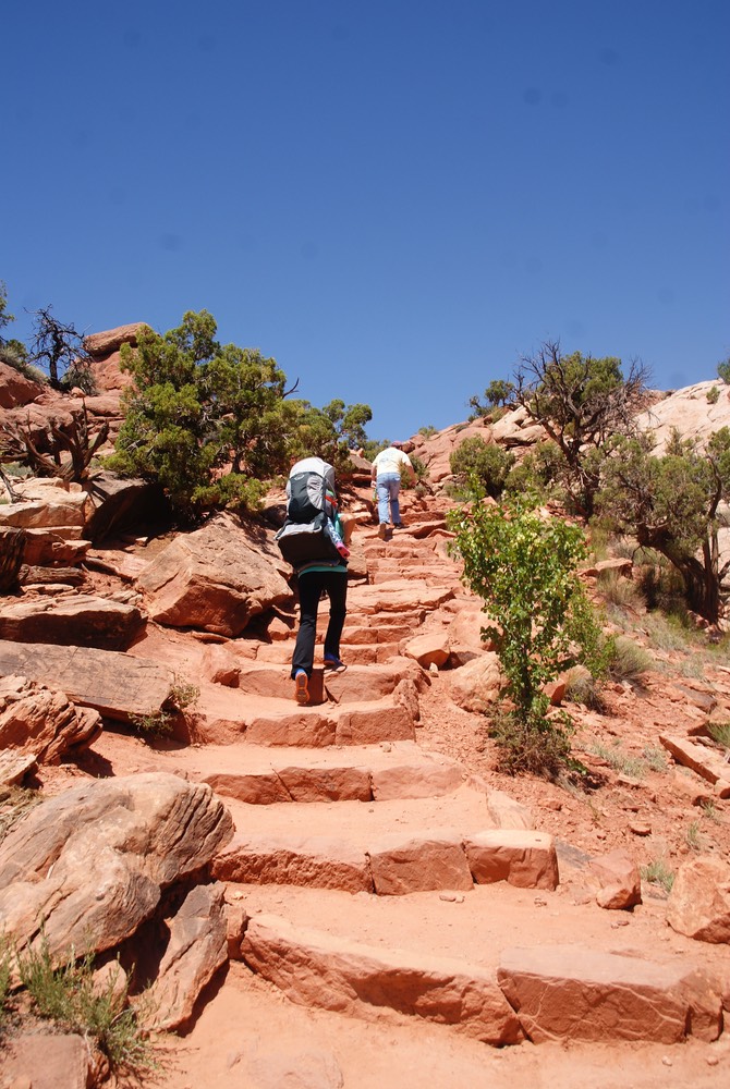
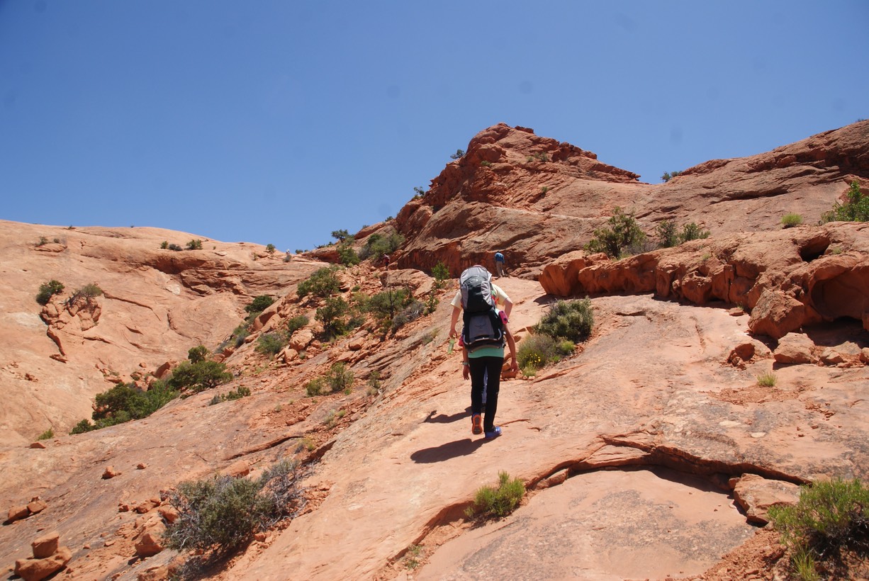
Once awake, we were all ready to go. Claire was loaded in the backpack & we headed out to the Upheaval Dome trail, which has some steep up & down slick rock including some stone-carved steps…eek! I’m sure Sara thought I was walking about an inch behind her the whole way…because I was in case she fell. But she was sturdy, fast, & steady the whole time. I’ve backpacked a lot before, & with more weight than Sara had today, but I’ve never backpacked with a precious little girl on my back…I’m sure I don’t have the nerves for it! (And I’m also sure I fall way more than Sara!) But it was fun to hear Claire chatter while we hiked & see Sara & Kevin enjoying the hiking & scenery of this fascinating place. Here’s some pics from this hike!
One of our selfies!
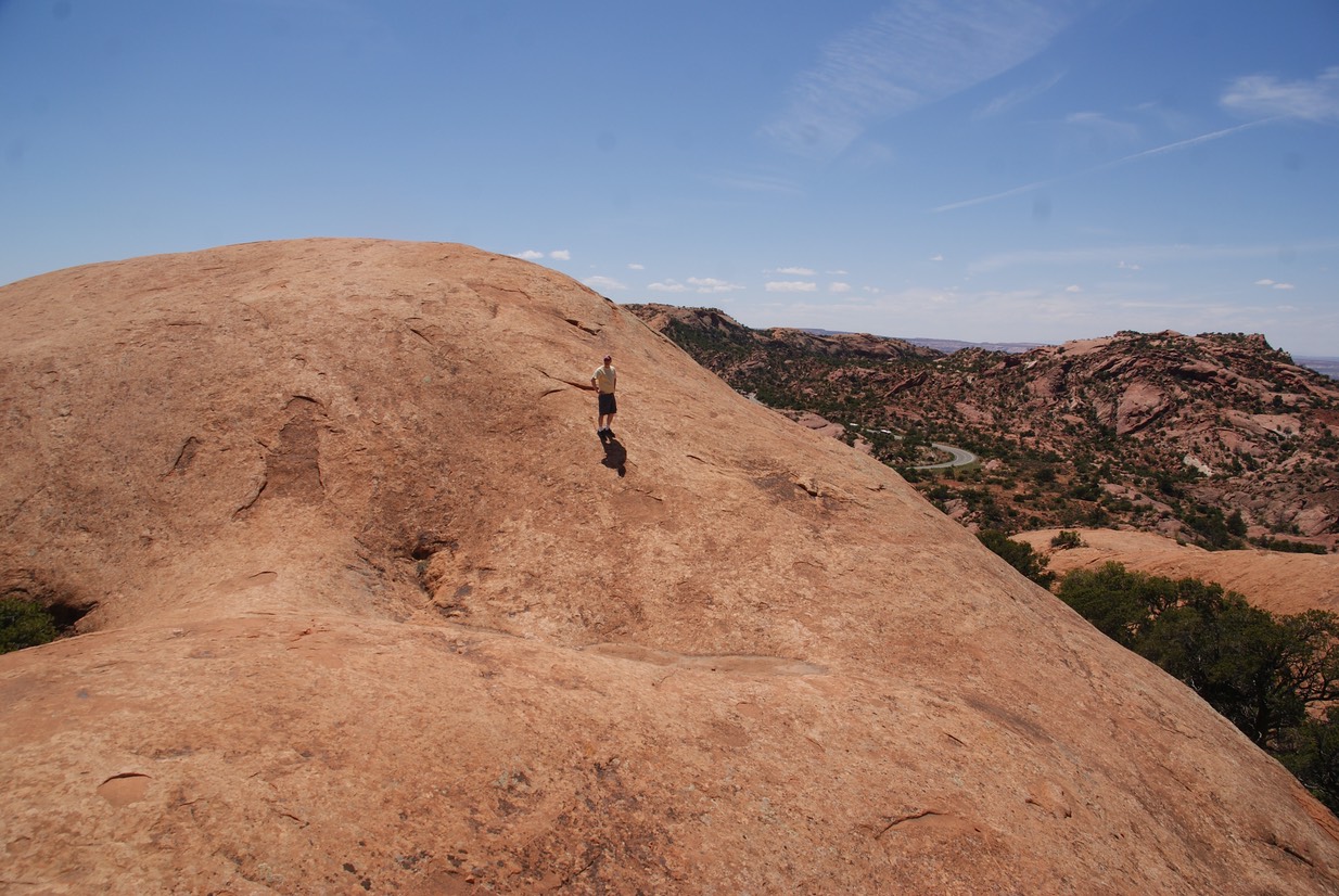
After the hike, Sara wanted to do one more…this one not as long, but still pretty steep. It was called Whale Rock (yes, that’s the rock we’re climbing up.)
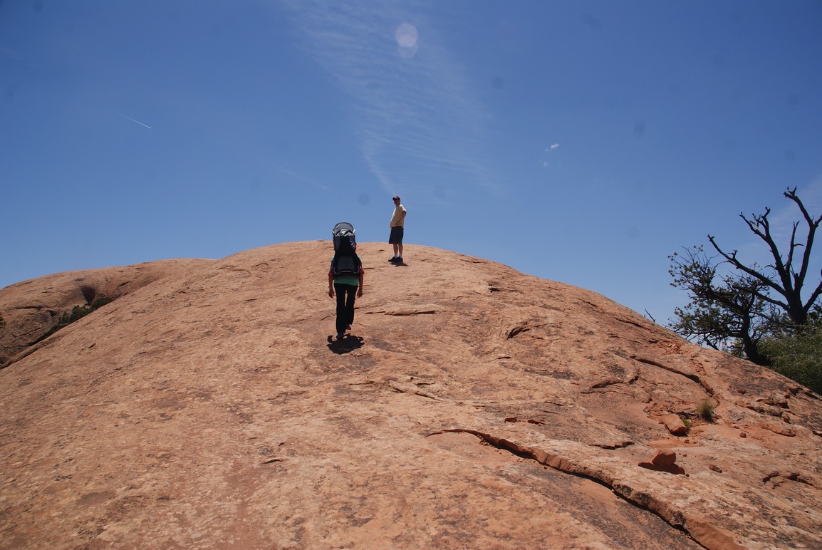
The rock continues without a trail up a super super steep face…Kevin started up it, but then turned around. Sara & I weren’t even going to attempt it (although I’m sure Sara would have if she hadn’t had Claire on her back!)
The day ended with dinner in town & then hugs & good nights. I soooo wished Danny were here to enjoy this with me! I’d get to hike with them again tomorrow in Arches National Park…I can’t wait!
PS: Claire really liked “Gki’s wawa” ….this hiker girl needs a Camelbak!
home 1 2 3 4 5 6 7 8 9 10 12 13 14 15 16 17 18