day 17…7.16
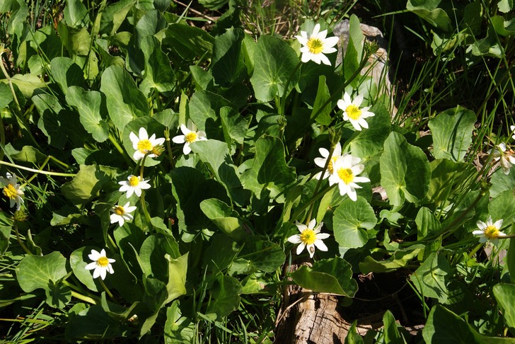
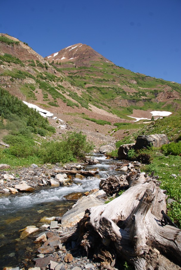
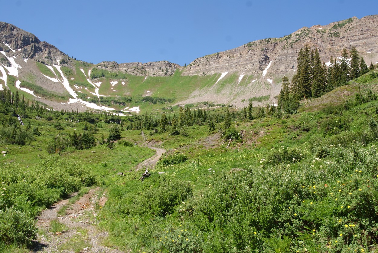
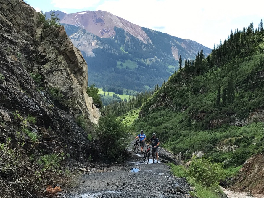
I woke up sluggish this morning, considering taking a day off from hiking. But my time out in this magnificent place feels so short, & the sun was shining so brilliantly, I decided to go for it in spite of feeling tired. I was going to shoot for Daisy Pass….the trailhead just down the road. I don’t like driving through the river & down this always nasty 2 mile 4WD road, so I hiked it. The road is a beautiful walk with many waterfalls & wildflowers along the way.
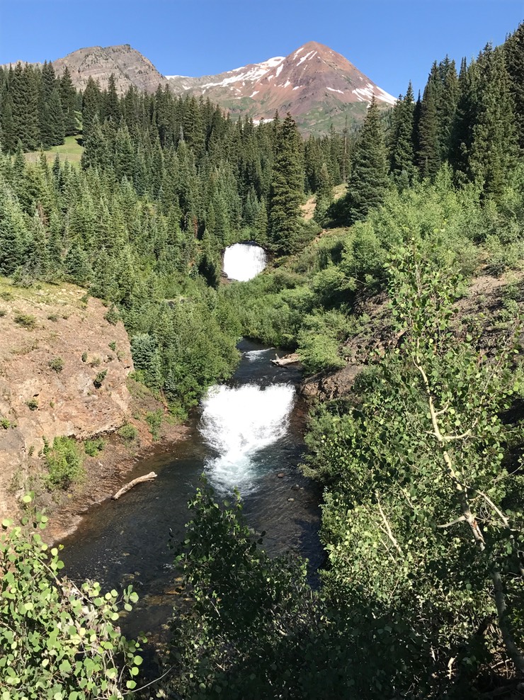

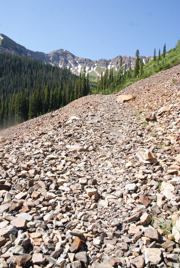
There are a couple of different hikes you can do once you reach the end of the road, but my trail went through a good sized water crossing, then up a trail of slate type rocks another 2 miles but a whole lot more elevation gain. The trail actually follows an old jeep road, but most of the evidence of the road is gone, leaving a rocky, uneven trail.
This is not a new trail for me, I’ve done it once ALMOST up to the top…about 300’ below the summit when I was turned around by a storm, & once a couple of years ago with Danny. I remembered it was a big climb, but my memory didn’t hold all the details!
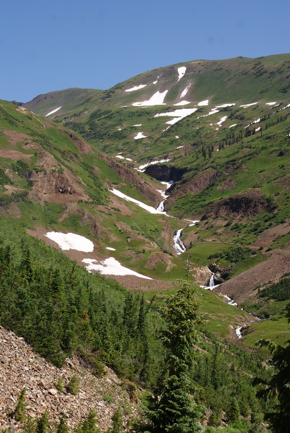
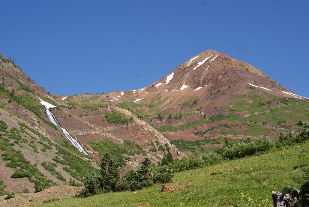
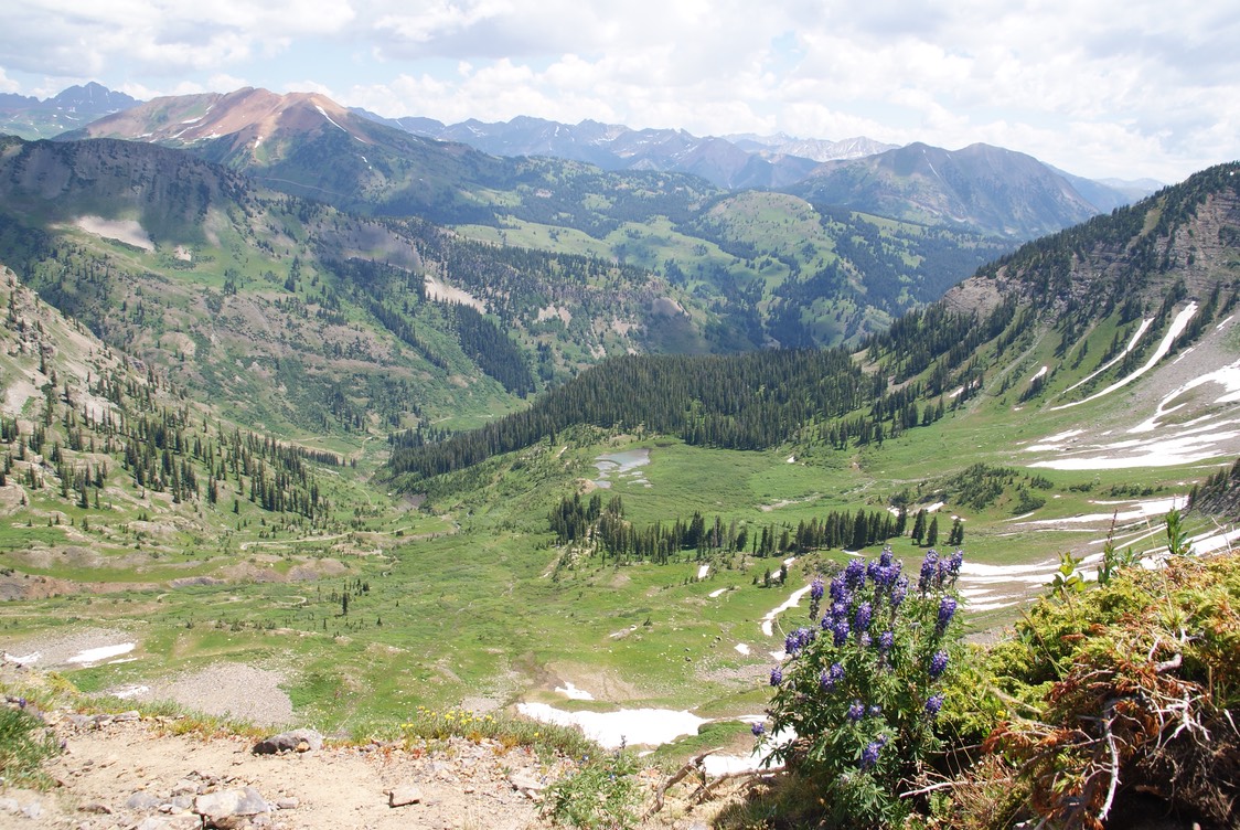
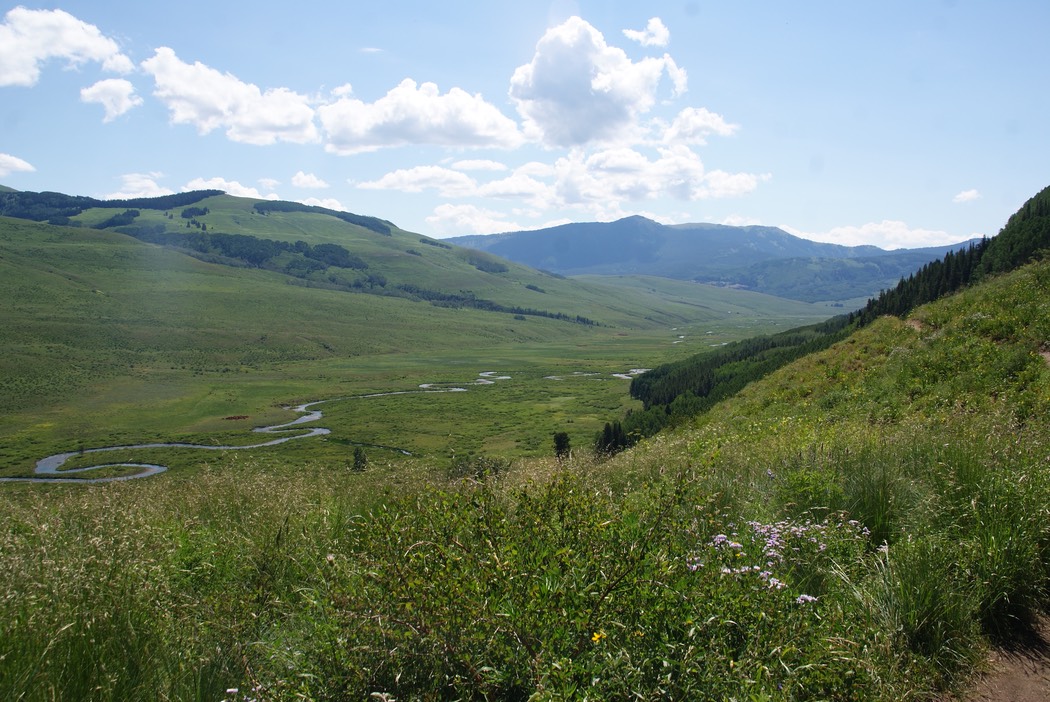
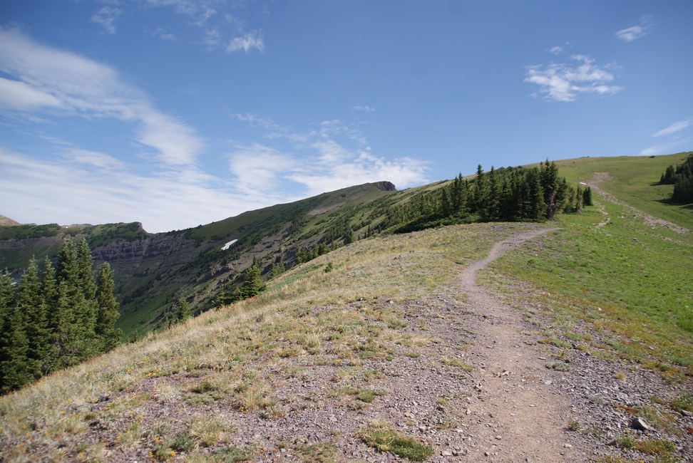
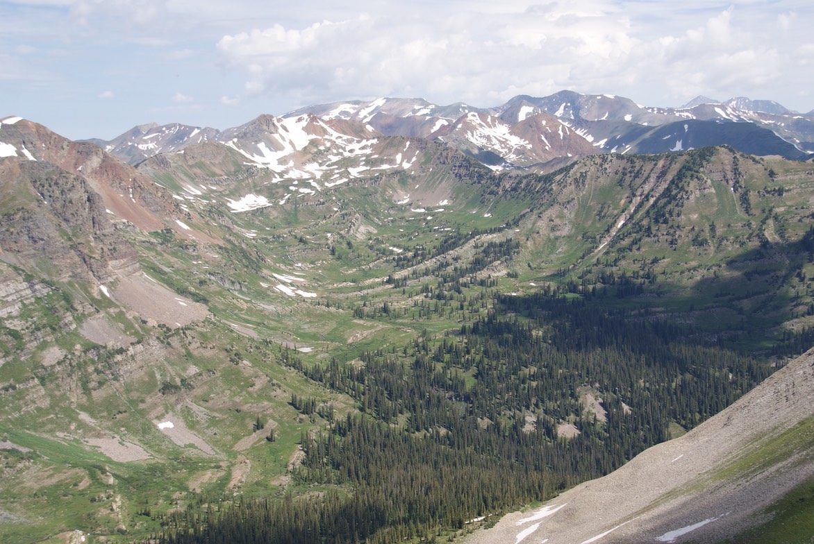
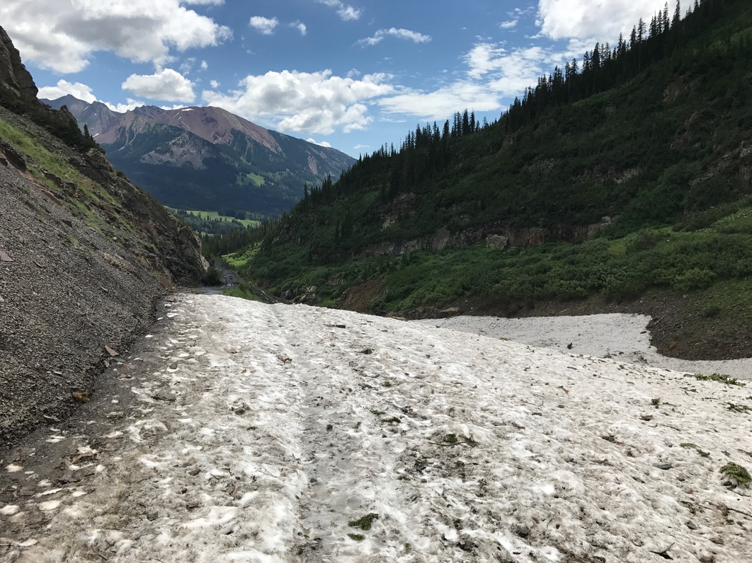
The photo below shows the top of the very narrow pass…look in the middle at the top of the ridge to where there is one single tree…that’s the pass. The pic is taken from about 1/3 of the way up. If you look down from the tree & over to the right you can see a faint trail. And if you look farther to the right you can see the triangle-shaped snowfield that I’d have to cross…twice going up & twice coming back…but I didn’t know this yet.
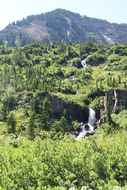
The road eventually goes further, on up to the backside of an old mine, but the pass trail starts the lung-busting switchback climb up to the top. There was a couple in front of me about my same pace, so I watched with some anxiety as they crossed the first then the second snow field. I don’t mind snowfields that you go up, or that you go down, but going across is my LEAST favorite…UGH! Sitting on the trail right before the first snowfield was a mid-twenty something girl with a backpack. She didn’t like the looks of the snowfields & was afraid to cross. So, we said hi, she told me her thoughts, I told her I was nervous about the second one especially, but I was headed up.
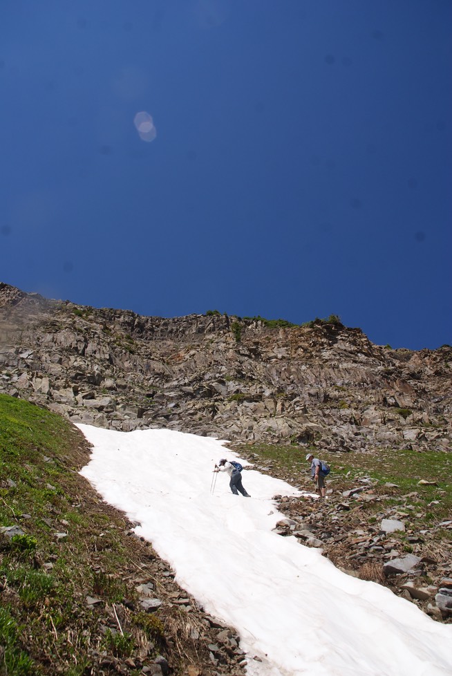
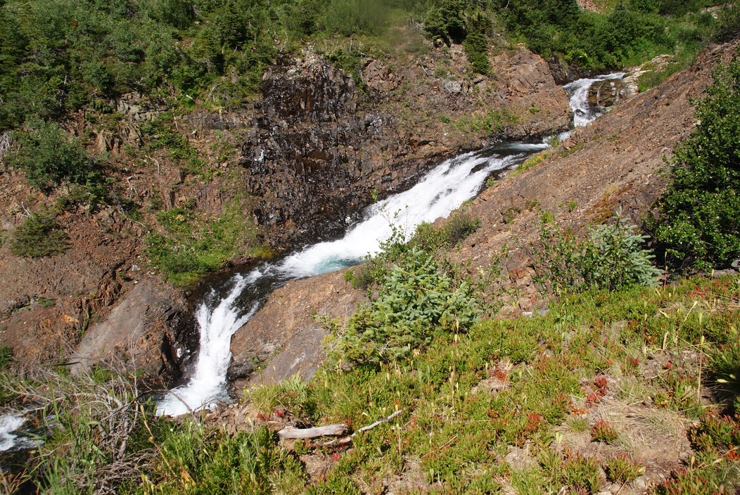
The snow was pretty firm & the steps were farther apart than my stride, but I dug in my poles, didn’t look down & got across.
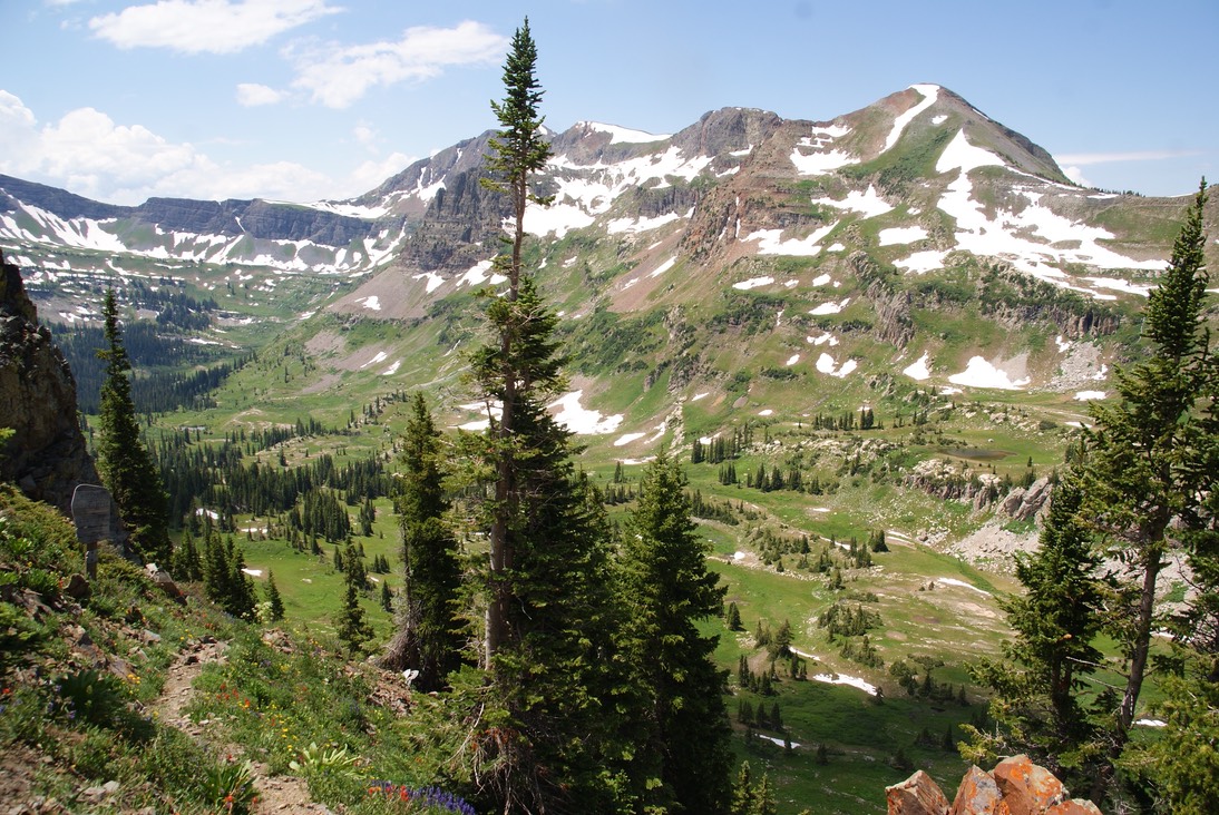
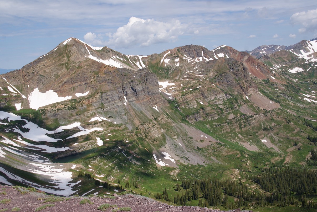
Legs shaking, I headed up the trail, thankful to be on dirt. The rest of the hike is just a slog up hill…stepping, breathing, stepping, breathing. The trail gets soooo steep & the switchbacks so tiny you can put your hand in front of you & touch the trail…& to make it more exciting, you’re on scree by this point. Teenie tiny rocks that don’t give you much of a foot hold….these were the details I had forgotten. The top is pretty narrow, but I sat for a bit, took some photos & looked over the pass down into Democrat Basin. I’ve hiked into that basin from another trail, & it’s so beautiful!
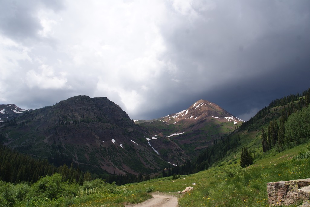
This is the view looking towards Slate River Road & back the way I had come (you can see the trail & then the road).
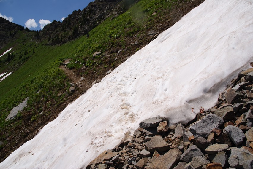
I didn’t stay long at the top, because other than seeing the beautiful views, my mind was wondering about the snowfields I had to cross. I carefully headed down the super steep part, made down a few more switchbacks then to the snowfield. This one had been the scariest. Now with the sun up higher, it was easier to dig in new footsteps, it was also more slick. I noticed a ‘slide’ mark, that I didn’t remember, but thought I shouldn't focus on that, hoping I wouldn't follow in someone else’s slip, & just dug in & went across. I went right down to the next easier one & made across. Two steps on the dirt & I fell…but only one foot slipped out from under me on the rocks & landed hard on my butt & arm. I was OK…& so grateful that it happened after the snowfield. I got up, brushed myself off & headed down to the next switchback. I noticed the young backpacker girl sitting in a weird spot off the trail. I slowed down & said “Hi” as I passed & she quietly said hi back. Then I said, “Are you OK?” She told me she’d tried to make it over the second snowfield & slid…all the way down passed the first one then onto the rocks. She was shaken but only scratched & I’m sure will have plenty of bruises soon. She got up & decided to walk down the rest of the trail with me. She was fine, & as we talked her nerves settled. I can’t imagine how scary that was…& it must have been her slide marks I saw. It was getting close for the afternoon storms to roll in & as I crossed the first big water crossing the skies darkened. I just kept my Chacos on knowing I’d have the river crossing in two miles. I walked as fast as I could & about 3/4 mile from the crossing, tucked under a tree, stowed my camera away in my pack & put on my rain jacket. It began to lightly rain, but I made it through the river & just back to my car before the drops got heavier, thicker & wetter! That hike had been waaaay harder than I remembered, I hated the snowfields, but I was glad I was able to walk down with the backpacker & distract her from the fall.
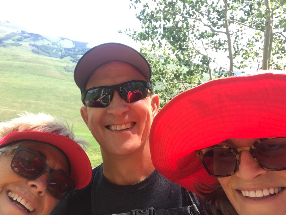
I drove into town & directly to the Brick & ordered a Stone Russian Imperial Stout…almost 11% but thick & tasty (& pricey too!) Jill was back in town, with Greg in tow & they’d been checking out the little place in town they rented. We all ended up going out to dinner together at Donita’s Mexican place. Soon after dinner, I headed back out to camp, now way more tired than when this day began!
day 18…7.17
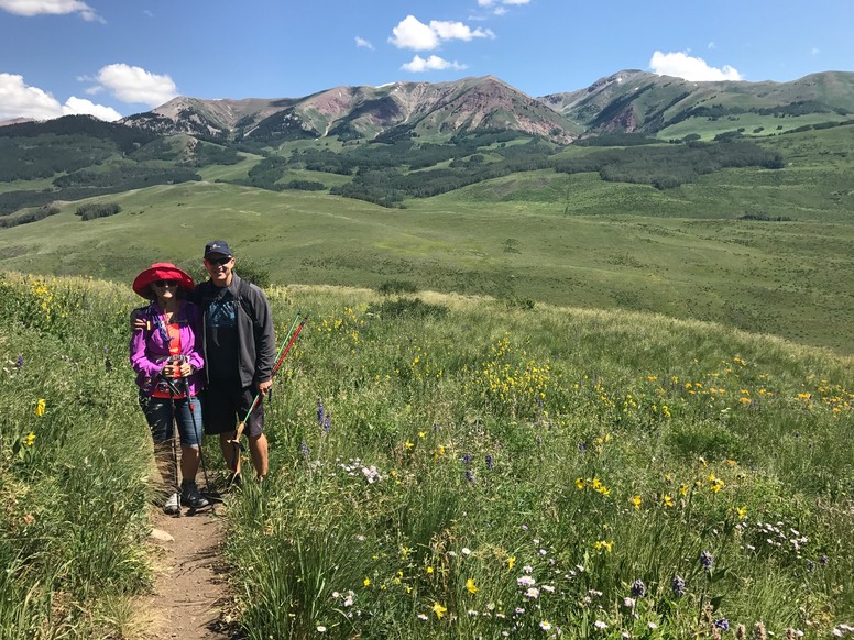
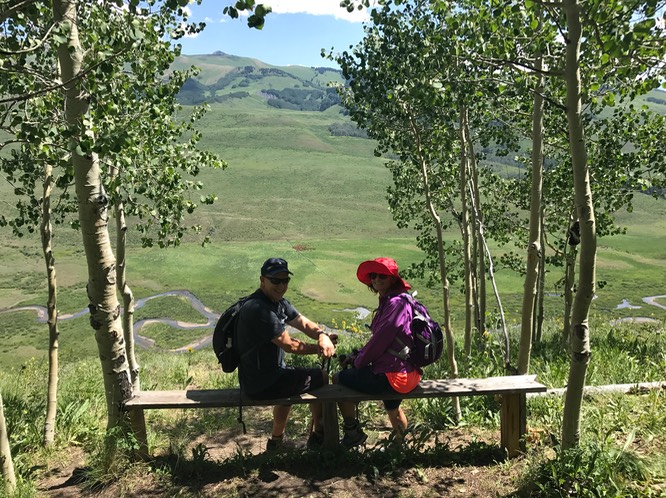
The Meander trail is fairly new to me (last year) & it’s a sweet trail that m e a n d e r s along the back side of the mountain, fairly gently terrain & overlooks the East River Valley…I love this valley! I thought it would be a good one for Jill & Greg’s first hike in CB. Greg is still having knee issues, so we were going to take it easy.
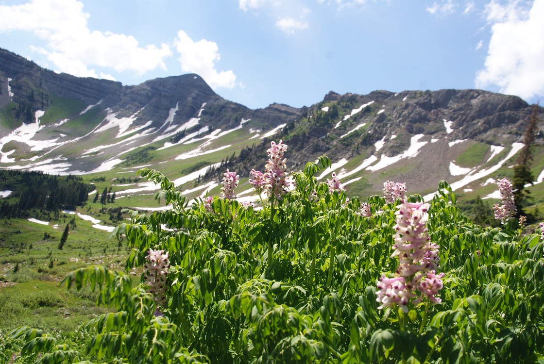
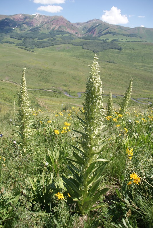
I spy a Green Gentian!
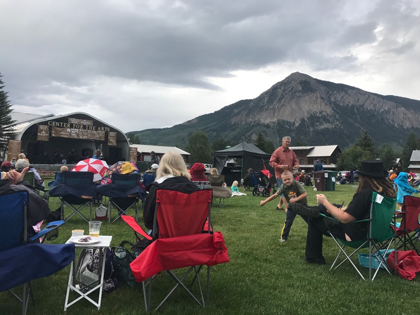
After the hike we all ate a late lunch at the Ginger Cafe, then Greg went back for a nap & Jill & I went into a couple of stores we’d missed last Friday. Then we parted ways as she went back to the little house & I went to the Brick for a beer. The skies had been off & on drippy & dark, but there was a concert in the park tonight. Lots of people were there, & I went for about 1/2 of it before it began to rain harder, so I packed up & headed out to my little campsite for the night.
day 19…7.18
Greg’s knee was hurting last night, so Jill told me they were going to drive the valley roads instead of hiking. I took off to Kebler Pass to one of my very favorite hikes…Scarp Ridge. I was sad Jill couldn’t do this with me, since she loved it the one time she hiked it, but I was excited anyway…it’s magnificent, but kicks my butt everytime! Sometimes there’s a snow on the trail, but this is a giant field you go up & down…not across, so I wasn’t worried about & as it turned out, there was no snow at all.
Looking over towards Green Lake…a whole different hike.
The views from the top are soooo AMAZING!!!
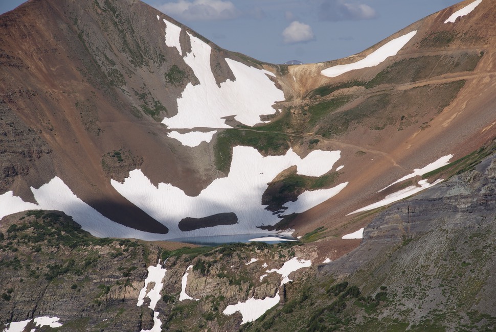
The view of Blue Lake below & the Oh Be Joyful Valley.
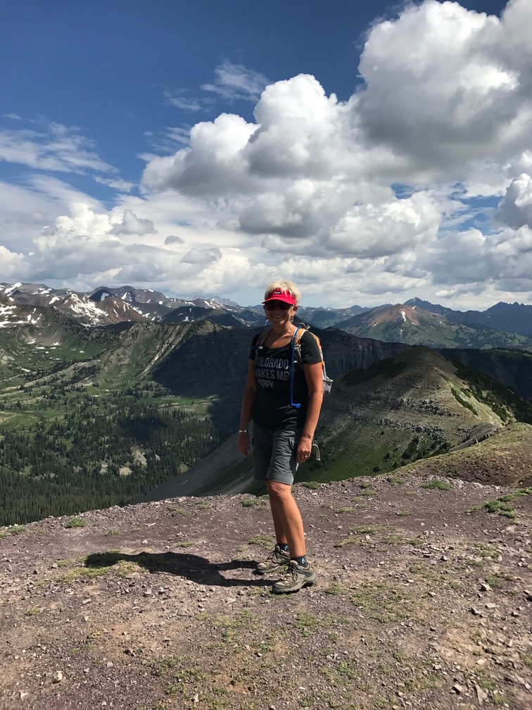
Two other couples arrived shortly after I did & one of the men was telling the other couple all the places they were looking at….He was so wrong, but I just sat there taking in the views. Then after the one couple left, he was trying to tell me one of the Maroon Bells was something way different in the north part of the state. I told him it wasn’t, but he was insistent. Then I just let it go…some people have ego’s bigger than these lovely mountains. His wife took him away down the trail (yay!) & I was alone. I ended up being up on top for almost an hour…it was just perfect! And right before I left, another couple came up & asked me to take their photo, then they took mine in my new “Colorado Makes Me Happy” shirt….yes siree….that’s a definite true fact!
I hiked back down to my car, which by the way, the parking is it’s own headline this year. To make a long ugly story short, the owners of the area where are the cars used to park & decided to not allow parking anymore. So, on this random Tuesday morning, I was the 13th car parked along a steep, rutted 4WD road. It’s not safe, it’s crazy, but the owners of the land definitely have the right to ‘not share’ & to be assholes. This is not the first thing this mega-rich group has done to snub their noses at the people of CB & the tourists. This battle has been going on for awhile, so every year I hike Scarp Ridge I’m so grateful that I’ve gotten to do it one more time. The trail is on National Forest Property, but in these crazy political times, who knows what’s going to happen. I really love this hike & would hate to see it disappear….so once again today, I’m so grateful I got to climb this mountain!
Down at the bottom of the road is Lake Irwin. Up until this year, there was dispersed camping between the road & the NF pay for Campground, which is one of the few around CB. But, the NFS has taken away all the dispersed camping here & now it’s all paid camping. I drove down to the lake, amazed at how busy it was, but backed in with a good view of the lake, opened my hatch, sat in the back & ate lunch.
As I was driving in town, Jill called & invited me to shower (yay!) & see their place & that’s what I did. We shared the wine she’d bought in Durango (yummy) & then met up a little later at the Dogwood Cabin for their unique infused drinks. They were headed out to dinner after that, & I was headed back to camp. Another great day in Paradise!
day 20…7.19
Jill & Greg were headed off today on their own hike, & I started my day at the Paradise Cafe for breakfast & my fave Cucumber Jalapeño Lemonade to drink later in the day. I drove out to Gothic Road & drove near the top to where the road is still closed due to the snowplug that blocks the way. I hiked up the road, always curious to see how much nastier this road has gotten over winter. I call this the ‘scary’ road, because it has an extremely narrow place, only for one car, with 500’ drop off & blind spots. It’s always an interesting drive! But today I was walking it. The road has a barricade at the top, & a big sign stating it’s closed to all motorized vehicles…so bicycles can go by, but that’s it. But, right before I got to the narrow part, about 8 or 10 motorbikes came roaring passed me. I was sure as I inched in closer towards the inside of the road, the bikers would stop until I cleared the narrowest part, but NO, they zoomed right around me. If I would have stuck out my hiking pole, I would have knocked the jerk off the edge (actually, he probably would have broken my arm!) Below is a pic I took on the way back showing just how narrow this road is this summer, due to a slide that’s still in the way. This is where he passed me.
The bikers were all stopped a short distance in front of me due to the snowplug. They were all suited up from head to toe in protective gear & I wondered how old they were. As I got closer I could see their pot bellies & then they were taking off their helmets revealing they were all about my age…way old enough to know better about passing me, but probably so old they couldn’t read the great big sign telling them the road was closed to them…they aren’t special even though I guess they think they are. Then they were taking up the whole space left on the road. I just stopped & looked up at them…then one of them stepped aside so I could move past. I was working on just being grateful in this moment & the beautiful mountains surrounding me & trying to not think that I wanted to push all their bikes over the side (mean-Vicki). The first of the group was gingerly making his big booted way up on the snow I think to see if they could push their bikes over the plug & onto the next road. The second old codger got up on the snow & said, wow, I’m really out of breath (they had all DRIVEN UP THERE!)
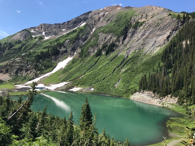
I went over the snowplug & onto the other side of the road & hiked up high above the oh-so beautiful Emerald Lake. The light was perfect today as the lake was so green & clear. A bit later & heard the roar of the bikers heading back down the road in the opposite direction….yay! peace & quiet once again!
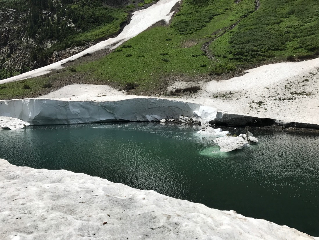
Look at the little floating glacier with the snow UNDER the water & the single tree floating….it was super cool! The snow wall was about 18'-20’ high…incredible!
On the way back I took a couple of photos of the snowplug.
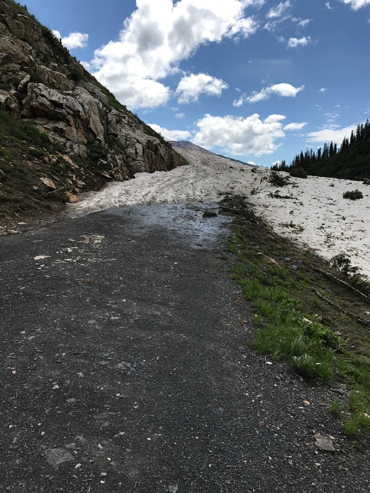
I don’t think this road will be open before I leave CB in early August.
Once back at my car, I drank some of my special lemonade, then made a quick stop at the RMBL Visitors Center to say hi to a couple of friends. Jill & Greg weren’t sure what they were doing for dinner, but I was in the mood for a burger so I headed to the Last Steep. Owned by a couple of KC brothers, I’ve enjoyed my friendship with Sean (one of the owners) since the second year I started coming here. I sat at the bar & we caught up about his recent travels to Europe with his family & all things CB. By the time my burger arrived, so had Jill & Greg. Greg loved his burger, telling Sean it was one of the best he’d ever had. It was a fun dinner chatting between all of us at the bar over some yummy food! Before too long, we said good night & I headed out to camp to enjoy the rest of the evening & get some sleep.