Day 1 9.26
I left Kansas before sunrise this morning heading back to New Mexico to finish the trip I’d started last spring. Always nice to see Kansas in my rear view mirror.
I drove all day & almost to sunset…about 12 or 13 hours. I knew it was a gamble to try to find camping at the free BLM site I headed to so late at night, but I gambled anyway & lost. The sites were full & now it was dark. I headed back up the road to a rest area on my map, only to find it permanently closed. This is the reality of the kind of camping I do…some nights it just doesn’t work. I drove across the road to a casino gas station & asked the security guy if I could sleep in their lot. He said yes & told me where to park….it was all a bit crazy, but I managed a couple of hours sleep. Not a great way to start a trip, but you have to be flexible or otherwise have your trip so planned out that you’ve reserved a place for everynight of your trip, months in advance then you have a place to stay overnight, but no flexibility to your trip at all. It’s one way or the other it seems.
Day 2 9.27
I left the casino early in the morning headed back to El Malpais National Monument. This is where my trip ended last spring when I caught Covid. I remember just dragging myself to see the arch…it wasn’t even a hike, just a walk, but I was so sick & thought, "you need to go figure this out…now". And so I’d left.
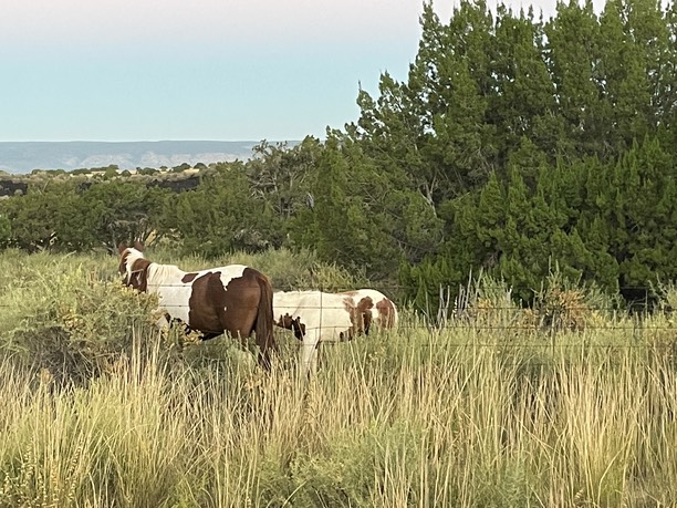
But boosted recently with the new vaccine, I’m back. And super stoked to finish my explorations of New Mexico. Saw these wild horses on the way into the park.
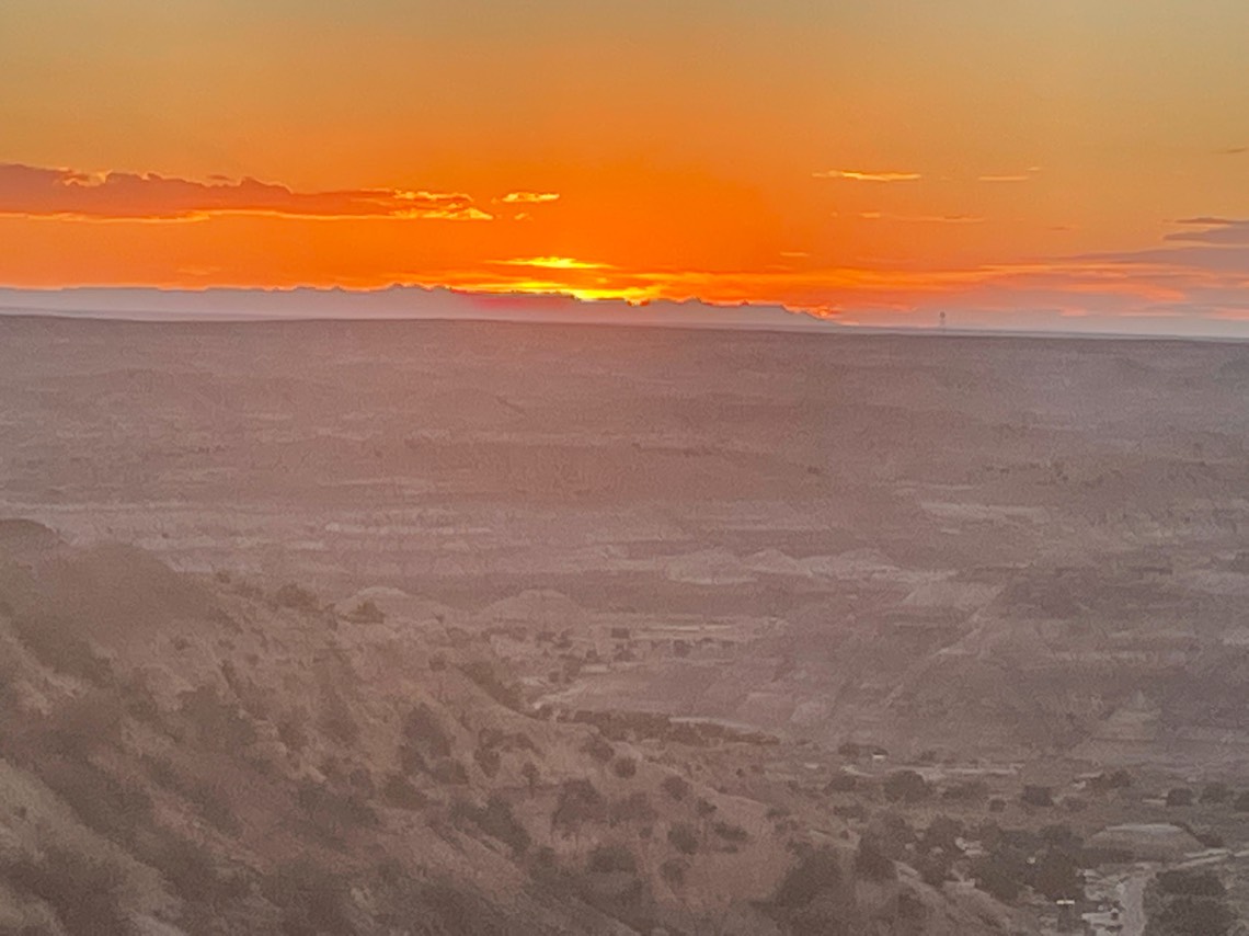
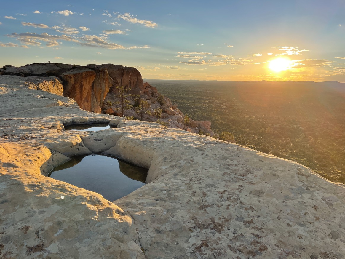
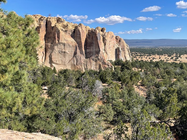
I drove up to the Sandstone Bluff trailhead to watch the sunrise & make coffee. I’d considered trying to get away with sleeping here last night, but didn’t. Tons of signs posted all over it’s just a “Day Use” area. But the sunrise was beautiful & the coffee tasted extra great with this view.
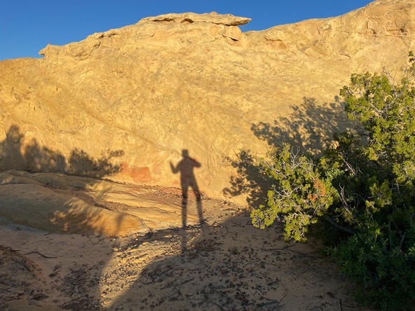
Playing around climbing on the rocks.
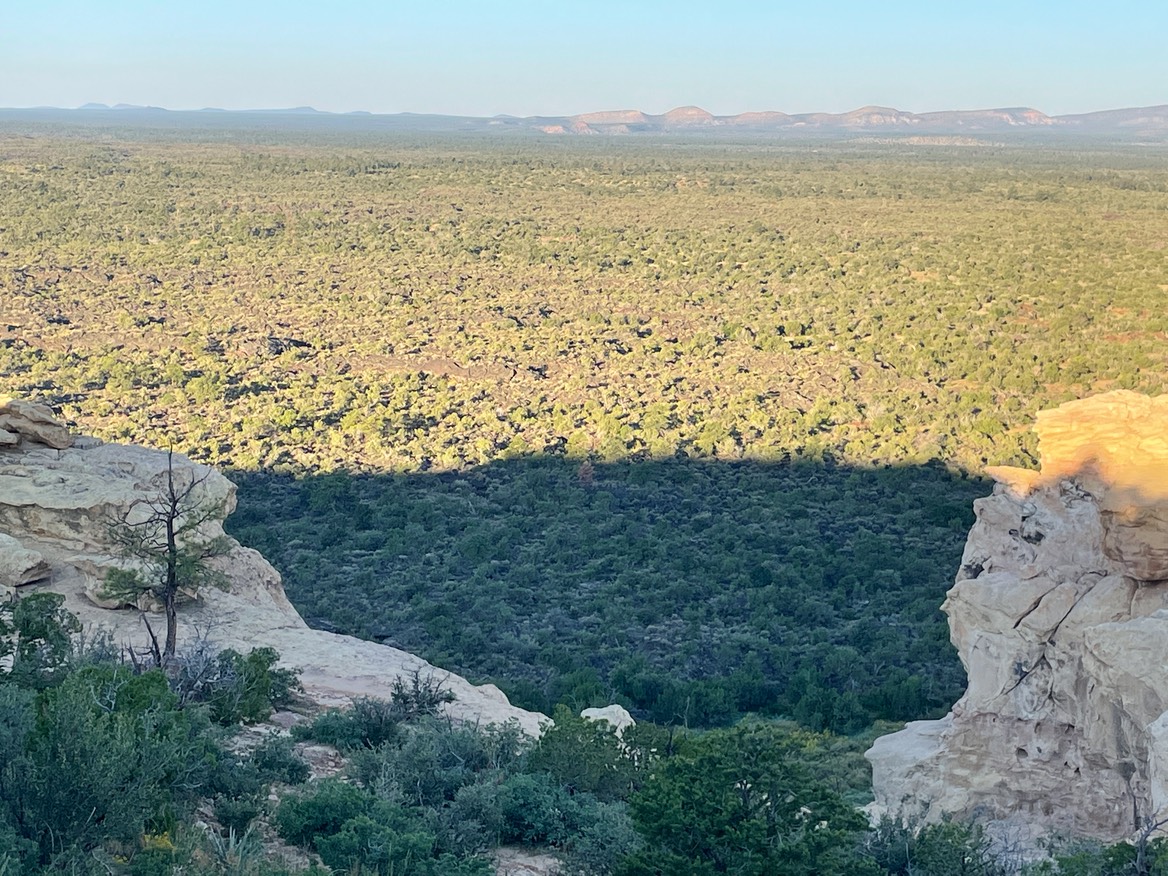
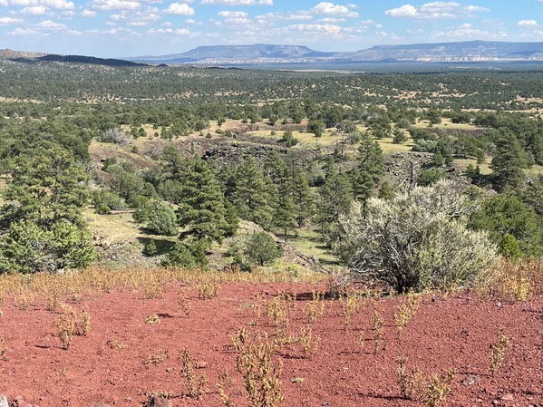
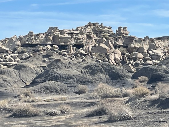
This is looking over volcanic rocks & layers. This whole part of New Mexico is volcanic layers, lava tubes, caves, etc.
I figured by this time, someone in last nights camp, would be moving on, so I drove back to the free BLM campground called Joe Skeen. Saw these wild horses along the way….ahhhh…a Mama & baby!
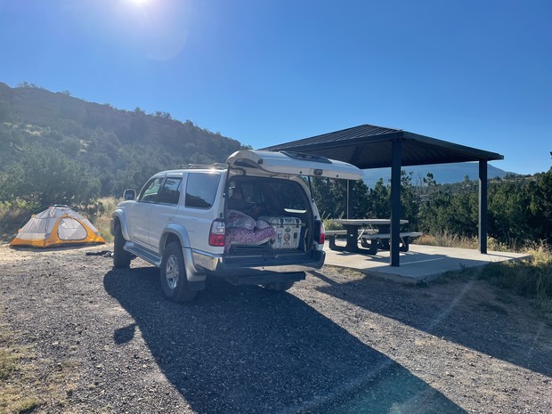
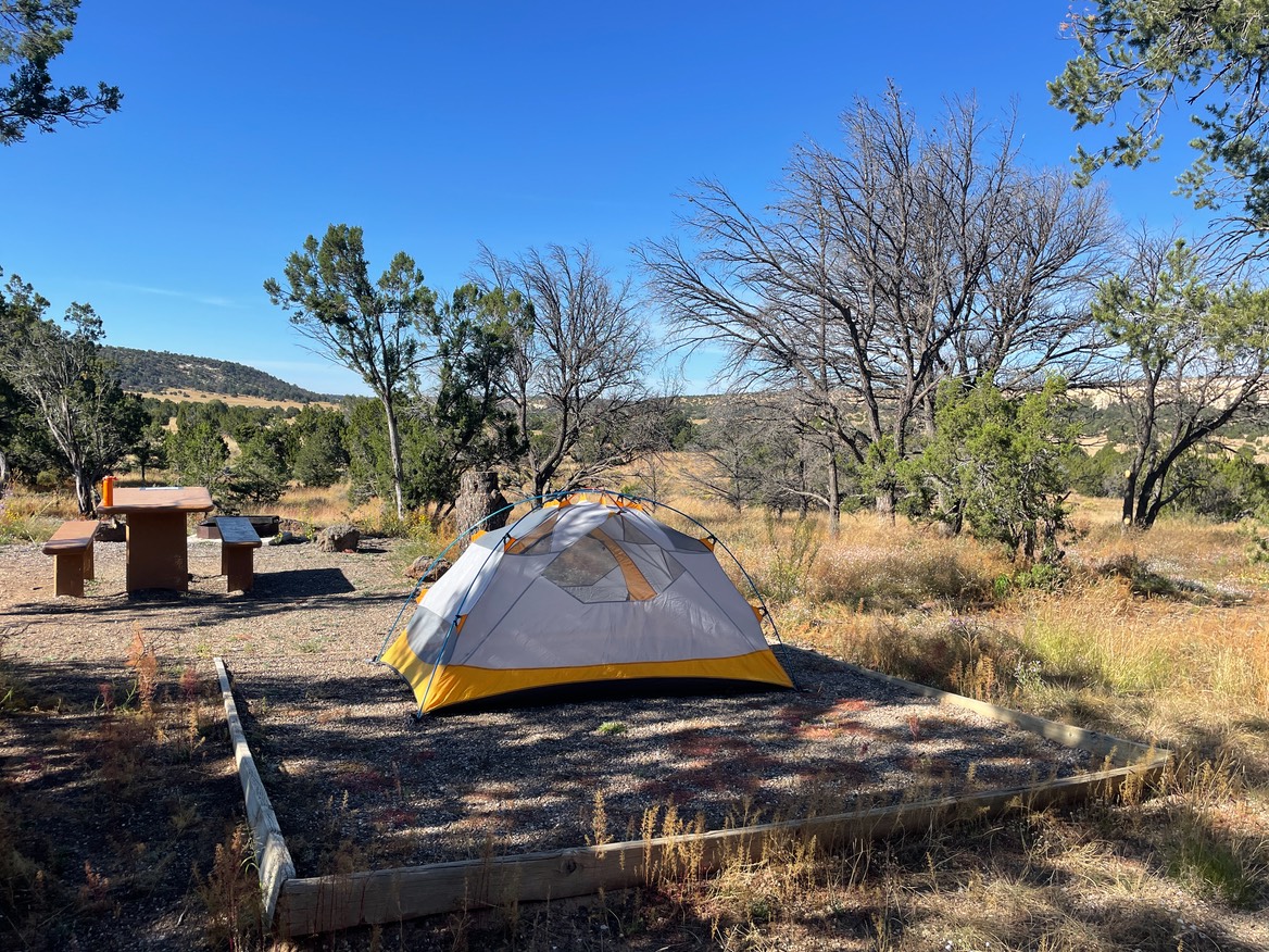
And, there were a couple of open spaces. I chose the one that had the most privacy, but it wouldn’t get early morning sun….you can’t have everything. And, I always think it’s a treat to have a picnic table, so 2 out of 3 for free is great. I set up a tent quickly, to hold my space, then took off for the trailhead.
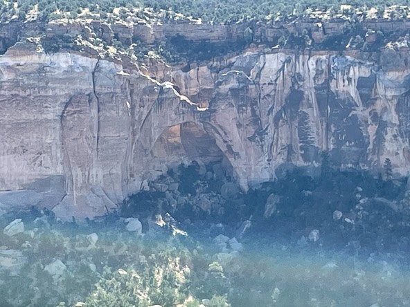
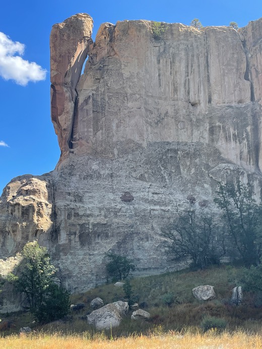
I stopped first to see the arch I’d seen last spring.
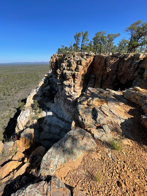
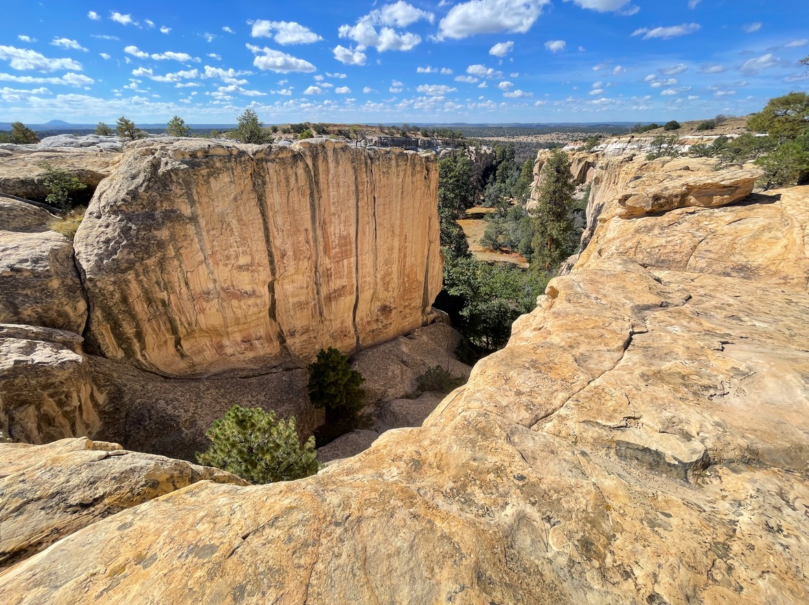
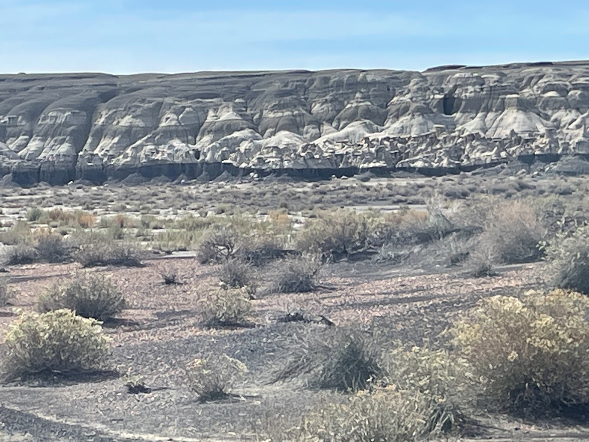
Then I drove some miles down the road through the park, to the Narrows Rim Trail. The trail would skirt the edge of the towering cliffs with an end view of the arch from above. It wasn’t an easy trail to navigate at times, & I could see remnants of the heavy rains they’ve had here recently.
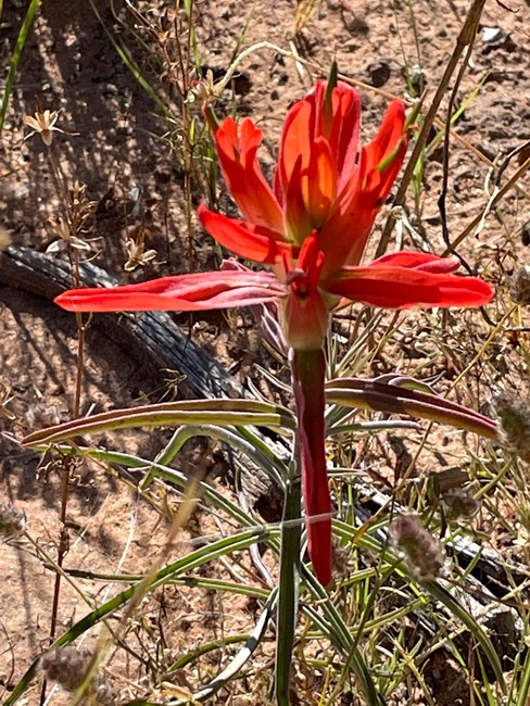
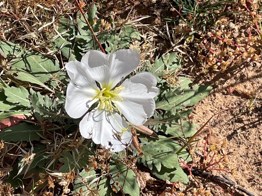
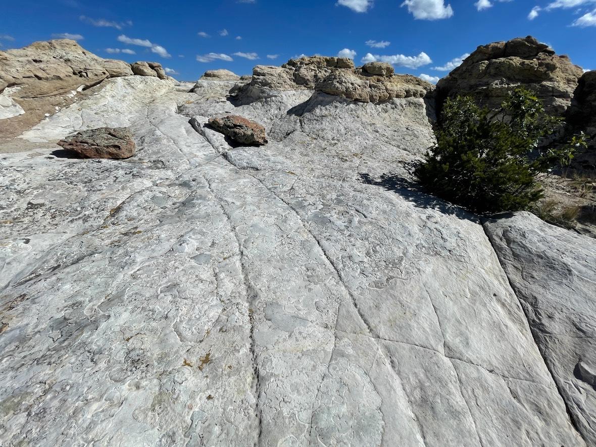
There was color on the trail!
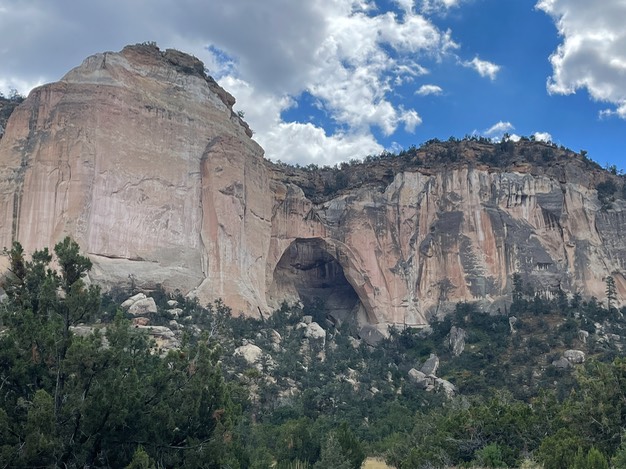
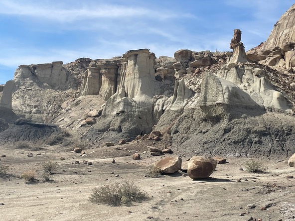
After about 3.5 miles, I came to a big drop off…the end of the trail with the arch in view in front of me!
I’d intended to go visit the Junkyard Brewery in Grants along Route 66 tomorrow, but my plans change more than they don’t. They got great reviews for their BBQ. It was still early in the day, so I went to Plan B…B for brewery!
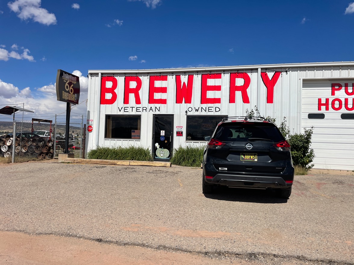
A nice guy greeted me when I came in & told me there wasn’t any food being served today…so now I was drinking on an almost empty stomach, but it won’t be the first time. So, I ordered a stout they had on tap from a guest brewery & visited with some other travelers that came into this quirky place.

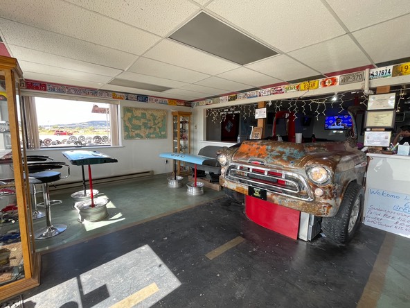
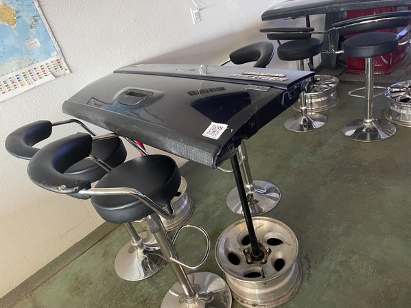
There really is a junkyard right outside the door…pretty much you park in the only open area that’s not filled with junk cars.
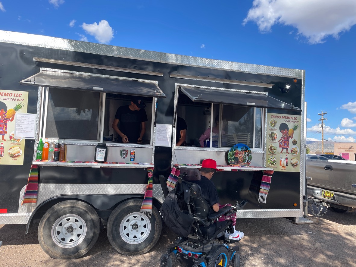
The guy that owned the junk brewery, recommended a food truck down the road, so I after my beer, I went to find some great local food. And it was so good. I’d mix the green chile & red chile sauce & down here that’s called “Christmas”, but one of them was super hot. After I’d downed most of my thermos of water, I asked them which color was the hot one? It was the red. Good to know, but I think it varies from place to place. Anyway, I got all my water in for today & tomorrow, just putting out the fire.
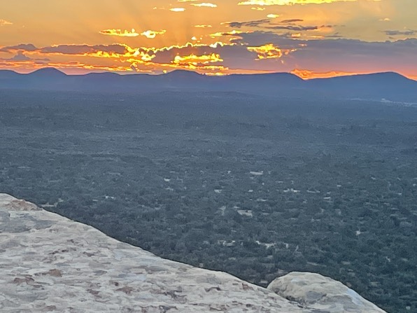
I went back to camp & enjoyed some time just in the quiet. Then went back to the same place I’d watched the sunrise this morning, knowing it would be even better for sunset. And it was the perfect ending to a good day!
I stayed out in the dark for a bit, just watching the stars pop out & twinkle up the sky. It was good to be back out under the night sky again.
Day 3 9.28
I made coffee & took my time this morning. I’d packed up the tent last night before I went to bed, but it was chilly in the shadows this morning. I’d met a couple yesterday (the only people) heading up to hike the trail I was just coming off of. The guy was driving a fairly new white 4Runner & asked me a bunch of questions about mine….it’s one of my favorite subjects. But, during that conversation, they told me they were staying at El Morro National Monument in the free campground there & would be leaving in the morning….& I should grab their site. #9 was the best in their opinion.
El Morro was where I’d planned to go next, so I drove the 50 minutes or so over to the park. There were three different places I wanted to go to today, but first I was going to get a campsite. I had my pick of 8 out of 9…I was an early bird this time. I took site #9, set up a tent & drove off to the Visitors Center to find a map.
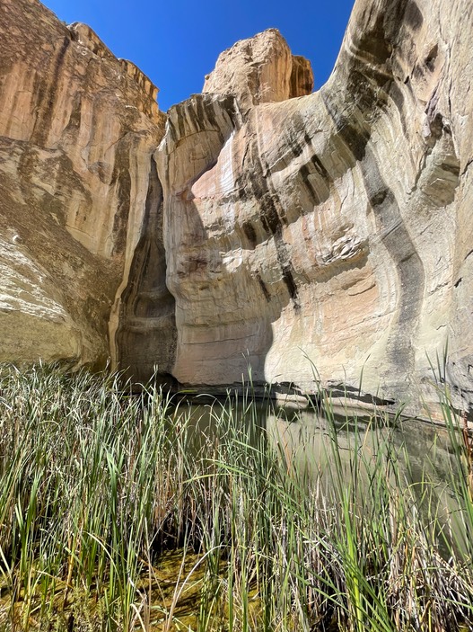
There are only a couple of trails in this small park. One takes you high up on the Mesa (on top of the rock below), then joins to wrap around the base of the rock (to meet a short trail) to Inscription Rock. The Ranger at the VC, told me the whole reason this park is here, is because of their ‘pond’. It’s the only year round reliable water source within 30 miles. Not a spring, but gets its water from winter snow melt & monsoon rains. During the late 1800’s, pioneers would drive by here so they could get water. The pond is pretty small, but 12’ deep. I asked after my hike how could wagon trains keep coming by here & not suck up all the water if it wasn’t spring fed? The Ranger said, it just never went dry.
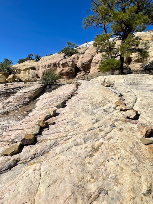
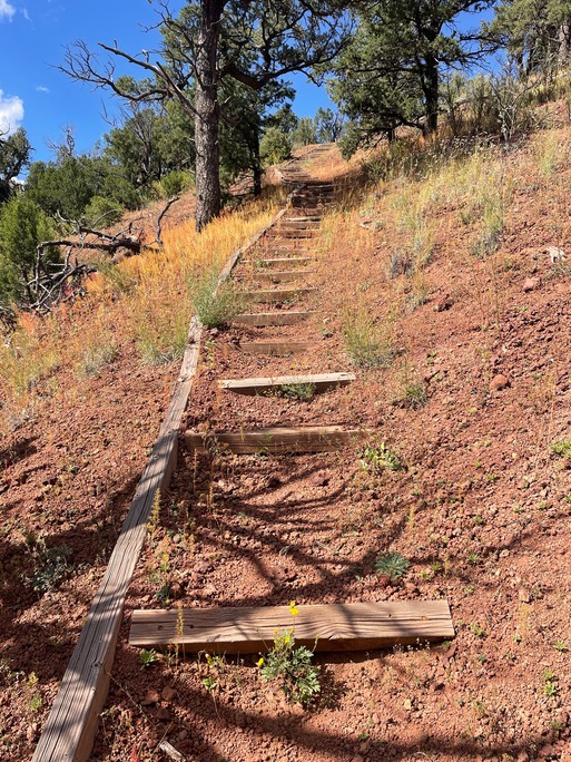
This is a fun fairly short hike, but you have to pay attention to find the rock cairns that mark the trail. There are also lots of stairs built in to get you on top of the Mesa.
Besides the rock cairns, there are paths cut into the Mesa. This was done back when the CCC was doing all kinds of outdoor projects to employ people…unknowingly, there was a lot of damage done to natural features in that context.
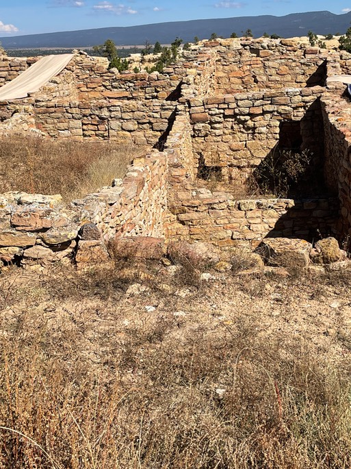
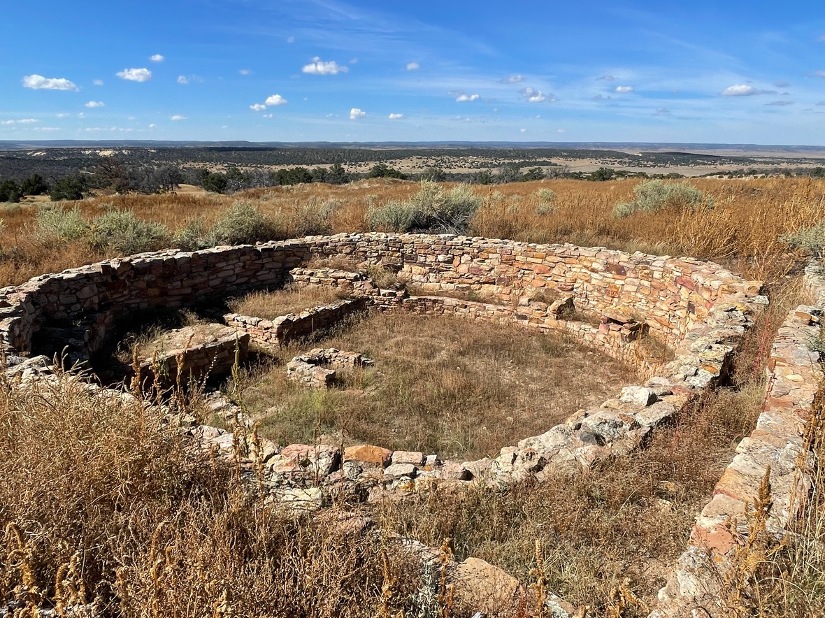
Once on top of the Mesa, you can see old dwellings from pre-Pioneer days.
The views from up here were fantastic! (And, on a side note, I was able to call Danny & visit for a few minutes. I’ve not had cell service & don’t have it in camp, so we were able to catch up.)
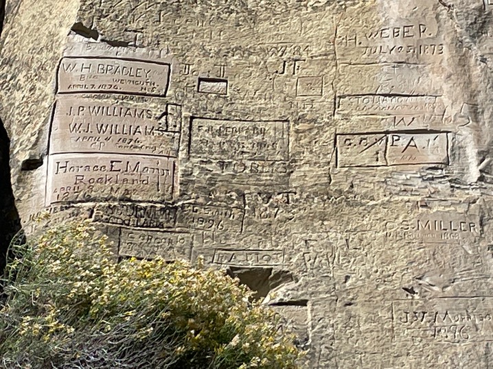
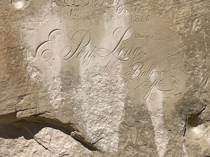
Then the trail starts down some switchbacks on the other side of the Mesa & takes you down along Inscription Rock. There must be at least 100 signatures here….only one from a woman. But, there are also Petroglyphs…I love to see those!
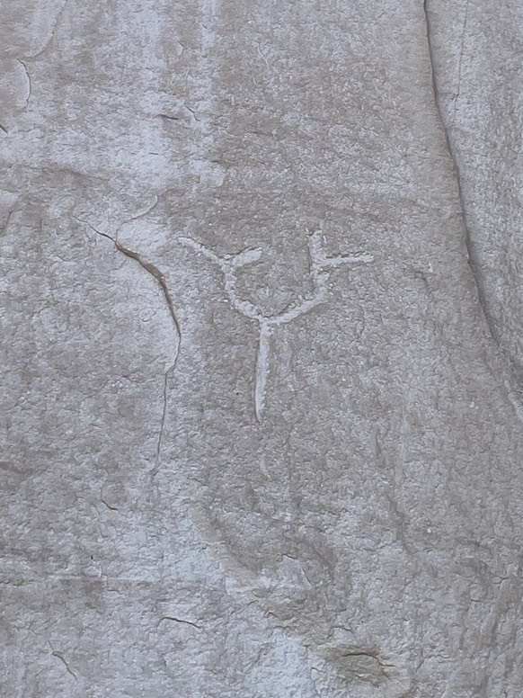
So, I walked along the wall, with my cheat sheet in hand, looking for the signatures & petroglyphs highlighted in the brochure.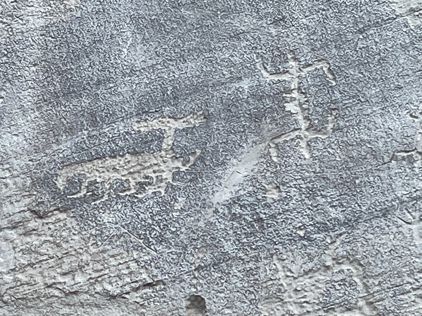
I’ve seen several of these types of walls throughout my travels, & am always surprised how elegant some of the signatures are when they are being carved into a rock wall.
The pond…not easy to get photo of it, but I was surprised how small it was.
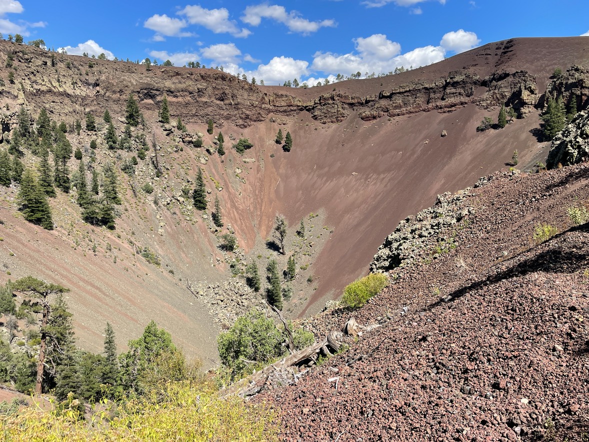
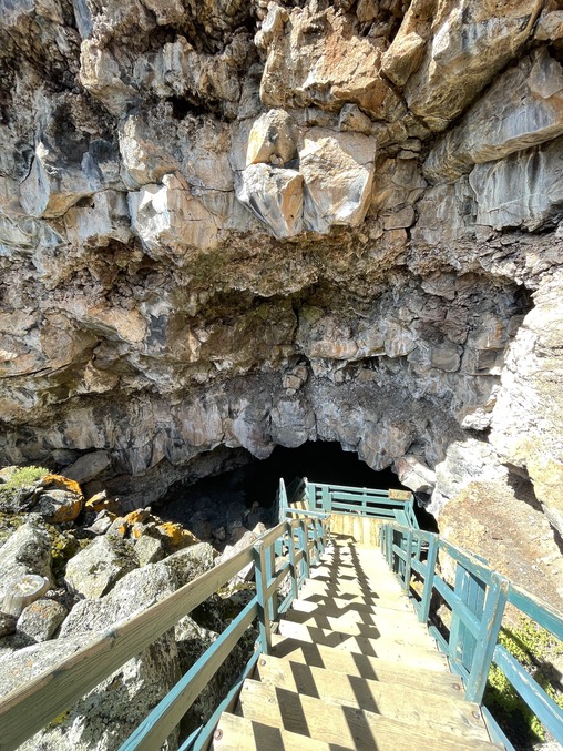
That was about all the hiking El Morro had, so I drove back up the road to the commercial site of Bandero Volcano & Ice Cave. This property has been in the same family for over 100 years. For $12 I could hike to both. It was short hike to the volcano.
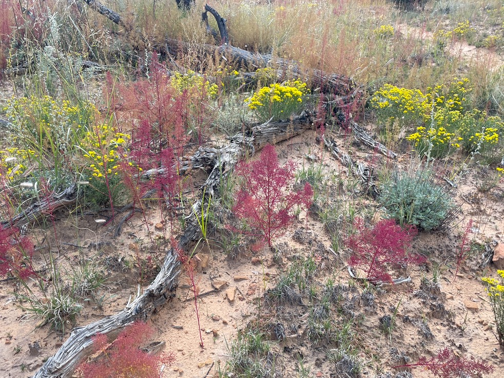
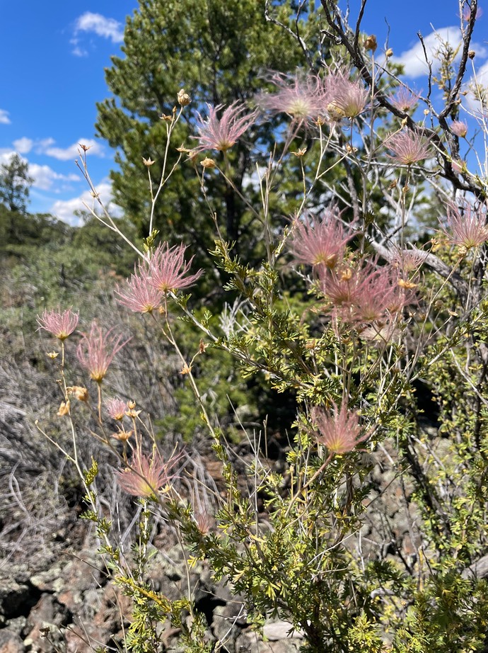
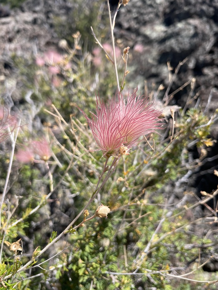
I took a different trail back…they called it the adventure trail. It was nice though, even though you’re surrounded by volcanic rock everywhere. I’ve hiked in volcanic areas before in Oregon & California, & it’s amazing to see what grows here among these hard, black rocks. I became obsessed with this bush. It reminds me of Prairie Smoke in Crested Butte. My friend Talie says it’s a flower having a bad hair day. These are so similar, but on a bush. Let me know if you know what they are!
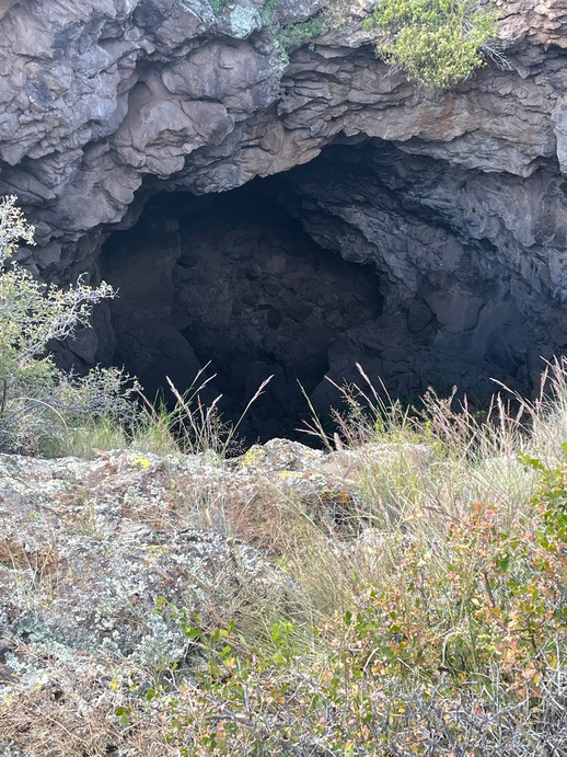
Then it was time to hike down into the cave (it was a short walk & a tiny cave).
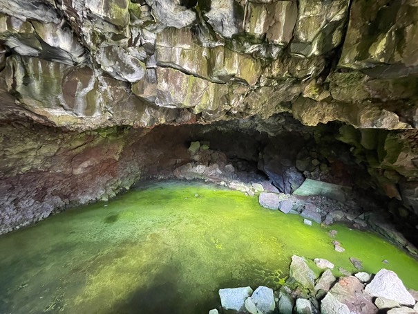
This is the only desert cave in the country where Arctic Algae is found. The owner told me that scientists have been here to study why, but have never figured it out. The green goo wasn’t what I was expecting.
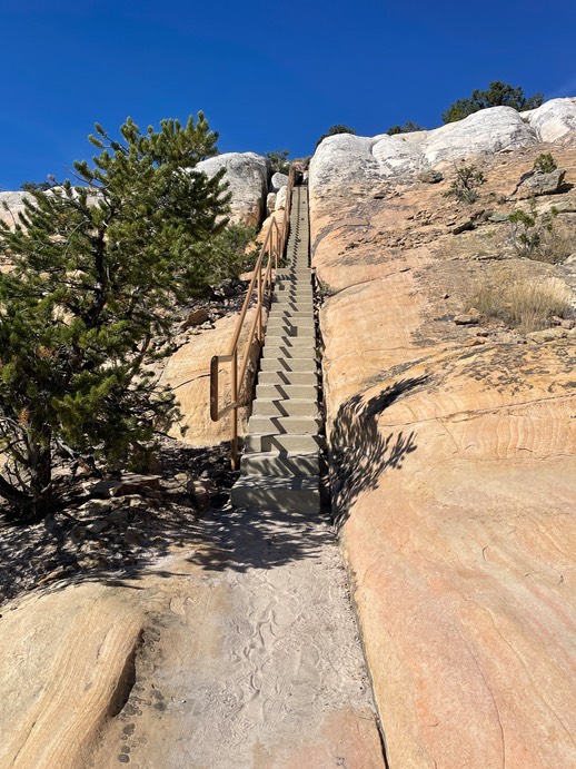
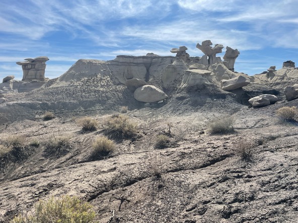
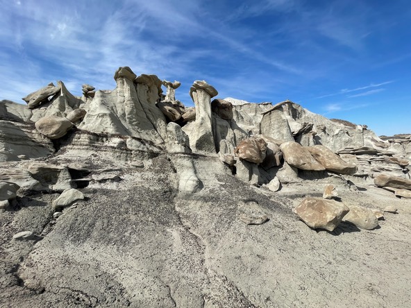
My last hike of the day was back up the road & back into El Malpais NM to the El Calderon trail which was 5 miles long. It’s not a magnificent trail unless you're in to big holes in the ground that you can’t actually go in to. I’m not a huge cave fan, but I wanted to hike this trail, just to be out more. And, so I did.
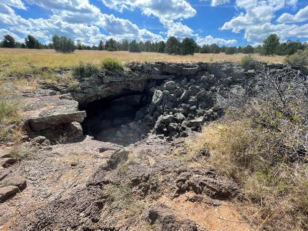
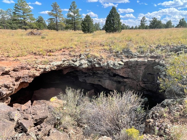
This trail crosses the CDT (Continental Divide Trail) & I was hoping to hike a little on it. But when I got on it, the trail was way overgrown, a section literally climbed up lava rocks & seemed to be going in the wrong direction. Since I didn’t have any kind of map & didn’t really feel comfortable on this obscure trail, I turned around & went back to the trail I’d started on.
This stairway climbs up to the top a view point.
The view from the top.
I was tired once back at camp. I’d noticed a pop-up truck camper parked in the space across from me when I’d gotten back to camp. Not just any pop-up…it was a Four Wheel Camper Project M. I’d never seen one of these in person; but only stalked them online & on Youtube.. A few years ago, I toured the Four Wheel Camper facility in California & learned all about their amazing but pricey & very coveted truck campers. At that time, the Project M wasn’t out yet. I thought there were two people in the camper across from me, but then I saw the woman walking the road alone in front of my campsite. So, I asked her how she like her Project M. And then there was a little bit of trip magic. Her name is Diane & she’s from New Mexico. She’s only had her camper since June & is really enjoying it. She invited me to see the inside of her new baby. And I think she’s done it great. Simple, easy & cheap…just trying to see what works & what doesn’t for awhile. I invited her over to my camp if she wanted to & later in the evening she did. We talked all things travel, camping, being solo & it was really nice!
But, I was bummed & nervous about not having cell service. Hurricane Ian was devastating Florida & soon to send flooding into Orlando. I was super anxious about Sara’s family. I know if I’d had service, I would have stayed awake all night looking at the news & watching live webcams & being filled with endless worry. Turns out you can still stay awake all night & be filled with endless worry even without looking at all that stuff. I had my inReach GPS on all night, & Danny knew he could get a hold of me by text…even though there was nothing I’d be able to do.

Day 4 9.29
I left camp early & headed back up the road to the last trailhead I’d hiked….I knew I had service there & the sun would have risen by the time I got there. I checked my phone for new on the hurricane in Florida & briefly talked to Sara….the kids & Kevin were fine as of early this morning, but there had been a little bit of flooding in the house.
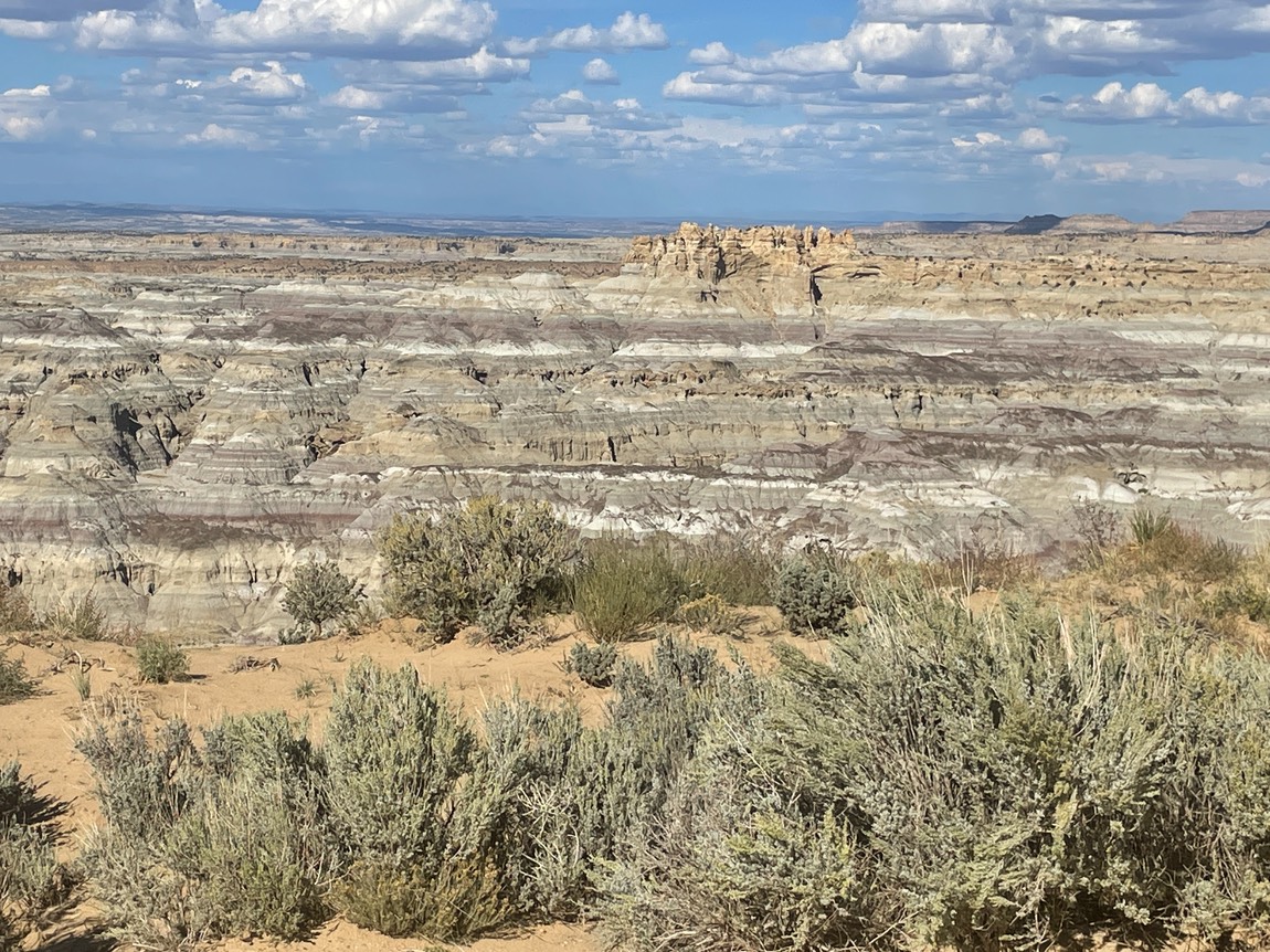
I had been thinking of paying the yearly subscription fee to join Alltrails so I could download maps to use when I had no service. I’d been warned by several people, I needed a downloaded map for my next hike. So, before I left the trailhead, that’s what I did. Then, I made coffee then headed north for 2.5 hours to the Bisti Badlands.
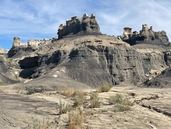
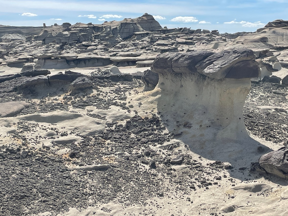
And, I took my first step into this strange place & was so glad I had something to follow. There is no trail. There aren’t any cairns. There is vast space, crazy rock formations, & it would be soooo easy to get disoriented here.
So, I had my downloaded maps' little red line to follow & an extra battery pack. So, I started walking holding my phone out the whole time. Once in awhile you could someone else’s footsteps, but that was about it. I only saw a couple of other people the whole time I was out here.
I found it annoying to hold my phone the whole time during a hike but worse, to be so reliant on a device. I’m sure there’s a ton of people that wouldn’t be apprehensive about wandering out here with nothing, but that wasn’t me. Have to admit, this hadn’t been my favorite hike during this trip.
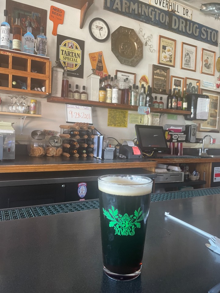
Had a yummy lunch & good beer at the Three Rivers brewery in Grants after my hike. I ordered the burger with the red chile candied bacon & it came with a side of green chile & bacon scalloped potatoes….wow!
I was fortunate to get to talk to Sara before I got out of service. It’s so heartbreaking what their going through. Their home was flooded with rains from Hurricane Ian. They evacuated by boat & friends offered them a place to stay. It’s been harrowing for them all. There is so much to do now…they’ve lost most everything that was on the first level of their home, including two vehicles. Kevin was able to put some stuff upstairs or up high before the water rose, but there wasn’t much time. Sara was working at the hospital, unable to leave until the flash flood warnings subsided & another shift to take over the ER. She was ready to wade a couple of blocks to help get them all out, when someone offered to take her home & get her family by boat. So grateful they are all OK, but Ian has left his horrible path of destruction through Florida. It was great to hear her voice….I only wish there was a way Danny & I could help them.
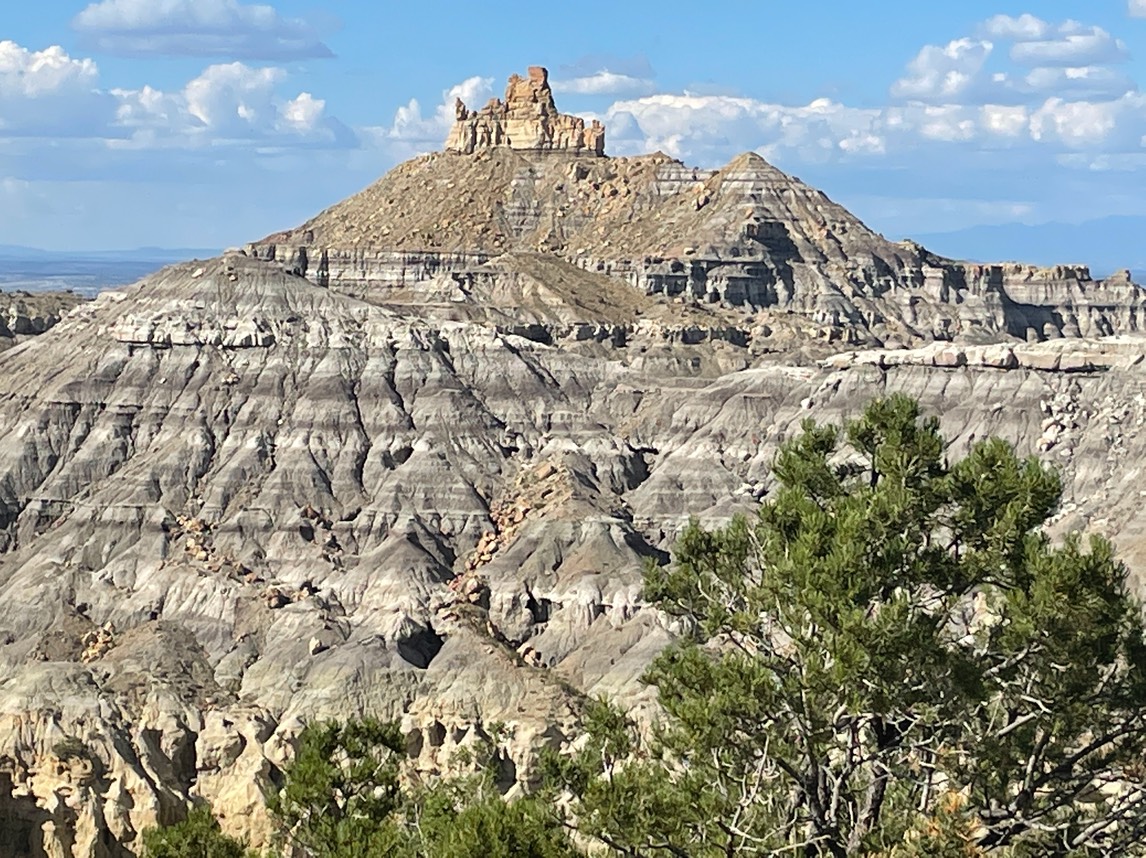
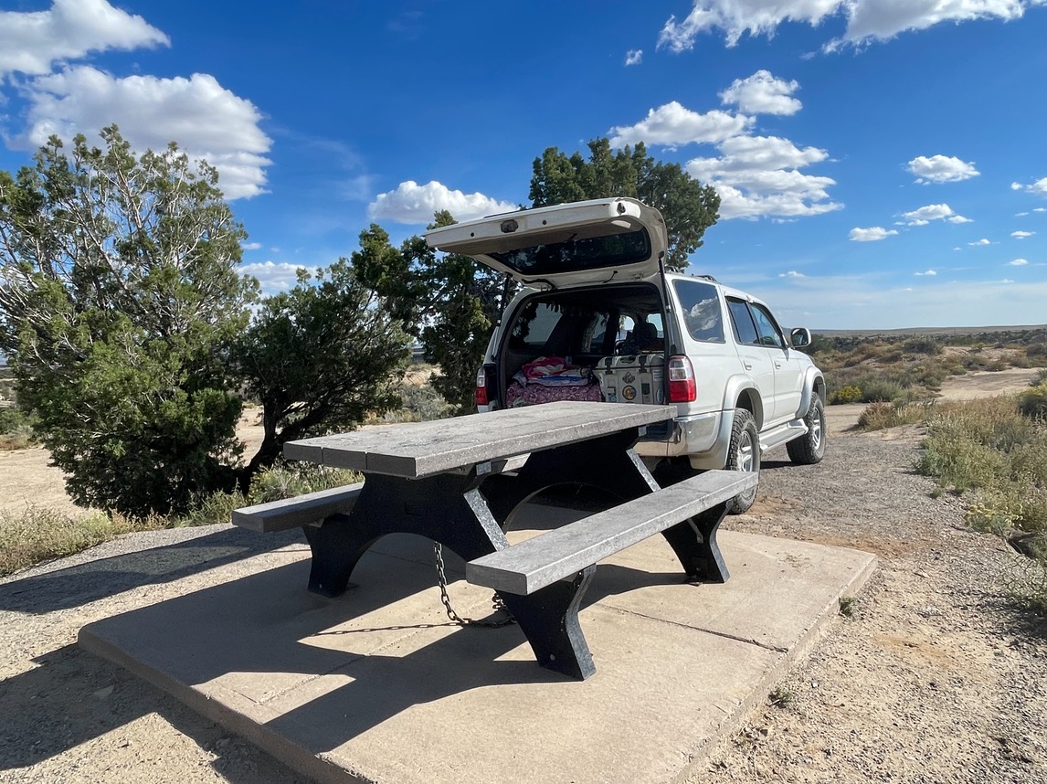
Drove down a bumpy dirt road to find this awesome free BLM campsite called Angels Peak. Great view from my perch!
It was a big slope to drive up to the picnic table, so I had to scoot as close as possible to get level. I finished the 1/2 burger & potatoes I’d saved from lunch & enjoyed dinner with a great view!
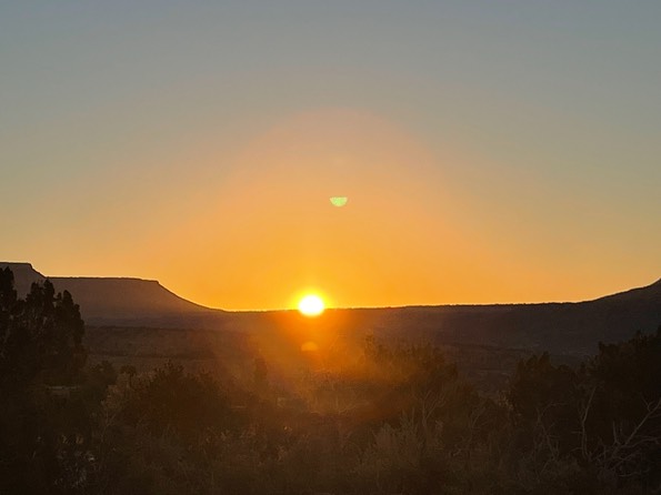
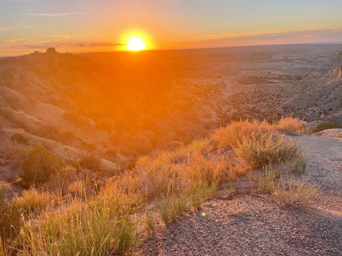
New Mexico has some great sunsets.
Ready to tuck in & dream into the night.