day 6 4.25
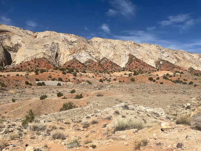
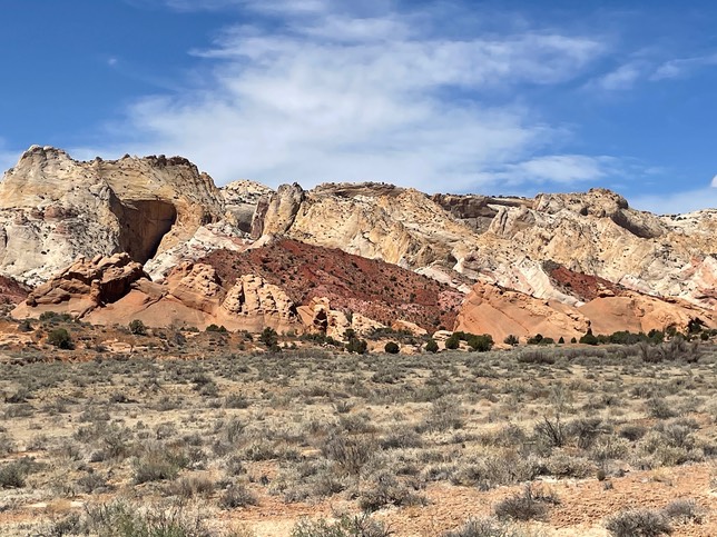
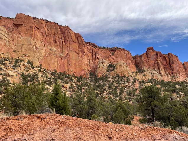
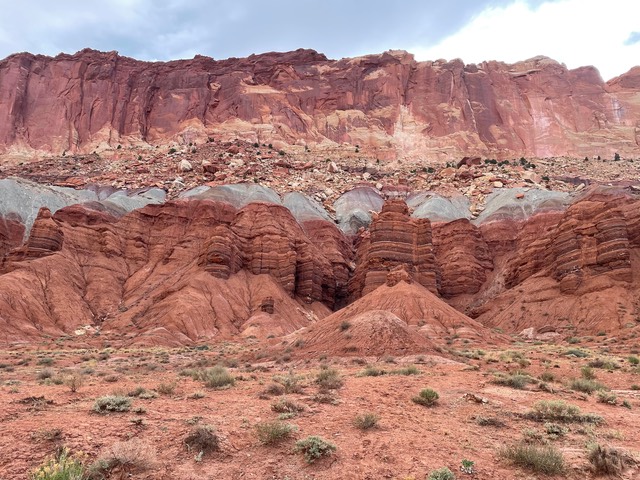
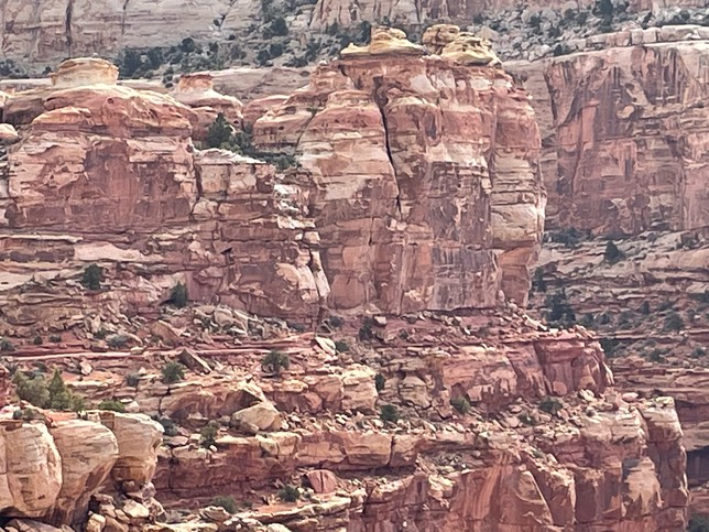
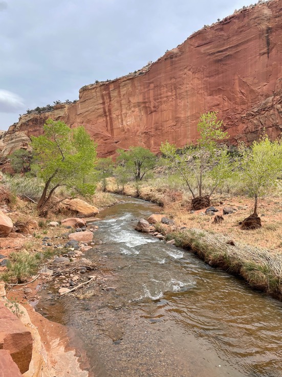
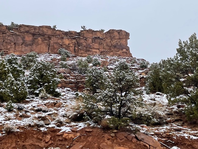
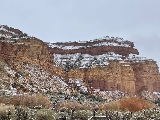
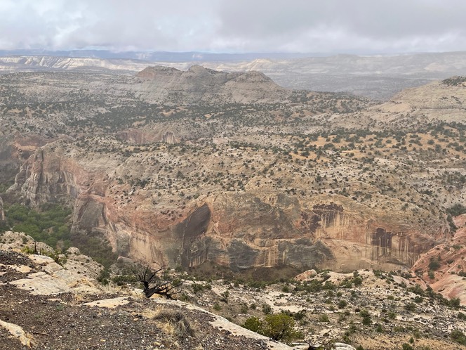
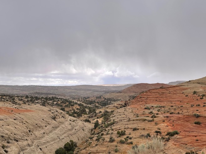
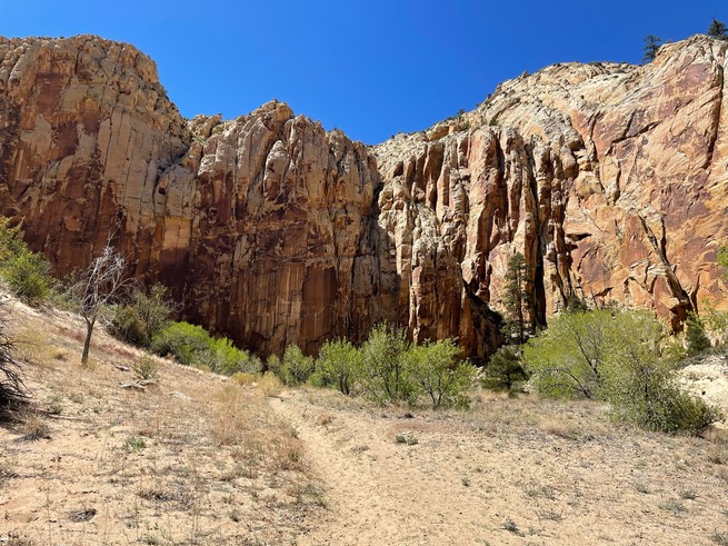
I thought I would hike today in Capital Reef National Park, but when I visited with the Ranger, I came up with a new plan. It was suppose to rain tomorrow, but not today. If I wanted to, I could get out of my comfort zone & drive a 130 mile loop into the backcountry & do some slot canyon hiking along the way. It wasn’t recommended I drive that road tomorrow in the rain, so today it was. I took off towards the sandy & washboard road that paralleled the Water Pocket Fold. It’s an amazing mountainous wall of colorful rock that goes for miles & miles & miles.
I made it down the icky Notom road to the first slot canyon named Surprise Canyon.
It was easy & pretty…a nice little hike.
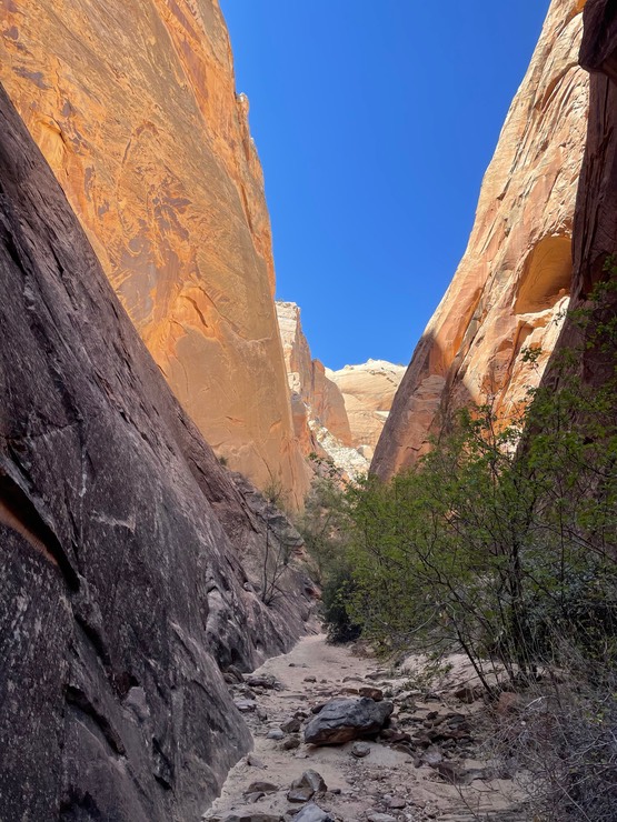
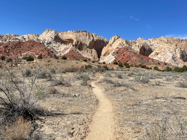
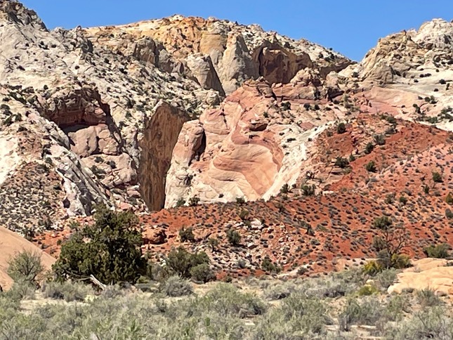
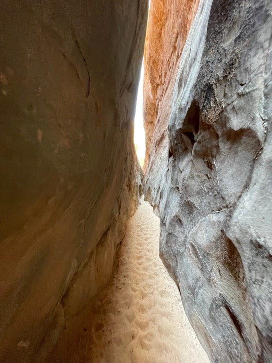
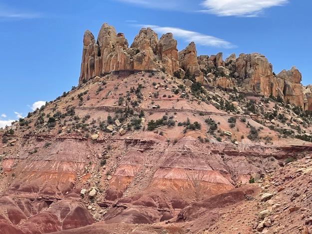
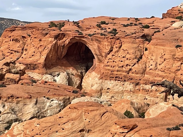
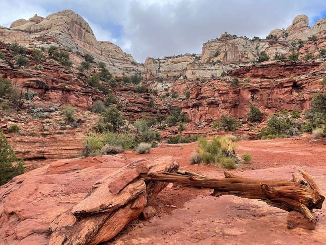
Just down the road is Headquarters Slot canyon & this one was a lot more fun! The trail began with this view & I was mesmerized by the colors of the rock.
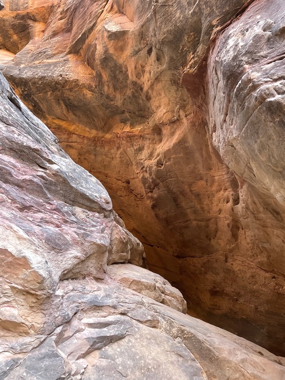
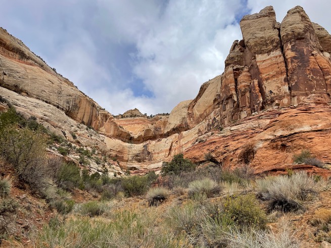
As I got closer & became obsessed with the striped section near the beginning of the slot….it was breathtaking!
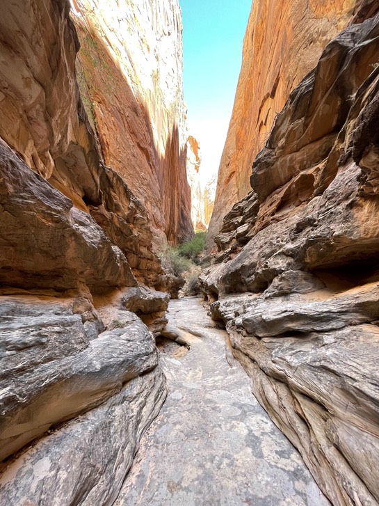
Hiking this slot was fun & there were only about 3 other couples there.
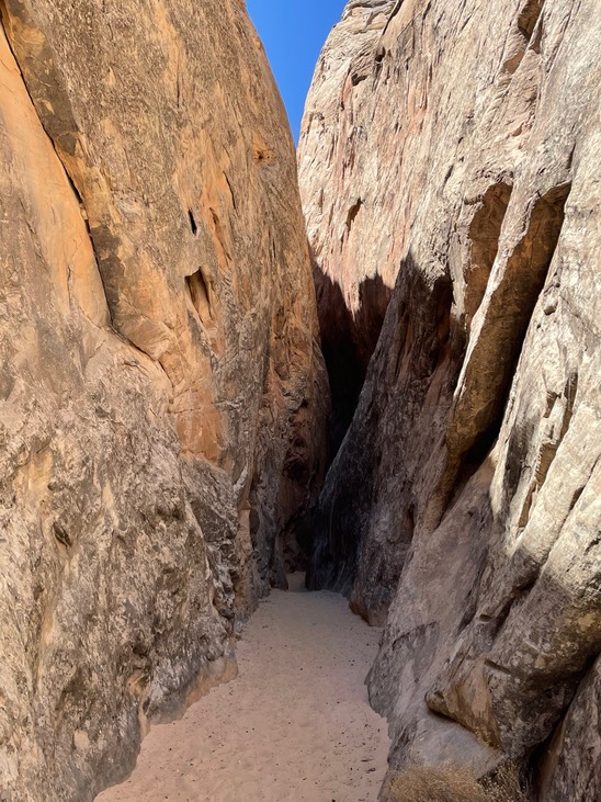
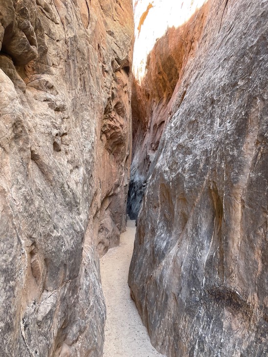
It ended (for me & most everyone else) after the climb up to a big boulder to climb over. I watched a guy climb down it & decided it wasn’t for me (he said he didn’t like doing the climb up or especially down too). The photo below is walking back down this rock to head back to the mouth of the canyon.
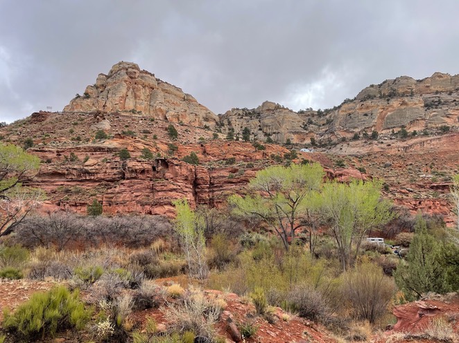
Now it was time to head back towards Capitol Reef & see the rest of the drive…which is called the Burr Trail Road. I knew most of it was paved, but not for the first 8 or so miles.
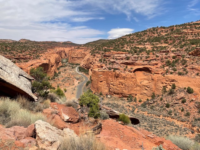
Before the pavement, I got to a big sign “Burr Trail Switchbacks”…uh oh. I seem to remember reading about these or watching them on YouTube sometime. But, oh well, I wasn’t going back on the sandy washboard road, so I started up. They weren’t bad…much better than the Moki Dugway & nice because I didn’t have anyone behind me trying to push me to go faster. The scenery was amazing!
This was one of the prettiest drives I’ve ever done! This is looking back down to Long Canyon along the Burr Trail.
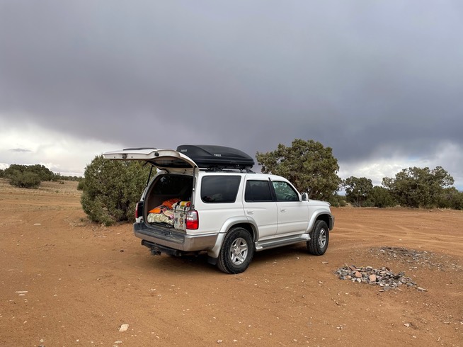
I found a spot to camp for the night between Torrey & Capitol Reef NP. I had service, which is nice, & privacy…no crowds for sure.
day 7 4.26
The weather was getting iffy…it was supposed to rain today & then tomorrow possibly snow. I always carry a rain jacket in my pack & I was ready to hit the trails.
My first hike was to Cassidy Arch…Butch was said to have hidden out here. I’ve hike MOST of this trail last time I was here, but a big thunderstorm was blowing in, so I had to turn around before I made it to the arch. The colors in Capitol Reef are so spectacular & today was overcast, which was perfect for photography.
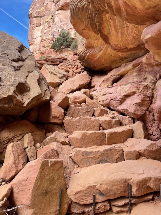
Steps along the trail as it climbs higher & higher.
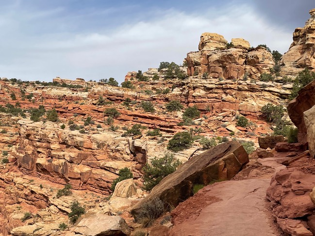
This photo looks back towards the trail…it’s the flat part about in the middle of the photo.
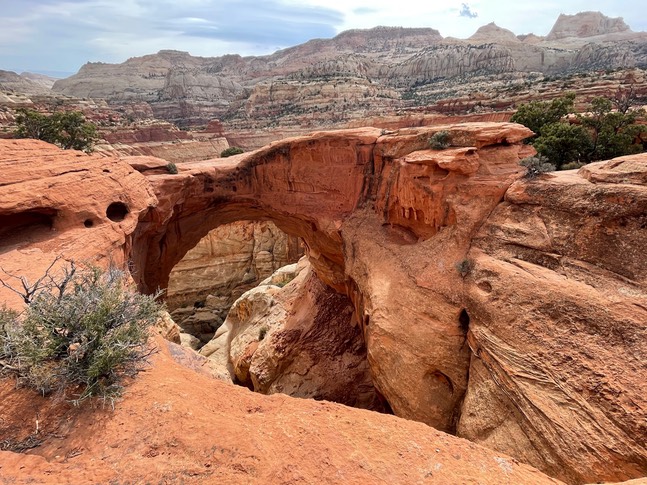
Looking at the arch from across the trail.
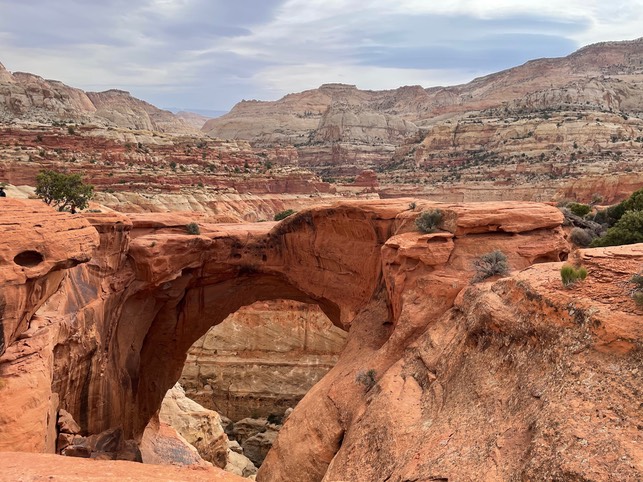
This was taken from behind the arch….fun to see different views.
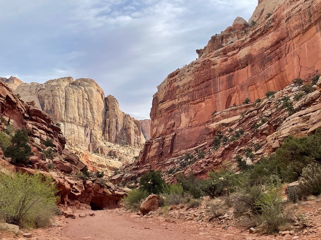
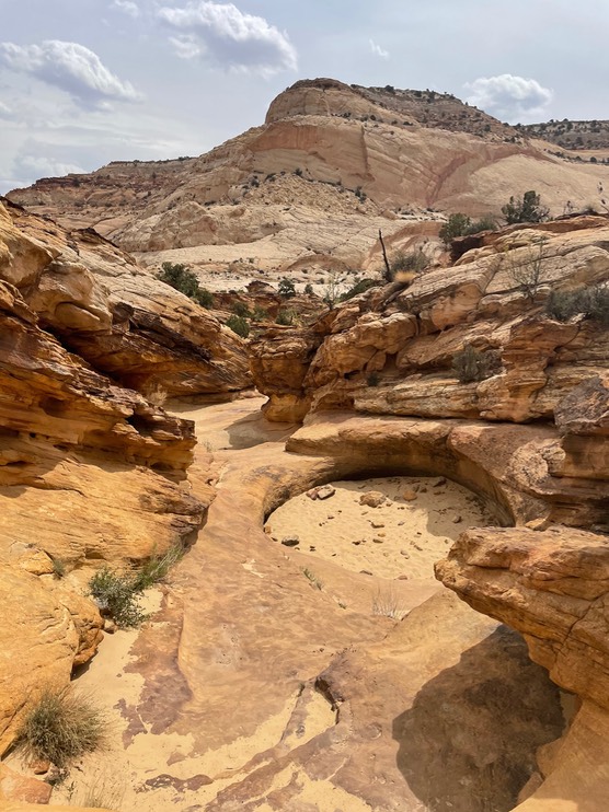
My next hike was to Capitol Gorge.
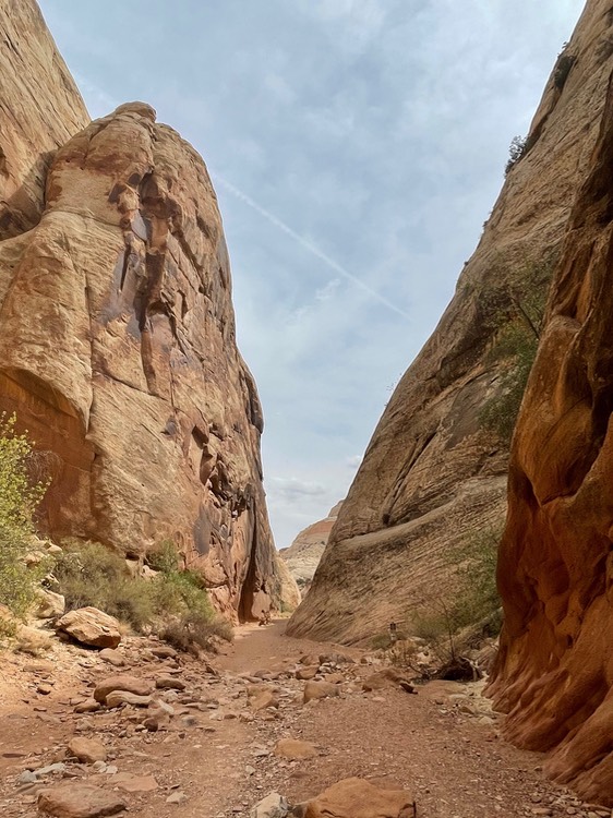
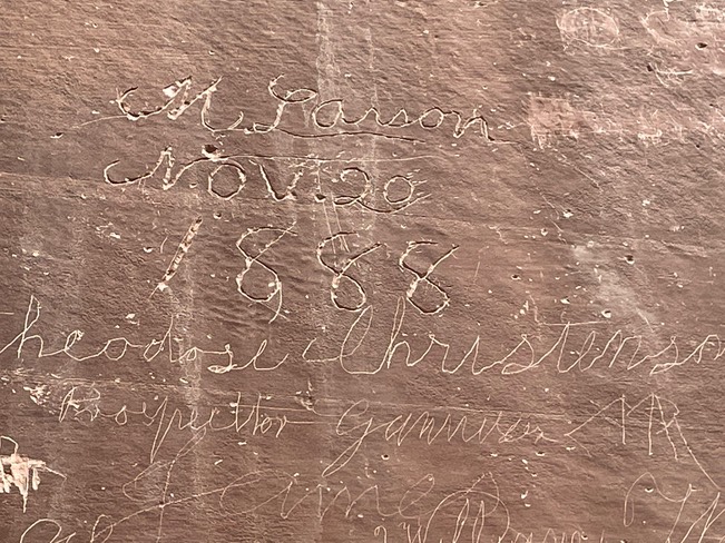
There’s inscriptions along this canyon from the late 1800’.
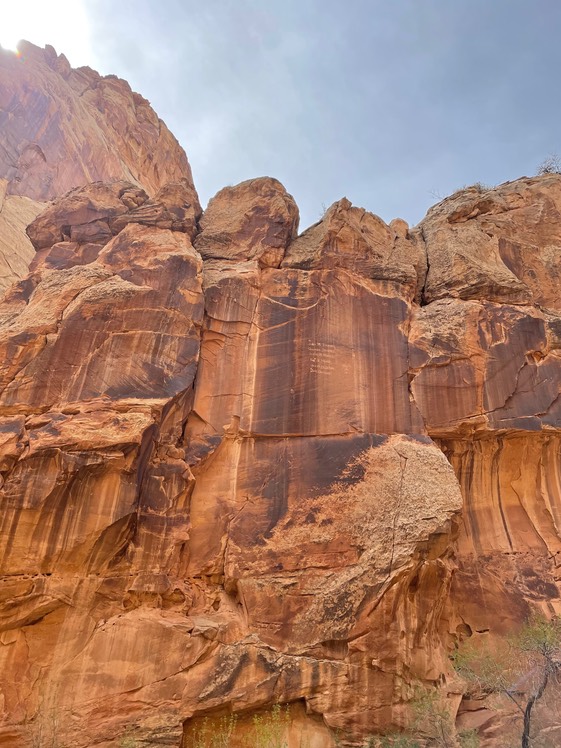
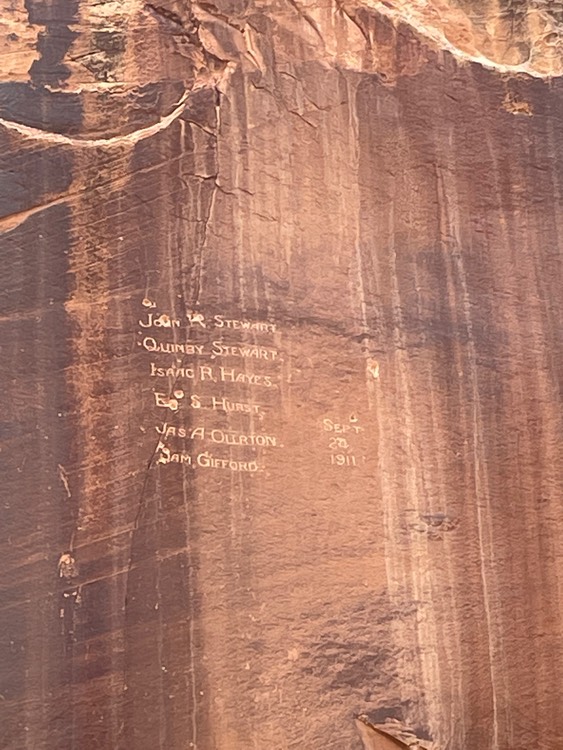
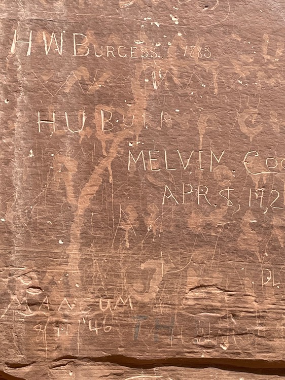
These carvings were so high up on the wall I have no idea how these old time vandals did it.
The “tanks” were empty….no water.
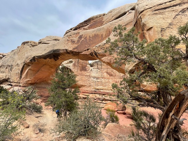
My last hike of the day was to Hickman Bridge.
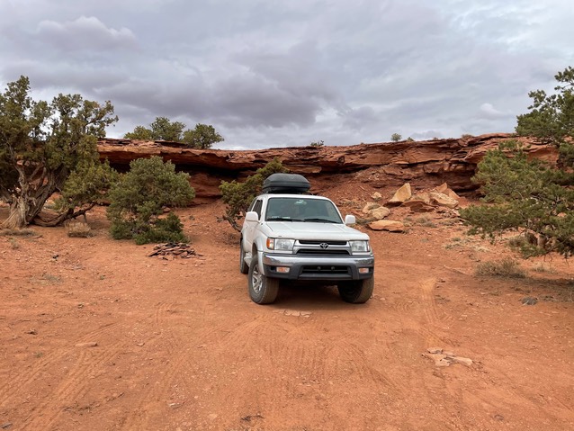
After my hikes, I went into Torrey to top of my tank & get out of town. But as I was doing that, I looked up in the direction I was heading…which is up over a 9,000’ summit & down into Boulder & the sky looked really crappy. I said to the Jeeper filling his own tank, “What is that?”. He said, ‘Oh it’s already started snowing up there”. Crap! I drove back to the same area I’d camped in last night, only chose a site a little easier to get out of in case it did snow down here tonight. I was bummed…I didn’t want to encounter any snow.
day 8 4.27
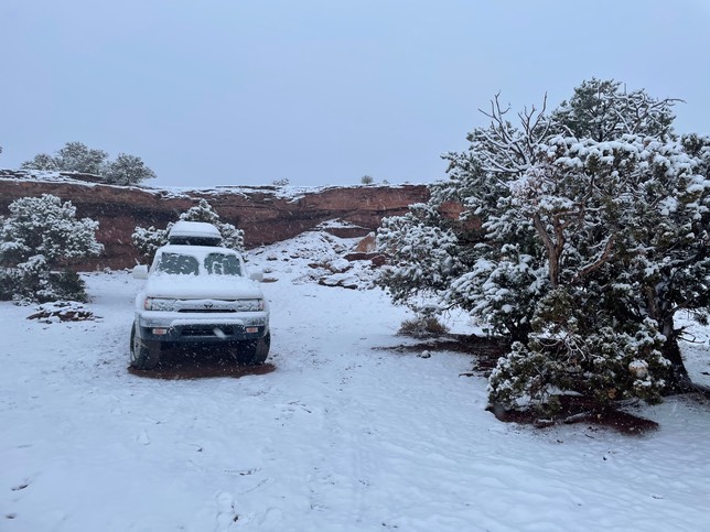
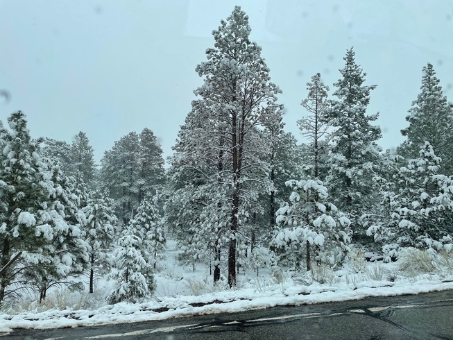
I thought I was in the clear when I stepped out in 33 degree weather at 4am to pee, & it was snow free. But, then I fell asleep & this is what happened in the next 2.5 hours. Of course my snow scraper was buried, but as soon as I could I left this sweet spot. It was still snowing heavily, & I didn’t know once it melted how easy these red roads would be to leave. I headed to Torrey to waste a day…yuck.
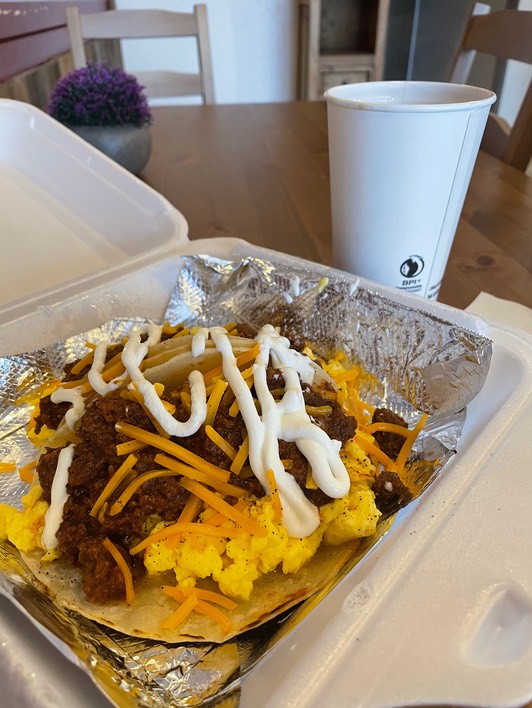
I found one place open by 9am for breakfast & ordered Heuvos Rancheros tacos. They tasted great, but I hated just killing time. There’s not a library in town, which is usually my go-to when I’m stuck.
So, I stalked the closed Visitors Center next door. After about 20 minutes I saw a car pull in the lot & he’d come from the direction of Boulder. So, I waved him down & asked how the drive was. He said it’s ok; no black ice, but if I was going to go, I’d better leave now. And, so I did. It was very pretty, but I’ve come to really, really, really dislike driving in winter weather.
It was slow going but ok, until it began to snow harder sticking to the roads as I climbed higher & higher. There were a few other vehicles on the road & those that pulled up behind me & wanting to go faster, got to go around me.
But, eventually, with white knuckles I made it over to the other side & there was NO SNOW there!! Yay!
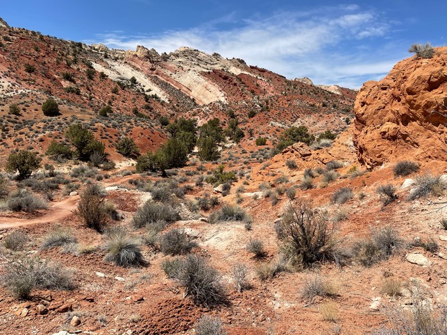
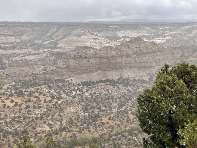
I passed the itty-bitty town of Boulder & started the drop dead gorgeous drive into Escalante. I think this is the most wild part of Utah…so many miles of crazy bad roads, super long way way off grid hikes & I bet some places that have never been discovered. I’m pretty happy that things have changed since the last time I was here. Three years ago, Trump was trying to bust up this amazing place, as well as parts of Bears Ears National Monument for oil drilling. I’m so glad that’s not going to happen under this administration.
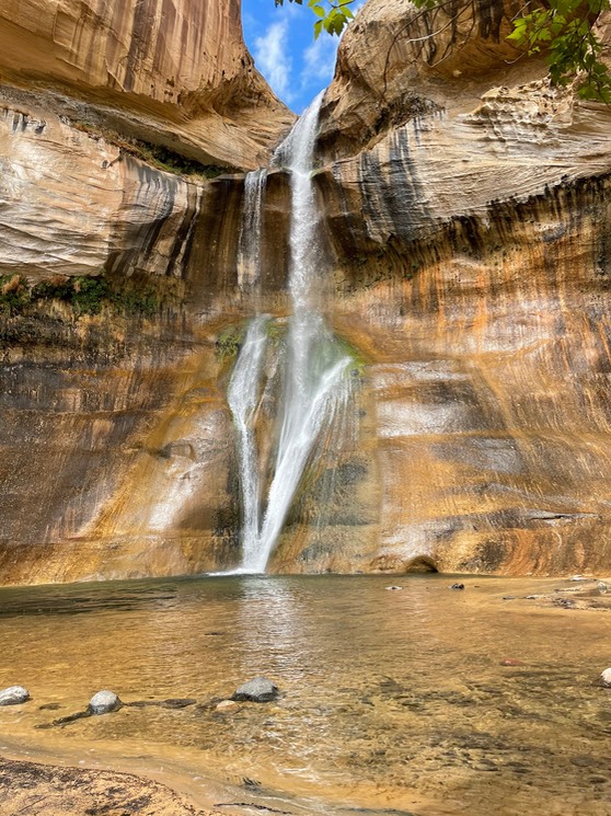
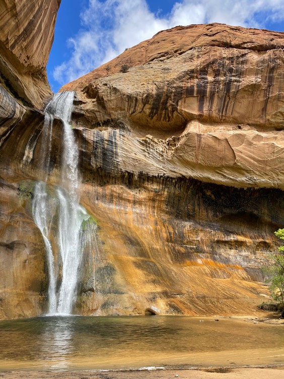
I drove over the Hogback & drop down to the Calf Creek area. I’ve done the Lower Calf Creek Falls twice before, but it was early & the weather, while not snowing, had been raining, so I thought that might keep people away. And, it did.
The 6 mile round trip hike is all on sand. So, the other good thing about hiking this trail today, was that because of the rain, the wet sand was so much easier to hike on.
A couple of views of the falls. I was #7 here! Yay! Last time I did this hike there were probably 50 people & 20 dogs…& the dogs all seemed to be fighting. You couldn’t even get a person or dog-less photo of the falls. But, today was fantastic!
After about 20 minutes, the population doubled. I put on my pack & passed another 20 people in a short distance. So grateful I was there when I was. I was about 1/3 of a mile from the end of the trail, when it started to rain again. I felt I’d really lucked out on this trail today.
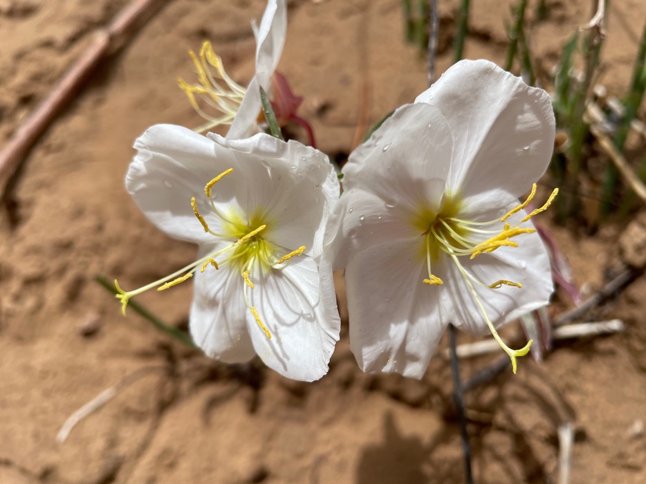
Springtime desert flowers.
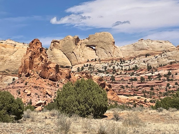
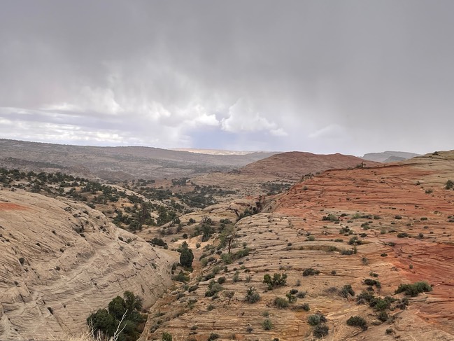
One of the viewpoints along the road.
I drove through the town of Escalante to the Visitors Center…I had some questions. But, they were closed…seriously? The sign said they were answering by phone…but no one did when I called. One of the scary roads I was considering driving had a report posted & it said the road was fine for 2WD vehicles & clear. Well, that answered one questioned. But, they were closed both today & tomorrow…crazy since it’s considered high season.
I drove back the way I’d come towards Hole in the Rock road & found camping soon & I had service. I reheated the taco I’d saved from breakfast this morning & had a drink. I sat & looked up hikes & tried to find answers to my questions. It was 43 degrees, so I was back in layers & the skies were looking stormy. More rain was expected tonight, but then good weather was forecasted for the next few days & it was going to warm up.
day 9 4.28
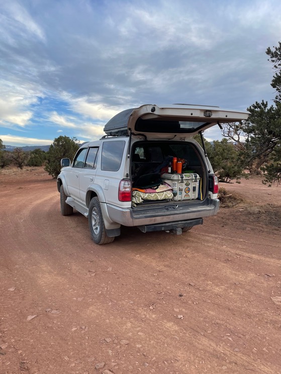
This morning I decided I wanted to camp here at least a couple of nights, so I put up my little backpacking tent to hold my spot. It wasn’t crowded out here…there are a gazillion spots.
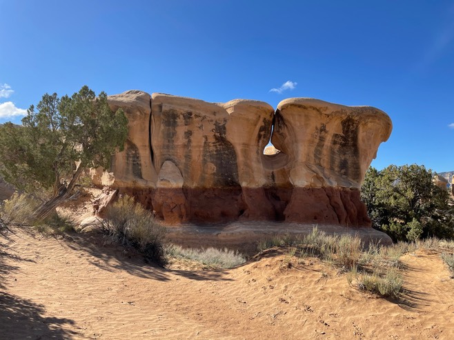
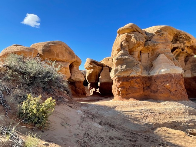
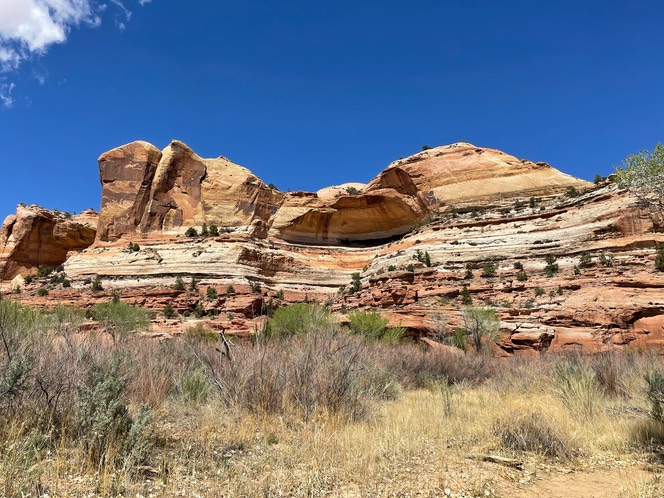
I wanted to drive to Devil’s Garden which is down Hole in the Rock road. Last time I tried to drive this road, it was so washboard that after 7 miles, I thought the fillings in my teeth might fall out & was worried every screw or bolt on my 4Runner would work it self loose. But, today, the road is in great shape. I loved walking around these great big crazy looking & beautifully colored rocks.
My new plan today was to drive from Escalante over Hell’s Backbone (which in the past I’d been afraid to drive) to Boulder. I went back to the VC to refill my water jugs & read the same report I’d seen yesterday…all was clear. I stopped in at the gear shop before I left town, just to see what stuff they had & I wanted to buy a guide book for the area. Glad I asked about Hells Backbone road, because the guy at the gear shop told me not to take it. The snow I’d driven through, also had covered that road. He said if part of it wasn’t blocked, it sure would be slippery & he would not recommend it. Bad mark for the Visitors Center for sure…wonder how many people took that report info & headed out. It’s not a road you can always turn around on.
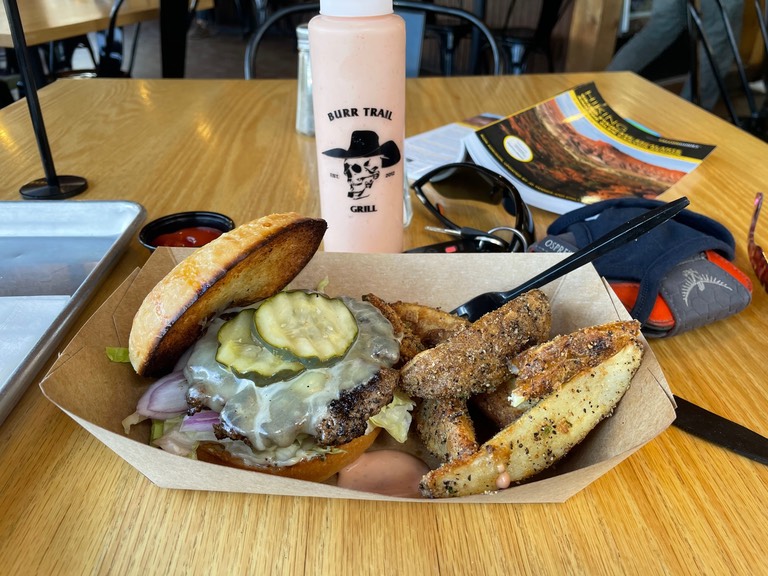
So, I made a new plan. I'd drive the highway way, over the Hogback & into Boulder. And that’s what I did. I wanted to eat lunch at the Burr Trail Grill which supposedly had amazing hamburgers. WOWOWOWOW! It was fantastic & so were those fries. And, they’re known for their hand pies, so I got a piece to go. Dang, that burger was soooo good.
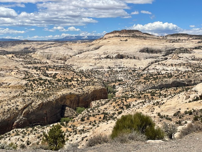
The view on the way back.
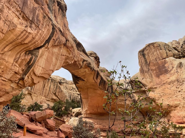
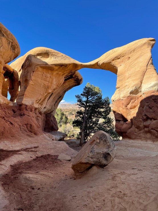
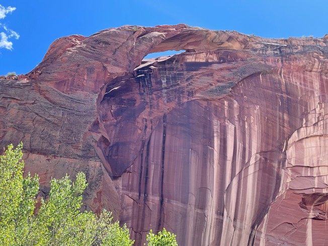
There was another hike in the Calf Creek area I hadn’t done…it’s a hike to two natural bridges. So, I parked along the road & followed the river, hiking though it about a dozen times as the trail criss crosses the river. It was only about ankle to calf deep & not cold at all.
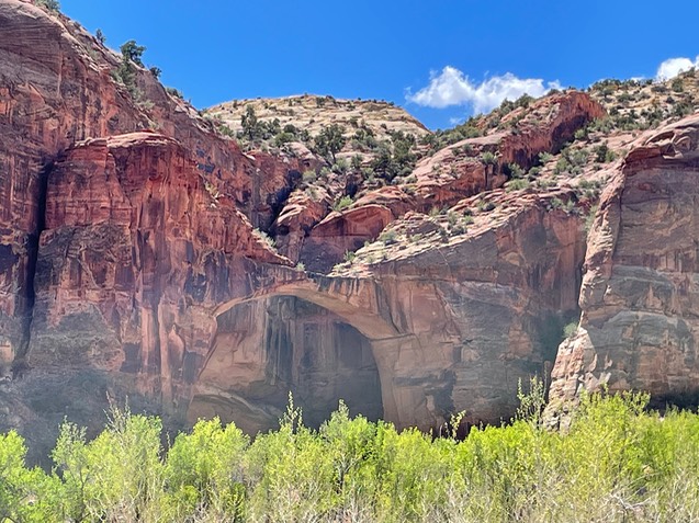
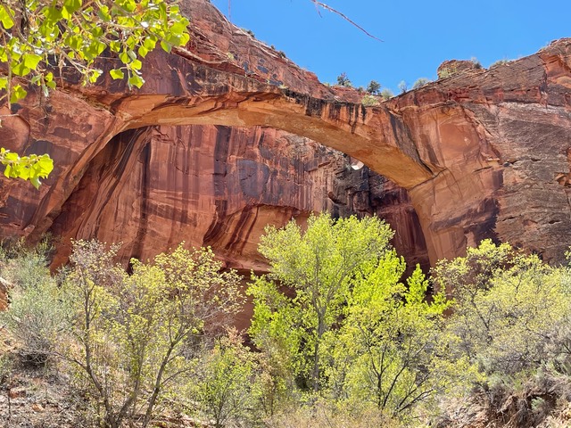
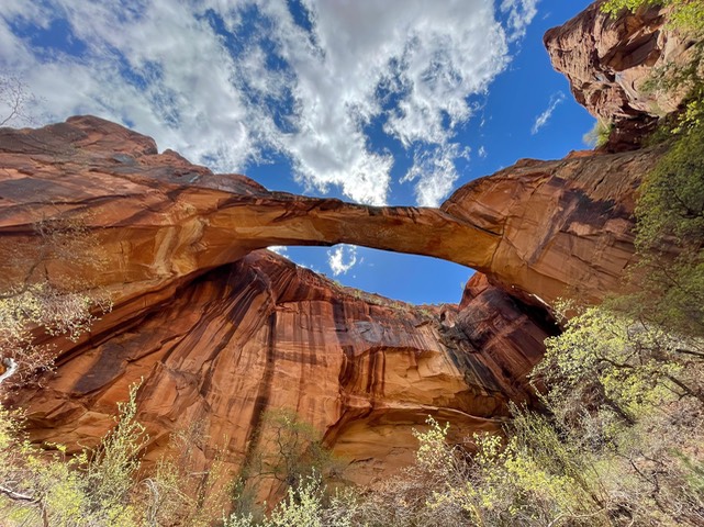
This was the second bridge.
I spent a quiet evening back in camp, had a beer, read & made a plan for tomorrow. And, ate my pie.
day 10 4.29
I spent a lazy morning in camp & finished a book.
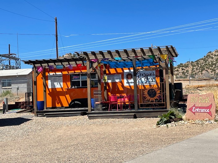
Finally, the VC was open today. I went & bought a couple of postcards & asked a couple of questions. Then I went for an early lunch at Georgie’s Outdoor Mexican Cafe. I’d read about this place from an Instagrammer I follow that plays a lot in this area. I wanted the fish tacos & the fish wasn’t quite ready, so Georgie suggested I go talk to the owners of the other gear shop in town, Utah Canyon Outdoors & they were great!
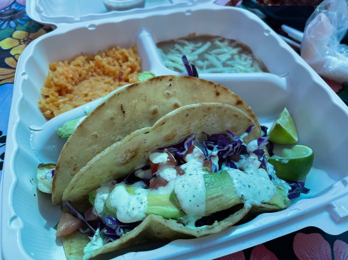
Then it was time for my lunch…yum! yum! For being two tiny towns of Escalante & Boulder, they have some really good food.
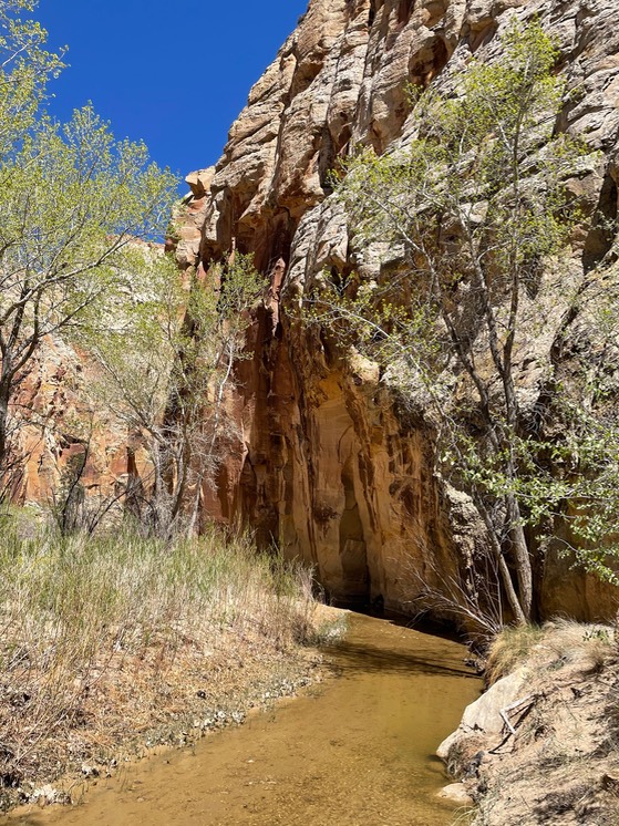
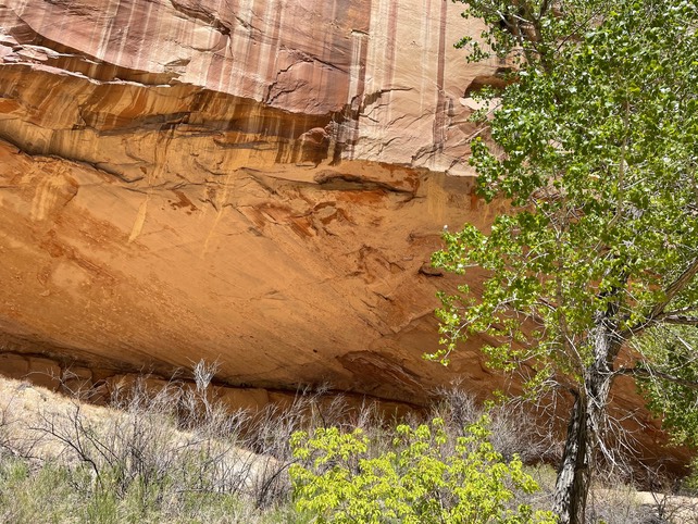
I was on the Escalante River Trail (from town). I’d done this hike before, but didn’t know about any Pictographs. The girl at the gear shop told me how to find them. It was definitely warming up now. The hike follows the river through the canyon. I just wore my sandals because you cross the water so many times.
And, I found them! Pretty cool!
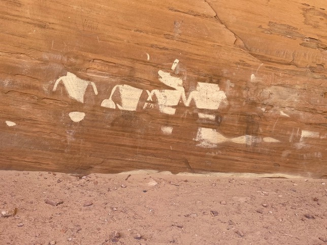
The pic below shows a bit of the overhang where the art was located. It could seriously fit about 100 people under it….so big! There was no way to get it all in my camera shot.
I got back to camp & tried out my shower. Since Covid hit last year, I set a new record of 3 showers in 80 days. I decided for this year, I’d research a shower & get one. And I did…it worked great. I do need to figure out a way to use less water, but it felt so good. I’m sure I still had bits of sand in my hair pre-shower. But, I was all clean & sweet after todays trial run. I made a salad for dinner, read a book & enjoyed a good beer. Tonights my 3rd night at my little camp spot at Hole in the Rock.