day 11 4.30
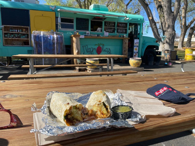
This foodie part of the trip is getting out of control. I don’t even eat breakfast burritos, but after the girl at the gear shop went on & on about the sweet potato, goat cheese, spinach & egg burritos at Magnolias, in Boulder, I had no will power. So, once again, I drove over the Hogback to Boulder. It was good, but not as good as the hamburger from the Burr Trail Grill (which is right next door). I ate 1/2 & saved 1/2, then drove back to the Burr Trail.
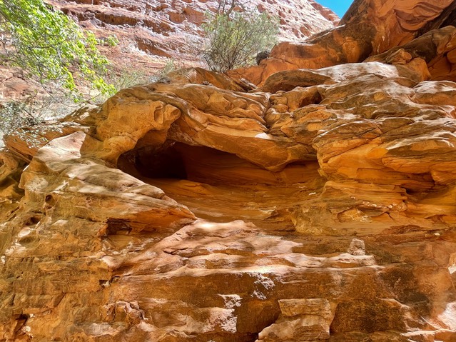
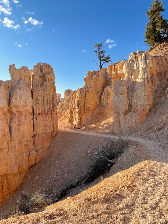
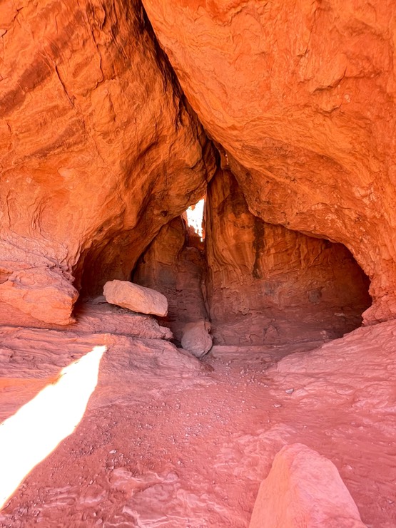
I was looking for a little slot canyon called Singing Canyon…supposedly amazing for singing inside the walls. It’s not marked by a sign or anything, just one of many pullouts along the Burr Trail. I was also hoping maybe a 3 piece orchestra, or Josh Groban or anyone that could sing might show up….because while music is a huge part of my life, I am not a singer. But, I found this sweet little slot!
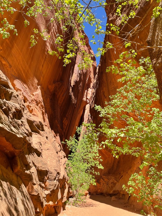
There was one couple just leaving, & one guy behind me going in. He saw my Kansas tags & said he was originally from Prairie Village (a town about 30 miles east of my house). Small world, but he couldn’t sing either.
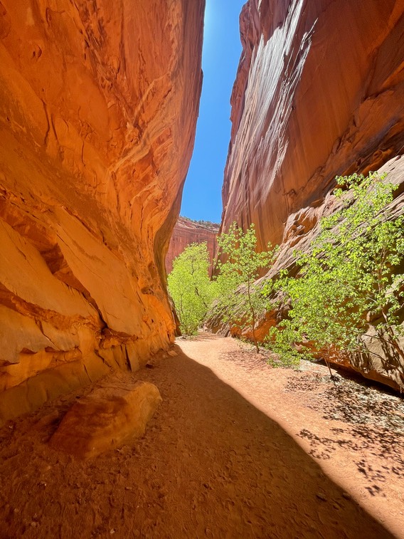
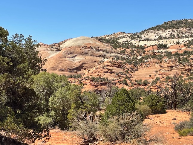
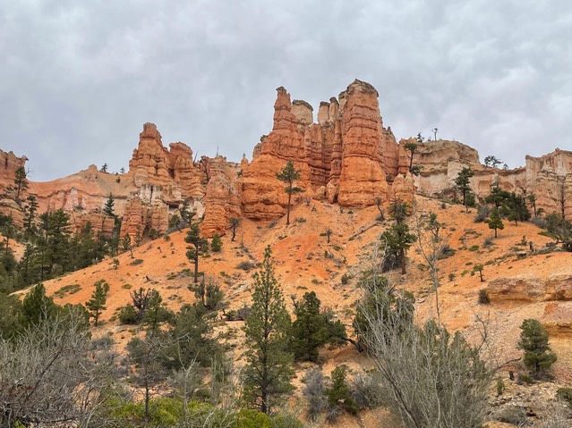
I drove the Burr Trail slower this time…I didn’t go so far back to the switchbacks, but stayed in the canyon. Wow…it’s spectacular!
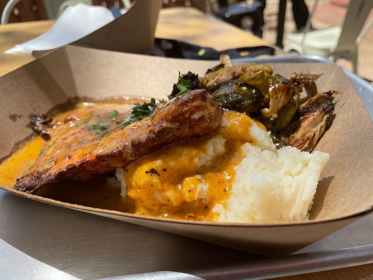
Because, at this point, I think I was going food-crazy, I stopped back by Burr Trail Grill to try their Fried Chicken. I was being insane! I rarely eat two meals a day, but I did today. I love fried chicken…one of the things I missed during my 20 year meat-hiatus. And, it was good! But, the burger was better!
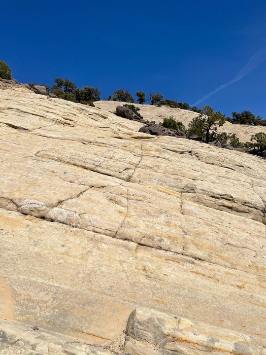
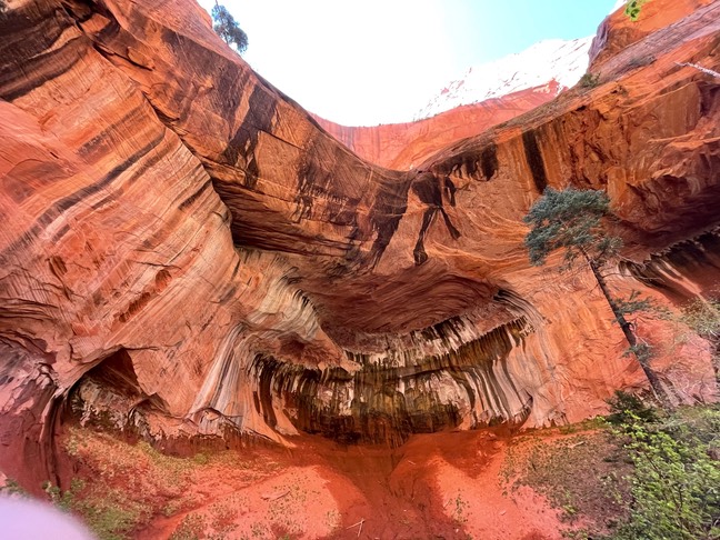
Then I went to try to find another unmarked trail (at least it’s not marked from the road) called Upper Calf Creek Falls. I’d never done this trail on prior visits…I was kind of nervous about it. And I was today too. Three different people had suggested I hike it, but with the disclaimer that it’s very, very steep. Same info when I’d read about it online. I found the turn off from the road, & then the trailhead. By steep I wasn’t sure if they meant “slide down on your butt steep” or “standing on your feet sliding steep”, so I started without my poles. It was the second version of steep, so I went back & got my poles. The problem wasn’t just the steepness, but the rock was covered in a fine layer of black sand…like the volcanic stuff. So, me & poles just slid together…kind of scary for sure. It went like this forever.
Also, all the food I’d eaten was getting cranky in my tummy. I should have known better. And, the temps were warming up but the sun was brutal.
I kept going down, slowly. Finally you hit some sandy trails, then rock again, then trail. Until you come to the waterfall.
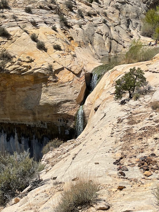
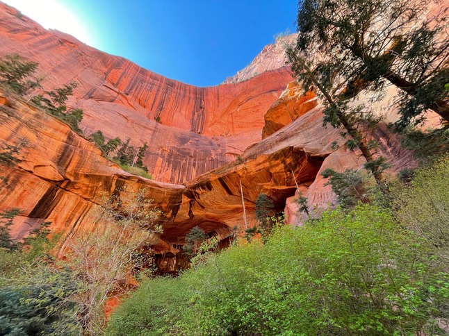
I’d read there were pools you cold play in at the top. There were four other people there & one big muzzled dog that kept scarily wandering over by the top of the waterfall, his owner chasing after him each time. The other couple were settled right in the center between the two water pools…no chance of getting a photo without them in it. They looked like they were set up for the whole day…a whole day of photobombing everyone’s pictures.
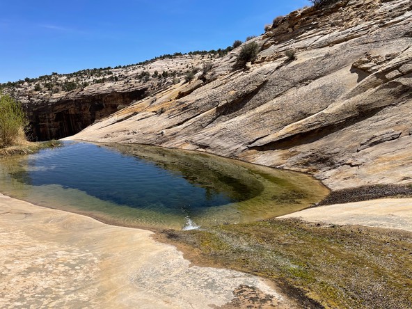
I soaked my feet for a bit, but my stomach was unhappy & I was getting hotter by the minute. And, I knew I had a giant steep climb to make back to the trailhead.
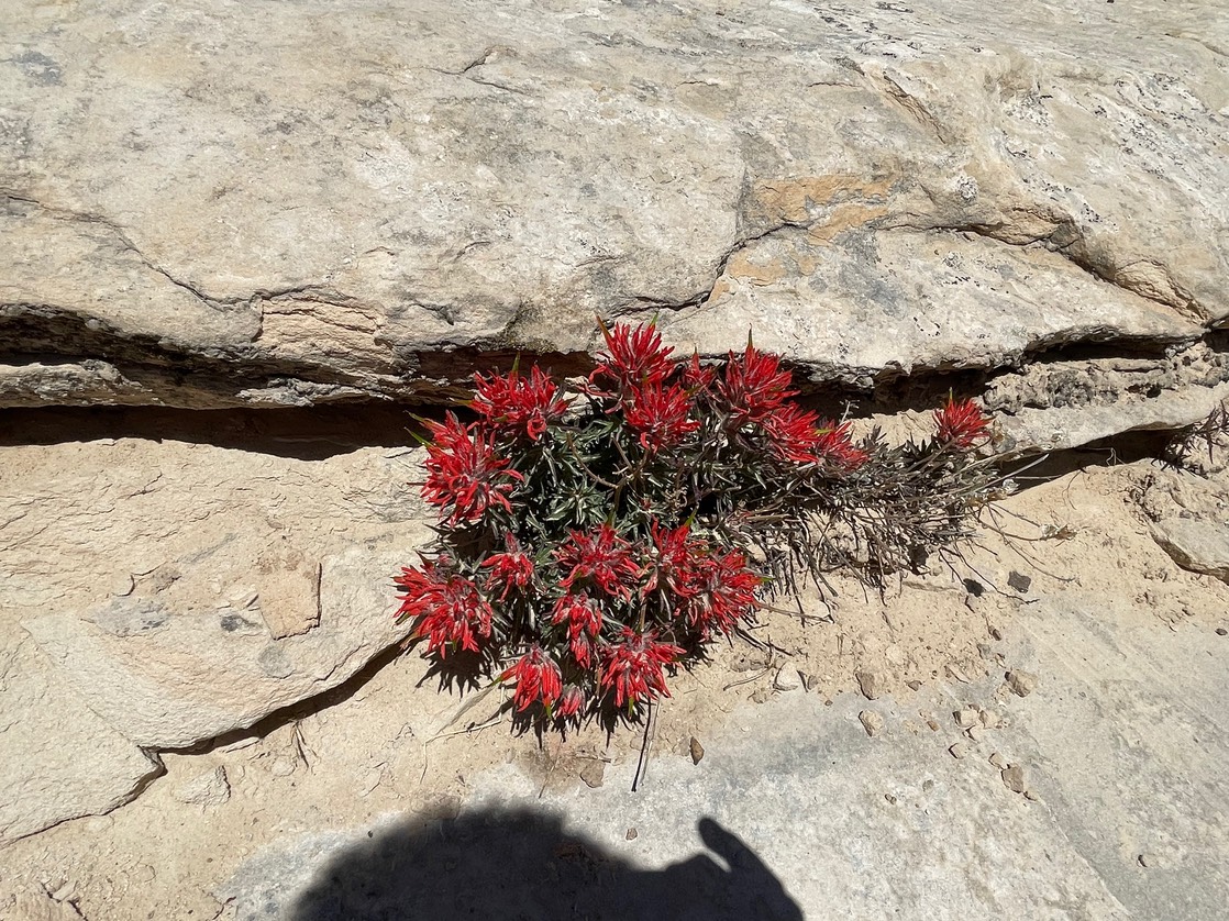
Wildflowers growing from the rock…amazing.
I took it slow going back up & found a way around the slickest part of the rock to a section void of sand. This trail kicked my butt & it’s one of the shortest I’ve been on since I got to Utah.
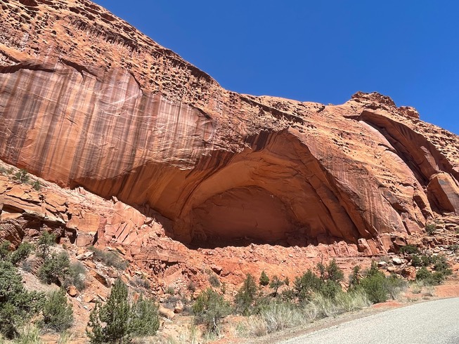
I tried one last adventure before heading back to camp. Someone told me of a section of petroglyphs called 100 hands (you can see it online). I had the directions on my phone, & it was on my way back to camp. But, I never found them. I did find the trail, but after looking all over & up on various walls, I never found them.
So, here’s something about Utah & especially the Escalante area. I am saving some hikes for when Danny joins me. I keep thinking he’ll be here with me someday, but so far he hasn’t had this much time off. Now, I figure if I come back in another 2 or 3 years, he’ll be retired & we can explore my favorite places & new ones together. He’ll find those petroglyphs…he’s an expert at observation!
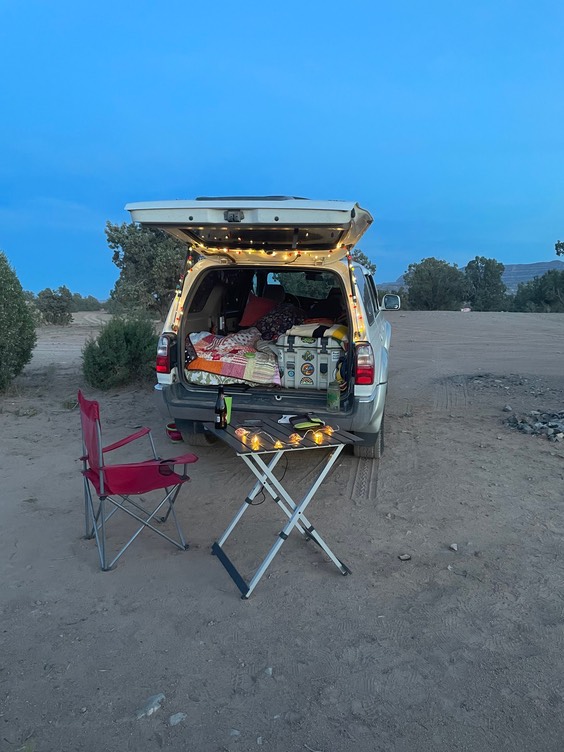
As the day went on I started to feel better. But, I was worn out. The area I was camping in was so empty…I couldn’t believe it. So, I turned on my music, had a beer, did some hooping, & as night fell, turned on all my twinkly lights. It was a nice evening!
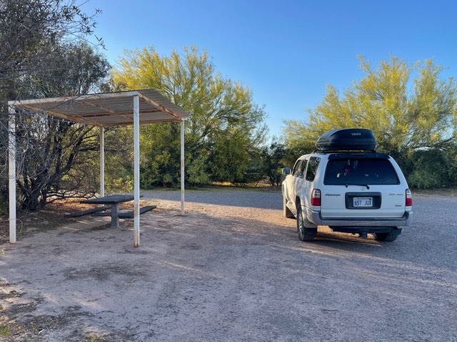
Night 4 in the same camp…time to move on tomorrow.
day 12 5.1
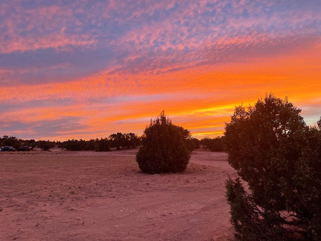
I watched the sun come up this morning loving all the beautiful colors in the sky. I made coffee, packed up my tent & re-heated my leftover burrito from yesterday, & then I was ready to hit the road again.
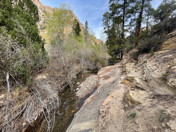
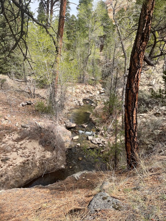
The woman at the gear shop told me about a 7.5 mile hike called the Lower Box. It’s a more forested hike & different than most of the other hikes in Escalante. And it was fantastic!! This was one of the favorites I’ve done here in Utah. It’s always going to make my list of hikes in this area in the future.
The trail went alongside & criss crossed Deep Creek about a dozen times to my turnaround point.
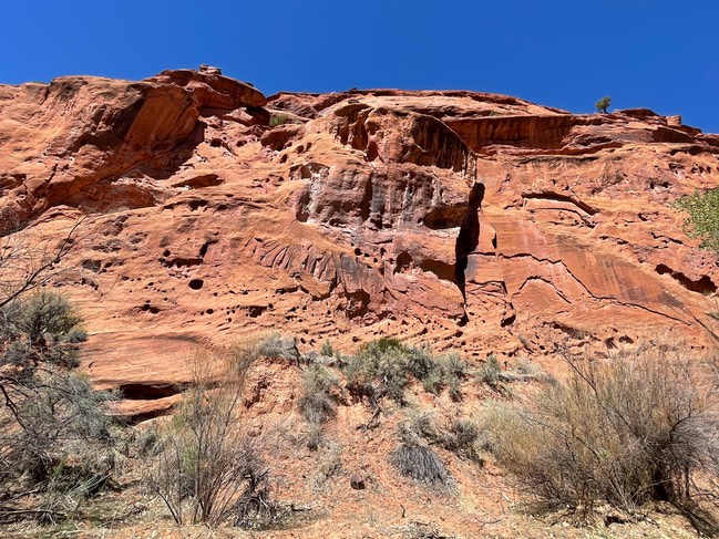
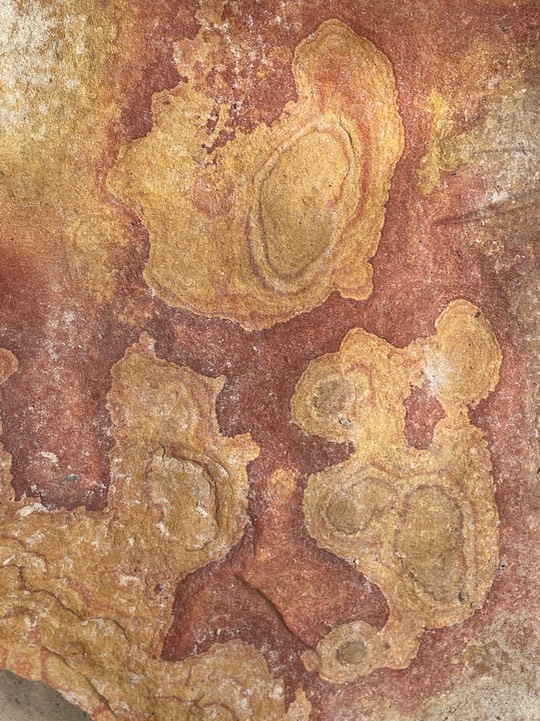
Some really cool rocks along the trail.
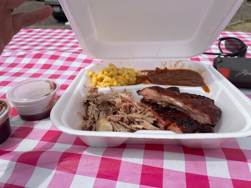
After the hike, I stopped & refilled all my water at the Visitors Center, then drove up the highway. I’d read about a BBQ place called IDK BBQ in Tropic & they were open, so I ordered dinner & grabbed a table outside. The sky was heavy overcast & it was pretty cool.
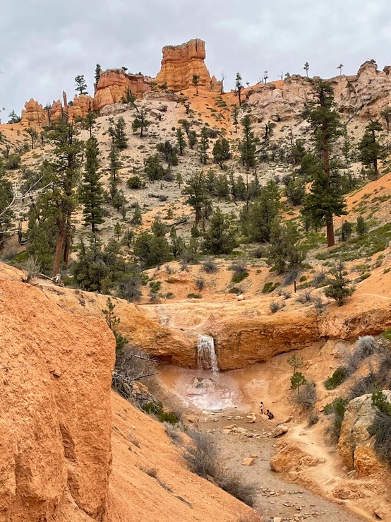
A really popular hike along the way is called Mossy Cave, which also has a waterfall. It gets really crowded & the parking lot gets full, so I decided I’d do a one-time drive through & if I found a parking spot, I take this short hike.
And, I found one! It’s a super short trail & the cave wasn’t really anything. But, this waterfall was really pretty.
I passed the entrance to Bryce Canyon National Park but then in about a mile turned down a forest service road to find camping. It was easy tonight. I changed into warmer clothes & settled in for the evening.
day 13 5.2
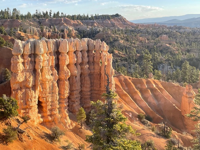
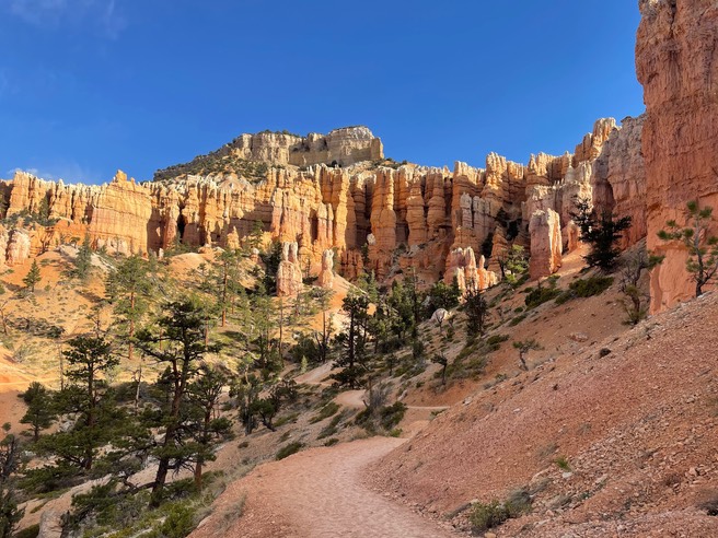
I left a very cold camp early & was on the trail inside the park by 7:30am. I was hiking the Fairyland Trail…one I’ve never done before.
I didn’t see anyone else on the trail for the first 1/2 (4 miles) of the trail.
The sun got warmer & I was soon able to start un-layering.
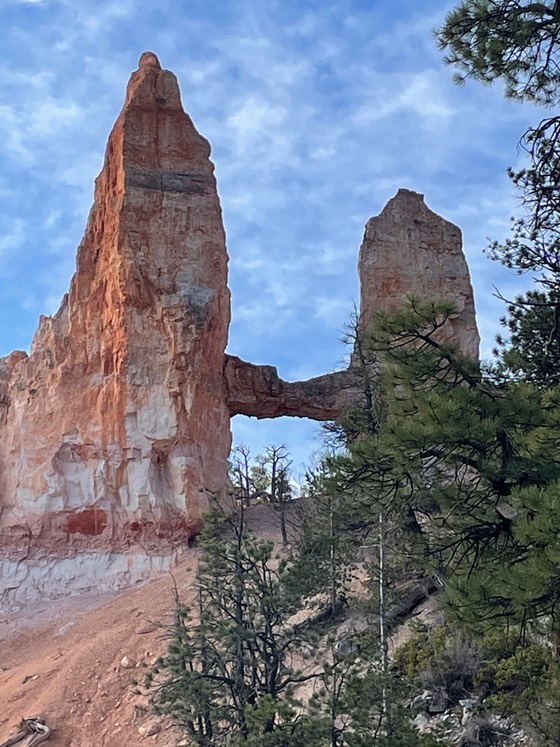
They call this the London Bridge.
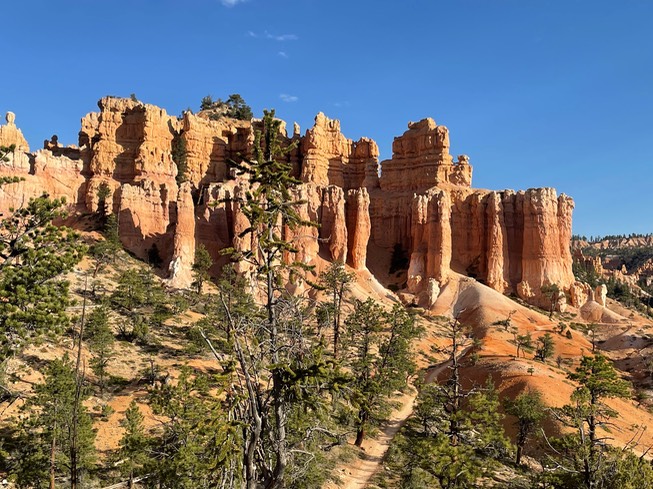
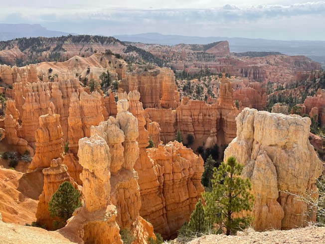
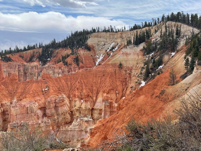
More Hoodoo views…they never get old!
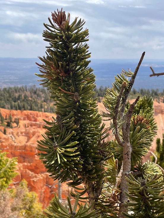
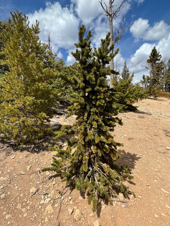
After the loop hike, I drove the scenic road to the end of the park & got on the 1 mile Bristlecone Pine trail…I love these trees. I think these types of trees are the oldest in the country.
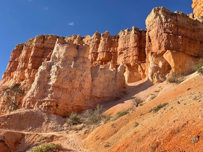
Bryce is such an out of world looking park…just breathtaking!
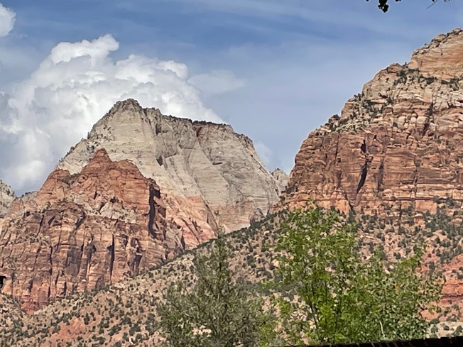
Then I was driving toward Zion National Park. I knew Zion would be every bit as crazy as Moab, if not more so. I’ve been there at least twice before & have done the Narrows, Angels Landing, Observation Point & many of the short ones. They are now requiring you pre-buy tickets to ride the shuttle. I was going to be happy just taking a leisurely drive through this part of the park. Every single pullout was over-stuffed with cars & people. Yikes! I’d made a good decision.

I stopped at the Visitors Center & asked my few questions.
Then I drove into town, stopped at Oscar’s Cafe for a much wanted margarita & maybe dinner. I’ve eaten here at least two times previously & was positive I had a margarita. But, now they don’t have a license for hard liquor but I could order a white wine margarita? Seriously? Only in Utah would a mexican cafe not serve margaritas. I was so bummed, but ordered the shrimp tacos & one of the best sangria’s I’ve ever drank.
Then I went to find camping in a spot I’d camped before. Only, now the BLM has made the area ‘designated’ camping instead of dispersed. The main road, Sheep Ridge, was easily drivable, but a lot of the roads down to the campsites were a mess & it was supposed to rain & storm tonight. At first I couldn’t find any camping. I was pulled over on the edge of a spot trying to look at a map, when one of three van owners (who were parking in this camping spot), came over & kindly said I could just park there for tonight. Really nice. I had great cell service but I didn’t like the spot all that well, & didn’t have much privacy, but it was really nice of him to offer especially as the wind was picking up & a storm & rain was starting to blow in. So, that’s what I did.
day 14 5.3
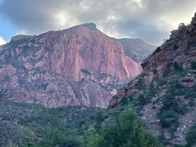
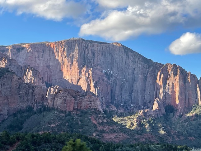
Well, the storm never materialized to very much & that was fine with me. I didn’t want to make coffee here, so I left & went to the closest town, got gas, then went north on the highway to the Kolob Canyon exit. This is still part of Zion National Park, but no one was here this early in the morning. I drove to the very top/end of the park to a view point & made coffee. I had to layer up as it was windy & cold. Theres a short hike to a view point & it was so magnificent!
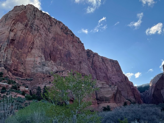
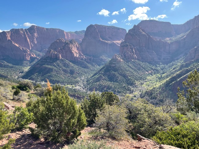
There are only 3 recognized day hikes here in this part of Kolob…the 1 mile to the Timber Creek Overlook, a 5 mile & 14 mile hike. I was next up to do the 5 mile Taylor Creek hike to Double Arch Alcove. I thought I might be one of the first people in the lot, but it was almost full when I got there. It was a nice hike with big views of the rock walls all around you as you hiked, a couple of old settlers cabins, lots of creek crossings & this really pretty double arch at the end of the trail.
I’d read about a hike down a 10 mile dirt road to a place described as pretty as “the wave”. I found the road, did the drive (really didn’t enjoy sections of it at all!) & found the trail. I got on the Yants trail under the now hot sun & found the Candy Cliffs.
They were definitely colorful & nice, but nothing what I picture the Wave looking like (if I ever can score a permit, I’ll let you know for sure). There was another couple that got there right in front of me, & one other couple that had hiked down the rock. She was doing all kinds of yoga poses as the photographer clicked away. I was tired by this point, didn’t want to compete with Warrior Pose or Downward Dog or god forbid the ever popular headstand while trying to get just a plain photo of the rock, so I decided not to climb down the rock. I still had to drive back the dirt road & find camping for tonight.
I did find the camping spot I’d intended for the night…the last camp spot in Red Cliffs campground. I got my ticket, backed into my spot, then checked for cell service. Nothing. It was important to me tonight to be able to talk to Danny. His long time & well loved German Shepherd named Six, had died early this morning. She had been struggling for the past few months & this morning she died while Danny was still at home with her. So, I wanted to be able to have a long visit with him tonight.
I drove away from the camp site & all the way back to Sheep Ridge road. Tonight I found my own space, down one of the gnarly roads, but with no rain or storms in the forecast, I really enjoyed this spot.
day 15 5.4
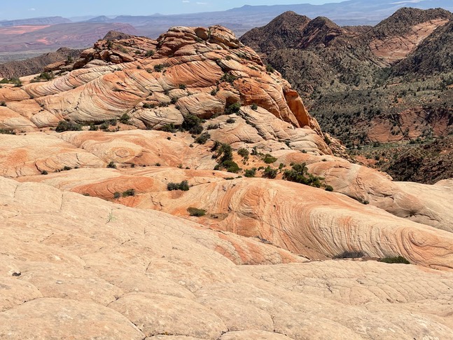
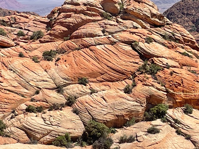
A park I’d been hearing a lot about this past year is Snow Canyon State Park. That was the destination for all of today’s hikes. I thought this first short hike was so cool! It’s called White Rock Amphitheater. You hike into this bowl of white checkerboard rock. I was the only one there this morning & you could just stand in the very middle & turn in a circle & find yourself in the bowl of huge white rock. So very spectacular!
I hiked the Butterfly trail, the Petrified Dunes trail, the Hidden Pinion trail (that was fun!).
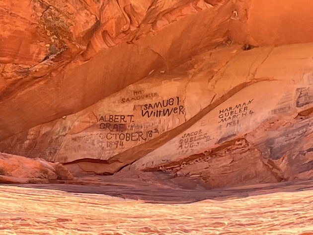
Pioneer names trail shows off names written in some sort of grease that’s lasted all these years.
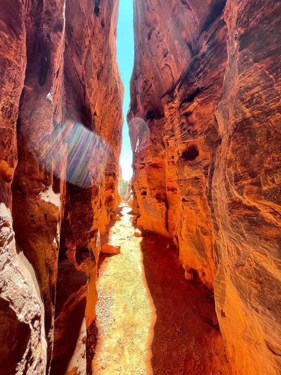
A tiny but sweet little slot canyon hike called Jenny’s Canyon.
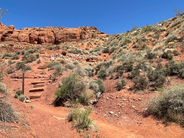
It was about 3pm now, getting much warmer & I’d hiked about 5 miles. I saved a 4 mile hike to Scouts Cave for the last (it was right outside the entrance to the park). The trail, in places was a dry wash & in other places rimmed with big chunks of volcanic rock. The pic below shows a flight of 74 stairs going up the side of the mountain as the trail gets closer to the cave (see the opening up there?)
The climb up to the cave opening made me a bit nervous. I really couldn’t see much of a trail, just looked like scrambling to me. One guy was descending as I was headed up & we stopped to chat for about 15 minutes. He was a local & gave me an idea of how to go up to the cave, told me there were more caves up here to explore if I wanted to (I didn’t) & then just told me a little bit about what it was like to live near St George, the heat of summer, the nearby climbs & trails. He was such a nice guy. Then he headed down the trail & I headed up to the cave.
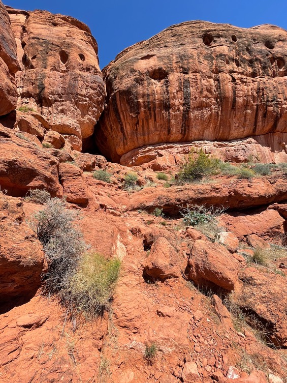
Scouts Cave.
Once I was back in the 4Runner, gassed & iced up, I drove until I crossed the state line for Arizona, briefly, then it was the Nevada state line. My free campsite for the night at the Wildlife Management Park in Overton.