7/16
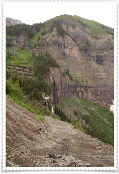
This morning I started on the hike up to Bridal Veil Falls...but didn't get very far. I parked at the bottom of the 4WD road, shouldered my pack and started up. But I was stopped by a construction worker, telling me that the trail was closed today. Heavy equipment was up on the trail and by the falls, moving large rocks, so they'd closed the trail today.
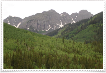
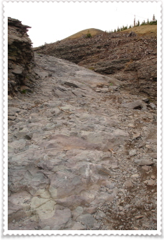
I regrouped and chose the "Jed Weibe" trail...one that everyone recommended saying "it's a local favorite"; "people work out on it" and "locals love to walk their dogs on it". So, I was thinking I'd do it, but it probably wasn't a difficult trail...oh I was sooo wrong. You hike up and up and up; 1200' in elevation in a short time.
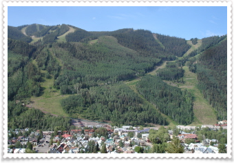
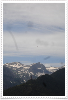
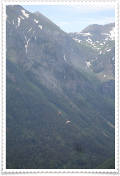
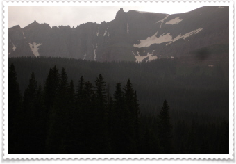
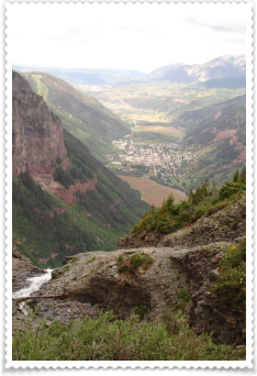
At the high point of the trail, there's a little bench. I sat down, drank some water, ate some dried fruit and looked over the town of Telluride to the opposite mountains...and the "carved out" ski slopes and then I saw two parasailors or hang gliders (I'm not sure I could tell the difference so far away). I realize my camera lens has some bizarre squilleys on light blue photos (no camera shop can seem to figure out what's wrong), but if you look closely, there are two tiny specks above the mountains....those are really adventurers! The photo on the far right shows them dropping a landing sail (or at least that's what I think it is). Anyway, it was cool to sit there and watch them float over the mountains and then down into town.
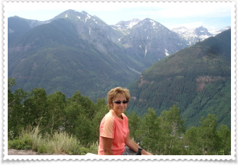
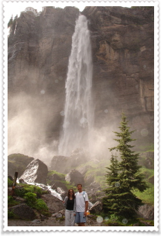
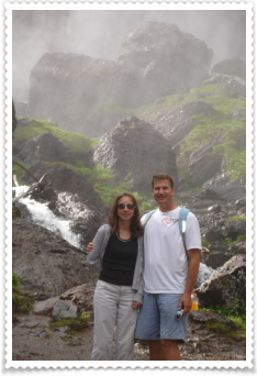
I'm not too bad with the camera timer, but what a back drop! (I just don't run, leap or jump like Danny does.)
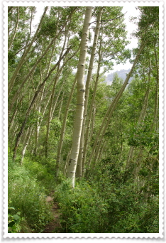
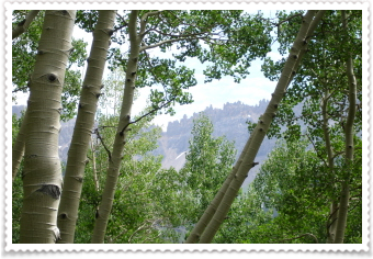
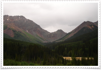
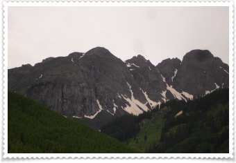
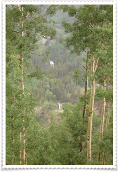
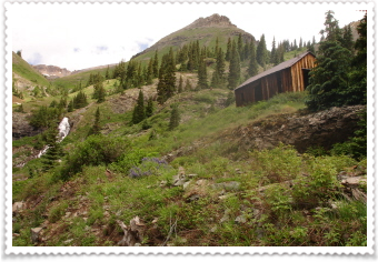
Then I started down into the forest full of aspen trees...they call this part of the trail the "enchanted forest". The photo on the right shows these craggy rock-mountains peeking through the trees. I found a trail that went up there, but didn't go far enough on it (it would have been 3 or 4 more miles and 3,000'+ more elevation!) to see them up close.
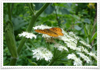
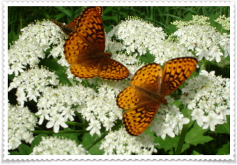
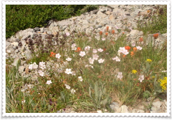
No new wildflowers today, but these butterflies were all over these flowers.
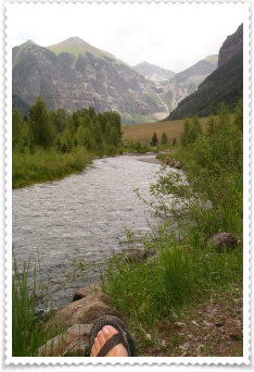
After my morning hike, I came back to the campsite, grabbed by trail book, water and went to enjoy some time by the water. But I was only there about 20 minutes, when the clouds came over and it began to rain...and it kept it up all day long!
So, after doing some reading in my car, checking out my soggy-on-the-outside but only a little wet in places on the inside tent, I went exploring in my car. I took the highway out of town and headed south.
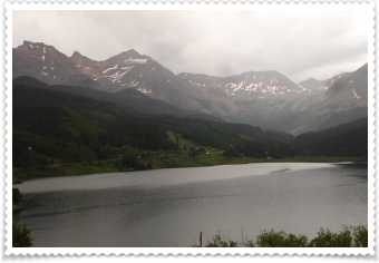
I drove by Trout Lake....really neat looking.
And then up to Lizard Head Pass.
My next stop was off the highway, onto a dirt road, and up to the little bitty town of Ophir. I don't know the history of this place....there is a 4WD road you can take over a pass, but I turned around in the town. There was a sign welcoming you to town that read:
"Welcome to Ophir- 9,600' Population 163 55 Kids 30 dogs 15 cats Countless Avalanches"
and you could see so many avalanche chutes...it was pretty cool though.
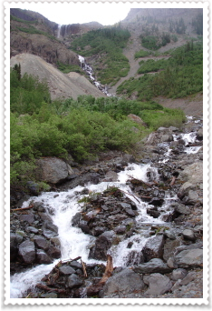
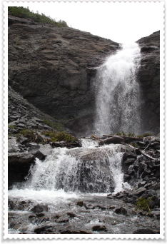
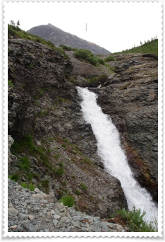
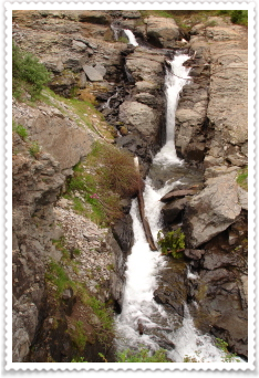
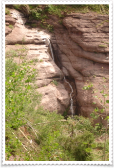
On the way back down the mountain to Telluride, I pulled off the road, walked a little ways, and saw these two waterfalls way off in the distance.
 q
q
 q
q

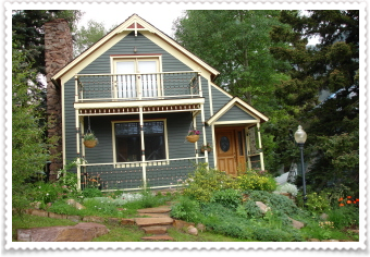
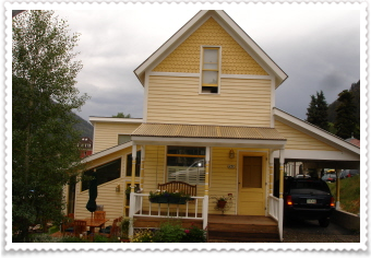
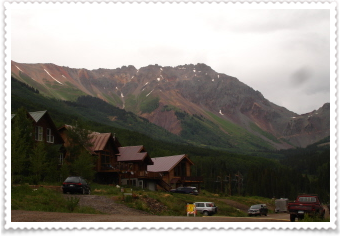
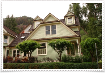
For those of you who've never been to Telluride, these are typical of some of the homes sprinkled throughout town...all kind of Victorian and cute....and then
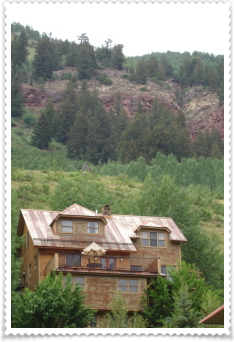
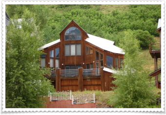
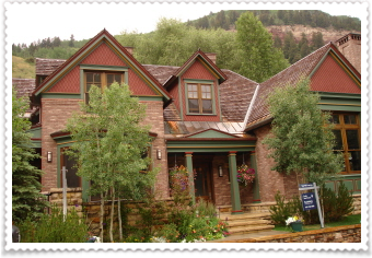
there's the second layer of homes, going up the mountain, are built more like large cabins; made from unpainted wood, lots of metal posts and steel roofs (no these aren't the big ones on the other side of the mountain...I refuse to give them any photo time), but this was one of my favorites...
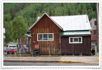
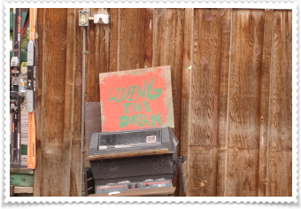
just a little tiny cabin in town with skis and ski poles lining they small yard...and the sign says "living the dream"...very cool.
It rained and rained all afternoon, with thunderstorms. Finally, it stopped, the gondolas started again, I donned by rain jacket and headed up the mountain. There was a free concert up there tonight; a string band called "Hot Buttered Rum"...they sounded good and so did the drink! The temperature has dropped since I got here, this morning being colder than the morning before; and tonight down right chilly.
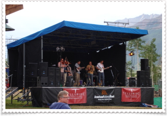
I shared a bench with an older couple from Phoenix, and chatting with them was nice. The man reminded me so much of our dear Bill! I know we all miss him so much. Then the rain started again. I abandoned the concert before the end, hoping to get a ride on the gondola back down to town...and I did...but didn't get all the way before the lightening started. We stopped three different times, to just sit there. Fortunately, I was riding in the gondola with three teenage boys and one mom....she wasn't friendly at all (matter of factly stating they had two homes in Telluride and neither was their permanent residence), but listening to the boys chatter reminded me so much of my own kids and how much fun they were at that age, I didn't care about the mom or the weather....(okay, well the lightening was making me a LITTLE nervous).
I stopped back at the brewery, tried the "10-13 Oatmeal Stout" and a salad, then left to walk back down to the campsite; the rain stopping briefly.
It's now pouring again, I'll head into the tent as soon as I'm done on the computer. I'm hoping for better weather tomorrow, and a good nights sleep tonight.
You all sleep well too.
*******************
7/16
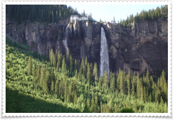
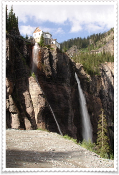
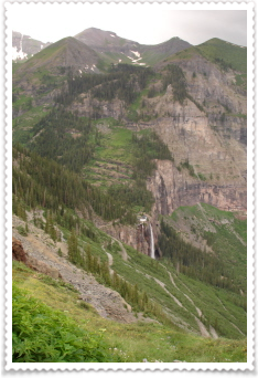
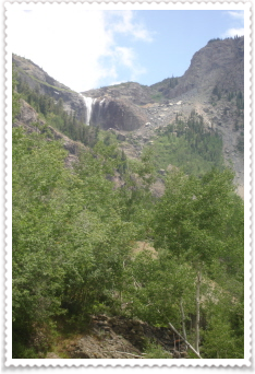
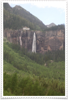
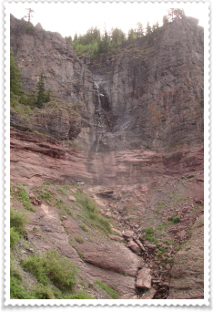
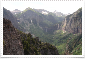
Yesterday I tried to hike up to Bridal Veil Falls...the tallest falls in the state of Colorado at 385', but the road was closed. But, today, it was open.
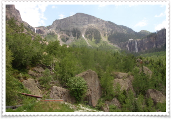
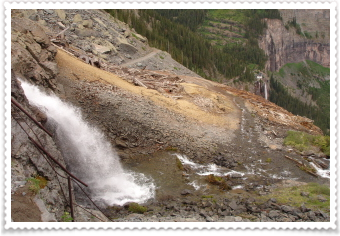
This is the view from the parking lot, of Ingram Falls (on the left) and Bridal Veil Falls (on the right).
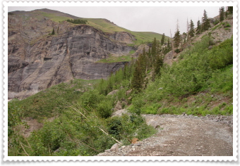
The trail is actually a 4WD dirt road that I could have driven up to the falls; but there really isn't any parking; and I wasn't really sure what condition the road was in...so I just hiked up.
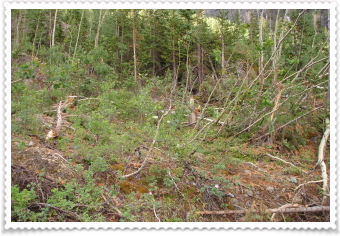
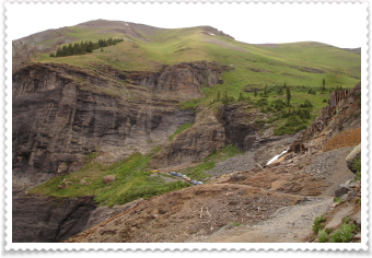
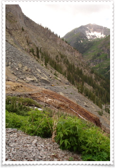
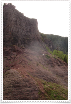
On the way up, I noticed this place that looked pretty wiped out....like a small avalanche came through...I say small, because big ones wipe everything out.
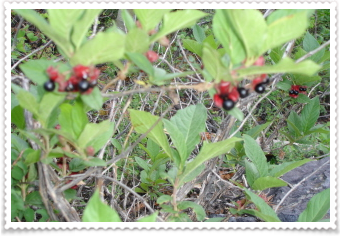

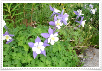
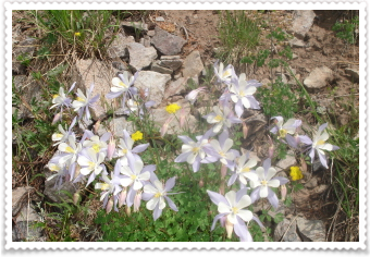
I'd seen these berry bushes before...sans berries...and the center photo looks like a wild rose. I know I've posted shots of Columbine before....but how can you ever get tired of looking at this perfect flower?
I met this couple on the trail celebrating their 20th Anniversary...Bobbi and Dan from Indiana. Small world...Dan's brother lives in Evergreen off Kerr Gulch Road...and really cool road that Jodee took me on when I was in Evergreen. Happy trails you two!
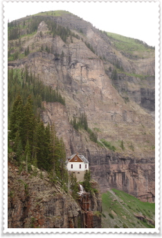
View from the road right below the falls. What looks like a house is actually an old power plant.
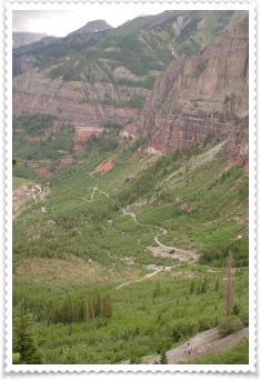
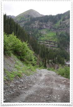
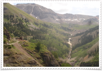
I knew at the top of the falls was another trailhead...Black Bear Pass. I've wanted to go on this 4WD road for along time...I've watched videos of people driving their 4WD on this crazy road on YouTube and just been amazed. So, now I was at the trail head...and I started up. It was a long, long way up to BBP and I didn't know if I would make having already climbed the trail to the falls.
The photo on the left is looking back down at the trail/road going up to the top of the falls. Now as I hiked higher, the sky grew darker. I'd made it up two switchbacks, and then, disappointed, turned around and went down. I'd made it back down to the top of the falls and then sat on a rock....would the sky clear? Was I just imagining it? I ate and drank and sat...for about 15 minutes...then I re-climbed the switchbacks.
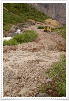
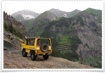
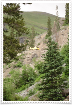
View from the road to Black Bear Pass. A little about this road....it's one way; coming from Ouray over to Telluride. And, today was the first day it was open. So, as I was hiking, alone, I thought how bad this road is...really bad...and about that time...around the corner (a really super tight corner) came about a dozen Toyota SUV's....very, very slowly.
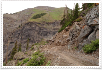
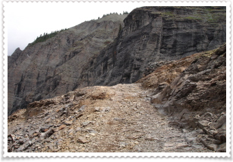
Photos of the road (yes, some of them don't look like "road", but more like a rocky path...just incredible!)
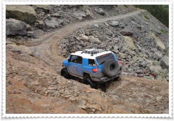
And photos of the super-brave, crazy drivers and their SUV's. This day was sooo entertaining...I ended up passing about 40 Toyota SUV's, a couple of jeeps, some motor bikes and this cute yellow thing called a Swiss Army Pinzgauer. Since the SUV's were driving so slow, and I was having to hike right next to them some of the time, conversations struck up (imagine that?). One guy, who was walking ahead of the first group, an note here: his super brave wife was doing the driving..... (there were three groups of about 12-14 each over the course of the day), told me there was a 4WD rally or festival in Ouray and about 200 vehicles were in attendance...he invited me to come to Ouray and said they could find someone for me to ride with.
Now, up to this point, I always thought I'd wanted to do this....right up to this point. Now, actually hiking along these "roads" only wide enough for one vehicle, with dirt edges spill off the edge to oblivion, and rocks as tall as my knee, big ditches as tall as my knee....I was beginning to change my mind about "actually" riding in one of these vehicles! But, it was pretty amazing to watch.
I'm such a chicken...but then I figured, I could always go next year right?

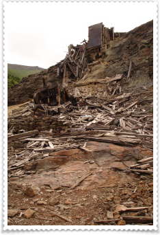
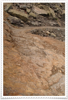
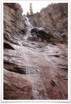
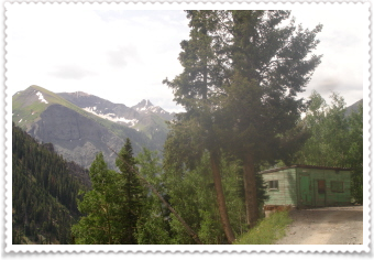
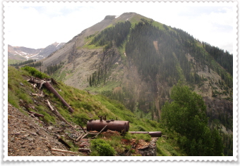
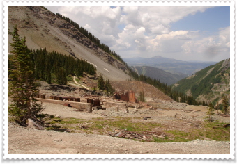
The photo on the left and in the middle is a shack leftover from the mining days...I'm so surprised at how much mining crap has been left all over Colorado....will it do more damage to clean it up? There were cables on the road, cables in the air, wood everywhere...it's too bad natures avalanche just won't sweep it all to the bottom...then surely someone would clean it up. The photo on the right is Ingram Falls; UP CLOSE. It was so cool how far up I'd hiked.
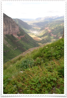
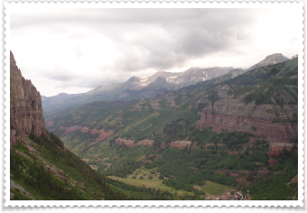
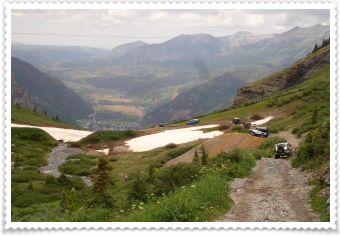
This is the view of Bridal Veil Falls from up high; and the photo on the right is a magnificent view of the town of Telluride.
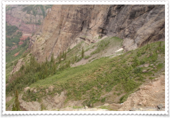
Remember the avalanche area I noticed as I was hiking up to Bridal Veil Falls? This is the top of the Avalanche path.

The photo on the left is above Ingram Falls (see the gross cables hanging there from the mine?)
I did have a kind of icky crossing across the base of the falls, but there was a dead tree and some wood there, that I used as a bridge (photo on right).
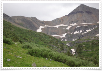
More views of the Falls....this was actually above the falls as I started hiking into the basin.
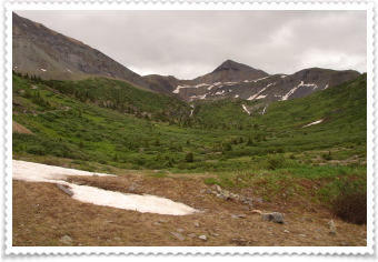
I finally made into the Basin below the pass. The pass is actually to the left of the big peak in the photo. I was still about 1 1/2 miles below the pass and about 1500' in elevation. I was tired! So I sat down on a rock, ate and drank and tried to decide if I could go on. I still had ALL the way back down to go. So, I decided that I would turn around and head back down. Maybe, someday, I could hike up from the Ouray side?
I'd only been hiking down about 5 minutes, when the rain came. Followed by thunder. Not a downpour, but eventually, enough for me get out my raingear.
I hiked back down, past the last group of SUV's and towards the crossing of the falls. As I went to step on my "makeshift" bridge...it started to move...slowly, but towards the edge of the falls. I immediately, just stepped in the water, caring less about a wet hiking shoe, sock and foot and more about not careening over the falls. But the little yellow vehicle, was just getting ready to cross the water, and offered me a ride. It was a young couple from "Telluride Off Road" just checking out the pass on the first day; before they took any paying customers. The trip across the water was greatly appreciated!
As I made my way down to the end of the Black Bear Pass road and to the beginning of the trail down from Bridal Veil Falls, I met another group of hikers...they were all from Austin! We visited for the rest of the way down to the parking lot.
I started out the morning on a solitary hike, but found this hike to be more social than almost any other hike I've ever done. But I really enjoyed it.
My short-lived passion for "off roading" I won't say came to a halt, but I will definitely need to think about it more. I'm still so fascinated by it, but not too sure I would ever try anything like this EVEN IF I did have my own jeep!
The rain briefly quit, long enough for me to un-stake my tent and dry out the bottom of it as well as the footprint. I then walked into town for awhile.
I'm now at the "Steaming Bean" coffee house, (where I've been buying a cup of coffee every morning) and using their wireless internet. They're getting ready to close, but the rain has stopped, and the evening looks like it's going to be beautiful, so I'm sitting out on the sidewalk, in their chairs, still working on this site.
It's been such a wonderful day. The Basin was amazingly beautiful. And while I wished I'd made it up to the pass, I'm happy that I turned around and hiked back up to where I did and that the weather was gentle on me.
It was great and fun to see all the SUV's too.
And, as I've said before on these solo trips, it's so incredible all the people you meet and where you least expect it.
I feel so lucky to be on this adventure.....now I need to figure out where and what I'm doing tomorrow.
I do miss Danny, my family and friends....I think about you all....often.
Find joy, everyday.
****************
7/18
Today's my nephew's birthday...Happy Day Brett!
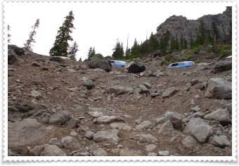
The hike I was going on today is also on a 4WD road, called Tomboy Road. It goes up to Royer Gulch, then onto an old mining town called Tomboy, and then over Imogene Pass. I started the morning, TIRED! I just couldn't get moving much.
But, I finally started on the road and it was hard going; I was sweating something awful, ruining the shower I finally took last night.
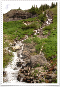
I enjoyed looking at the waterfalls, but didn't think I'd make it past the Gulch. My legs just didn't want to go forward.
But the uphill, twisting road ahead, just kept calling to me. You can see a jeep, that had past me, up on the curve above me.
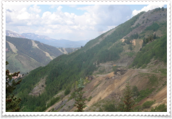
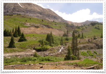
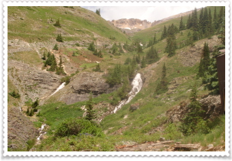
The views opened up as soon as got higher and I could see both the waterfalls I hiked up to yesterday. You can see in the photo above, the zigzag of the road/trail, that goes up to the second falls. It's always fun to see the trail you've hiked from across the valley or from another mountain.

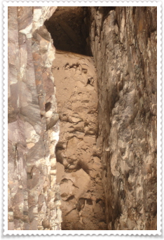
This was a tunnel that'd been carved from the mountain/rock.
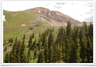
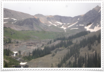
This is the view up to Tomboy and into the basin.
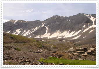
Tomboy was built in the 1890's; there were about 6,000 people who lived there (at least that's what the book says), a school, stores, and a daily stage stop. So, given all that, maybe they did clean up after themselves...but it sure didn't look like it! There was stuff EVERYWHERE....so much worse than al the stuff I saw yesterday. The scenery is just incredible though!
This shot was taken through fencing...it's probably 40-50' straight down into the rock.
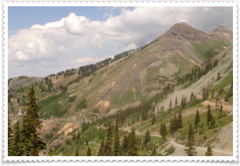
Now here's something to look at. The last photo on the right, is taken after I started back down from the basin where the town lies. I didn't go as far as the pass, but the road over the pass is kind of in the middle of the photo, and then over to the left, where the mountain is kind of red/orange.
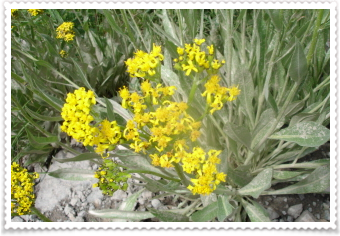
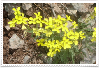
Here are today's flowers, some are new, but I'm noticing that more and more are popping out and mingling together. And, as I was hiking, I kept passing so many wild roses, and the scent was wonderful. Beauty for the nose and the eyes.
After about 2.5 miles on my up, my legs started working and the hiking got easier.....and then a jogger past me! On my way back down into town, the jogger past me going down...he'd jogged all the way up to the Pass...that would be 6.5 miles up and a whopping 4,234 in elevation.
I'd gone a total of 10 miles and 2,625' elevation gain and loss, and even though I had NOT jogged, I was really tired.
I'd already decided this would be my last day in Telluride. The campground I'd been staying in had been so great, and the list of hikes I still want to do in this area is long, but the campground fees are reeking havoc with my budget, so I packed up my tent before this morning's hike.
As I SLOWLY walked back to my car, the afternoon rain began. I left Telluride and about 15 miles out, a wicked rain/thunder/lightening/hail storm began...and I was glad I was in my car and not on the trail.
As I type today's info, I'm back in Crested Butte. I'm on my favorite road, in my favorite campsite.
I know I'll have sweet dreams tonight.