7/19
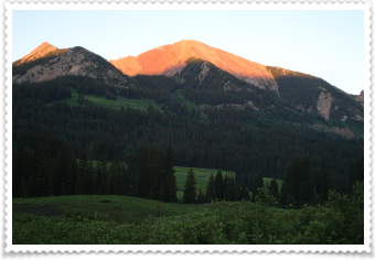
This was my view from my tent this morning....a spectacular sun shining on the mountain top as it rose. As it turns out, I didn't have "sweet dreams" last night...I slept for 10 hours! That practically has to be a record for me.
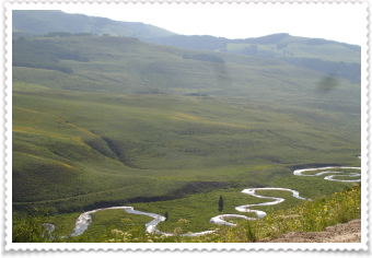
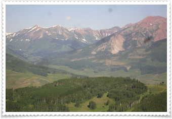
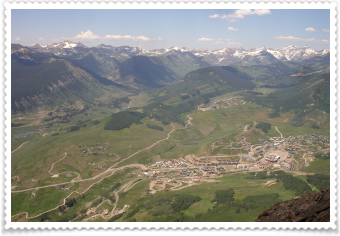
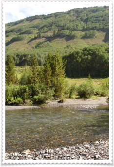
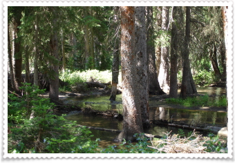
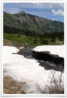
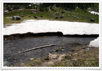
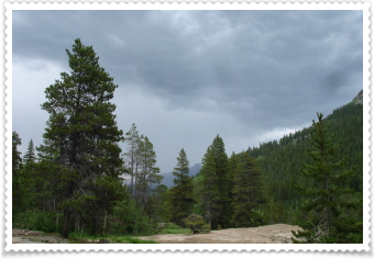
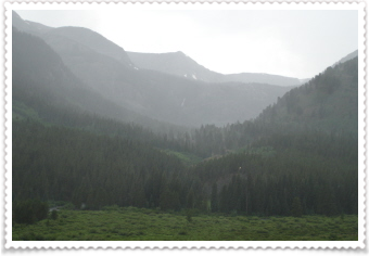
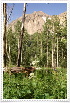
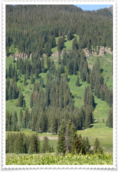
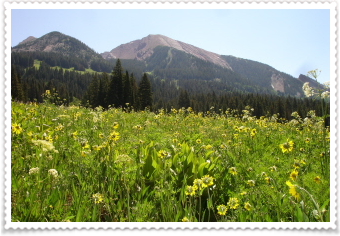
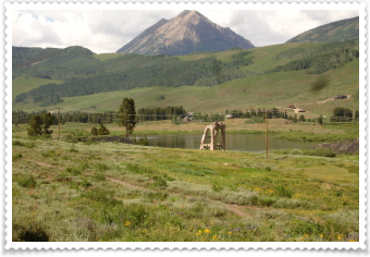
As I drove on Gothic Road this morning, to the trail head, this is what the valley below the mountains looked like with the stream weaving through it.
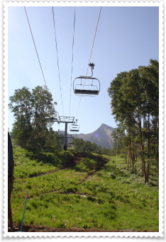
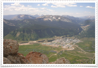
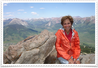
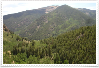
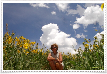
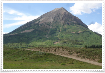
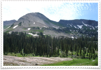
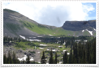
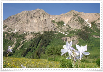
The trail I was taking today is up to the top of Crested Butte Mountain. It starts at the ski resort. A lot of people ride the chair lift to the top, then hike to the summit, then ride the lift back down.
I'm too cheap and I WANTED to HIKE. So, I started from the bottom. My guide book had said it was a 6 mile loop...or so that's what I thought I read...more than a couple of times. Thinking it was only 3 miles up and 3 miles, down, I only took one Nalgene bottle of water with me.
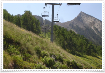
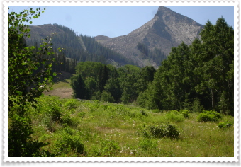
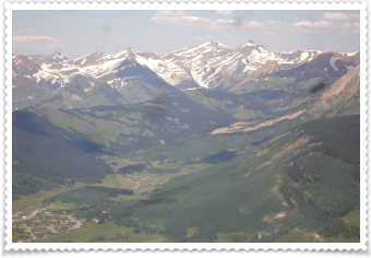
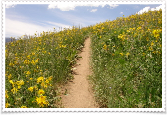
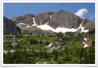
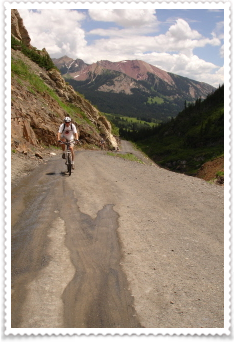
I kept hiking the road to the top, and going underneath the chairlifts from time to time. You can see the mountain getting closer in the background.
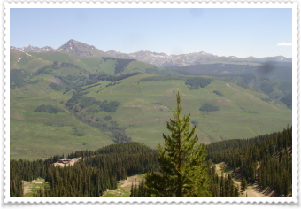
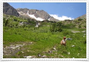
The views along the way were just amazing. But I know how fast (or slow to some) I hike, and as I turned another switchback, I read a sign that said "2 miles more to the chairlift". I knew I'd been hiking long enough that I should almost have been to the top. A biker rode by me, then stopped, so I asked him if he knew the distance from the bottom...he said 4.5 miles. EEK! Well, I thought to myself, if I get in trouble with no water, I'll just ride the lift back to the bottom.
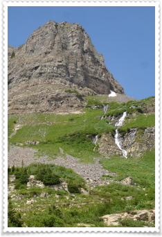
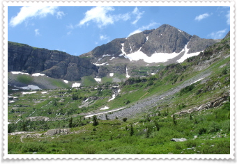
I reached the lifts, sat and ate some dried fruit, sesame sticks and drank almost the last of my water. I still had to hike to the summit, which was another 1 mile...up.
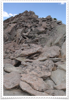
The last 1/2 mile or so was absolute "scrambling". This isn't vertical rock climbing, but it climbing up rock that has no trails, and it's best to use your hands to help you (or on the way down, to sit on your butt!)
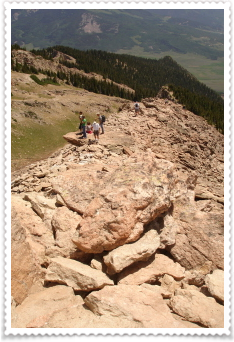
You can see in the above photo, the people at the summit.

WOW! Mind-blowing magnificence! You had a total 360 degree view; looking down to the towns of Crested Butte and Mt. Crested Butte, and all the way down the highway towards Crested Butte South....and the mountains...soooo amazing! I could see so far down Gothic Road, even finding the little town of Gothic....it all was just incredible. And I was incredibly tired, and thirsty, so I drank the last bit of my water.
I signed the "summit register" and at the same time met a group of really cool women, all traveling together from Michigan; hiking, eating great food, enjoying the scenery and loving Crested Butte. I took their photo for them, and they for me. Such a happy hiker!
Climbing up rocks is ALWAYS easier than going back down...but it was time to go down. I tightened my pack, tucked away my hiking pole and started down. It really wasn't too bad. I ended up having a wonderful conversation with Beth, one of the women from Michigan. Her group of friends sounds a lot like my group of traveling friends....very, very special women each in their own way, but together....WATCH OUT...we're all LIVING LIFE!
Looking across to part of the trail going back down to the chair lifts, with a mountain top peeking up behind.
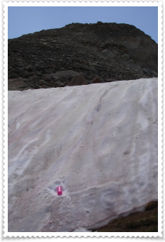
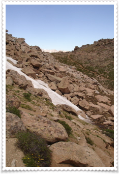
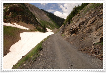
The day was so beautiful, the sun was shining and the sky was so clear and blue, I really wanted to continue my hike, going back down to the bottom. I'd passed this snowfield somewhere between the lift and the summit. While I know water from the streams and rivers needs to be filtered, the verdict was out on "snow". So, I cleaned off the top layer, and filled my bottle to the rim.
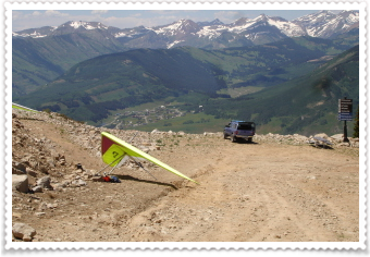
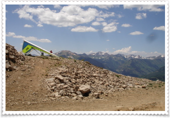
I passed these hang gliders on the way down....they were hoping to launch if the wind cooperated.
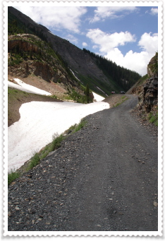
There was no one else on the road all the way down, so I enjoyed my "mountain flavored snow cone", the awesome views, the wonderful flowers waving in the breeze, and just being HERE.
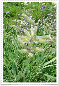
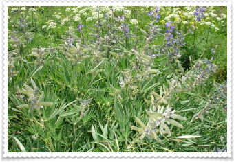
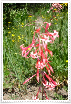
These purple flowers come out of these little pods...they look like snow pea pods.
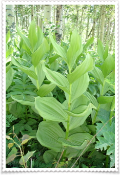
The really large leafed plant on the left, someone told me was called Indian Tobacco...I don't know if that's true or not, but it's beautiful and BIG. Some are taller than me.
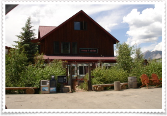
My legs and feet felt pretty trashed by the time I got back to my car. I'd been hiking for more than 6 hours. So, I went ahead and drove into Crested Butte, sort of "cleaned up" in a bathroom, changed my clothes, and took myself out to my favorite CB eatery...the Last Steep.
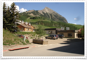
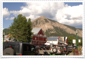
UMMM...it was delicious. I walked around town for awhile, and took another look at Crested Butte mountain from town...I actually stood on that peak earlier today....AWESOME day! What a lucky girl I am.
I'm going to finish this up, then drive back to camp.
PS: GOOD NEWS/BAD NEWS
The morning of my last day in Telluride, I lost one of my favorite rings...it just slipped off my thumb. It had done so the night before, but just thinking it a fluke, I put it back on. Then when I was packing up everything, I looked down and realized it was gone. I was majorly bummed!
I left my contact info and description of the ring (silver band that says "embrace life") at the campground but didn't know if I'd ever find it.
As I was getting everything out to set up camp last night, I noticed the ring on my middle finger almost fell off. Not wanting to lose another, one, I put it away in the car. Then, when I was pulling out a sleeping bag from it's stuff sack, the lost band popped out of the sack and into my lap!
Now, I know you're all thinking...wow...she must be losing weight....NOT NOT NOT! I'm gaining everywhere but my thumb and fingers. So typical of mid-life...but, I'm so happy I found my ring, I don't even care about everywhere else. (And, my wedding ring is snug, so I'm keeping it on!)
******
7/20
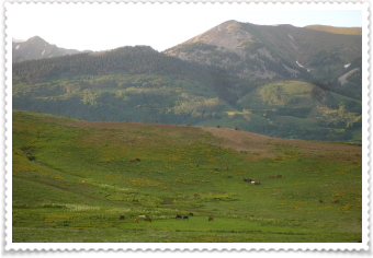
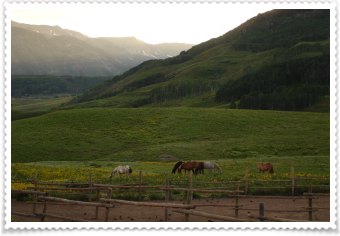
I pass this field where there are stables, every time I come up or go down Gothic Road. So, last night, after I'd finished working on my site, I stopped here awhile to look at this scene. This is also the last place I have any cell service before going back to my campsite, so I usually sit here to call Danny to say goodnight.
Today was laundry day...I barely had anything clean to wear, so I started the day by going to the laundry mat at the Hostel (I didn't take photos).
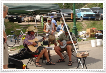
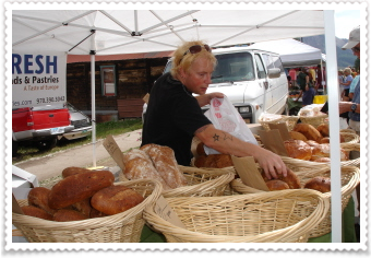

This morning was the CB Farmers Market; and I wanted to see what it was like. They have it right downtown; just sectioning off some of the street. It wasn't huge, but had a little band, fresh foods, and some crafts.
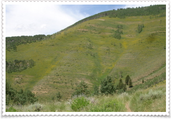
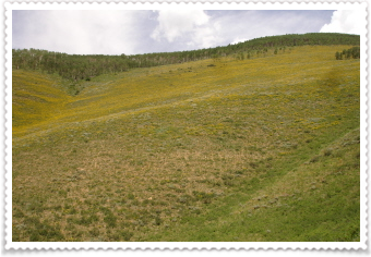
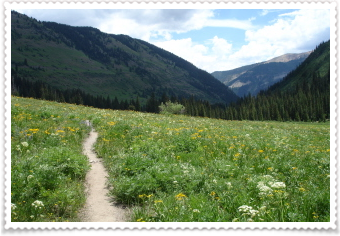
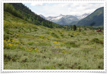
I wanted to go on a "gentler" hike today, and give my body a little rest. This hike started about 7 miles south of CB, on a gravel road.
From what I'd read, I knew I wouldn't have "big views" of "big mountains", but I was NOT disappointed.
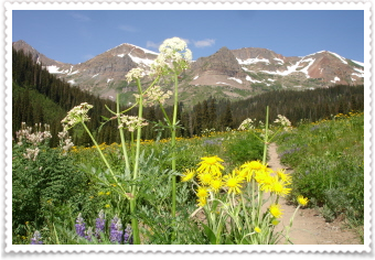
A wildflower day....
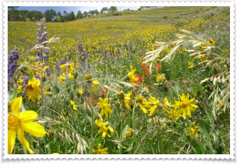
Flowers, flowers, everywhere! I had to do a little bit of climbing first, but, WOW! the whole mountainsides were filled with flowers. I doubt my photos can do it justice, but I was seeing thousands and thousands of flowers. Some were over 3' tall.
There were only a couple of mountain bikers going my way (and they were going much faster than me!), and a couple of small groups going the other way. So for most of the hike I was alone...and it was so cool.
As far as I could see up; and as far as I could see down....lots and lots of magnificent flowers!
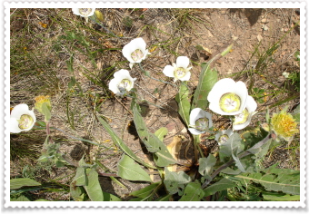
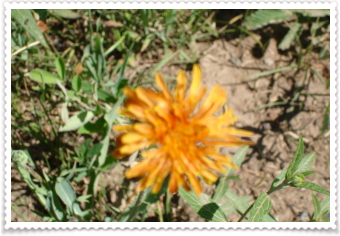
This was one I hadn't seen before.
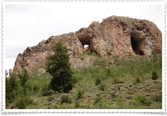
Near the end of the trail were supposed to be some caves you could explore. I brought my headlamp with me, but knew I wouldn't go in unless there were other people around. It turned out to be this giant rock...the "opening" on the right actually contains some rooms you can go into. But, since no one else was around, I passed. I got back to the car, then drove down the road farther into the mountains, just to check it out.
The road I took to the trailhead is paved the first part of the way, and skirts the town of "Crested Butte South". So, on my way out, I drove through and took some photos of this neighboring town.
I goofed around Crested Butte, had dinner and met a nice couple from Park City Utah. We exchanged hiking stories for awhile. Then I drove down another road I've wanted to explore. The mountain on the left is Gothic Mountain, only this was the "backside" or maybe the front, but I've been seeing the "other" side of it every time I drive down Gothic Road. It looms over the little town of Gothic.
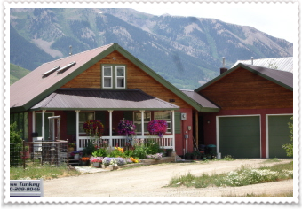
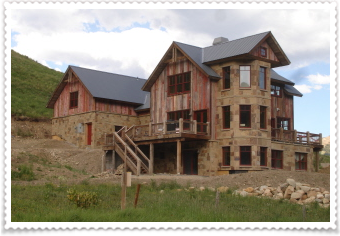
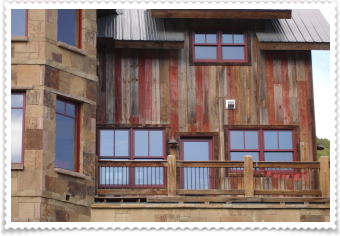
The road I was exploring was "Washington Gulch" and they're are homes on it for the first three or four miles. I thought this one was really neat, not the shape or size, but the combination of the woods (all the different colors) and the stone work. It was pretty neat.
And now I'm back in camp, the sun has just set but darkness hasn't arrived yet.
The birds seem really loud tonight, or maybe they're just super happy.
Last night, I was awake for about 3 hours in the middle of the night...and it's just incredible how quiet it is here. You can hear the stream in the distance, and once I heard some coyotes, but other than that, it's very, very quiet.
Today was another great day.
******
7/21
Today is Barrett's birthday....Hope you have a fantastic day!
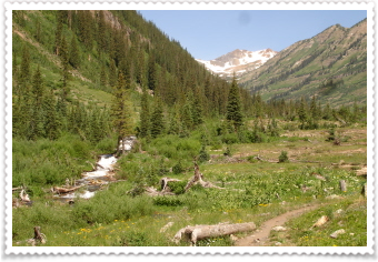
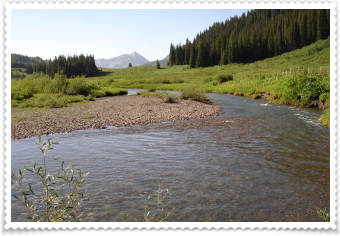
The trail I was hiking today is called the "Oh-Be-Joyful" Trail, because it follows the Oh-Be-Joyful stream through the Oh-Be-Joyful valley. Danny and I asked about hiking this popular trail a couple of weeks ago, but the Slate river was way too high and you start the trail by fording the Slate river. But I had heard and asked, and was told the level of the river had dropped and it was okay to cross now.
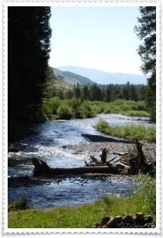
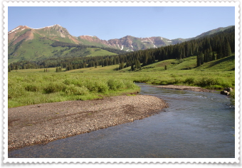
The crossing was wide, knee deep, but the current wasn't so strong that you couldn't see to the bottom (photo on left). The other photo is just a pretty view of the river with the mountains in the background. I changed from my sandals, into my boots, and started hiking.
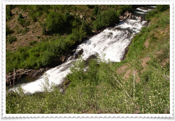
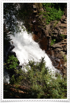
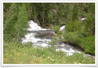
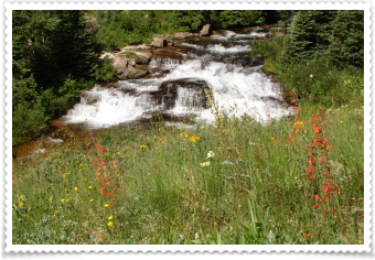
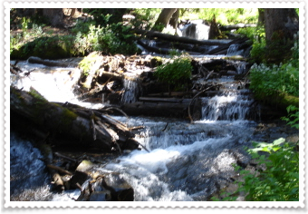
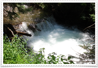
The trail followed next to the Oh-Be-Joyful stream most of the way...there was water everywhere. Beautiful waterfalls all along the trail.
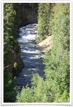
And water way out of it's normal banks.
The trail wandered through the valley, winding it's way up to a cirque of mountains. And I was Oh-So-Joyful that I hadn't had to cross the Oh-Be-Joyful stream...yet. I only had to cross it once, but put my sandals on and my feet enjoyed the freezing cold water that wasn't very deep, just wide.
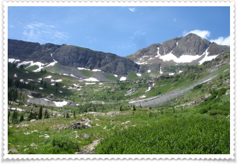
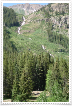
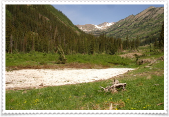
It was a long hike, and I thought there would be lots of other people on it...but I saw no one the entire time I hiked. You end up in this basin. Of course the trail keeps going up, another 1/2 mile to a lake, and then on up and over a pass.
The photo on the right is where the trail went...into the water and over snow. I wandered around awhile, trying to find another way across. I didn't find one easily, and just decided this would be another wonderful hike to bring Danny on another time, or better yet, a backpacking trip. So, I sat down, ate my lunch and just drank in the view.
This was the farthest I'd hiked into the backcountry so far, 6 miles, so I had that far to hike back out.
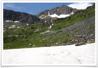
The photo on the left is above me, and where the lake sits. In the photo on the right, the mountain looks crooked, but it's only my camera tilting as the self-timer went off!
It really is a beautiful basin. See the low spot on the photo on the left? That's where the trail goes over the Pass.
After lunch, I turned around and headed back down the trail. The trail actually winds down to left, in between the three mountains and back down to the river.
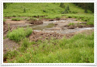
There's evidence of Beaver activity....but none were "posing" today.
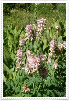
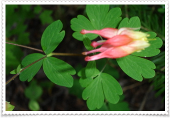
I've seen this flower before, but not in pink. So, here's today's flower of the day!
I kept hiking down the valley, and finally saw some other hikers/backpackers. When I had about 2 1/2 miles to go, the sky began to darken. By 2 miles left to go, you could hardly see the mountains at the end of the valley...and the thunder began.....then the lightening off in the distance.
I hiked faster.
I probably hiked the fastest 2 miles I've ever hiked. It started to rain lightly on me, which I didn't care about, being mostly concerned that the lightening stay far away from me. As I approached the river crossing, the rain picked up and I wondered if I should cross or not...the lightening wasn't right above me, but still a little off in the distance. I put on my rain jacket, sandals, and tried to run (which didn't work in knee deep water) across the river. Right when I jumped in my car, the skies opened up and the rain poured...then it hailed....and storm moved directly over me and my car. But, I knew I was safe in my car.
Since, I was 4 miles out on a dirt/gravel road, I took off as soon as I was settled.
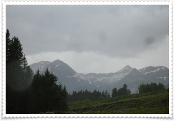
The storm stuck around the rest of the afternoon and the temperature has dropped about 20-25 degrees...it's very, very, chilly!
I'm in town tonight for a free OUTDOOR concert. It turns out it's the same musician that performed in Salida on the fourth when Danny and I were there! It's still raining, but much more lightly, and you can hear thunder once in awhile...however, there are about 75 people out in the park listening to the music (I got a great parking spot, so I can see and hear it all, but I'm dry and warm.)
I hope my tent survived the hail (it did that twice) and Gothic road isn't too muddy.
Until next time...
PS: I've hiked 100+ miles since I've been in Colorado this month!
***************** ****************************** ****** **********
7/22
Last night I'd just finished talking to Danny at the top of Gothic road, and started the drive to my tent.
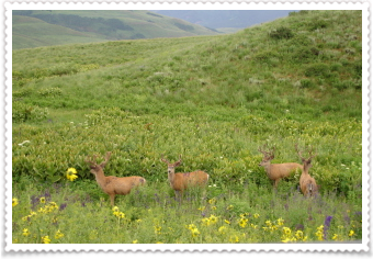
Over off to the side of the road were these four Bucks! Really wonderful to see, so I just stopped and watched them until another car came and I had to move on down the road.
This morning's hike began right down the road from my tent. Two weeks ago, when Danny was here we did a loop that included half a trail called Trailriders or #401. It's really popular with the mountain bikers, but we thought it was really beautiful. (It was the one with the 40 snow piles in the forest!) So, I wanted to do the other end of the trail, and it began with a 2 mile walk down Gothic road to the trailhead.
A beautiful morning, sunny skies and sparkling water.
The trail was pretty gentle, compared to the other end. Parts were forested in the aspens and pines, and then big views would open up and just take your breath away.

Pretty water....and....a BRIDGE!
If you look really closely, in the lower fourth of the photo, to the left of the tallest tree, there is a tiny speck of blue...it's my tent!
I'd decided it was time to clean up a little. I hiked off the trail, way off the trail, stripped down and cleaned up...sans soap, but the water was soooo cold, I'm sure it killed all the dirt and germs! This little waterfall was right below my "stream-bath" spot.

These are my floral-photos of the day....the one in the middle is very strange looking, and I saw all of these while on the #401.
It was early afternoon when I'd finished the hike and "bath", so I hiked in the area behind the campground....everyone had gone for the day. It was trail-less, but there is a really pretty meadow.
I drove up the road to where the scary part begins, to check out the snow-plug. I couldn't believe how much had melted in two weeks. However, there is still enough snow covering the road to keep it closed. There were some kids on that end (from Texas) sledding down the snowfield!
I went into town, made a few phone calls, and had a piece of pizza (ummm...it's a place called the Secret Stash).
I then drove a little way up Kebler Pass and started a little trail the locals use for working out, etc. and is also accessible from town, called "Woods Walk". It was only a couple of miles, but got my legs moving after my meal and I enjoyed the scenery. Actually, I'd done part of this walk when I was here in April (the part that wasn't under several feet of snow). It looks like they made part of the Slate River into a lake; (see photo on left) that wasn't there last summer. They probably did that so it wouldn't flood so bad this year, after all the snow...just a guess.
It was supposed to storm here again this afternoon, but it's been sunny and blue skies all afternoon.
ummm...what will tomorrow bring?