day 10…7.24
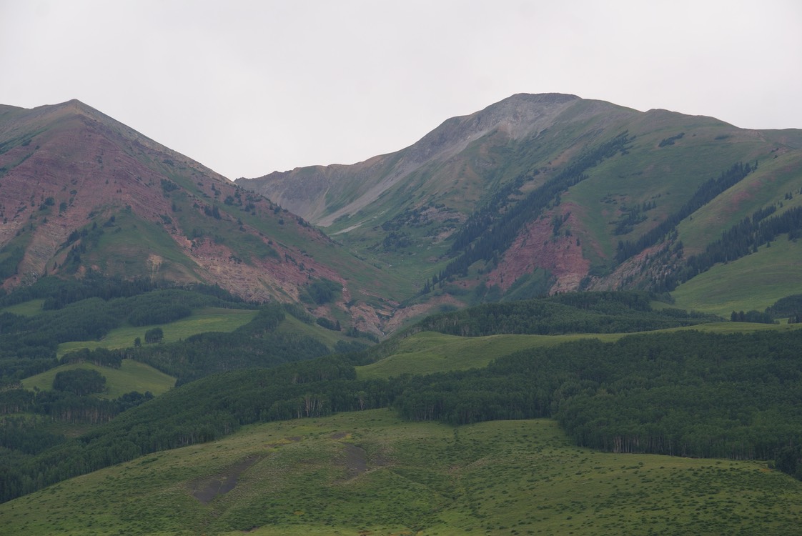
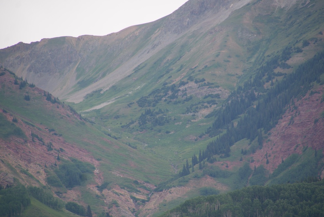
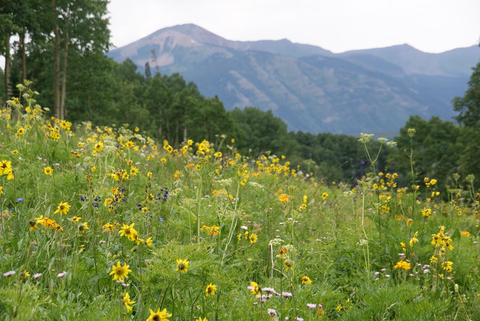
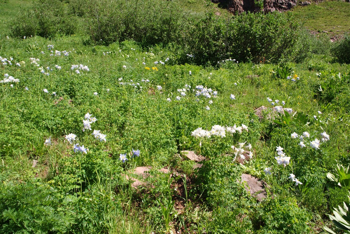
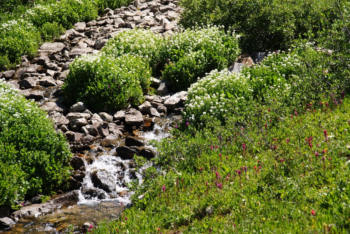
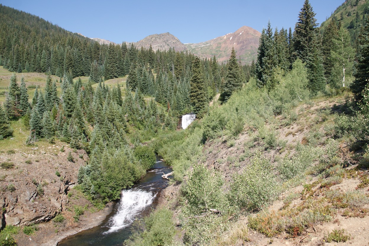
Talie & I ran into each other as I was driving up Washington Gulch road yesterday morning. I saw a woman sitting in the back of her truck, coffee cup in hand, looking like she was absorbing the glow of the morning sun…it was Talie. I stopped & we chatted about how our week had gone & she mentioned maybe hiking a new trail on Sunday or Monday. She ended up setting it up for this morning, & included a long time friend & her 15 month old baby. We hiked a trail, new to me, called the Baxter Gulch trail, just south of town. The trail winds up near Whetstone Mountain…..one of Talie’s favorites.
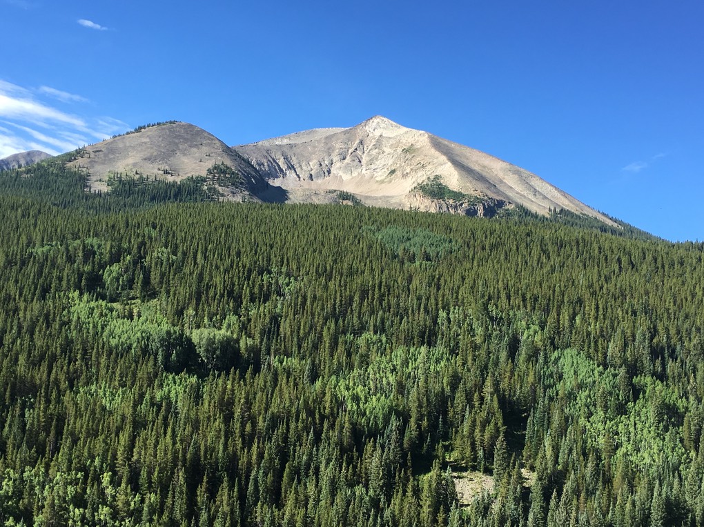
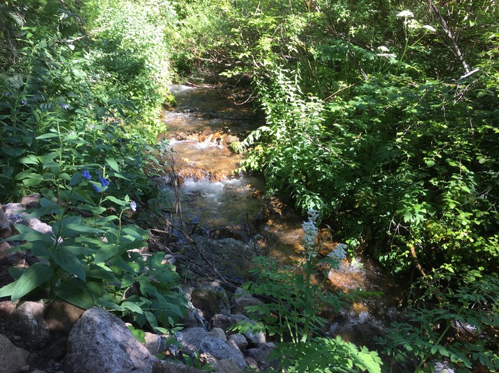
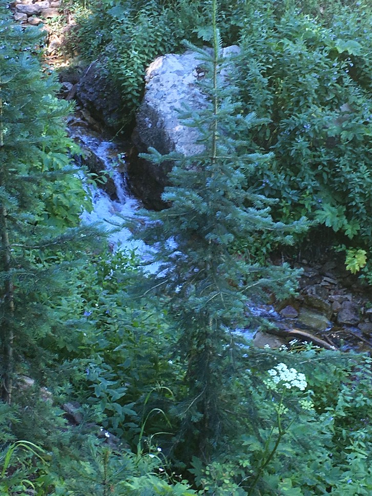
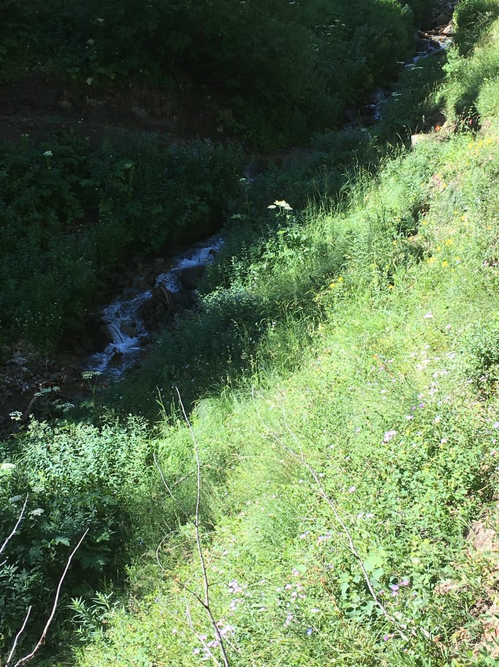
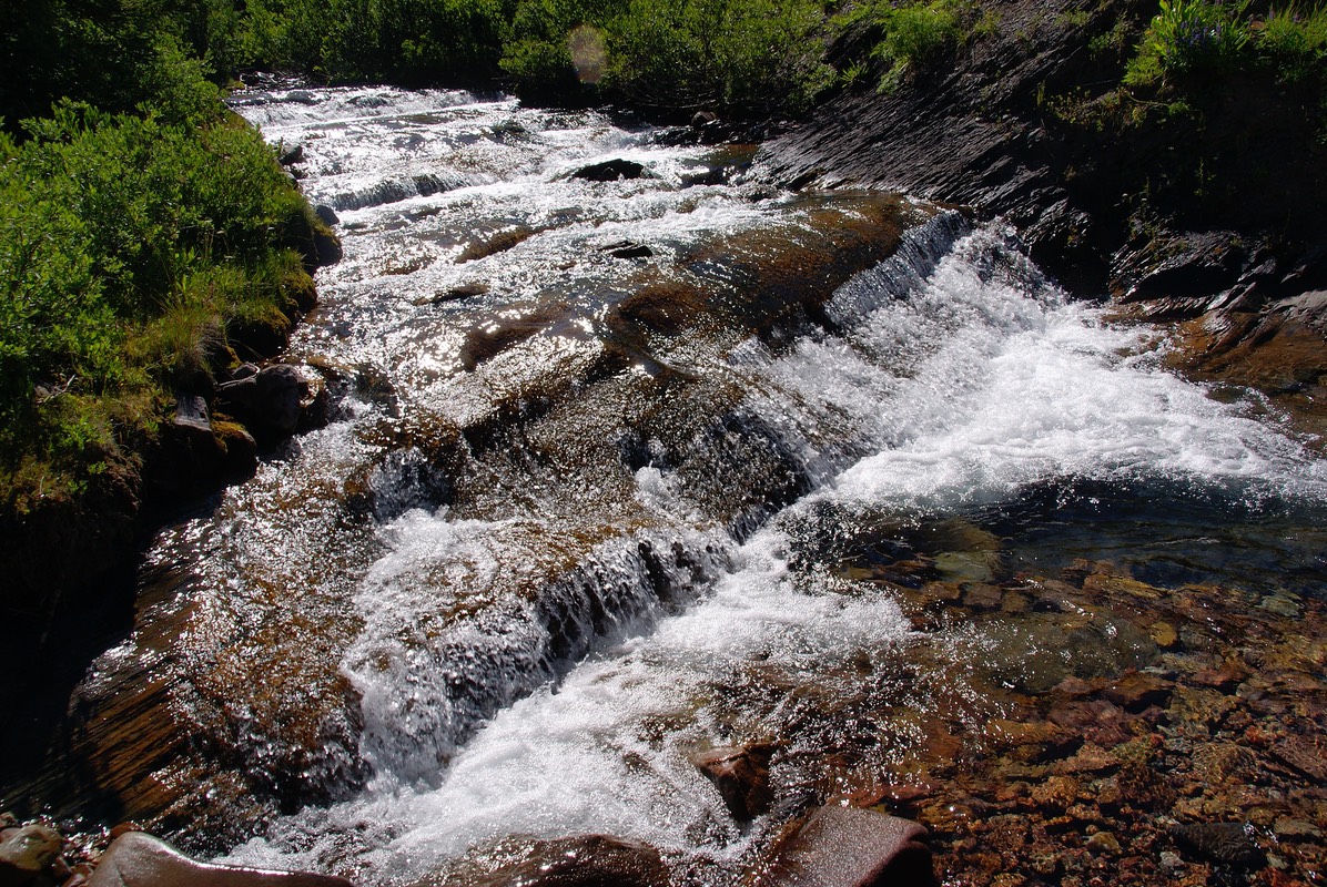
The trail winds through Aspen forests, then open meadows, then the pine trees & over a couple of sweet streams. It was so much fun to hike in between Talie & Callie & hear of their world adventures!

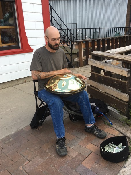
After the morning-filled hike, we all said good bye. It was fun hiking with Callie & her baby, Addie. A little younger than Claire, it was great to hear her jabbering away & loving the outdoors! I drove back up to CB to stroll around the Farmers Market for a while. And ended up exchanging contact info with a couple from Texas, who I initially met at the Dogwood earlier in the week. We all love the hiking trails in CB! I listened to then visited with this hand drummer for awhile…love this music!
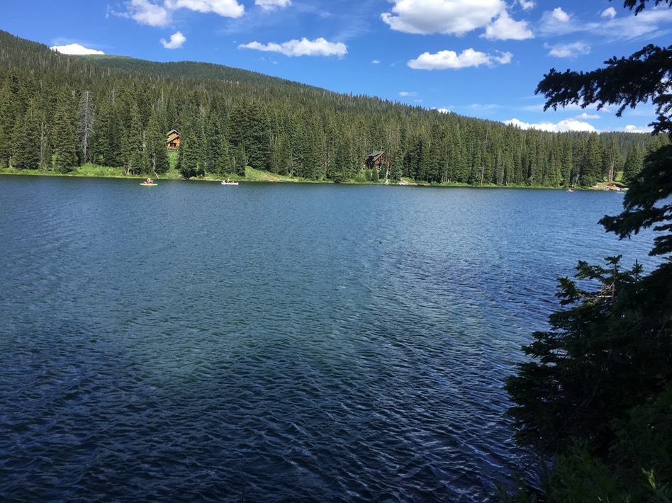
After I was done at the Farmer’s Market, I drove out to Lake Irwin hoping to set up my hammock amongst the trees & just chill. But there were a gazillion people out there, so after a short while, I just turned around & drove back Kebler Pass.
As I was driving down the road, I spotted a trail off to the side…I felt the urgent need to investigate! It was marked as the Carbon trail. I parked the car & got out to check it out for a short walk. Once back in CB, I stopped in at the Dogwood for a drink, visiting with Dillion, then headed back out to camp.
day 11…7.25
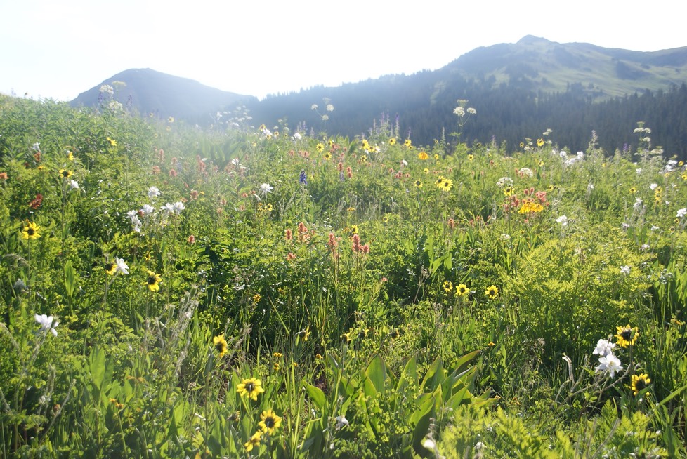
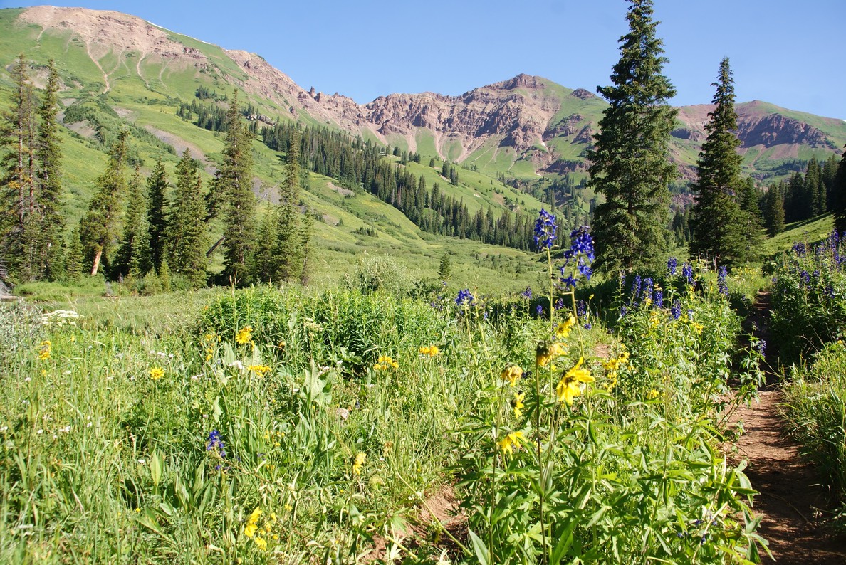
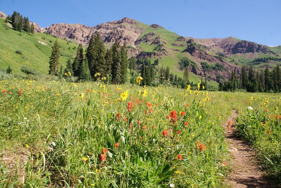
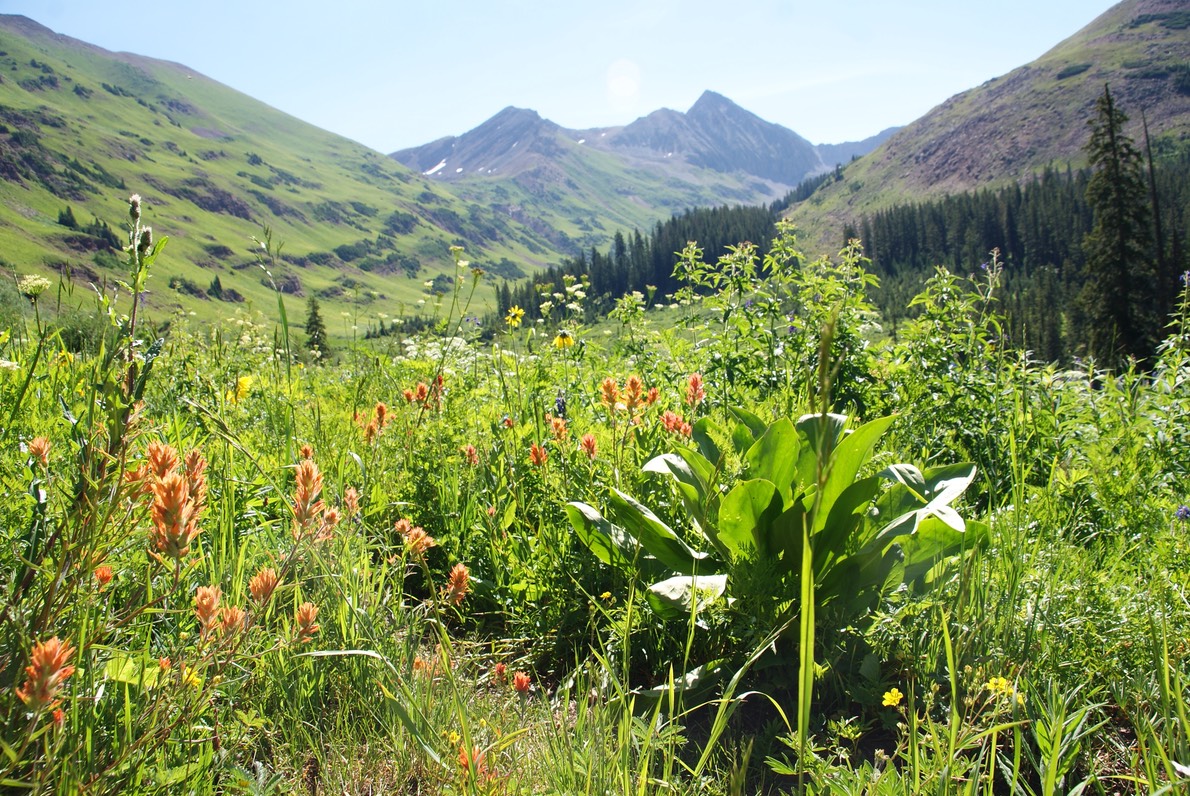
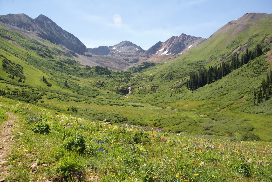
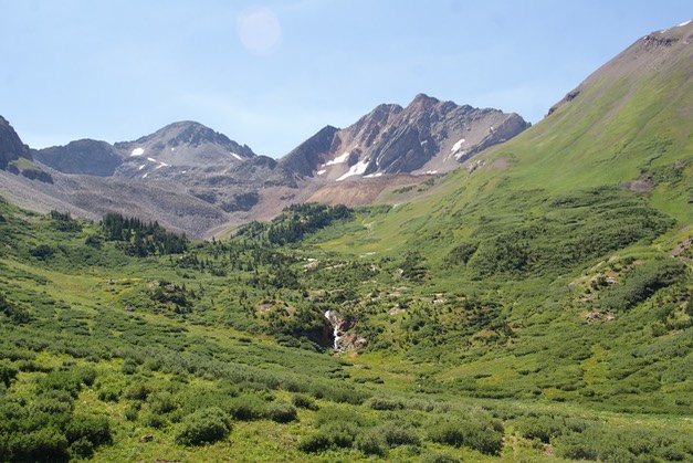
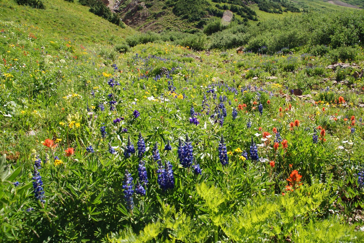
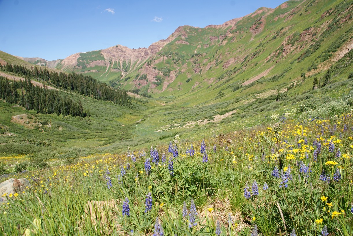
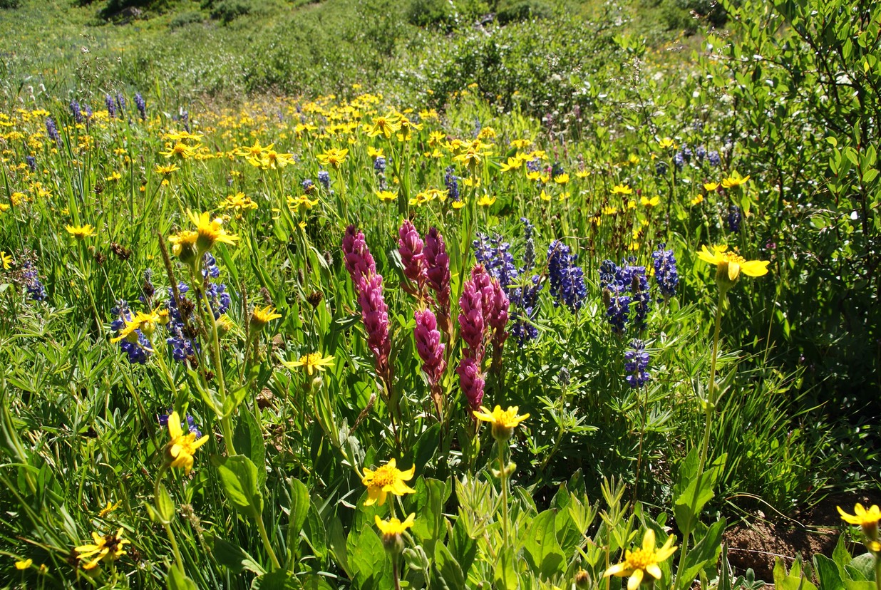
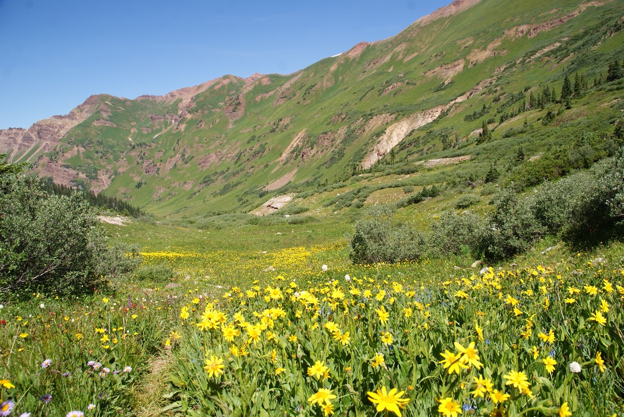
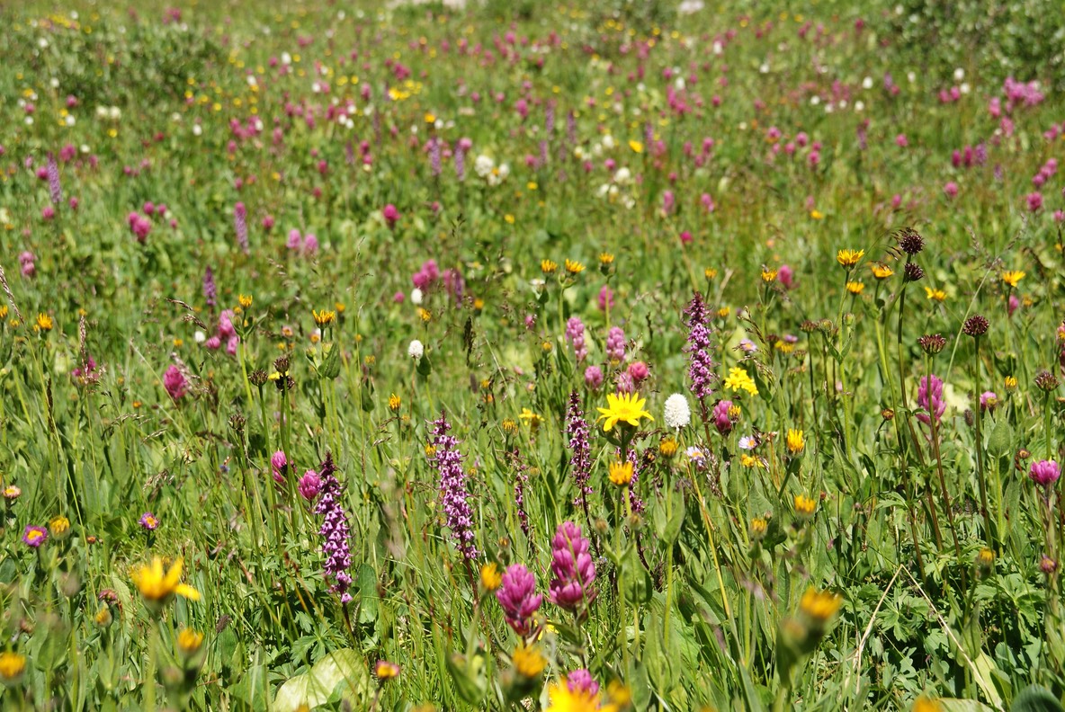
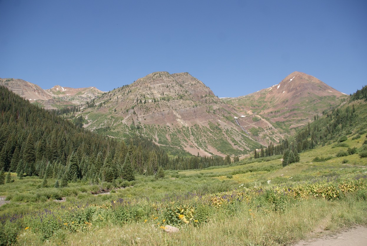
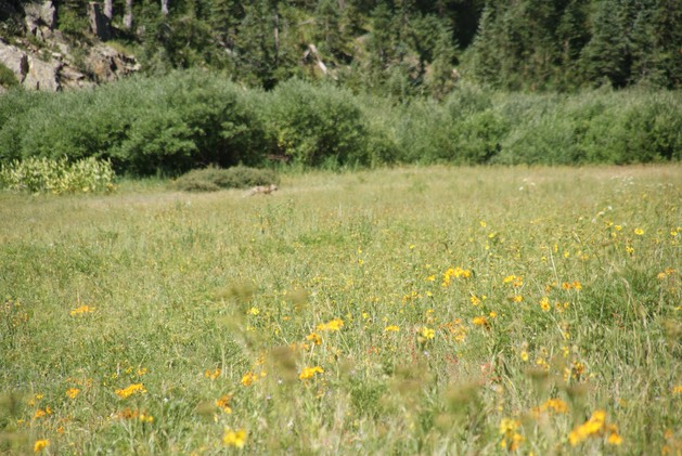
Steven & I were planning a hike up West Maroon trailhead today; Max was taking a hiking-break. We met up in town, then headed out Gothic road, over the skinny part of Gothic & to the trailhead….all without any incident. The trailhead parking lot was full of cars, but the trail wasn’t too bad…everyone seemed to be fairly spread out. IT WAS BEAUTIFUL & FILLED WITH MAGNIFICENT WILDFLOWERS! I was glad Steven got to see this blue-ribbon hike in Crested Butte…one of it’s most popular!!
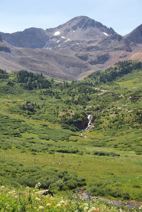
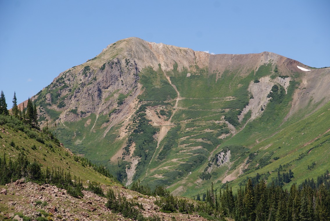
You can see the trail to the pass that leads another 6 miles over to Aspen; this was our turn around point.
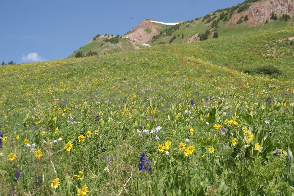
This trail has some big views & tons of wildflowers still in bloom. Steven was just amazed! & it was so much fun to see his excitement…I had it too! We had a great hike back, managed the road, then went into town. We met Max for a salad at the Secret Stash, then said our good byes. We met a little while later at the free concert in the park, but they were in & out as I just sat & listened to the music. About a 1/2 hour before the concert ended, I was ready to head back to camp. We all hugged good bye…it had been fun hiking with the brothers! I made it back out to camp to enjoy a little more daylight before packing it in for the night.
day 12…7.26
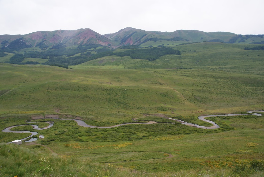
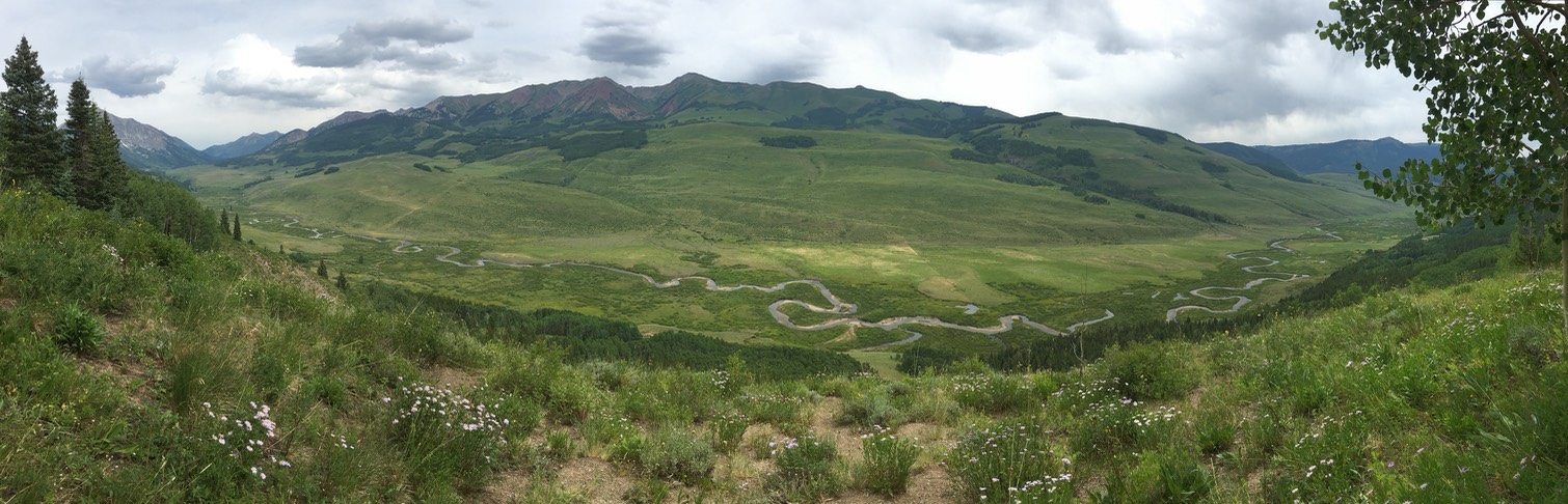
This morning I felt sooooo very groggy…like a balloon with no air! I had breakfast at Paradise, then hit a new trail I’d never hiked…Meander. I’d heard about this trail…& thought it was short & level & went around the back of the mountain overlooking the East River Valley….I LOVE THE EAST RIVER VALLEY. I couldn’t find much info about it…I’d picked up a map at the Visitors Center, but no one seemed to know how long the trail was. I tried calling Mt. CB to ask…just kept getting a recording. So, in the end I just loaded up my pack & set off for an easy walk. The trailhead sign said “Lower Meander”….it was easy & gentle & had awesome views of the East River & the mountains that stand behind it.
Danny & I have hiked the Deer Creek trail which goes above the river on the other side. I really am curious & want to hike the valley in between the mountains…so I took lots of close ups of that valley from the trail.
The trail really did meander along the backside of the mountain & it was just lovely. I only ran into two other people…both locals walking their dogs. The trail gently climbs higher, winding it’s way through the aspens. You can go down a side trail to a bench that overlooks the whole valley. This is a pano shot I took…so awesome!
The lower Meander eventually becomes the Meander & goes up the side of the mountain…switchbacking up through open areas then aspens. I saw one mountain biker. I really hadn’t wanted to hike a long hike today…I felt exhausted from the moment I woke up. But this trail just kept climbing higher…sometimes you’d have a view of one of the gazillion dollar mega mansions on the mountain, but mostly just wonderful views of the valley. I eventually crossed a road, so instead of keeping on the trail, I took the road. My map wasn’t much help, but I knew I was always going the right direction. Then..up popped a bar on the side of the mountain! A big surprise!
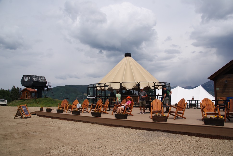
The Umbrella Bar was perched on the side of the mountain. I asked the bartender for a little guidance in looking for the right trail that would loop back to my car. It was no wonder I was a little confused, it seems the map the Visitors Center had given me was a really OLD map…figures! (While I love MOST EVERYTHING ABOUT CRESTED BUTTE, it’s kind of a well known fact that their Visitors Center is pretty unfriendly, & unhelpful…unless you’re looking for lodging (guess that’s who pays their salary) & THEY DEF HAVE THE WORST BATHROOM IN TOWN.) So, I wasn’t surprised the map was outdated. Actually, the bartender gave me the wrong directions too. I didn’t have anything to drink because they didn’t have a very good beer selection & all the drinks were super expensive…& given all that…I really didn’t need one. But with the new map in hand, I found my way to the Prospector Trail & my way back down the mountain & to my car!
I found my way to the Brick & my friend Rick was there. I had an amazing beer called the Woot! Not only a fantastic Imperial Stout, but wonderful background story. I always enjoy visiting with Rick & nursed my 13.5% beer very very slowly. I drove back out to camp in the early evening, enjoying beautiful crystal clear night skies.
day 13…7.27
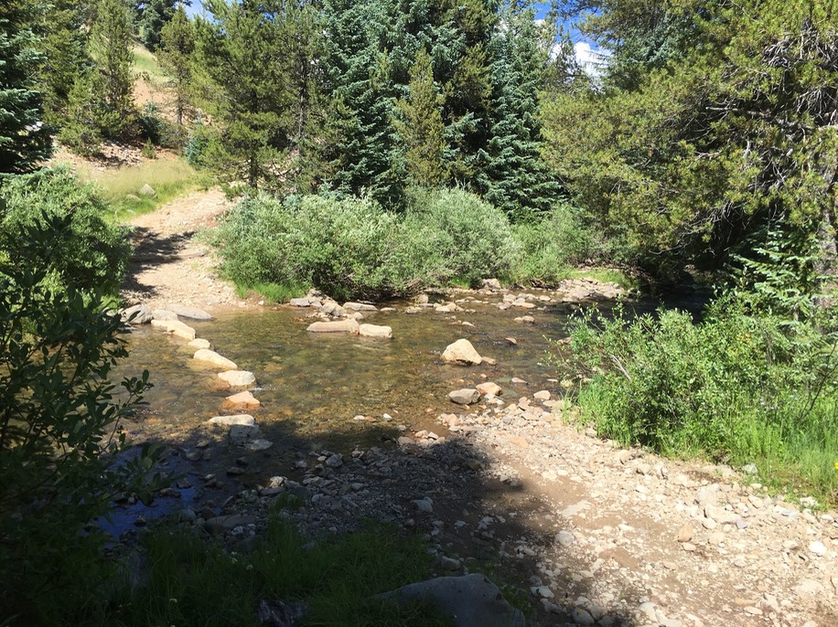
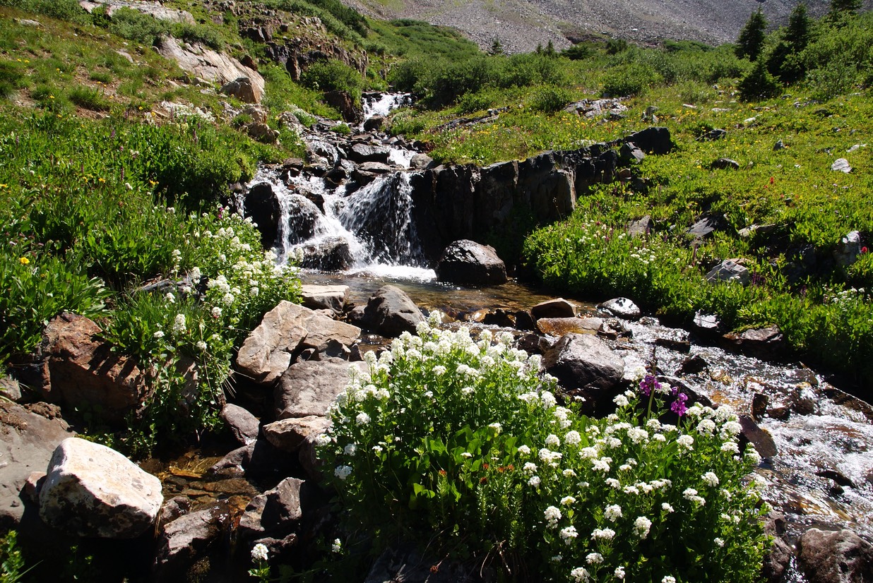
Today would be my biggest hike yet…Rustlers Gulch…about 12 miles if I made it to the very top. I got a pretty early start & crossed the really freezing cold East River. I hike this trail in my Chacos. I used to wear my hiking shoes, then switch to my sandals at every stream crossing, but this is a super wet trail. At least three stream crossings early on, then usually part of the trail is mud or running water. So, a few years ago, I just decided to wear my sandals & forget the low hikers. The third stream crossing is usually the scariest one for me…narrow, deep & swift. But this year, someone put some boulders in the middle of the wide part, so I just boulder-hopped & made it over with no problem!
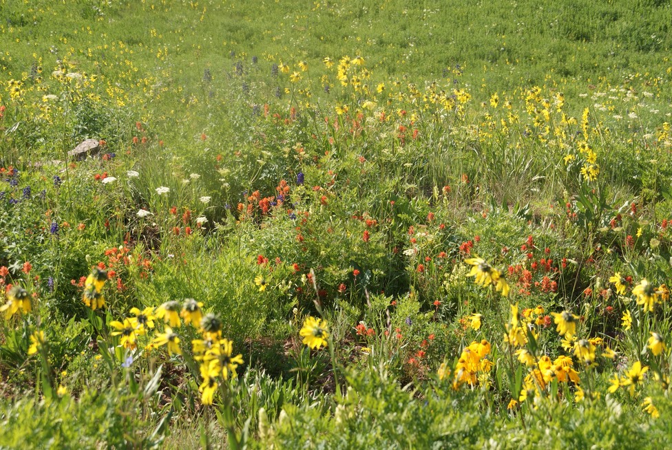
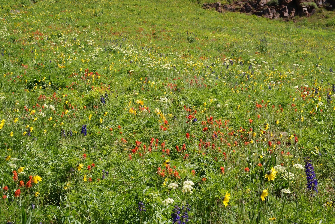
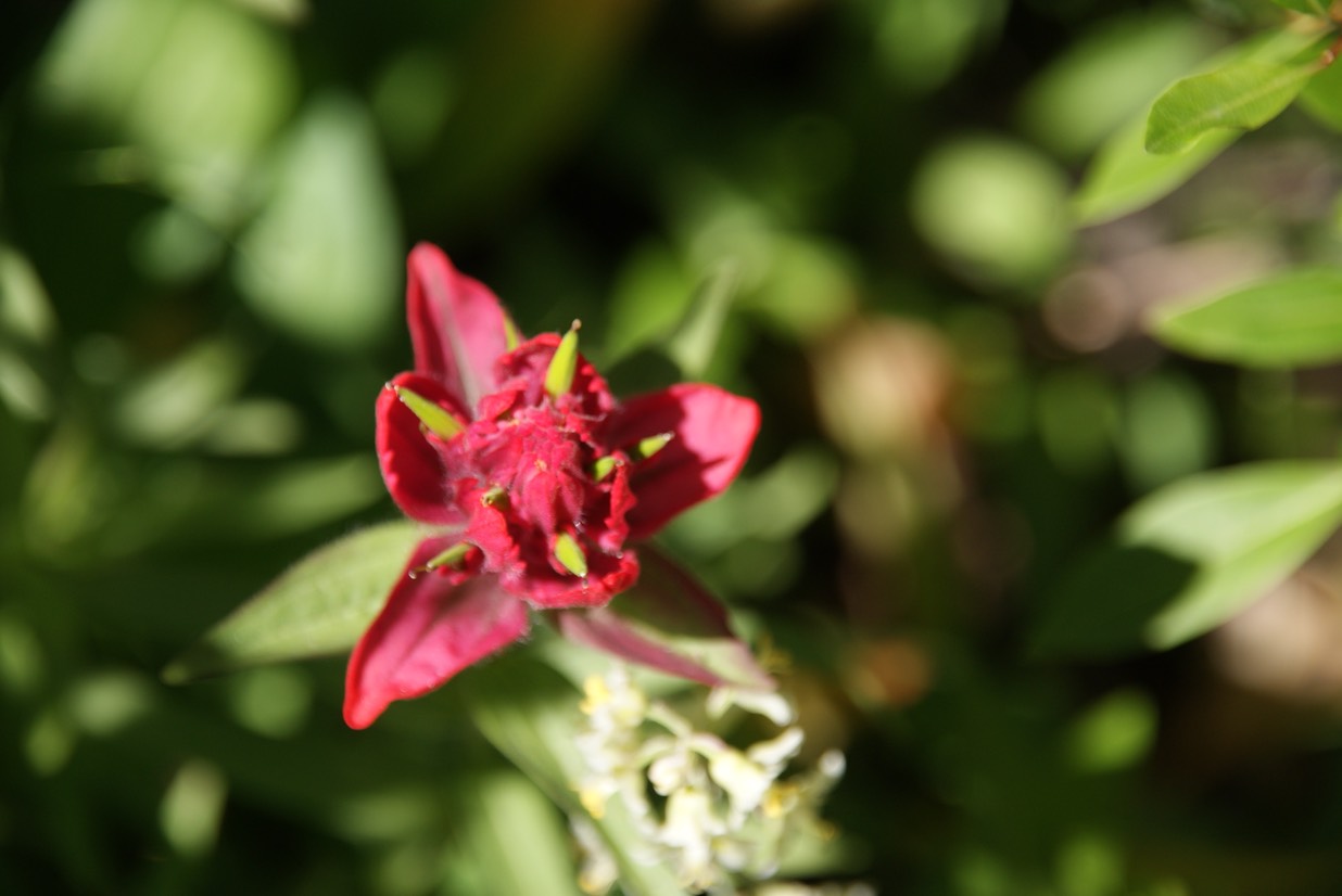
The climb into the valley is fairly gentle & after the 3 mile mark the wildflowers were spectacular!
Tons of Columbine!
I found some Green Gentian, but none blooming.
I was loving everything about this hike! I felt like I could fly up the mountain!
Close up of one of the waterfalls.
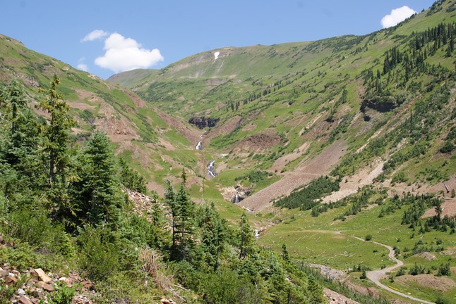
The views back down the valley I’d just hiked (trail on the right hand side).
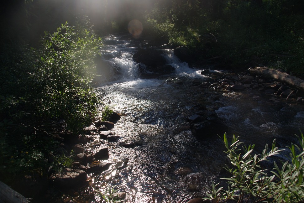
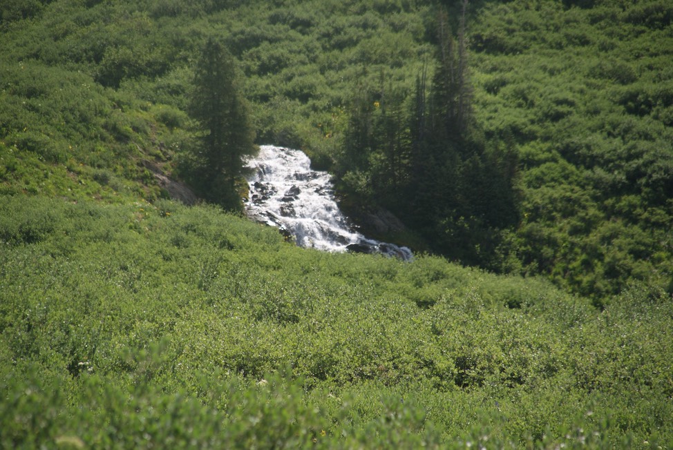
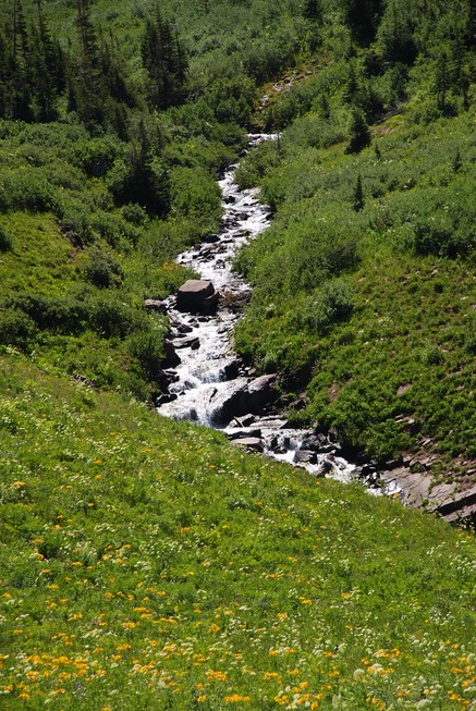
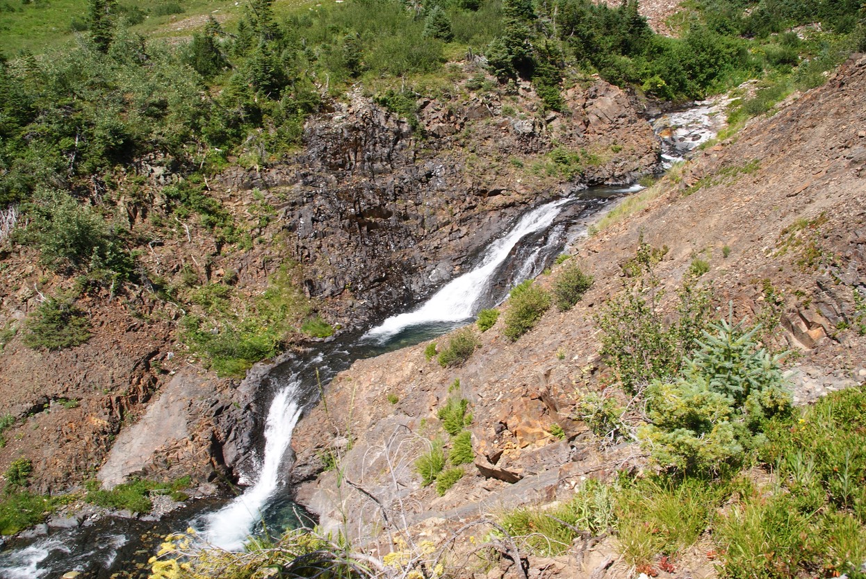
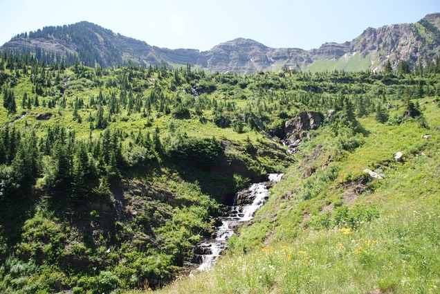
Nearing the end of the trail, I crossed one more creek with all of these super awesome waterfalls!
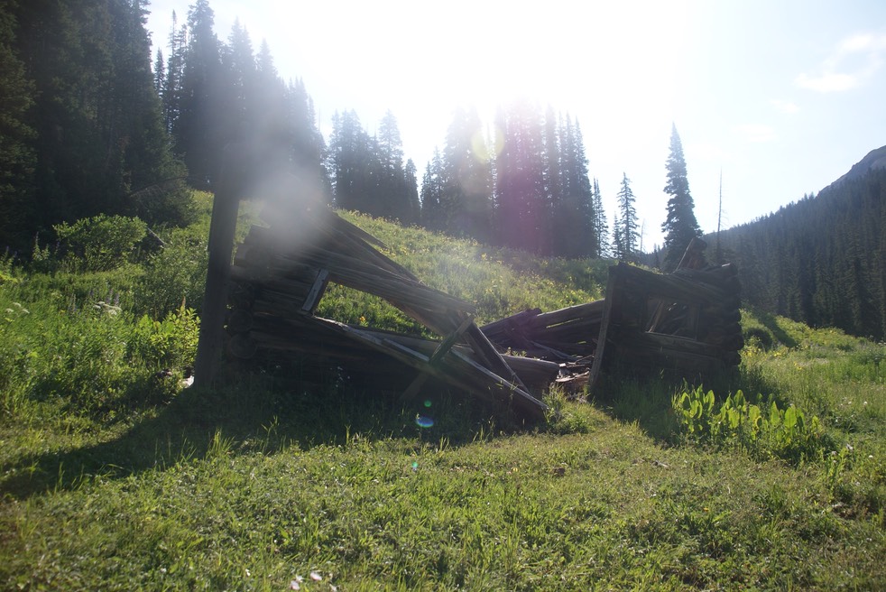
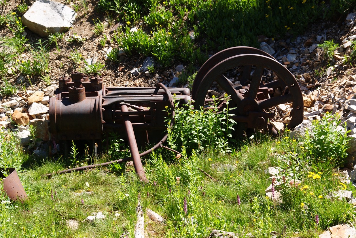
This is more mining crap left from the old days.
The trail ends at the base of the mountain…where all the scree is.
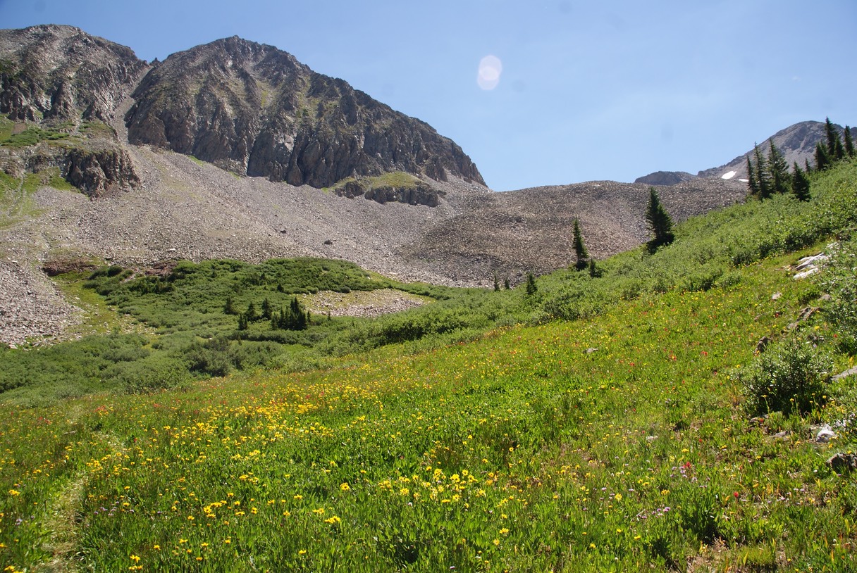
Another view back down the valley, as I turn around & head back down the trail. What a super splendid magnificent hike!
Never ending flowers in the valley…AWESOME! Lots of Pink & Purples!
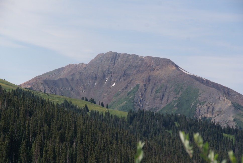
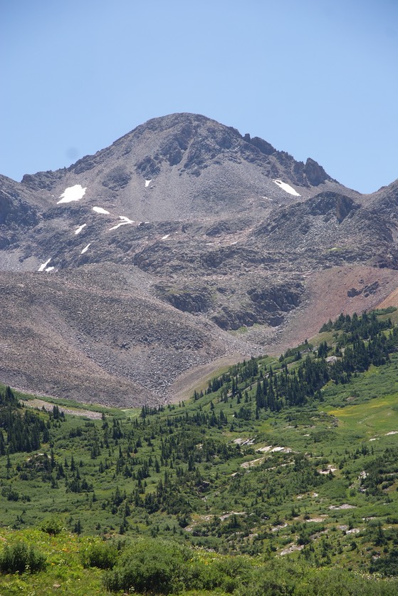
A view of a trail I’ve never taken from this side…switchbacks that go up to Mt. Belleview.
What a super amazing hike today…12 miles! I was tired but sooooo stoked! I hiked back down, through all the water & back to the car…hot, tired, dirty feet & a few more fly bites, but joyous! I drove into town & straight to the Brick for a burger & a Melvin 2x4…an Imperial IPA…yum. I met a guy from OK…another beer geek & we visited for about an hour while I ate & drank. I’d promised my artist friend Kate, if she needed help packing up for a festival this weekend, I’d be available. I drove over to her place after the Brick & we worked at packing up her trailer & truck. She was gracious & let me do a load of laundry & shower….YES! It’d been a week & I was so needing one. I drove back out to camp before dark, sat in my chair for about 30 minutes…exhausted but loving my time out here!
day 14…7.28
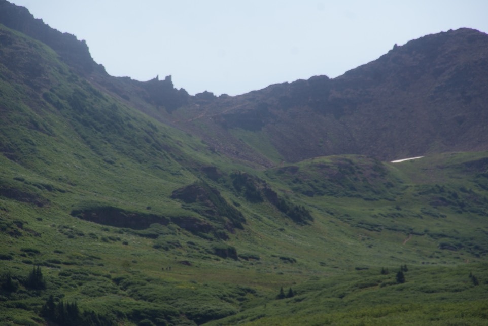
The middle of the night was not kind…I fought a headache all night long…sucking down a few tylenol & a lot of water. This morning was incrementally better, but not great. I made some coffee only to realize my cream had curdled (all that damn ice I’ve been buying must not have worked!) I felt like a slug. I wanted to hike up Daisy Pass which the trailhead is only about a mile from camp. Instead, I dumped my yucky coffee & drove to town. I ate a quick breakfast sandwich at Paradise, got some coffee & my power-juice (their cucumber jalapeño lemonade) then drove back out passed camp & to the trailhead. Headache was still there, but not horrid. I needed all my brave-stuff for the drive up the 2 mile road to the trailhead. Talie had hiked it earlier & said she thought I could drive it…sure. I drove through the river & up the road, leaving my comfort zone every 10 seconds. I realized how slanted my 4runner can go as the road pitched & dipped. But then I couldn’t tell how deep the next spot was….I was loosing my nerve! OH DAMN! This makes me sooooo mad at myself. Go forward into the unknown or Try to back up?…a whole other scary experience. I decided I’d try it going backwards, so I lowered my back window & did the best I could & finally found a spot I could back into the drive back the way I came. This sounds like I’ve gone a long way right? It was about 1/3 or 1/2 mile after the river crossing…but soon super slow over all the obstacles. I drove part way back down the road to a place I could pull over & park, loaded up my pack & headed up the long road. By the time I’d gotten to the trailhead & finished hiking the road, I was glad I hadn’t driven it, but I wasn’t sure I was prepared to add the 4 miles to my hike. I was tired when I got to the next stream crossing & considered turning around there…but kept going & crossed the fast flowing stream. This is also a old mining area, so the ‘trail’ actually is a rocky uphill old road…tortuous on the feet. The trail climbs for the next 2 miles, then one more additional straight up climb to the pass. I stopped about 4 times, ready to turn around. I made it all the way up into Baxter Basin, but looking up the last two miles up to the pass seemed like forever. The falls are beautiful, there were some super nice flowers & I’d seen a fox. I sat down a couple of times in the road, just to try to get the energy to move up & back on the trail. This was my 14th day of hiking…I haven’t missed one yet. I decided 6 miles was going to be it for the day…not 10 & a summit hike. I got up from the ground, took one last look up to the pass, & headed back down the rocky road.
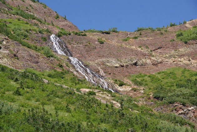
The pass is up there in the center…way way way on top of that mountain!
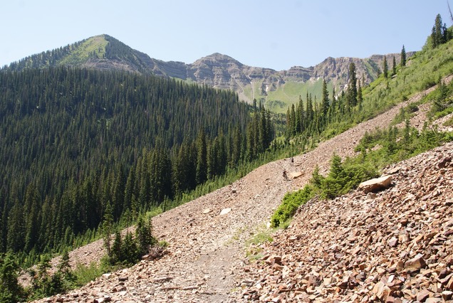
When I got down to cross the stream, there were 4 backpackers at the bottom. They were 3 students & one Professor from RMBL. They had backpacked up near the mine for last night to do some research. We all hiked down the road together. I was fascinated as they told me all about their research, where they were from, their favorite trails, etc. The Professor has been one at RMBL for 30 years. She said she’d driven up this road several times & gotten a flat tire most of the time. As it turns out, she was parked near my 4runner. It was a super fun way to hike the tedious road back down & I was really glad to have met them all.
Once back in town, I went to the Brick for another WOOT!, a salad & a slice of pizza visiting with one of my fave bartenders, Alex. Now I’m at the little lovely library working on the site & getting caught up on email & everything charged up. I’m so anxious for Danny to get here on Saturday. I have a full day planned for tomorrow, so headed back to camp soon after a quick trip to the store for paper towels, water, 1/2 & 1/2 (non curdled kind) & of course, ICE.