day 19…8.2
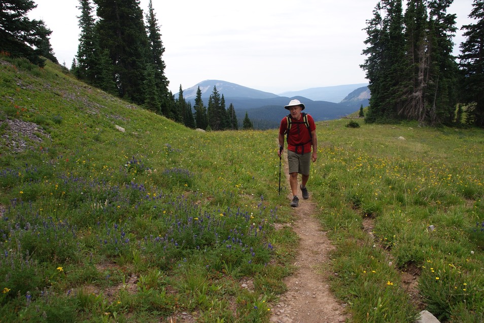
Today we were going for a big hike. I’ve tried to summit Mt. Emmons twice before. One other time with Danny, we got almost there before the skies started turning dark & the trail got super sketchy (I think one of us chickened out more than the other. Note: Danny NEVER chickens out, so you can guess who it was!) The other time, I’d hiked up an old jeep road from Kebler, but when I got near the top & saw the rest of the trail….skinny in a narrow bowl (which still had snow over part of the trail), I turned around. Today, I was seriously hoping to get to the top!
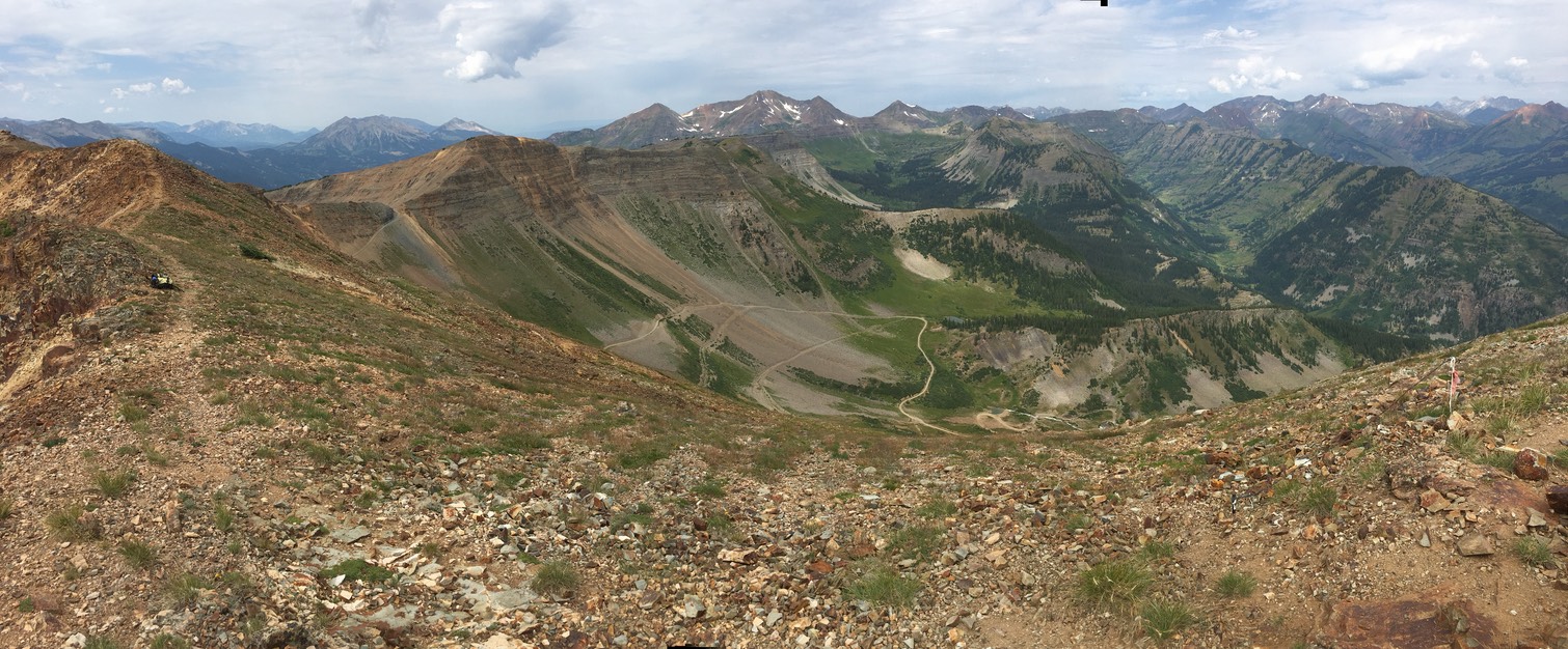
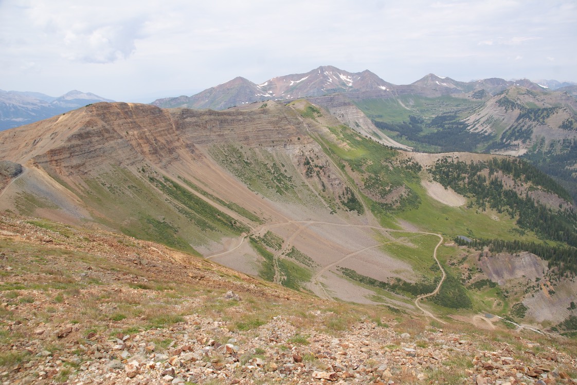
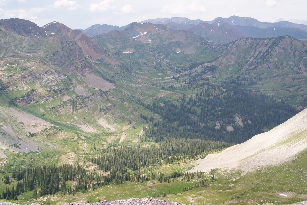
We started at the Scarp Ridge trailhead, but took the middle loop up to the ridge. This is lung busting climbing & it would continue all day. The route we ended up taking was at least 10 miles & 3,400’ elevation gain & loss. The terrain was dirt, rock, scree, uneven ground, big rock….a killer on the ankles & feet.
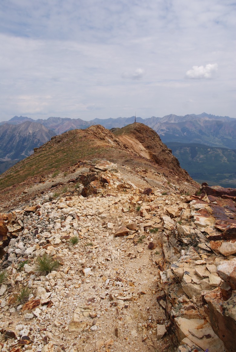
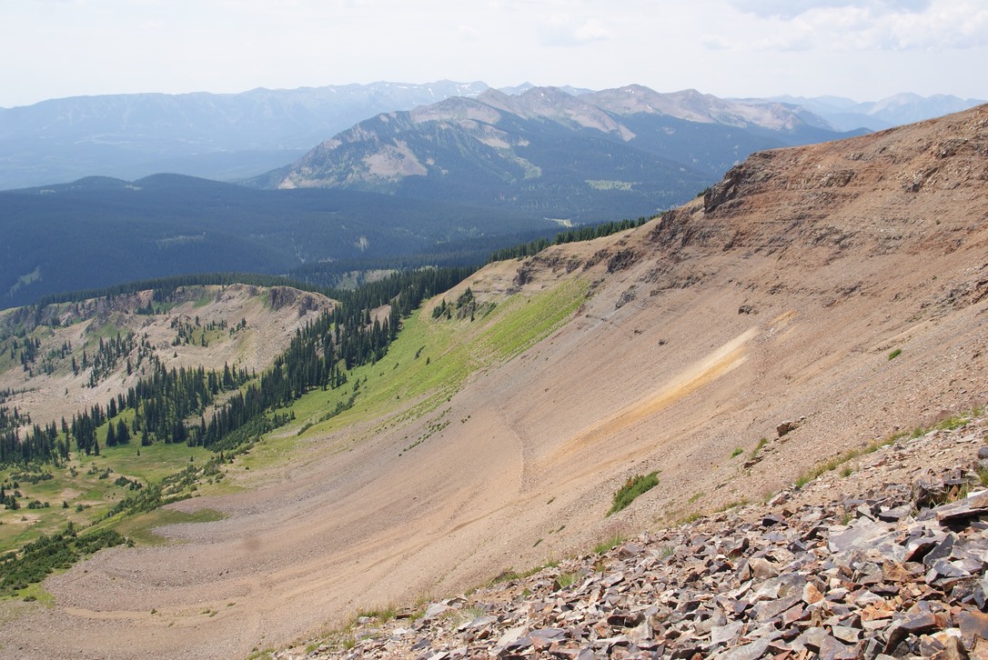
A view of the ridge.
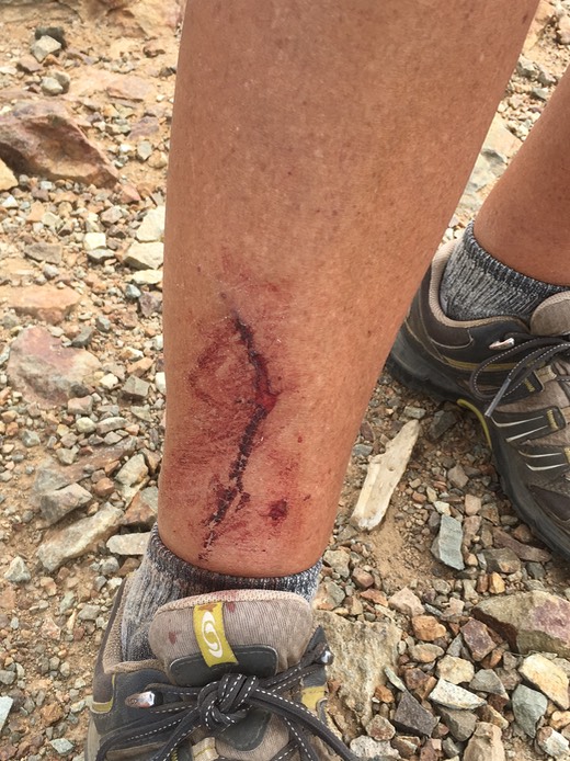
Part of the trail went through waist high to should high scrub brush…thick & hard to get through & impossible to see what’s on the other side or below you. I was leading this part of the hike & soon after stepping into the brush, I was viciously attacked by a stick! It wasn’t like you could stop in the middle of all this trail, you could barely bend over. The blood soon seeped into the tongue of my hikers & smeared all over my leg, but thankfully wasn’t hurting.
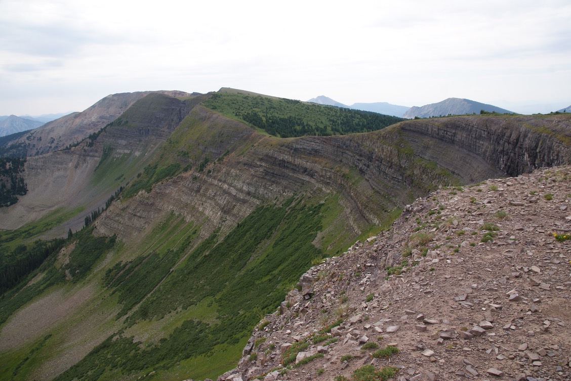
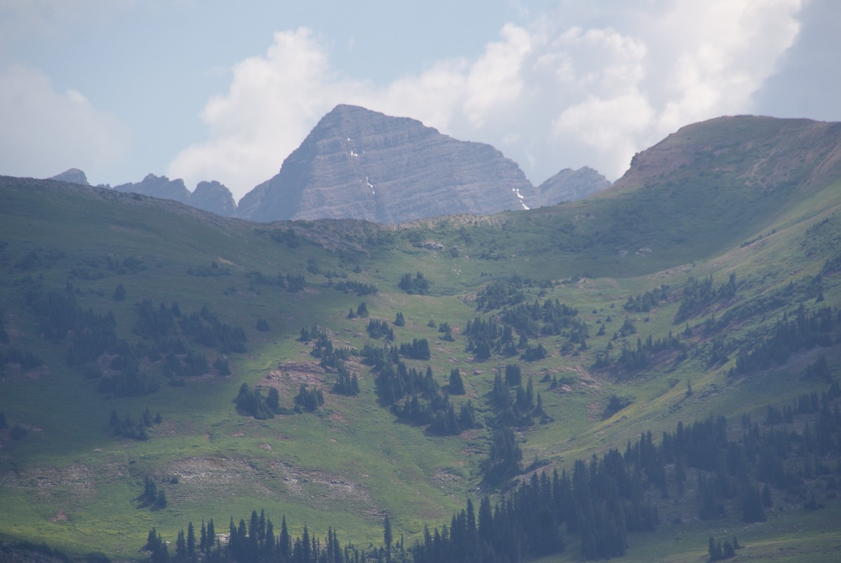
We kept going & going & going. We’d climb high up then go back down, only to climb higher up the next ridge. The skies were overcast & there’s a cool breeze up here & no threat of storms, just perfect weather for this killer hike. The pic below shows the last part of the hike…definitely the part you had to be most careful on. There’s a gully to the right of the ridge (you can’t see it from the pic) but you have to climb down the right side then climb back up. It was sooooo steep & very loose rock…at one point I just sat down on my butt, put one foot under me & one foot forward & slid the rest of the way down.
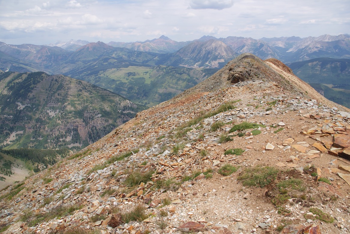
We finally had the summit in our sights!
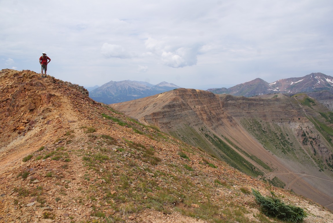
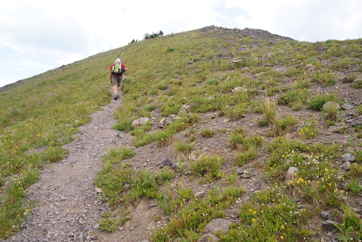
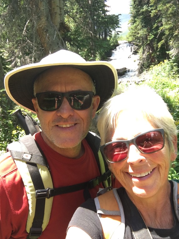
Danny making his way to the summit with a view of the ridge behind him.
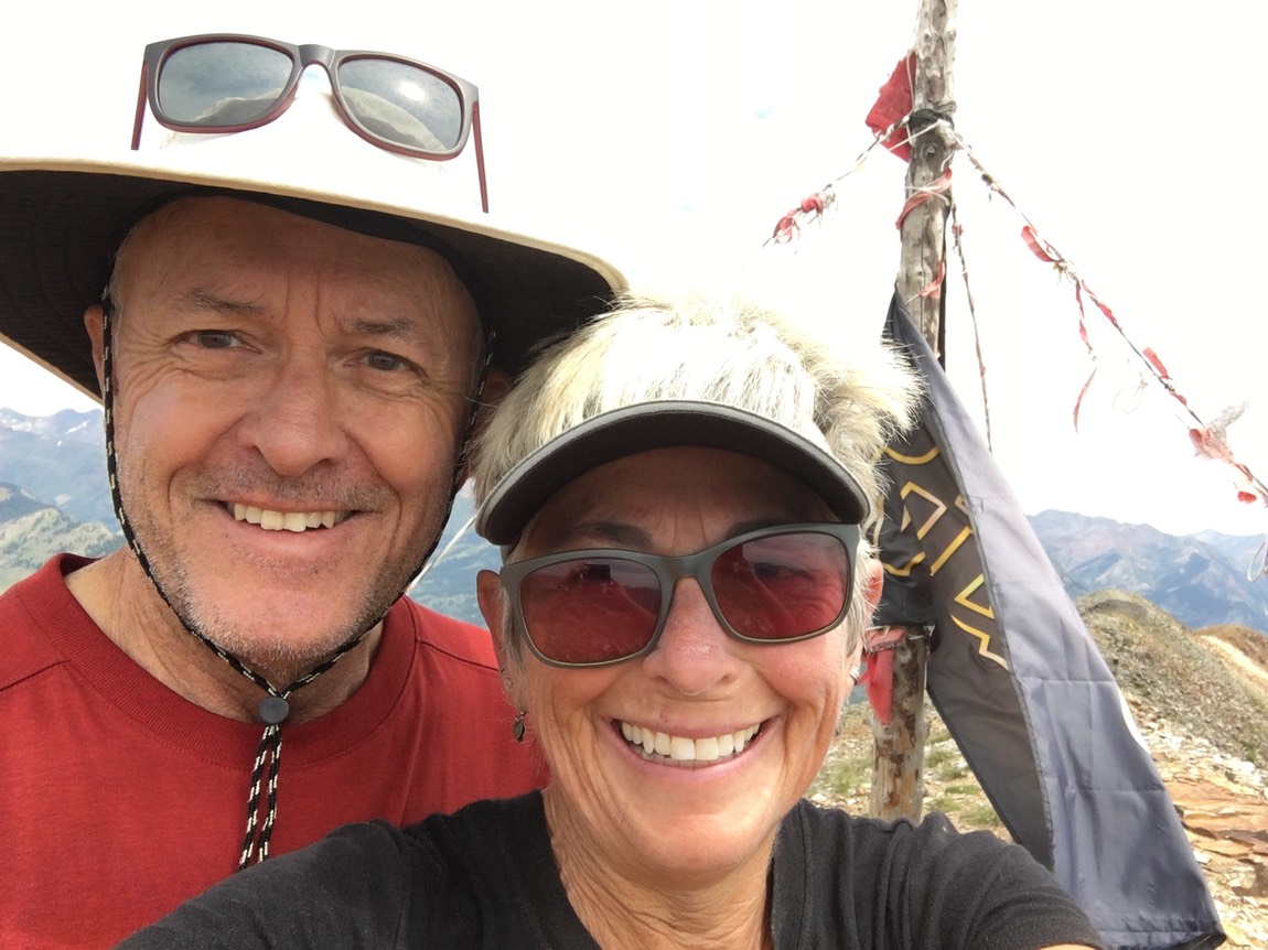
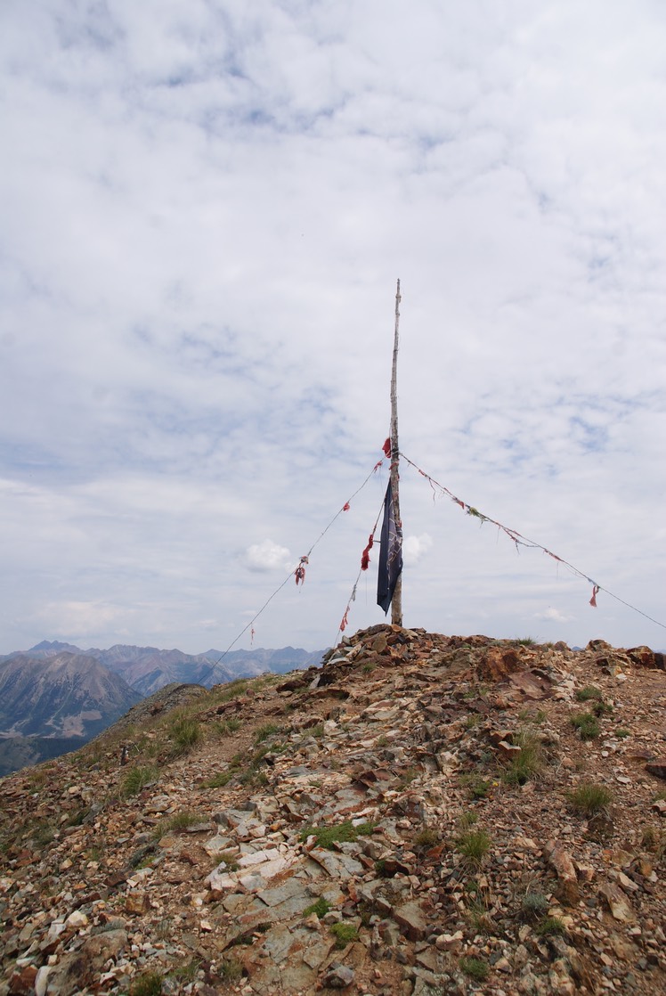
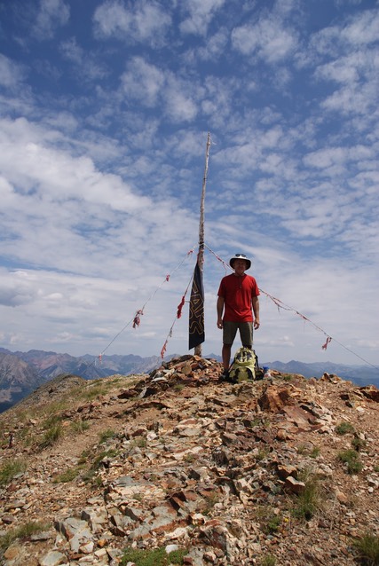
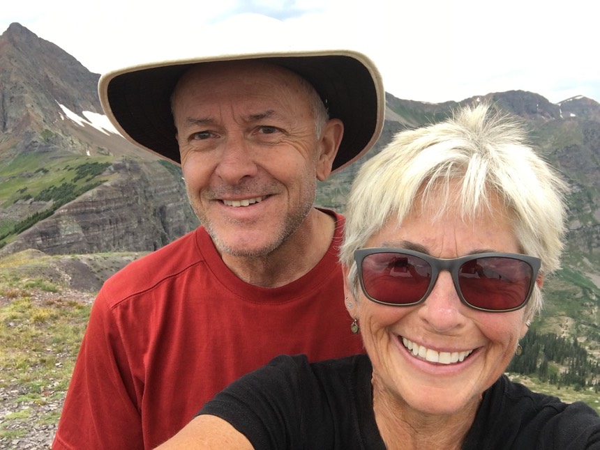
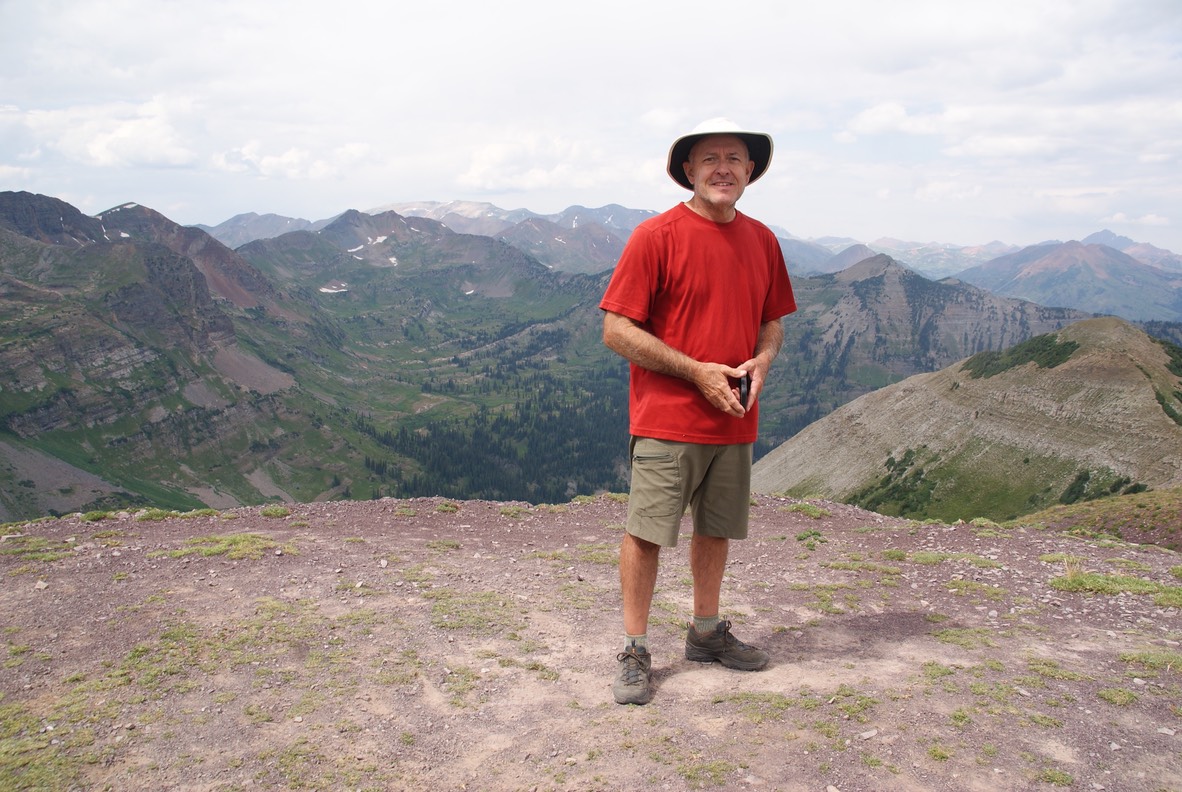
We made it!!!! Mt. Emmons….12,420'
We sat & ate lunch & rested & took in all the magnificent views!
The summit…third times a charm!
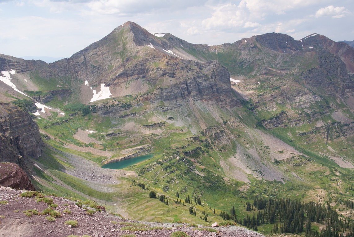
My pano shot.
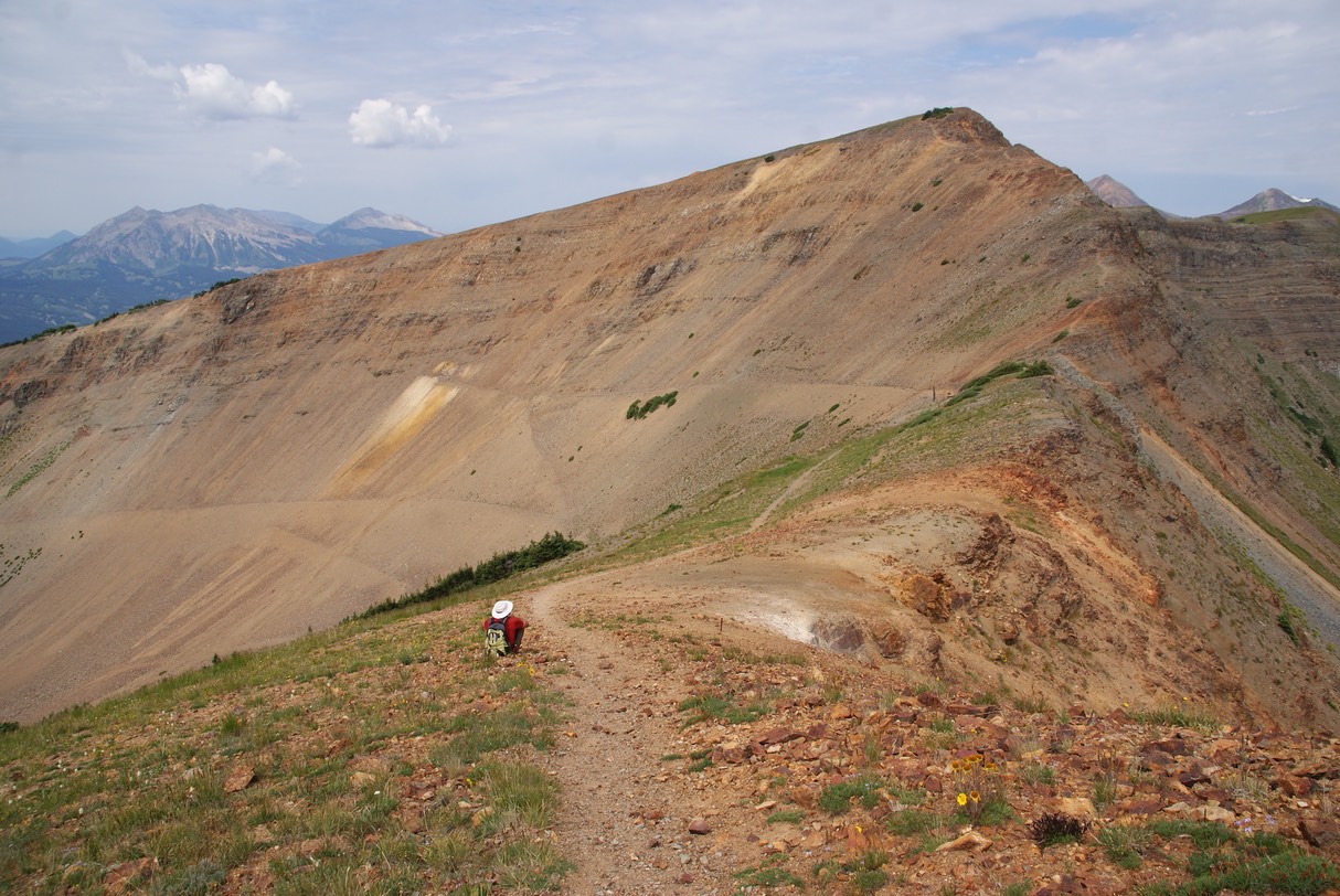
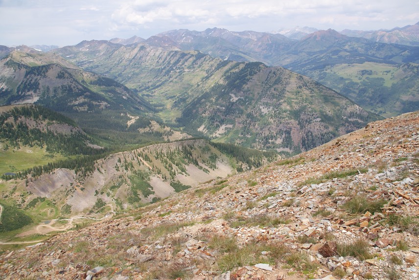
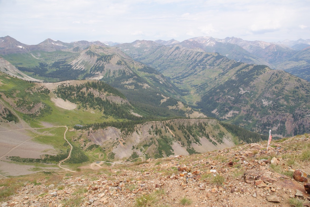
Looking back across the whole ridge. Depending on the weather, we were going to try to hike the whole ridge back to the farthest high point. Super glad we’d made the summit, but the hike back was going to be hard & long.
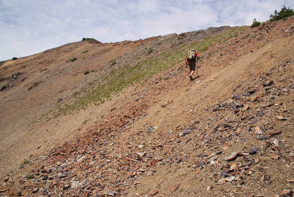
Going back up those steep sections was tough.
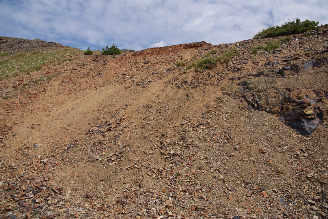
I passed the view of the trail I’d bailed from before, & while looking at it, finally forgave myself for chickening out….it looked like a horrid trail to hike AND I’d still have the difficult section that Danny & I had just hiked; the little tiny line going around the right of the bowl is the trail (& it had snow on it when I was there).
But on the way back through the scrub, Danny killed the stick that had attacked me…My HERO! After hiking back up & down & up & down & over & through all the hard stuff, we ran into the trail we’d hiked up. The weather still looked good & though we were tired, we were only a mile or two & a 300’ or so from the high point on the other end of Scarp Ridge…one of both of our’s favorite views. So, we kept going. Danny was almost out of water & I had already ran out. But we made it to the top & after two other couples left, we had it to ourselves!
At the top of Scarp Ridge…12,190'
We made a quick video to send to Claire, so she could see her Papa & Gki in the mountains! We were really tired & had the 1.5 mile hike straight back down…but at least it was all down! We made it back to the car, drove into town, ran a couple of errands & ate Mexican at Teocalli Tamale. Then headed back out to camp for the evening. What a wonderful but exhausting day it had been! We were both so freakin’ stoked we’d made it to the top of Emmons.
day 20…8.3
This morning was clear & beautiful…we didn’t get any rain yesterday even though storms have been predicted everyday this week. We were going exploring again…looking for a new place neither of us had been called North Pole Basin. I have seen pics & heard people (mostly locals) talking about this new area. It had been privately owned until the CB Land Trust bought it & it’s now managed by RMBL, where they also do some research on the 165 acre basin that’s surrounded by big beautiful mountains! The guy at the gear store said we could drive the mile long road up to the tiny parking space…HA! But, since I had Superman with me, we crossed the stream, the giant mud hole & headed up the super rocky road. I was super far out of my comfort zone, hoping my 4Runner would go over the boulders strewn across the one lane narrow road. It was helpful having Danny there…sometimes to guide me, sometimes just to agree with the way I went over or around the rocks. But I knew I wouldn’t drive this road on my own….I’m so glad we didn’t meet anyone coming down! There had been a Landcruiser go up the road before us, so the two of us took up both parking spots (also glad there was a spot for my 4runner or I’d have had to go back down!)
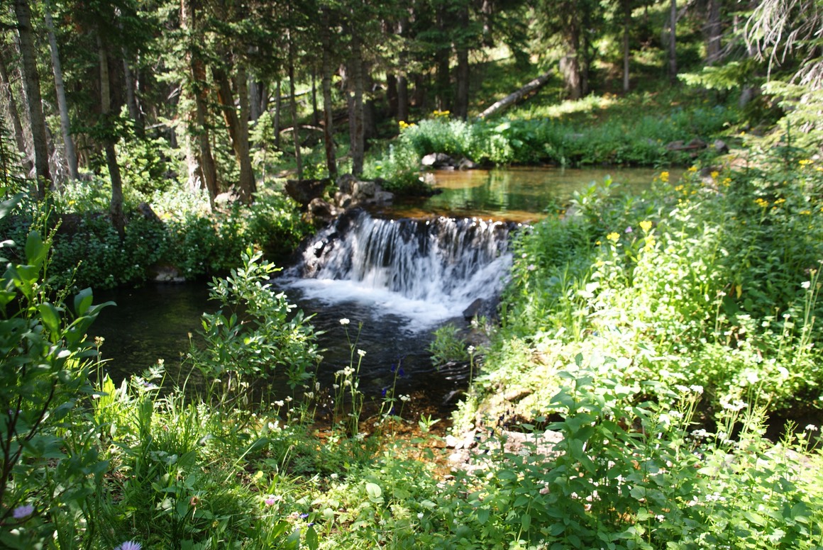
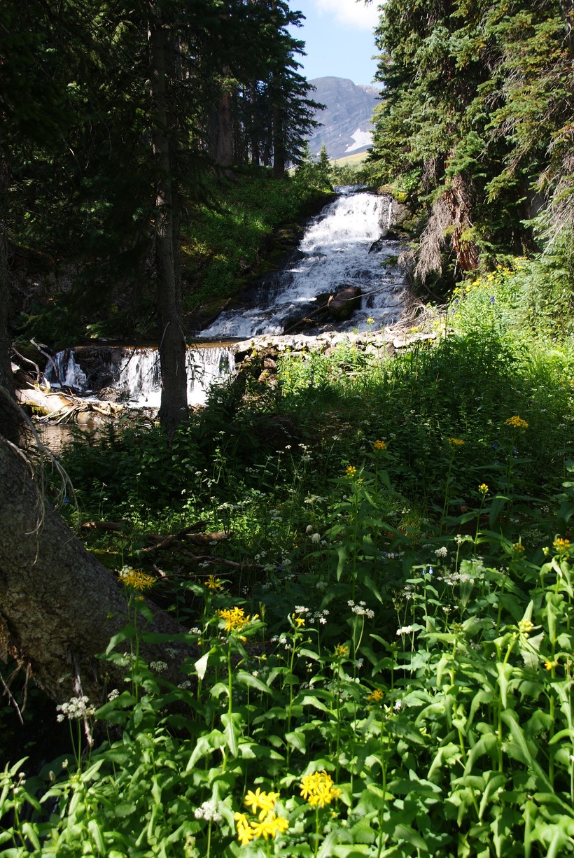
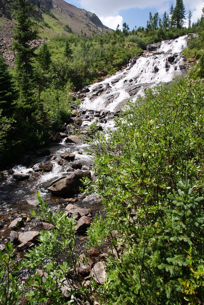
The road continued beyond so we could hike side by side. We soon came across some stream crossings & then waterfalls as we made our way up into the Basin.
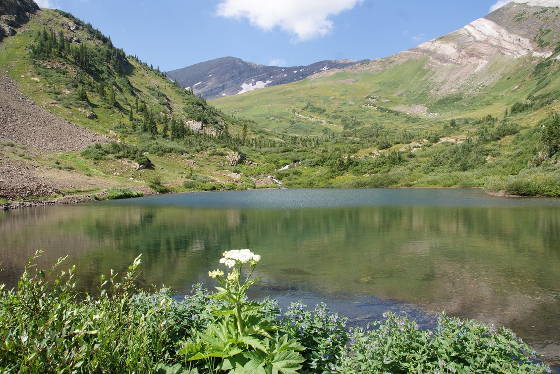
The trails were faint & after starting & stopping & turning around on the one that disappeared, we backtracked & went down to another trail that goes through the middle of the Basin. It was really, really pretty. There were a couple of other small groups hiking up there, but we were all spread out. We thought there might some lakes around the knob (the one you see in the photo), but we were both feeling the effects of yesterday’s big hike, so after going about 1/2 way up, we turned around & thought we’d come back explore this Basin all the way to the end, another summer.
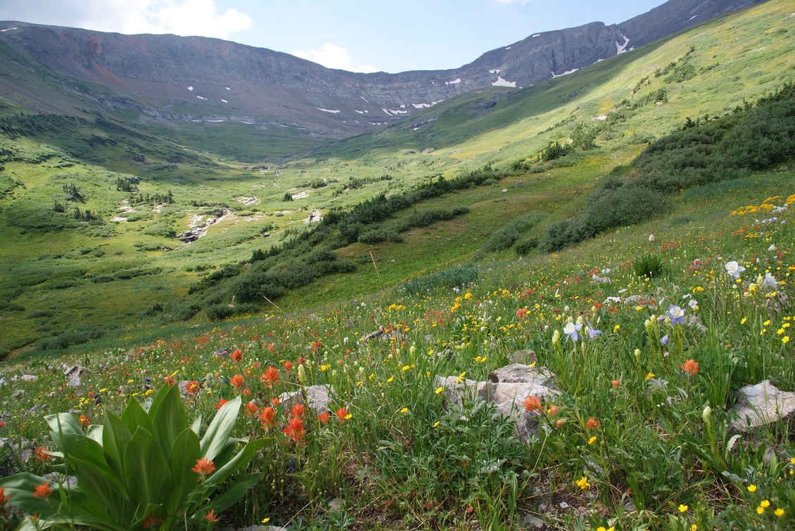
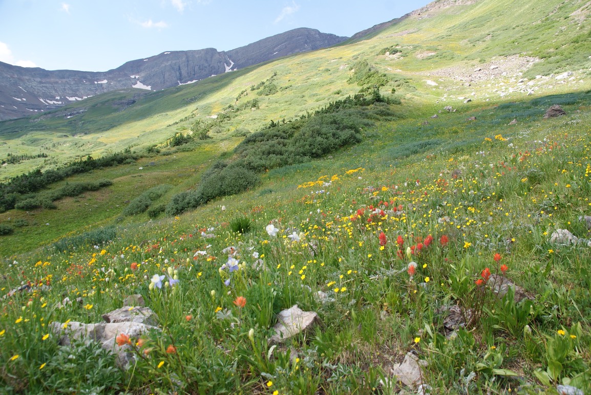
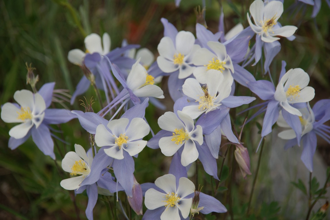
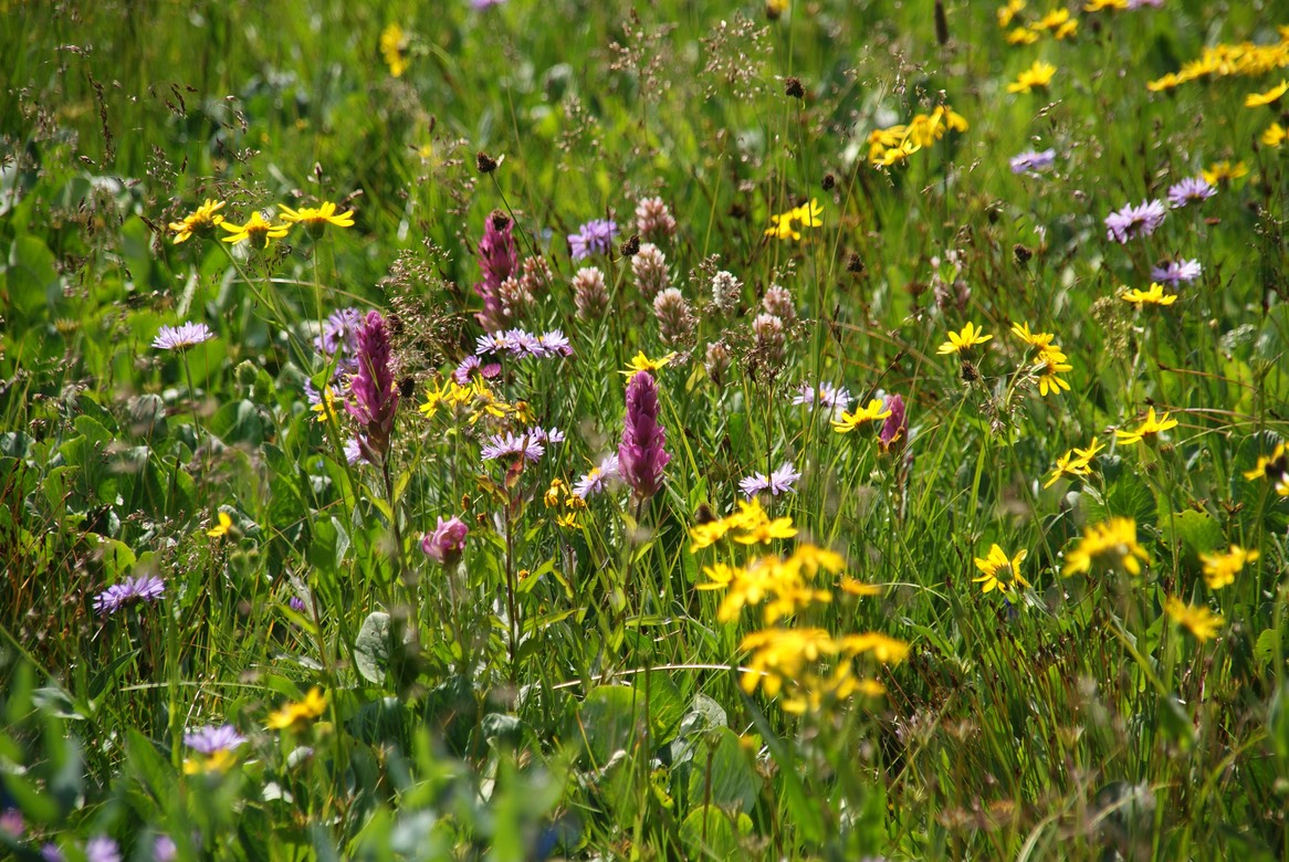
The wildflowers were just amazing!
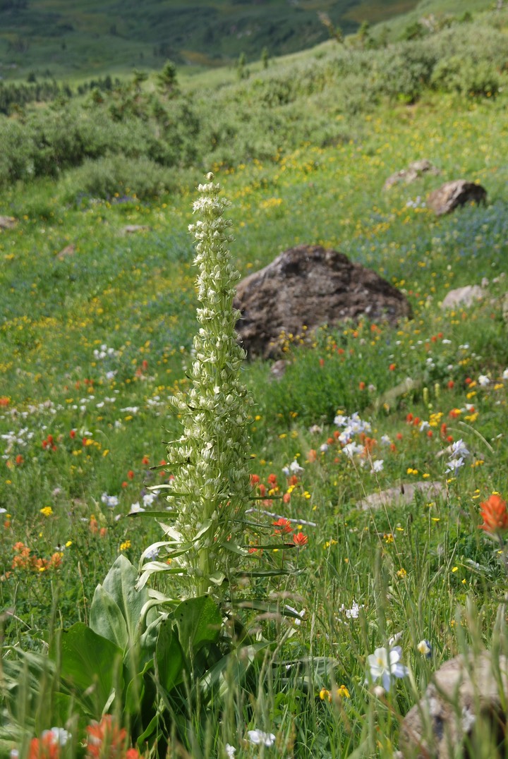
And I found a Green Gentian blooming!
And you could see one of the Maroon Bells as we hiked down out of the Basin.
As we got back to the 4Runner, I handed over the keys to Danny. He didn’t mind driving back down the steep, narrow & rocky road & I ALWAYS learn from him when I’m sitting in the passenger seat. We stopped at RMBL’s Visitors Center on the way off of Gothic road & I said hi to Greta (whom I’d met last year) & to Rick & introduced him to Danny. I also said goodbye knowing we were leaving CB soon (very very sad face!). I did ask one of the guides there about how to get into Virginia Basin. He’d been there once, 10 years ago & had just bushwhacked his way up there. After looking at our map & views from afar, I had suspected we didn’t hike high enough before…& I’d mentioned the new way I thought we might find the trail. He wasn’t sure. But, as we were changing out of our hiking shoes in the parking lot, he excitedly came back out with some news. He’d pulled up a Google Earth map & thought he’d found a trail up there. Now we had a new plan to find Virginia. He made me promise, if we found a way in, to come back & give him the details. I’d happily do that!
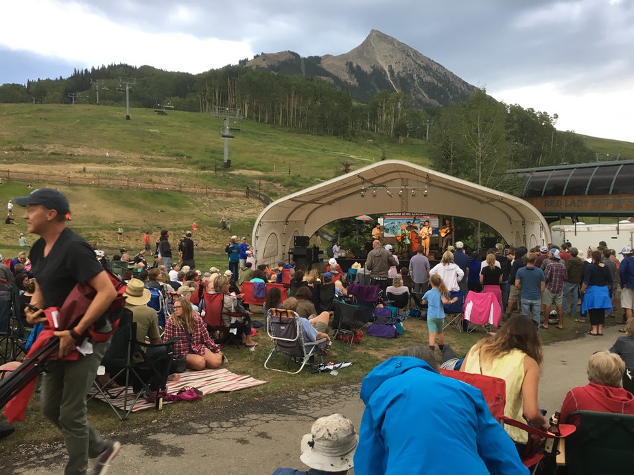
We went to Momo’s for lunch, stopped by KBUT (the local radio station) to report my necklace lost (they do a lost & found program), then we went to the Dogwood Cabin for drinks. Dillon visited with us a lot, telling us about his latest adventurous backpacking trip (new places for us to explore!) Then I gave him a hug & we said goodbye. He’s not sure if he’s staying in CB for another summer or not. But, I can follow his adventures via Instagram. It’s been so much fun getting to know him better. Even though we hadn’t hiked more than a few miles today, we were still pretty tired. It had been pouring rain outside & we didn’t know if the concert up at Mt. Crested Butte would be cancelled or not. Everyone seemed pretty excited about the entertainment…Peter Rowan, a blue grass guy. The rain tapered off to a sprinkle, then mostly off for the whole evening so we enjoyed our time at the base of the mountain listening to the music. I saw Talie & introduced her to Danny (he’s heard soooooo much about her! I a huge fan!) We visited, hugged & said our good byes. She’s off to New Zealand again in the fall with many, many other adventures in her future plans. We’ll definitely keep in touch!
The temps were dropping, the forecast was worse than ever & by the time we got back to camp it was sprinkling again. Danny read for a while & I downloaded all my photos & worked on the website until my computer ran out of battery. The rain continued through the night. We were thinking ‘Plan B’, but neither of us want to leave Paradise yet.