day 4 . July 7. 2009
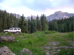
Today's trail is named "Molas Pass" trail. It was just down the road from my campsite last night.
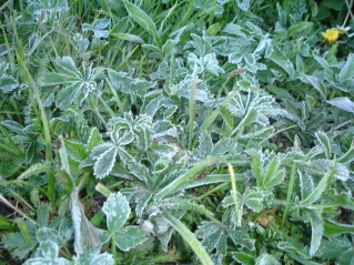
Last night was the coldest it's been so far at night, and I knew it wasn't just me, when I started out on the trail after 8:30 and there was still frost on the foliage.
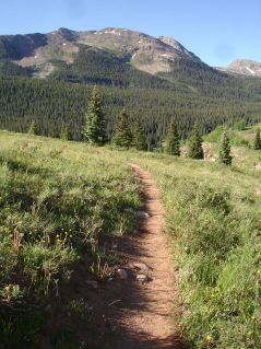
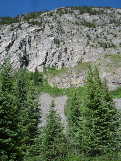
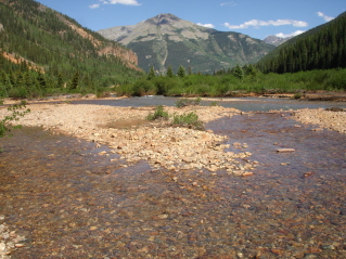
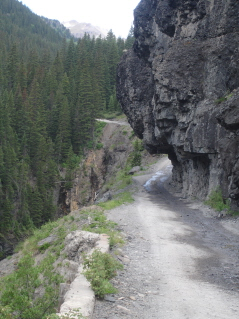
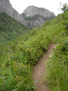
The trail was nice and wide open, starting at 10,600' elevation and dropping a whopping 1,700' to the canyon and the Animas River (the same river I saw yesterday).
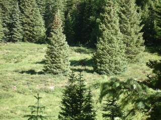
As I entered the first forested part of the trail, I heard a thunderous hoof sound off to my left in the meadow. I peeked out and climbed down over some fallen tree trunks and spotted this female elk! I slowly got out my 35mm camera with the zoom, and managed to snap a photo right as it was running off...I was so amazed at how loud one elk was!
I meandered through the trees for a little while, then the trail began to drop...and drop...and drop.

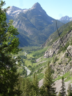
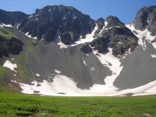
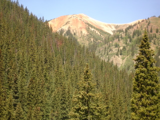
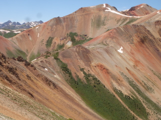
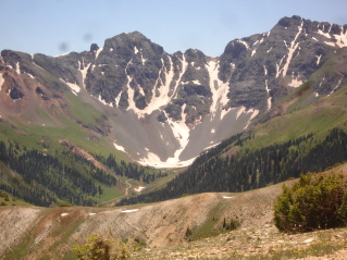
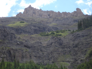
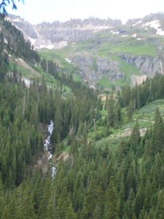
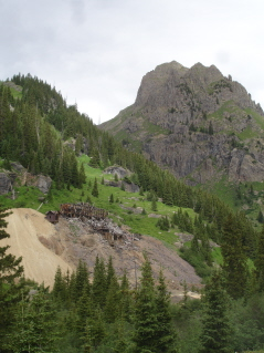
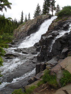
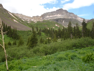
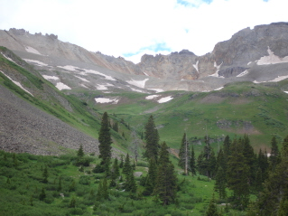
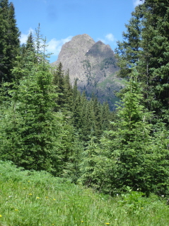
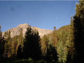
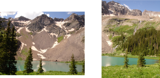
As I came around one switchback, I was rewarded with this really big view!
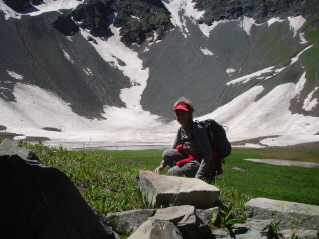
On my way down, I passed a couple of backpackers who had been out on the trail for 6 days. I didn't envy the final part of their trip...having to climb 1,700' with backpacks on. One of them I visited with, Stace Hardin (don't know if I'm spelling that right) was from Beaumont, TX and loving being in Colorado....he was contemplating staying another couple of weeks, so we visited about great hiking spots in this awesome state....I hope he has a wonderful time hiking!
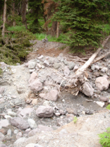
I had one small creek crossing (and no sandals with me) which was pretty easy but freezing cold!
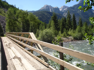
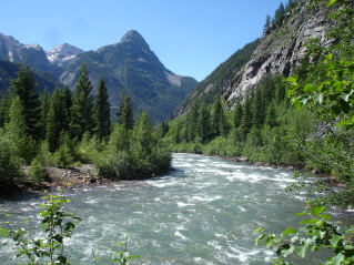
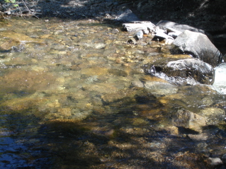
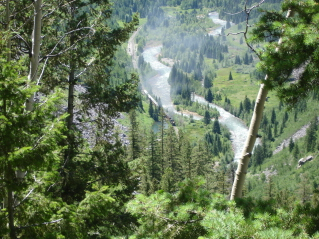
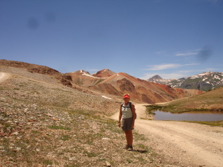
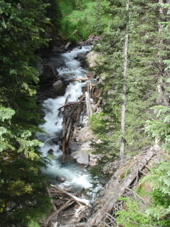
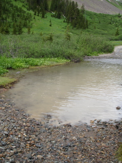
I made it to the bottom, crossed the bridge and stared at the beautiful, violent, crystal clear river.
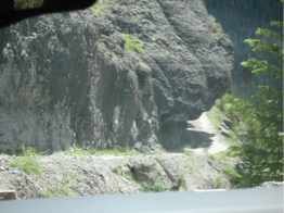
The DSNG train tracks that follow the river; looking straight up to this big, huge, mountain...you feel pretty small down here. The trail followed along side of the tracks, then crossed them, went up into the forest and continued on. I turned around after about a mile, and was preparing myself for the climb up.
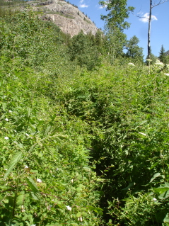
This is the kind of trail I REALLY DON'T ENJOY!...all enclosed and you can't see ahead or see what's underneath you (usually big rocks and mud). There was only a short section like this today.
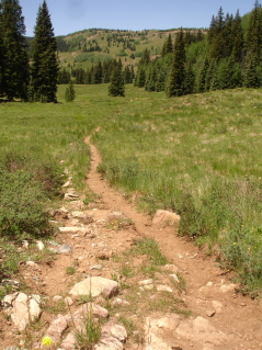
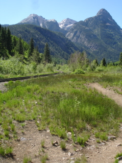
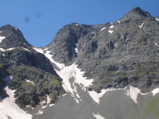
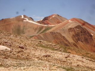
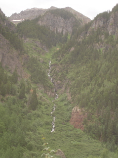
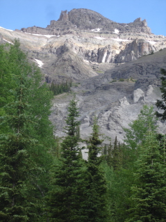
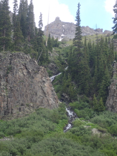
As I climbed the switchbacks, the only noise I heard was the train whistle and made to the edge in time to see the train along the tracks (and all the smoke it was spewing out). The pic on the right is of the trail through the valley, heading back towards the trailhead.
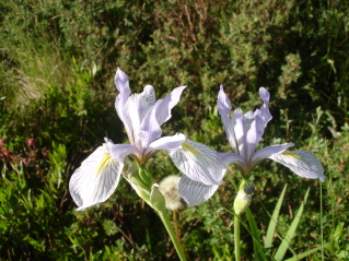
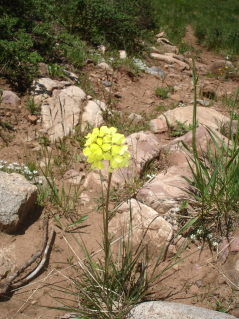
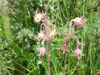
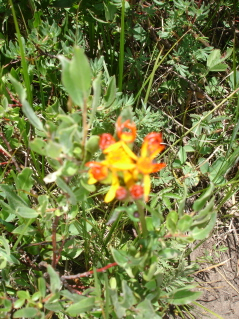
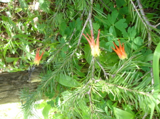
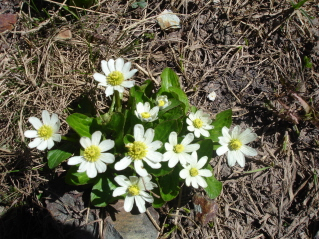
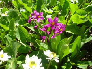
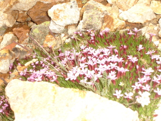
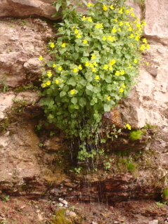
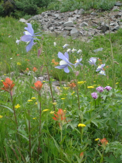
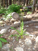
Today's wildflower pics...the one on the left is a wild Iris....so magnificent!
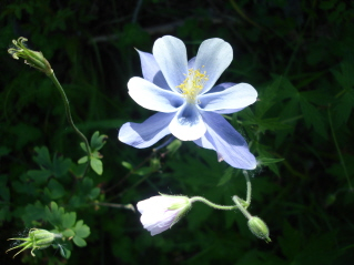
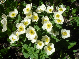
And, my favorite and the first one I've seen on this trip...the Columbine.
I left the area and drove to Silverton, where I'll be camping for at least a couple of days (and I'm out of ice).

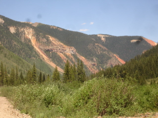
I'm camping just outside of town, down a popular dirt road with 3 pay for camping areas. The road is lined with waterfalls, red colored mountains, and tons of avalanche chutes.
The road is called "South Mineral" after the creek that follows along the road.....here is the one next to my campsite....
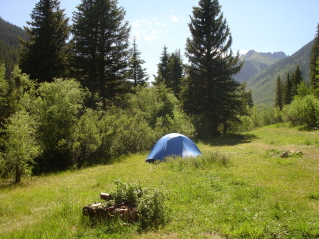
...which is free! This area also offers "dispersed" camping...which means pitch your tent where you can...so I did! Lovely, isn't it?
*****
day 5 . July 8. 2009
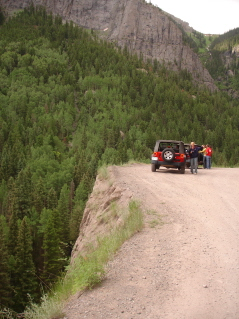
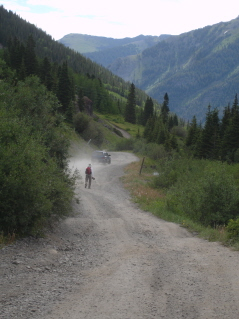
Last night was the first night I didn't sleep great and so I changed my plans for the day. I treated myself to a simple breakfast from the Brown Bear Cafe in Silverton, then decided to explore a little and drove up to the Silverton Ski Area...it's pretty unique compared to most ski areas...but is in no way a "resort" but instead for the hard-core backcountry skier. Anyway, I drove along a nice gravel road, with beautiful views all around. As I got to the end of the road, I noticed two dirt roads going in opposite directions. One was skinny and twisted up and out of site; the other looked like it ended at the base of a really big mountain. So, I got out my 4WD book and tried to find them in there. Then a great big red truck exited for the "base mountain road", so I waved him over and asked him the condition of the road....there were three guys, a little younger than me and a young boy in the truck and they all told me what a great road it was, how easy it was, etc. and the lake at the end of the road was so beautiful. The driver owned a cabin up the skinny out-of-site road. So, I decided to try it (okay, this is where I need to STOP AND REVIEW who gave me the info (a GUY in a BIG TRUCK); how used to these roads is the source (HE OWNED A CABIN UP THE MORE SCARY ROAD) and finally, my backcountry 4WD experience (I'VE DRIVEN IN REVERSE ALMOST AS MUCH AS I'VE DRIVEN FORWARD)....but I didn't do any of that. I went forward...and for awhile the road was fine...just bumpy.
Then it got really rutted (actually had orange cones on one side...the side that didn't drop off 70'; and by the way, I did ask the guy if there were any "shelfs" that dropped off a couple of hundred feet? He said no...next time I'll rephrase the question to "Are there any shelfs or drop offs?" ....because really 70' or 500'....I don't think it would really matter to the driver!) and went around a blind corner...so once again, I found myself asking myself questions....is this the WORST it is? is ANYONE else coming around the curve? and would I have to back up around the curve and through the ruts? My answer to myself was to back up NOW...which I did, and found a wide spot to park my car in....got out my pack and began to walk. As it turns out, the road only got a little worse around that curve, then it was fine....but I kept walking.
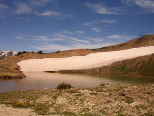
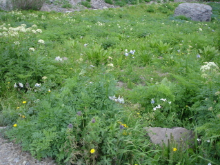
It was worth the walk, as there was a wonderful, still mostly frozen lake at the base of this big, gray, rocky mountain...and all around the base were tons of wonderful wildflowers.

As I was walking down the road, I saw another person way to chicken and scardee-cat to drive this road...no, no, what I meant to say is a fellow hiker who enjoys hiking 4WD roads. I've never run into another hiker on a 4WD road before. As we got to visiting, he told me his truck was parked at the very beginning of the road (he was afraid to drive it up there at all).
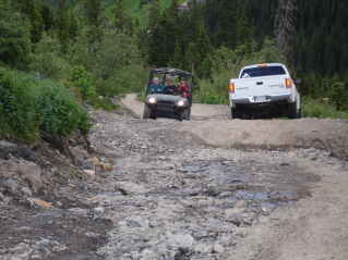
Anyway, I hiked back down to my car, and drove down the road, and returned to the pullout I was at before I went up the road. Then I started looking at the skinny and twisted up and out of site road...not to drive, but to hike (I try not to be STUPID more than once a day). And, so I ate a snack, put my pack on, and began the stroll upwards....and up and up...I was passed by lots of jeeps and 4WD vehicles, about every other one had a tiny little foo-foo dog who would stick it's tongue out at me as it passed and I know it was thinking..."I'm in a nice car, enjoying the ride and you look like a sweating pig"...but maybe that's not what the little dogs were thinking (the people riding in the vehicles probably were).
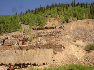
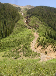
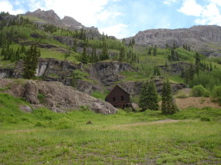
The views were really pretty and there was a huge old mining site, and soon I came to a turn off in the road, to Corkscrew Gulch, or I could continue on straight...which seemed to go on forever and I knew I'd never make it "anywhere". This is something I've learned since I've started hiking these 4WD roads....you really learn to enjoy what's around you...because these roads are usually so long, you can't get to a certain destination. The two other things I've learned are: 1. You get a little envious of those people passing you, driving with so much confidence; and 2. you get really dirty; all the dust they stir up as they drive past you, sticks to your sweat.
I decided to make the turn and go up Corkscrew. I panted my way up the narrow path...and found a bathroom!
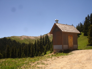
(There's never one there when you need it and one nice one here when you don't!)
Here's another thing I've learned about 4WD vehicles...they come in all sorts of shapes and sizes. Mostly there are jeeps, and lots of super great Toyota 4-Runners, then you get a few random other SUV's, you get ATVs, and then there's a whole bunch of things that look like 4WD golf carts, go carts, fun rides at the carnival; it's really weird, but everyone seems to be comfortable in whatever their driving and it is a source of entertainment for me as I WALK.
So, to go on, as I was walking by the bathroom, 2 men, in a little souped-up rugged looking golf-type-cart, jumped out and asked me to wave...they were taking MY picture (it's usually me always taking someone else's picture)...they said they'd never seen a hiker this far out (did that mean distance or that I was just cool?)...anyway, we visited for a couple of minutes. They told me the trip to the top of the pass would take me awhile...since it was a very steep road, but that the views were fantastic. So, how could I stop? That thought, spurred me on to continue.
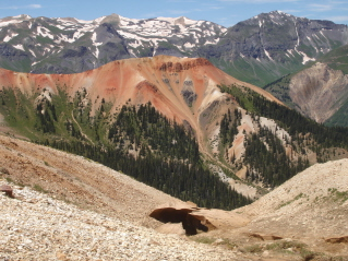
And I was sooo rewarded for my efforts! It was magnificent and breathtaking. The red in the mountains around Ouray are just amazing. So, I sat and ate my lunch and enjoyed the area....then started back down.
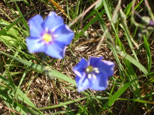
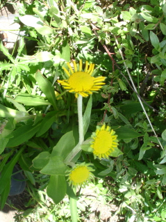
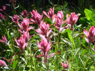
These little beautiful flowers kept me company while I ate lunch.
This is looking across the valley, back towards the little frozen lake I'd driven/hiked to earlier today.
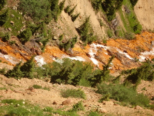
There is a lot of "orange" around here...this is looking down off the road to the creek below and you can see that all the rock in the creek is orange. I'm sure there is a scientific/geology term for this, but there are huge areas of orange along this road.
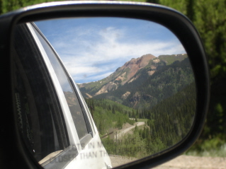
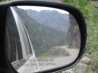
My first "rear-view" mirror shot of the trip.
One big thing happening in Silverton beginning this Friday is the Hardrock 100 Endurance Run...one of the toughest races in the world. The participants have a total vertical climb and descent of 66,000 feet and the runners have 48 hours to complete the circle. Wonder what those bodies look like?
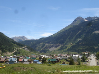
This is a shot of the town of Silverton, coming back down from the ski-road. As I've said in past trips...I don't love this town; the restaurants don't seem very good, the people aren't friendly (except one guy who was super-friendly and it creeped me out), and the stores are all t-shirts, ice cream and native american jewelry....however, with that slamming narrative said, the mountains and waterways that surround this area are breath taking. So, be sure to visit Silverton if you're ever out here....just bring your own food, don't expect a smile and keep your credit card in your wallet!
I'd had a great hiking day, and left the little town on my way to Ouray.
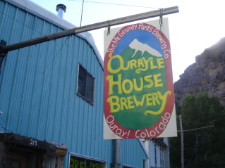
There is this little odd kind of brewery here....I enjoyed a beer, the atmosphere (unlike anything I've seen before) and visited with the owner/brew master who gave me some great camping and pizza-finding ideas. Then, I went a got a slice of pizza and a salad (YUM! first greens I'd had since last Thursday!) and then went to find a campsite.
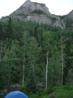
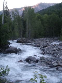
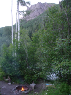
So, I've popped $10 bucks for a campsite tonight, and may stay here again tomorrow night. It's out off a gravel road and I grabbed the last site. It's next to this huge, loud, but beautiful creek. I've built a fire, and settled down next to it with my book.
*****
day 6 . July 9. 2009
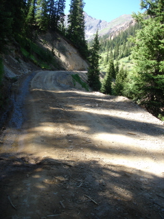
The gravel road I'm camping off of, leads to a 4WD road that is one of the most popular in the state...it leads to Yankee Boy Basin...a place I've been hearing about from other hikers for a couple of years. The book I have (not to be trusted by a flatlander), says the beginning of this road is easy; however, there is a warning to "not be complacent, as there are drop offs that some people have missed"...this makes me feel sooo confident. But, I drove up it anyway...looking to the jeeps ahead me to see what the road was like.
Really cool hanging flowers off the side of this rock wall, with a little waterfall coming out the bottom...however, this was not the place to be distracted,
because on the opposite side of the road is a place called "the drinking cup" with quite a little "edge", but it was wide and not terrifying.
This road was lined with amazing waterfalls....only great if you're the passenger....drivers should be looking at the road!
A narrow and curvy section of the road came next, but I drove it. Here is another rear-view mirror photo (I did STOP the car while taking this pic, just so you're not worried about me driving AND taking photos at the same time!)
Then I got to the part of the road, where I pulled over and parked my car, got my pack and began to walk.
This part of the road is called "the shelf", since I WASN'T driving, walking under this was a piece of cake...I'm short after all.
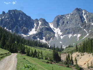
I can see why this road is so popular, the views everywhere are just wonderful. Huge, sky-reaching mountains, loud and crystal clear waterfalls and streams and gorgeous wildflowers...are surrounding you every way you look.
Meanwhile, tons of vehicles passed me.
I did see another hiker on the road; he just sort of waved and said it was a long way to the top.
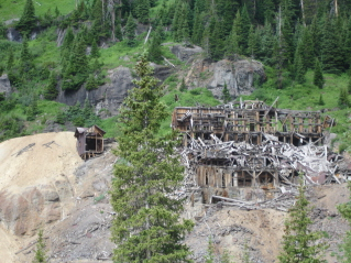
Lots of old mine sites along the way.
At this point, I was doubtful I would make it to the end of the road; I was tired and I had a long, long way to go. So, I told myself I would hike to the place called "Twin Falls" and then review my energy level, the weather, etc.

The falls were wonderful, but the wildflowers in this area are unbelievable! Tons and tons of Columbine, but tons and tons of so many different kinds of flowers....really great. These pictures don't do the flowers justice...they were just perfect.
Meanwhile, the traffic continued, and most people turned around at the falls. I couldn't help but watch as two vehicles met, in a really crazy spot...they passed just fine...and I realized I was probably more nervous watching than they were....I really need to get this fear under control.
I continued to hike, trying to see how far I could get. I passed a sign warning drivers that the road gets worse and it did. There were huge rocks to drive over and giant ditches to drive through. Then I came to this water...about knee deep in the middle. I tried to see if I could go around it without getting too wet, but decided this would be the point to turn around. I was disappointed, but I'm hoping I can come back someday and make it all the way to the basin.
I did snap a few photos from the closest point I reached....someday, I'll be back and make it all the way to the top!
I turned around and began to hike down.
As I passed the Twin Falls on the way down, a Toyota 4Runner stopped and asked me if I wanted a ride down....I said "you bet" and jumped in. I recognized the driver, because I had noticed her when she passed me on her way up the mountain; she had white hair and drove with a smile...I thought then, wow!
Well, these women are AMAZING! Meet Betty, Gerry and Roberta (they call her Bert).
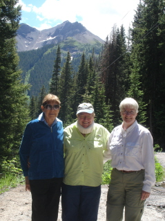
They were so friendly and nice, and I enjoyed my ride down with them so much. The were heading up another 4WD road, and I was going to get out and walk back to my car from there; already so glad to have met these women even in the short time we visited.
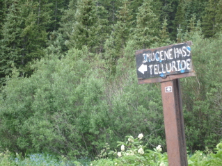
Then we came to the turn of for Imogene Pass (I had hiked part of this 4WD road from the Telluride side last year)....and they invited me to ride along with them. They weren't sure at the time if they would go all the way to Telluride or turn around and come back. If they decided to go onto Telluride, I would just get out at the top, and hike back down (they had saved me miles hiking by giving me a ride down from the falls, and these women energized me so much, I could have hiked all the way back from Telluride!)
And BRAVE...Oh my Gosh! I don't know ANY OTHER WOMAN as BRAVE as Bert, and Betty and Gerry were so confident too....I was in AWE!
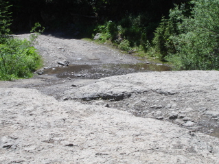
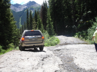
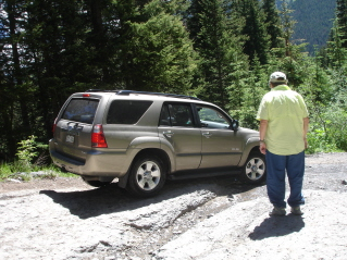
The pic on the left is one of several obstacles we came across, and they would just review the situation, then go forward...in expert fashion. So FEARLESS....I was like a kid in a candy store...only this was way better than a candy store. These women are who I WANT TO BE! They go out every weekend in July and August driving these roads.

Views along the way. We did end up turning around, Bert deciding she'd try this pass another time.
Then, Bert pulled off the road and we had a picnic! The conversation was so wonderful and these women are truly enjoying life and the beauty of this wonderful state (and others too...they also go to Utah to see the country!) This is they're car...and they love it.
The view of "the Shelf" on the way down.
They dropped me at my car; we exchanged email and phone numbers and they made me an offer to come visit them in Grand Junction and to meet up again with them in a couple of weeks for another 4WD road. I don't think I'll be back in Silverton then, but I'd bet that sometime, I will end up in Grand Junction. When Bert got out of the car at my drop off point, she said to me "Now, Vicki, I bet you could get in your car and drive all the way to the falls"....my response to her was "How did you get so brave...were you always this way?" (and I knew I couldn't do it...not by myself...there's that getting near the edge-part on the right side of the car...the part you can't see when you're alone....well anyway...that's my excuse and I'm sticking to it!)
But the smile on my face was huge....this is the best part of solo-travel....it's the people you never expect to meet that make such a difference! And I won't ever forget these women...I wish them sooo many more wonderful, exciting and adventurous trips together...they're great!
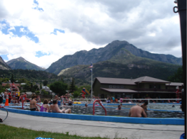
Okay, this picture looks kind of dorky after all the magnificent scenery I've seen on this trip and then posted. But, after 4 days, I needed a shower...the creek-bath I had, just didn't cut it for very long. So, I bought a day pass at the Ouray Hot Springs, went in took a shower (washed a pair of hiking pants and a couple of pair of socks too) and then sat in the hot springs for a little while.
I'm now at an Internet Cafe in Ouray. I'll post this and then maybe eat dinner, but will probably head back to the hot springs for sometime this evening, then back down the gravel road to my little tent. The hike I have planned for tomorrow begins right across the road from my camp ground.
*****
day 7 . July 10. 2009
So, let me tell you what happened at the Ouray Hot Springs Pool last night....I'm soaking in the hot water with a killer view of the mountains, (really great) and I recognize this guy sitting across from me with his wife. I'd seen them earlier today up on the 4WD road and they'd spoken to Bert as we passed. Then she told me they were from the Kansas City area. So, of course, I asked him if he was from KC and they are actually from Overland Park. We had a nice long chat and visit. (They knew one of our counselors at the college, and spoke very highly of him.) After my skin was all prunee, but muscles quite relaxed, I said goodnight. What a small world!
Wilderness-Starbucks
The name of the trail I'm hiking today is "Weehawken" and the trailhead is directly across from the campground I've been staying at. The trail...as always, starts out climbing up.
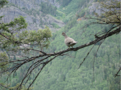
I think this is a grouse...whatever...it's a pretty large bird (I've seen them out here in Colorado on other hikes). I jumped as it flew out of the brush next to the trail when I hiked by!
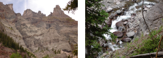
here were some pretty cool rock formations on the top of the mountains.
The trail rose above the creek, then dropped down, then rose again; so the sound of the flowing water followed me on my hike.
The trail started out climbing through as aspen forest, then just a dirt trail and then scree (I don't love scree), so I slowed my pace in hopes I wouldn't fall. The trail just got more "adventurous" the farther it went. There were about 6 of these drainages/ditches/dry creeks/whatever you call them, that you had to go through. So, the trail would DROP down (a couple of times so steep I just slid on my butt), and you'd have to follow rock cairns to find the trail; but mostly it was just the "slide" factor that was challenging.
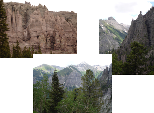
The formations in the mountains were pretty cool. These are some of the views on my way back on the trail.
I've done so much great hiking in my first week, but I'll admit this was my "least favorite" trail. I had to be sooo careful on the scree, and I was pretty dirty by the time I climbed, slid, crawled out of all those ditches! Back in the car, I said good bye to Ouray....I'd stay longer, but I wasn't going to pay more campground fees, and it's against the law to sleep in your car in the city limits....I could take the chance, but I decided it was time to move on.
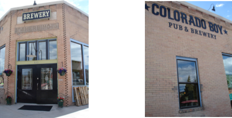
The next town up the road is Ridgeway...which happens to have a new brewery. I had a wonderful Hefeweizen. This is little brewpub is really cool on the inside...I would have like to try another brew....but thought I probably shouldn't since I had a little driving to do to get to my next campsite.
I was headed towards "Blue Lakes" trailhead...down an 8+ mile dirt/gravel road...which as it turns out, was really nice...a little bumpy towards the end, but it gets you really close to the mountains....so magnificent.
The hotel Mazda, tucked in for the night.
*****
day 8 . July 11. 2009
See the almost-full-moon? I started the hike about 7:15am and the moon was still shining above the mountains.
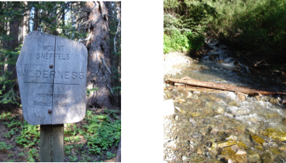
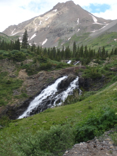
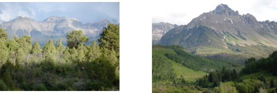
Today's hike is in the Mt. Sneffels Wilderness Area; the mountains are big, gray and still snow-covered; my first creek crossing.
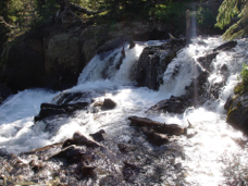
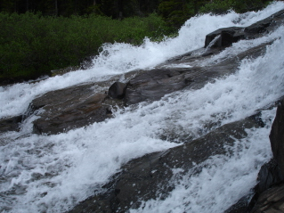
Tons of water! Lots of water falls and fast, furious flowing creeks.
When I was at the trailhead, another solo hiker pulled up, jumped out and began hiking. About 1/3 of the way up the trail, she was taking a photo of some columbines and I caught up to her. She introduced herself....Joanne from Bayfield, CO, and we ended up hiking the rest of the trail together. It was really nice to hike with someone, and we found we have a lot in common...such as our thoughts about 4WD roads and crazy stream crossings.
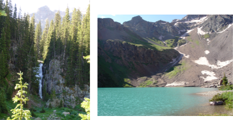
Another waterfall; Blue Lake (the lower one) was so incredibly blue!!! It was just beautiful!
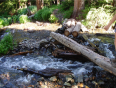
The second stream crossing...balancing across those logs!
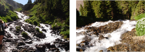
We decided we hike up to the Upper Blue Lake...until we came to this Waterfall to cross....the pic on the left is the area to cross on...wet rocks covered in fast flowing water...the pic on the left is the DROP OFF GOING DOWN HILL! So, in other words, you wouldn't just get wet if you fell in, it would be like a bad water ride at a theme park! We assessed the situation, then turned around and went and at lunch at the lower lake
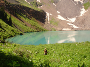
Me in front of Lower Blue Lake.
More views of the Lake. You might not be able to see it very well, but there was this huge long waterfall coming down the mountain and into the lake (pic on right).
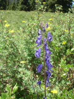
Eye candy!
This is the tallest dandelion I've ever seen (and I needed an excuse to stop and catch my breath while climbing up all the switchbacks!)
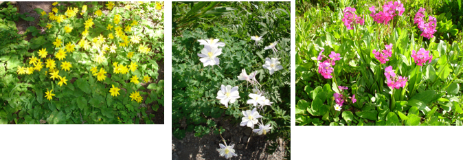
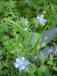
Today's wildflowers...the columbine are everywhere....more and more flowers are blooming everyday!
I'm currently at a coffee house in Ridgeway, using their internet and electricity. I'll head back up the 8 mile road this evening...the trail I've chosen for tomorrow, begins at the same place as today's.
hope all is wonderful in your life!
later,
v.