day 20 . July 23, 2009
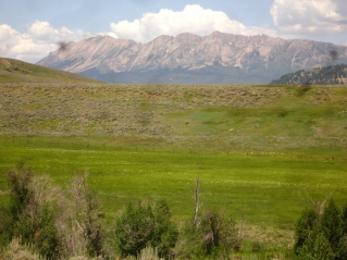
This morning's hike took me about 45 minutes southwest of Crested Butte, down Ohio Pass Road into the West Elk Wilderness.
Danny and I did a backpack loop in this area a few years ago.
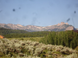
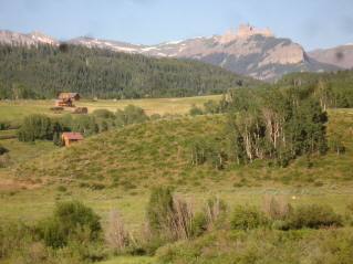
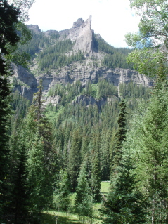
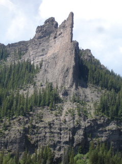
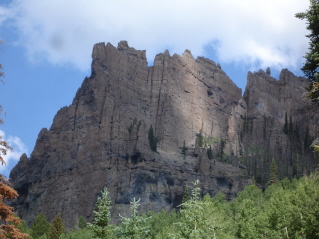
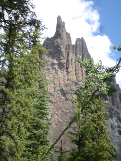
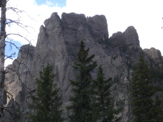
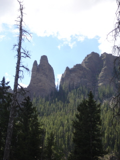
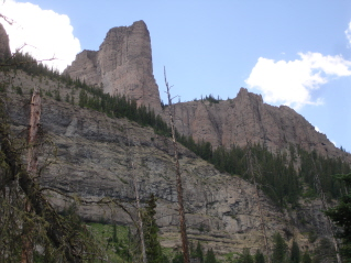
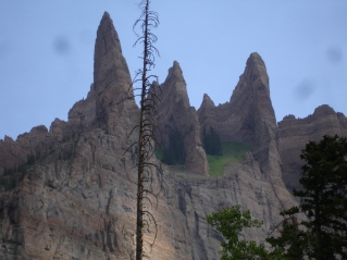
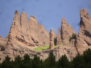
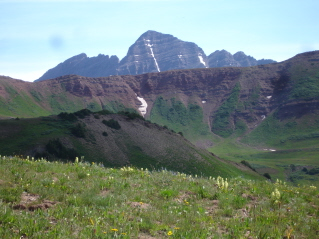
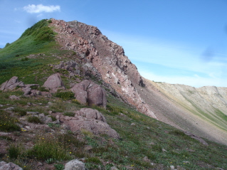
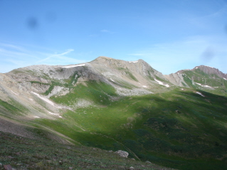
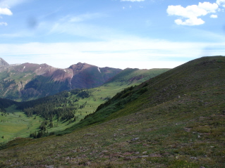
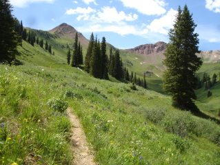
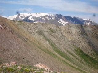
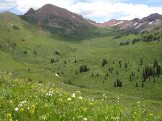
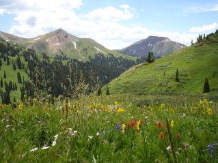
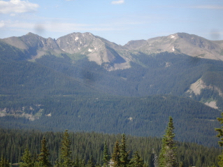
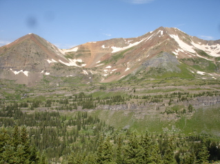
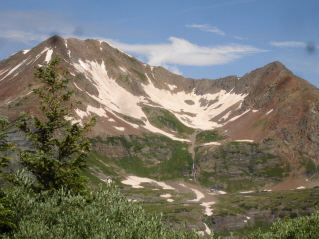
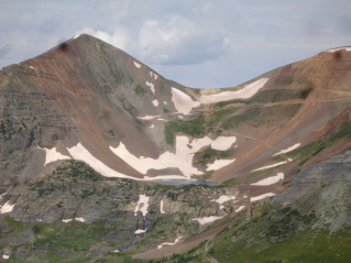
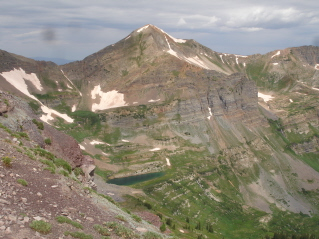
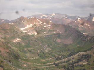
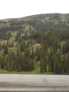
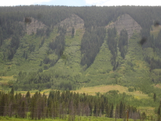
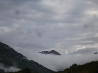
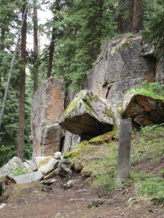
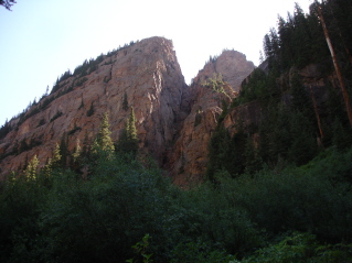
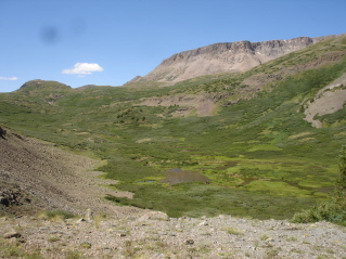
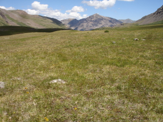
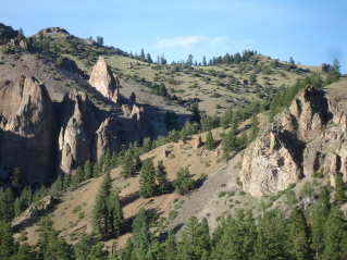
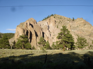
These are some of the views of the "Castles"; rock formations that this area is known for.
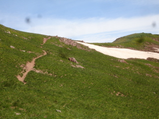
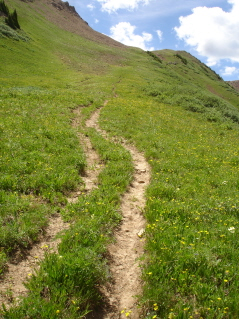
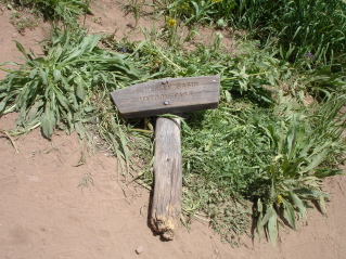
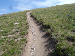
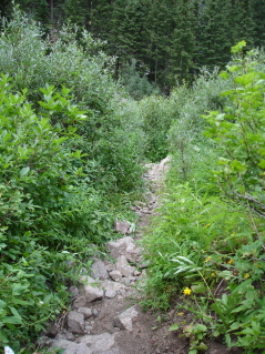
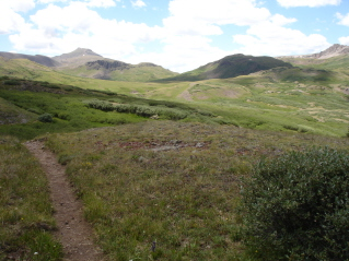
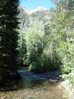
So, once I made it down the forest road, I encountered the very familiar sign "Narrow and Rough Road Ahead"....and as always, I ask myself, "could I drive this road?"; "will my car plummet 500' off some shelf?"; "can I drive this in reverse as well as in forward?"...and so, as usual, I walked. One mile later, after walking a pretty good road that I'm sure I could have driven, I made it to the trailhead. This trail is named "Mill Creek"...you guessed it...Mill Creek runs along the trail (they're very creative here in Colorado!)
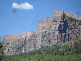
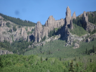
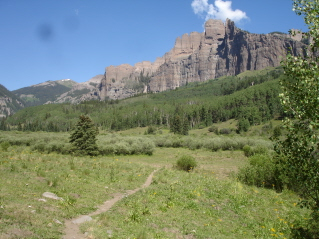
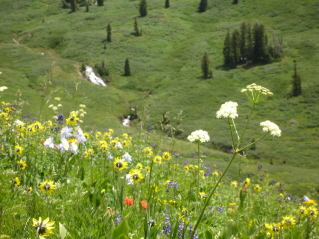
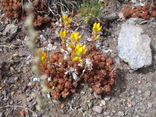
This hike is all about the rock formations...no wildflowers today. I think I saw about 4 (okay, maybe a few more, but not hardly any).
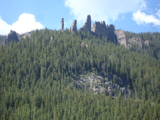
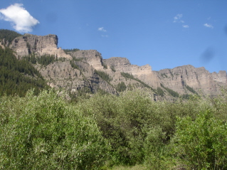
So, I have a bunch of "rock formation" photographs...you can see some will be the same, only they change as I hiked closer...take a look.

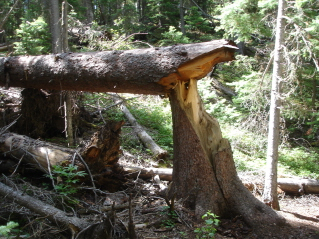
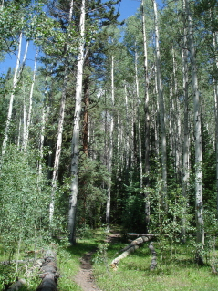
The trail first started on the road (unless you drove it), then just on a dirt trail; then I had a stream crossing (Mill Creek; left pic), a really large "broken" tree (center) and then into an aspen forest (right pic) with glimpses of the formations every once in awhile.
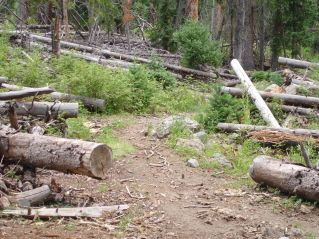
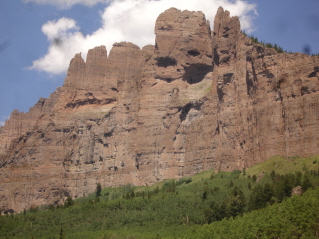
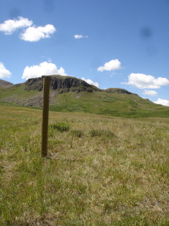
Then I hiked through a "deadwood forest" (my term, I'm not sure what it's really called). I'm not sure why, maybe it's because I don't think they're pretty, or that I wonder when do all these trees fall down (hopefully when no one is around?), but it seems the perfect place for something to jump out at you....kind of dark and creepy. After this section, the trail opened up for me to take close ups of the formations. This trail actually goes in 8 miles to Storm pass.
I knew starting the trail this morning, that I wasn't going to hike up to the pass. I hadn't slept well last night, and was already tired when I WOKE UP this morning...but I kept hiking, a little further than I intended.

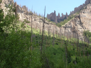
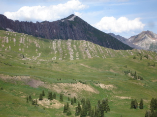
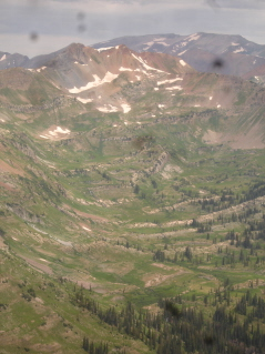
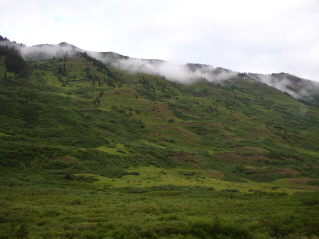
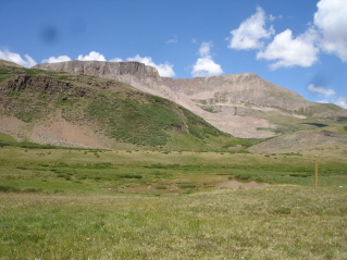
These pics are kind of neat....there must have been a fire here at some point. You can see (pic on left) all the burnt trees and the small and short foliage beneath them where it's re-vegetating; See the tall burnt tree? (pic in center) and the bright green grass growing in between the rock formations; you can also see it in this pic (on right).
One last look as I hike back towards the trailhead.
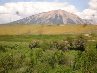
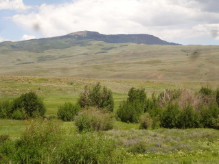
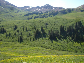
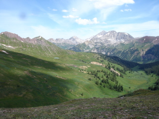
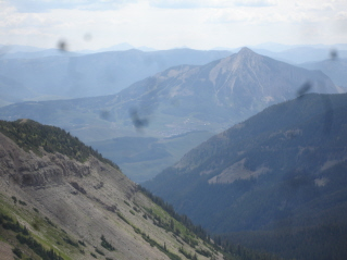
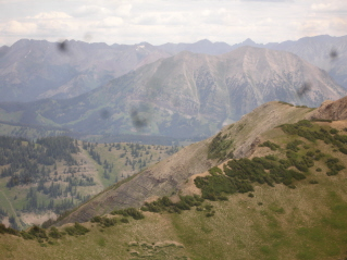
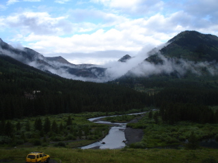
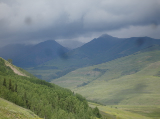
These are really cool views of the valley. I didn't notice them this morning when I was driving to the trailhead, but they are amazing...so I took these while I was driving towards Gunnison. The mountain (left pic) is looking back towards Crested Butte...but notice the field that sits beneath it (acres and acres) filled with yellow flowers; (pic in center) shows all this beautiful open space...it's soo hilly, but there's so much of it; and behind (pic on right) this hill, sits more of the Crested Butte mountains.
After my visit with Stacy (she was the sister from Gunnison) I decided since I was only about 15 miles from there, I'd take the afternoon and tour the town a little. When I leave Crested Butte (I know, some of you think I never will) I won't be going the southern route through Gunnison...so I should go now.
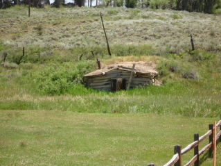
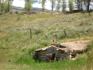
I passed this old sod house on my way to town.
Stacy told me of two neat sounding re-sale shops; one that sold used sports/outdoor gear and one that sold clothing.
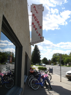
All Sports Replay was pretty cool. I tried some clothes on and ended up buying a pair of capris (they are new) that I've been trying on in the gear store in Crested Butte...they're Prana's and always the same price in any store or on the net....but here...even new...they were $15 bucks cheaper...what a deal!
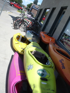
I really wanted a kayak...mmmm...then again, it didn't sound fun going in circles around my pond when I get back to Kansas; actually, that sounds kind of depressing!
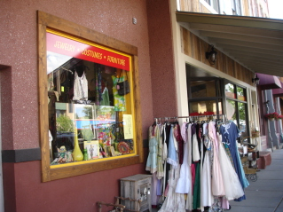
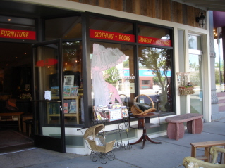
The next store I sought out (which Stacy told me about) was Boomerangs...and it was great. I tried on a few things, but ended up buying only a hoodie (I'm trying to be good...especially since I was about to EAT OUT ....AGAIN!) This store also had a really cool used bookstore upstairs. It was about 3:00 (my lunch/dinner hour), so I asked the owner where I could find really good food here in Gunny (the local's term for the town)...she walked over to the window and pointed across the street to Sugah's Cafe.

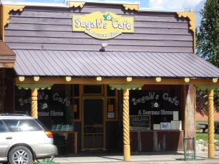
So, after I purchased my hoodie, I strolled across to Sugah's and ordered a tuna burger which came with sweet potato fries....yummy! I sat at their outdoor dining area (although the inside is really cool too) and enjoyed today's meal.
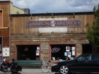
I went into one other shop, but didn't buy anything...and then noticed it was happy hour at the Gunnison Brewery. So, I ordered a pint of their Gunny Pub Ale...it's an ESB. It was pretty good (believe it or not, I haven't had much beer or much alcohol on this trip).
So, now I'm back in Crested Butte, at the little coffee house, computer plugged in and connected to the net (only tonight I'm NOT drinking coffee...I really hope to sleep tonight!)
So....stay tuned...you all sleep well and have super-sweet dreams.
PS: The bears are still all the talk here in Crested Butte...they keep showing up late at night in town, breaking into garages, cruising around the streets, and getting into the trash.
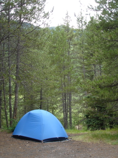
At the campground...we're all just comfortable and safe...no bears.
*******
day 21 . July 24, 2009
Today's trail begins off Schofield Pass/Gothic Road (the one I refer to as the scary road). The name of the trail is Hasley Basin and isn't on the map officially, but several people have told me it was a must do!
Of course, the problem, as always, is how to get to the trailhead. It's 2 miles from the place I'd park my car.
BUT, my day started at the Camp 4 coffee house in CB....WHERE I RAN INTO a biker guy that Kindle and I had had a conversation with on the top of Paradise Divide the day we hiked Yule Pass. We visited about the hike he had told us he was going on yesterday, and then I asked him about "the road"...He said that he and his wife and not found any problems with "the road"....they'd been driving a Subaru. So, the seed was planted....I AM SO TIRED OF HEARING MYSELF SAY THAT I'M AFRAID TO DRIVE IT AND AM KIND OF TIRED OF WALKING THE ROADS JUST TO GET TO THE TRAILHEADS...with that said, as I got back into the Hotel Mazda....she seemed a little bolder, braver, and ready to eat rocks!
And so we did...we drove around the scary shelf....and we drove over the deep ruts....but we didn't drive through the deep water, but were just on the other side of the trailhead, so we parked the car in a nice shady spot....she rested while I hit the trail. WE ROCKED!
The trail to Hasley Basin begins at the same trailhead as the super popular hike to West Maroon Pass. So the trailhead parking, looked similar to a mall parking lot, with lots and lots of cars (I know...they all drove through the deep water!).
The trail starts in the forest, but then quickly heads up hill. You pass this old cabin on your way up the trail.
I passed about 6 people who I could tell were not going far on the trail; they had lots of photography equipment and l think they were on a guided "how to photograph wildflowers" tour.
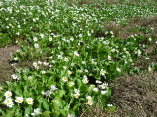
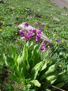
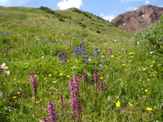
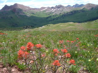
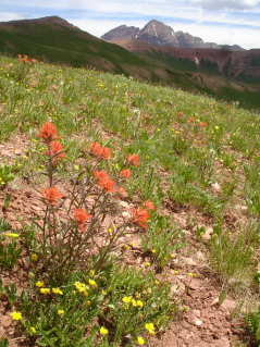
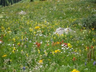
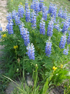
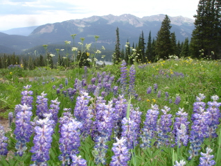
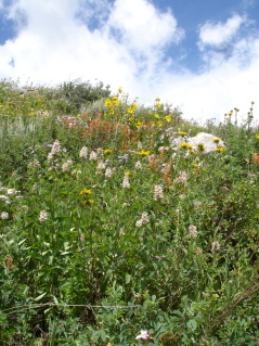
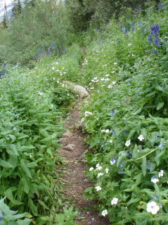
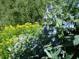
This is the most concentrated area of flowers I have seen so far on this trip....INCREDIBLE!
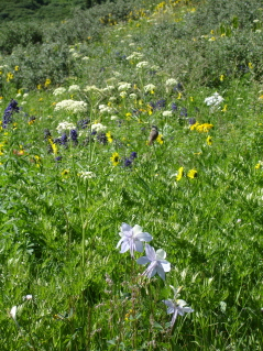
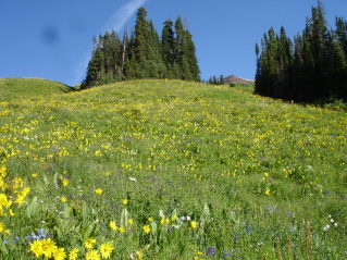
So magnificent! There was just the trail, and all along it were flowers so thick...amazing!
The trail wasn't "officially" on my map...it's shown as an "unmaintained trail"...so I kept looking for the cut off or a sign or something. I thought I remembered how the West Maroon trail went from the backpack trip Danny and I did here last August.
But soon, the trail meandered up to the left (not the way the West Maroon Trail should go, but definitely the way Hasley Basin should go...but I never saw a junction, a cutoff, or really any other choice...so I wondered if I was still on the West Maroon trail....clue #1 that I wasn't sure which trail I was on).

Nothing about this trail was looking familiar (and I can usually remember what the trails I've hiked on look like better than I can remember most anything else...clue #2), but I kept hiking....and I was noticing that I didn't see anyone ahead of me (there should have been about two dozen people...and no one behind me...I knew there were at least 6 people behind me....clue #3)...but I kept hiking.
It was all too beautiful to stop...and I wasn't worried or concerned to be on the wrong or right trail...it was an out and back trail...so if I was wrong or right, all I would have to do is turn around a hike back the way I came.
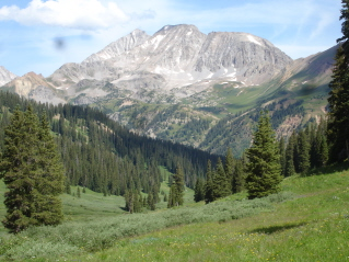
And then I saw this view of one of the Maroon Bells (which always just takes my breath away) and knew I'd never seen it before on the West Maroon Trail....so was I on the Hasley Basin trail (clue #4)...I kept hiking, going up and up and soon I could see a pass in front of me.
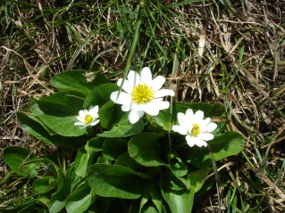
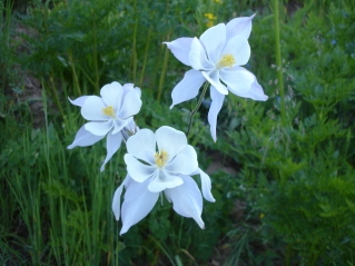
But, before I finished climbing up to the pass, I saw my little "tundra daisies"...and then a whole bunch of them!
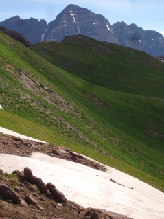
Snow up by the pass.
And I was getting closer and closer to the top of the pass...I knew Danny and I hadn't climbed this pass on last years hike (clue #5)
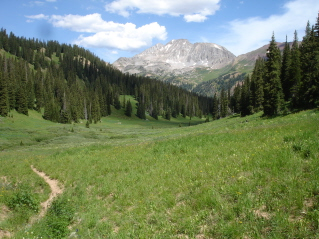
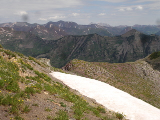
This is kind of my "panoramic" view from the top....just MIND BLOWING!!!!. I knew I'd NEVER BEEN HERE BEFORE (clue #6), but felt soooo fortunate to be here...whether or not I was on the right trail.....this was just the most beautiful mountains and landscape in front of me.
That's when I should have stopped....but it was like a drug pulling me more into the mountains...down the trail...and I mean DOWN...about 1000'....(and after I'd just climbed up to the pass which is about 12,300' elevation).
So, after 5,7987,8908 clues that I was not on the West Maroon Trail (with all the people) but on the Hasley Basin trail, I found myself sitting at the bottom of the pass with my map out for about the 4th time since I'd started....no creek by the trail (another clue); according to the amount of time I'd been hiking, I should have been to the basin about 45 minutes ago (another clue). So, I decided, it was time to turn around...and hike back up (I thought I was going to die...not really, but it was very, very hard).
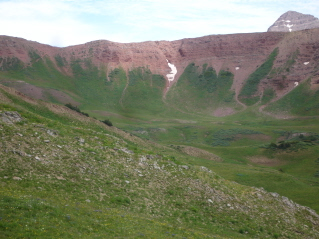
The pass is to the low spot to the left of the tall mountain.
I didn't really care which trail I'd been on ....it was beautiful....but it was driving me crazy that I couldn't figure it out for sure.
Continuing to the top...it took awhile, since this side of the pass is farther down then the other side.
When I got to the top, draining my water and eating a protein bar, I broke out the binoculars, sat down with the map (again) and figured it all out. I had been on the Hasley Basin trail...and through the binoculars, I could see the trail (just as it was in my memory) up to West Maroon Pass and I could see a lot of people on the trail.
So, I wasn't crazy, wasn't too stupid, was really, really tired, I had finally figured it out, I WAS SO HAPPY TO HAVE HIKED THIS TRAIL!
dI don't know if you can see a little bitty trail going up the side of this mountain, but its called Frigid Air Pass and Luke, Peter, Danny and I backpacked it the very first time I ever came to the Snowmass Wilderness area...it was a hard pass as I remember.
As I was on my way down, two women hikers passed me (the first I'd seen). And so I asked them about the junction for the Hasley Basin trail...was there one? Emphatically they said "yes...but the sign is laying down on the ground"...okay I thought, I sure hadn't seen one. Could I have been so unobservant or overcome by the flowers that I hadn't noticed a sign?
But I continued to hike down....and THEN I NOTICED...I wasn't on the same trail that I hiked going UP...what's with that?
Knowing this was not the same trail I'd taken, I wasn't surprised when I saw the sign....THERE WAS NO WAY I PASSED THIS SIGN AND ENDED UP ON THIS TRAIL. It's a mystery.
The view (for real and as I remember it) up to West Maroon Pass.
I kept looking for the trail I took up to Hasley Basin, but never found it.
Then I stopped looking, and just took in all the magnificent flowers and beauty that I was totally surrounded by...it was just perfect.
I made it back down to the trailhead...pretty dirty...but fortunately still had the big stream to cross. So, as I put on my sandals, I pulled out my bandanna, and cleaned up in the stream.
Me and the Mazda took off back down the road...careful, but not scared.
As I got back into town, I checked my tires (I had to put air in one yesterday, and have continued to check the one I had repaired last week). And, the tire I had put air in yesterday was really low...was luck on my side or what?. Now that I knew where to have tires fixed in CB, I drove to the mechanic's and checked it in. While they repaired my tire, I had a piece of pizza at the Secret Stash...caught up on some phone calls, then went back to pick up my car.
In conclusion...TODAY WAS....
perfect...surrounded by millions of wildflowers and majestic mountains galore!
lucky....that I made it to town with my tire and made it to the mechanic before they closed for the weekend;
weird...that I couldn't figure out exactly which trail I was on...and still don't know how I ended up hiking TO the Basin;
a first...that I drove that damn road without being frightened.
So, I hope you all enjoy your weekend...step out of your comfort zone and do something bold!
*******
day 22 . July 25, 2009
What a beautiful morning! Today, I'm hiking a trail that I learned about from Anne and Mike, the couple writing a hiking guide. Also, a couple of other people have mentioned it to me, although just as an out and back hike.
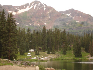
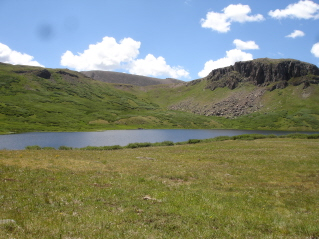
To reach the trail head of Scarpe Ridge, you need to drive Kebler Pass to Lake Irwin.
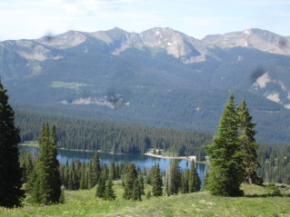
There's a large campground at Lake Irwin (Danny and I bought a tent site there late one night, a few years ago on our way into CB). It's one of those campgrounds filled with large RV's...not too pleasant to look out, even though the lake and the surrounding mountains are gorgeous.
What I didn't know (until the couple I visited with at the mechanic that was fixing my tire) was how to get to this trail head, which is to take a road that goes AROUND AND BEHIND the campground....WOW!. There is so much really cool, free camping up there (why would you pay at the campground?)! You drive this gravel/dirt road up to this old lodge, and that's where you park your car. There's no official trail sign, but just some computer-made-then-laminated sign nailed to a tree.
As I was getting my pack together, a young couple and their dog drove up and started on the trail before me.
The views as you start the climb and looking back down at Lake Irwin.
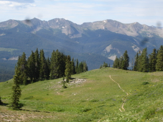
The climb is probably about 1 or 1 1/2 miles up and up and up (you're climbing to a ridge), so it takes awhile, but the views around you are so wonderful.
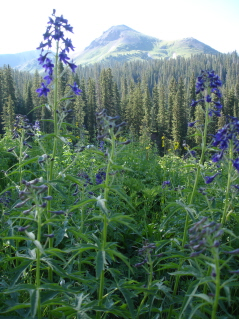
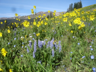
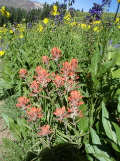
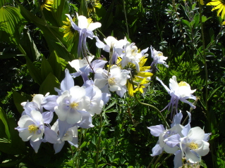
There were some nice wildflowers along the trail, but not near as many as you see on the trails in Snowmass Wilderness off Gothic Road. However, this bluish/purplish flower smells wonderful...and there were lots of these, so my nose was in heaven!
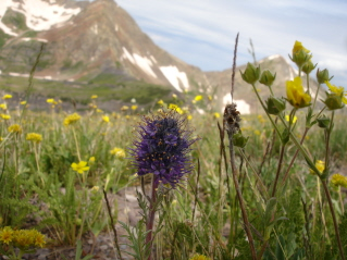
More flowers...these are really cool. The little flowers on the right are growing in the tundra.

The trail just keeps going up, and you think you're almost at the top (pic on left) and then you get there and there's more trail.
This mountain is always on your left as your hiking up...you just get better and closer views of it as you hike higher. See the trail that goes over the pass? There's also a lake at the bottom of the mountain called "Green Lake".
AND THEN YOU'RE AT THE TOP OF THE RIDGE!
SOOO BEAUTIFUL! All of a sudden the trail ends and then there's just an edge....and your eyes are just filled with the views of these amazing mountains...just one right after the other...for as far as you can see! (the pic on the right shows one of the Maroon Bells peeking over the top of it).
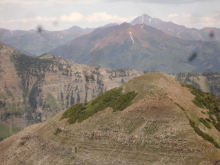
I could see some of the same views as I did from Hasley Basin, only you see more mountains in between.
You probably can't see it in this picture, but there's a yellow tent down there...lucky backpackers!
This pic is kind of hazy, but that's Mt. Crested Butte in the background, and right below it you can see the town of Crested Butte.
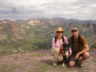
This is Sage and Neil and their really cool dog, Cooper.
We had a great visit about some of the trails we've hiked and our love of the Crested Butte area (they live here).
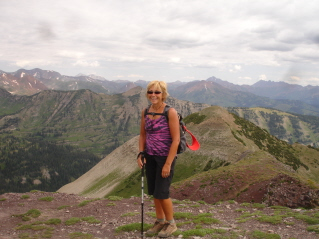
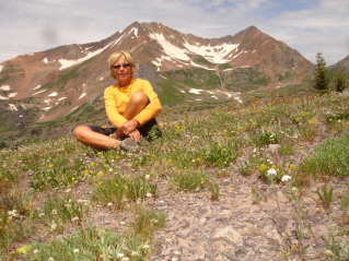
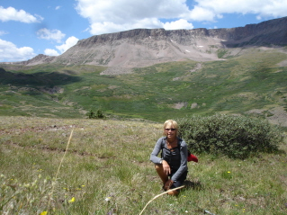
Sage was nice enough to take a pic of me....what a perfect place!
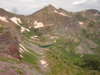
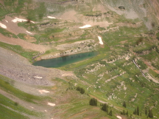
This mountain was off to the left...the pic on the right is a close up of the lake...there are also some backpackers down there.
I really enjoyed visiting with Sage and Neil; and Cooper just was so sweet and kept giving me "hugs"; soon they decided to hike back down, so we said good bye and wished each other many happy future travels.
I just couldn't take it all in...the views were so very awesome! I sat there for about 45 minutes, just looking.
Then the skies and clouds started to gray-up, so I headed down. I hadn't gone to far, when I heard thunder in the distance, but nothing ever came of it (the whole rest of the day was kind of overcast, and looked liked it would burst out in storms, but it never did).
I passed a few hikers on their way up...but the guide-book writers had told me this was a 7 mile loop, so I kept looking for another trail. I finally saw it from about 1/2 way down, and then about 200 yards from the start of the trail, I saw the junction. This will be my "mystery #2 hike" for when I come back to Crested Butte next time.
Self-timer portrait.
Views on the way down.
This is the view of Lake Irwin from the bottom (near the campground). There were people out fishing and kayaking today. Above the lake you can see the lodge where the trailhead is, and WAAAYYY above that, you see the ridge.
Oh...wait a minute....why all the gazillion cars in parking lot? Lots of dressed up people? Oh...it's a wedding! (At least they didn't close the lake or the campground or the road for it...I'm really, really over it!)
This is the view of the mountain I drive by on Slate River Road about twice a day...tonight I just noticed the weird formations with the rock and trees kind of making this unusual pattern.
Well, I'm back in camp early, rode my bike for a little bit just up and down the road. Then I went to try and see the elk Kindle and I saw the other morning...they didn't show, but I saw lots of deer and quite a few with fawns.
I built a fire, made me some chai, and sat and read until it started to rain...but it was a very gentle rain. Eventually, though, it did send me into the tent.
Sleep well.
*******
day 23 . July 26, 2009
Last night the rain quit about 10:30 and I turned off my headlamp, and went right to sleep.
About midnight, I got up to go use the "tree", and the sky was so clear and there were so many stars out; I thought that was a good sign that today would be great weather. It was such a gorgeous sky.
But then about 2am, the heavy rain woke me up...so I just laid there and listened to it awhile....then a huge burst of lightning, and lots of thunder....and then just the rain...and then just the thunder, but you could hear it moving off over the mountains.
I eventually fell back into an easy sleep.
I was up and out of the tent by about 7:30, and the heavy clouds were all around, skirting the edges of the mountains....it was really beautiful.
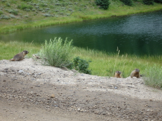
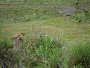
Maybe it was the storm, the rain or that it was Sunday morning, but my little family of Marmots (there are three babies at least...) that usually greet me when I drive by, were sleeping in.
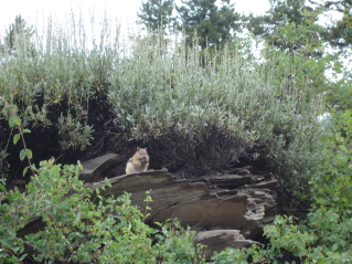
But, posed in their normal spot, was this little chipmunk...they are so cute. I bet I've seen hundreds of them....running like crazy across roads, trails, up trees, through the campground, over logs...they're everywhere!
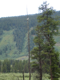
I'm not sure what kind of bird this is...it looks like some kind of Heron, perched in the tree, this early, misty morning, above the lazy and winding Slate River.
The weather still looked doubtful after breakfast, I made a couple of phone calls to catch up with people and then about noon, I took out on more of a walking trail than a hiking trail...it goes around Mt. Crested Butte, but near the bottom, I wasn't trusting the weather at all.
This isn't a hike known for it's wildflowers, but the side of mountain near the trail was filled with them....(the sky looks really blue and clear, huh?)
But this is what it looked like in the other direction. I'd only gotten about a mile down the trail, and heard some thunder over the mountains in the distance, so I decided to turn around. I hadn't gotten very far when it started to rain...but pretty gently.
The thunder continued and then got really close...and then all of a sudden BAM! right above my head! I have never heard thunder that close (although I didn't see any lightning)...there was a woman on the trail in front of me and I think both of us jumped a few feet in the air! I knew her "hiking-mates" had continued down the trail, so as I was passing her, I asked her if she had a car to sit in when she got back to the trailhead...she said she did and that the thunder had really scared her.
I then started running (with my full daypack on) to the car...I still had quite a ways to run (I've been thinking about taking up jogging again...boy...do I ever need to!)...and was sweating and getting rained on all at the same time (I was just waiting for a hot flash for the ultimate heat/water treatment) but made it back to the car right before it began down-pouring. Everyone was running for cover; bikers were pedaling so fast down the road...it was raining so hard, you couldn't see in front of the car very far.
It was then I made my decision to leave Crested Butte today.
I'd seen the weather forecast earlier today and it's supposed to be like this all week. I wouldn't attempt a high altitude hike when the skies look as they have since early morning today (and have continued to all day). So, knowing my tent would be soaked, I headed back down Slate River road to pack up....however....
as I drove through Crested Butte and towards the road, I noticed not only had it stopped raining, but hadn't rained at all on the road.
My marmot family was out to say good-bye to me as I drove towards the campsite.
My tent was only slightly damp, and that was from last night's rain. As I started to break it down, it started to sprinkle. I managed to get everything all packed up before it began to rain harder.
I drove back into CB to the hostel...knowing that the sweaty run I'd done had definitely put me over the "you really need a shower" stage, and so I enjoyed the hot water and getting all sudsy, clean and sweet.
I took myself out for one last meal at the Last Steep, and am now at Rumors, the coffee house, where I've been doing my web postings.
After I finish this, I'll figure out where I'm headed to next.
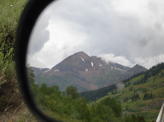
This is my last shot of Crested Butte for today...a "rear-view" mirror pic.
The people here in Crested Butte are so friendly, and I have truly enjoyed visiting with several while on the trail, as well as the Barista at Rumors (boy did she have a story to tell about Yule Pass) and the waitress at the Last Steep.
And while the skies may be dark, grumbling with thunder, and spitting rain, my heart is so full of great memories and views of the all the breath taking, outstanding and magnificent beauty I've seen over the past two weeks.
I will miss being here.
*******
day 24 . July 27, 2009
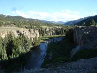
So, in my "original plan" (the one I'd been working on last spring to decide what and where I was going in Colorado this month), Plan A was to drive north to Lake City, in my first couple days of being out here. Now I'm on Plan T (I love changing my mind!) and, now it's my last week of the trip, and, on a whim, I decided to drive down from Gunnison to Lake City. I was here two years ago, after a ton of people kept telling me I should see this place, and they're right....it's really pretty. As you get nearer the town, you head down into a canyon, with giant walls and the Gunnison River running through it.
One of the big draws to Lake City, is it's the starting point for the "Alpine Loop"...starting with Engineer Pass over to Ouray, and then coming back on Cinnamon Pass. (The only part of this I've driven, is part of Cinnamon Pass they call "Shelf Road"...yeah....it wasn't too bad, driving on the inside, but coming back driving on the outside, was a little scary!)
So, I decided, late last night, that early tomorrow morning, I would go to the local jeep guide that does full day tours on the Alpine Loop, spend the big bucks, and spend the day just looking around...giving my legs and lungs a rest. So, bright and early, I showed up, but they were booked for the next two days, so that idea ended up being a bust.
I got out my Lake City guide book (that I'd purchased the last time I was here) and picked out a hike...it's called "Cataract Gulch"...the trail follows (guess what creek?) Cataract Creek the whole way up to (guess the name of the lake?) Cataract Lake...which is about 12,200' in elevation. So, I knew there would be tons and tons of climbing up...no rest for my legs, feet or lungs today.
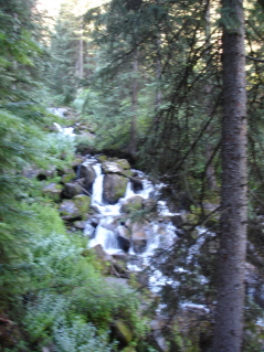
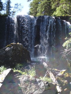
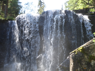
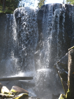
This ended up being one of the most diverse (as far as trails go) trails I've ever been on. It was sooo cool! AND, it was "eye-candy" the whole way as far as waterfalls go...there were so many, INCLUDING ONE OF THE MOST BEAUTIFUL AND AMAZING BACK COUNTRY WATERFALLS I'VE EVER SEEN!!!!!
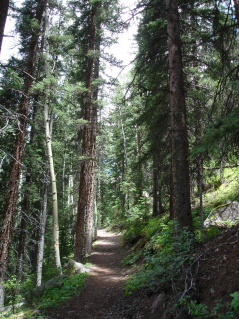
The trail started out climbing switchbacks in an alpine forest...a wide trail, dirt and pine needles...really nice. There were a few rocks and roots on the trails...kind of slippery from yesterday's storm, but such a nice trail.
Then the trail changed to a "wet-willow-walk" (my term). This is where the sides of the trails are covered heavily in willow bushes (depending on how tall the bushes are, these are the trails, I don't like....you can't see in front of you or what's beneath you, but this one wasn't too bad), and because I always hike early, they're usually thick with morning dew, so your pants get soaked and sometimes your shoes and socks too. This one was plenty-wet...the sugar-coating came off my lemon drops that were in my pocket, and I had to carry my camera (usually in my other pocket) in my hand to keep it from getting wet.
Then it went back to the "switch-backing forest".
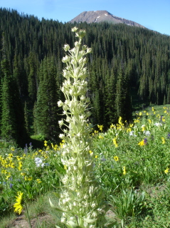
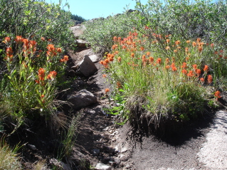
Then it changed to what the guide book called "the Garden"; the trail was lined with wildflowers.
In places, there were these big huge really cool rocks along the side of the trail.
The only people I'd passed (in the first mile of hiking) was a group of 4 backpackers...all about 25 years old...and told me the trail just got more and more beautiful as you hiked....makes you really excited to keep going!
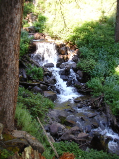

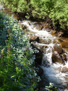
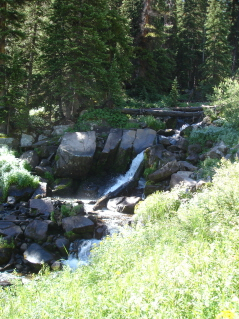
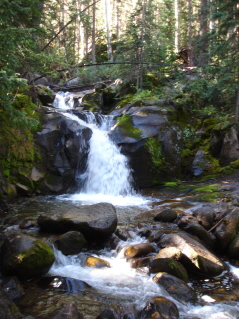
The waterfalls all along the way, were so nice!
When you looked out, at the huge surrounding mountains, they were also diverse! Some were gray, some were red, some more mountainous, some just giant rock walls. This pic is the morning sun shining on the red rock walls.
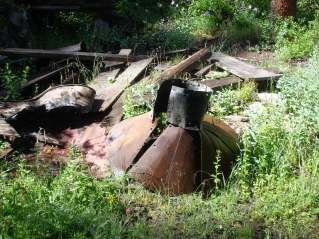
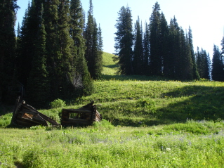
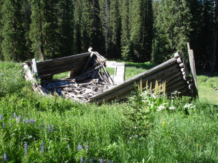
There was this pile of "mining-junk" along the trail too.
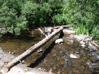
And, yes, I had three stream crossings. I took my sandals, but not sure why. The first crossing was on a log (it was nice and dry) that was just a matter of testing my balance...and I crossed it just fine.
The second one, was a log that looked wet and slick (been there, done that, and fell...wasn't going to be fooled a second time). So, I went for the path across some rocks...yes, they were a little under water, but the water was only about ankle to calf deep in the deepest places, and I must have had a memory loss that I was packing my sandals, or thought I was a water-fairy that could just glide over the rocks...because that's what I tried. The water-fairy now had soaking wet socks and hikers...the kind that "squish" out water with every step. (I'm so bright sometimes, I amaze myself!). Oh, well, it was only water!
The third crossing came, and it was two logs across, single wide...and the logs looked wonderfully dry...however, now my hikers were soaking wet....looked like a "slip and fall" waiting to happen. I was already "squishing" with every step, so I just plopped right in and walked through the water. (I figured with all of that "water-agitation", my socks might be considered washed now?)
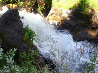
The trail began to climb away from the forest, the willows and the flowers out into the open. But right before it did, you came up the trail and saw this breath-taking waterfall!
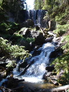
It was soooo cool! I couldn't quit taking photos of it or quit just staring at it.
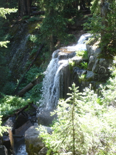
Side view of the fall as I climbed up the trail and past this wonderful waterfall.
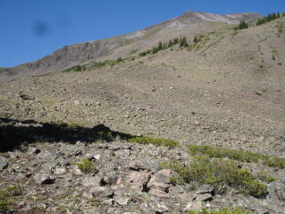
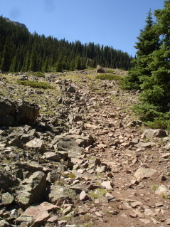
Then the trail, keeping with it's diversity, changed to talus (large rocks) and it was totally open. You weren't quite above tree line yet, but the views were 360 degrees...you could see in every direction.
After hiking through the talus for about 20 minutes, you came to an area (good for camping) that had the last of the trees and a few bushes and wildflowers. The trail climbed pretty hard through this area.
And then it just opened up...no trees, no bushes, no flowers, (no people)...nothing but views. At this point, I was hiking above 12,000'. I hiked at this altitude and in this huge open area for more than an hour (and that didn't include the talus area).
The skies were blue with only big puffy white clouds, but I was aware of the time, and kept swiveling my head every few minutes to keep checking out the sky. I had so far to hike back in the wide open, so I gave myself a "turn-around" time....if I hadn't made it to the lake by noon, I would turn around...no matter what. Then I should be back into the trees by 1:30 or so.
The trail just disappeared, and you were hiking on the tundra, and using these poles as guides.
The peak you're looking at is called "Mt. Sunshine"...it's one of the fourteeners.
I made it to the lake at 11:50 am. The lake itself wasn't that spectacular...it's about 16 acres, but it sits in such a wide open amazing space. As I looked across the valley and got my map out to review, I could see where the trail started again, and went up and over the ridge...crossing the Continental Divide and over the ridge....but that would have to be for another time.
I hardly spent any time at the lake at all, still being a "swivel-head" and watching the sky (yesterday's thunder-jump made me more nervous today!)
So, I turned around, and headed back across this magnificent space.
Self-timer portrait.
As I was hiking back, right before the talus area, I heard this piercing, extremely loud "scream"...not a scary type of noise, more like a teenage girls "yahoo" or something like that. It stopped me dead. I wasn't afraid, because it sounded like it came from across the valley...but directly in front of me. I started to scan the tops of the peaks...thinking maybe someone had summited one of the mountains...then I heard it again. I'd never heard any noise so loud or anything like it before.
It wasn't a person, it was an adult coyote. Then it was followed by the sound of lots of small baby coyotes. Now, Danny and I hear coyotes and baby coyotes howl all the time, although it's most always at night...we live in the country have some around. But I've never heard this sound before. It was so neat.
Once I reached the talus, and knew that if the weather turned worse, I could be back down into the trees in just a few minutes, I took a break...drank some water, ate a protein bar, and got out my binoculars to see if I could see any of the coyotes. I couldn't and didn't hear them again...but felt so fortunate to have heard them, at least briefly.
I left the talus area, and began to hike down...and passed a herd of people. There were 20 of them...a school group from somewhere in Missouri, hiking UP. I don't think they had a map or book, or knew too much about the area...because the adult in front asked me "is there a lake somewhere around here?" I told him it was about 1 1/2 hours away...in the open...above 12,000'....and they all kept hiking...just following their "leader"....ummm....hoped the weather stayed nice and didn't storm...but "not my problem" as I continued to hike down.
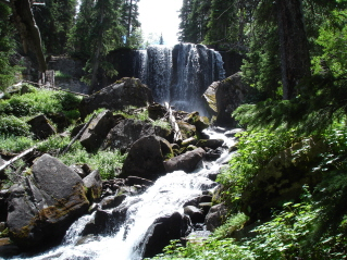
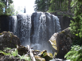
I couldn't resist taking a couple more photographs of this most incredible waterfall as I hiked down.

Mt. Sunshine in the background as the clouds started to turn gray.
This is actually the first stream you come to, (I didn't count it though because), it has a really nice bridge you use to cross. As I got to the end of the trail, I took off my wet shoes and socks (although the shoes had dried out more than I would have thought), and washed my feet and legs in the water...and washed out my socks again too, and, finally, put my sandals on.
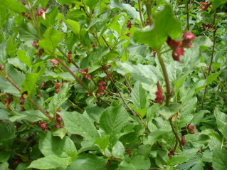
There weren't too many flowers today, but the ones that lined the trail, were, as always, beautiful and such a pretty site. There were lots of these "dried cranberry bushes" (my term, I do know that dried cranberries don't grow on bushes, but passing these always makes me hungry for a handful of dried cranberries!)
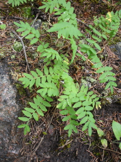
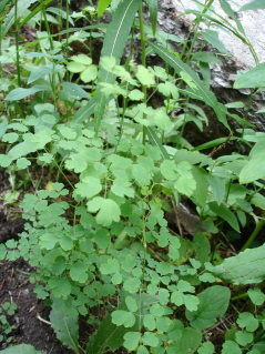
In the forest, there were tons of kinds of ferns and moss....really neat stuff too.
So, tired but safe from the weather (it was beginning to rain a little now), I drove back into Lake City.
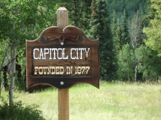
I went to the Visitors Bureau and got some info and visited with a sweet little old lady. She was probably 70, with a heavy German accent, but was at the desk and came around to ask if I needed any help. We talked about Engineer Pass, and she told me I could drive the first 9 miles to Capitol City...anyone could drive it...in any car....no problem. (How many times do I need to be fooled by little, white hair, older women who think nothing of driving these terrifying roads?) I asked my 3,580 list of questions, regarding 4WD roads and she just smiled and said "no problem" to all of them.
When I got back in my car, I checked my new Colorado 4WD Roads book and it said the same thing.
And so, I drove up the road.
And, she was right! It was pretty much just a gravel road, that winds around, most of the time you can pass an oncoming vehicle...you just had to go slow. And, I WAS THE MOST POLITE DRIVER, LETTING EVERYONE BEHIND ME, PASS ME AND EVERY VEHICLE THAT WAS ONCOMING, I'D STOP AND LET THEM GO BY...I'm sure this is due to my sweet personality, and not anything to do with the fact, I don't like driving fast on these roads (remember, I've had two flat tires on this trip) and I don't like going next to the "EDGE").
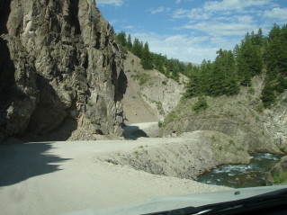
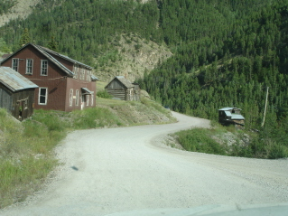
Some of the views along the road.
This was my turn around point.
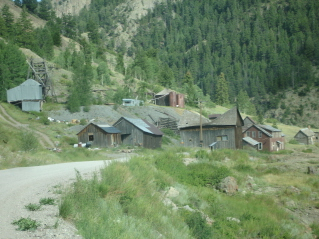
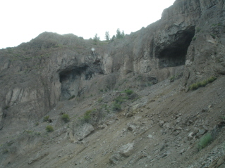
An old mining town along the road.
I got back to town, sat in the car (it was raining harder now) and pulled out my maps and guidebooks.
It had been a fun day in Lake City...the hike was spectacular and driving, even just part of an "easy" road, was fun; but I thought I was ready to move on.
So, about 7:30 pm, I left and headed north.
This is some of the scenery you see as you drive north, out of Lake City.
It was after dark, when I pulled in Salida. I'd dodged quite a few deer on my way here.
I found a place to park the Hotel Mazda, and went to sleep.